|
Uphall, West Lothian
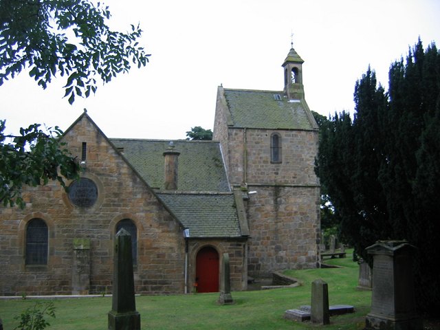
Uphall ( sco, Uphauch, gd, Ubhalaidh) is a village in West Lothian, Scotland. It is a swiftly growing village in a conurbation with Broxburn to the east, Dechmont to the west and the major town of Livingston to the south west. Uphall is 30 miles from Glasgow and 14 miles from Edinburgh in the Scottish Lowlands. Uphall Station and Pumpherston are separate villages that lie to the south of Uphall. Uphall has one primary school (Uphall primary school), several grocery stores, two cemeteries, a skatepark, football fields (King George Park), a golf course, a lawn bowls club (Middleton Hall) and a selection of public houses and hotels including the Volunteer Arms, Dovehill Arms, Oatridge Hotel and Houston House Hotel. History Uphall was historically a small settlement known as Wester Strathbrock (from the Gaelic "Srath Bhroc" meaning valley of the badgers), with its neighbour Broxburn being named Easter Strathbrock. The parish was centered around Strathbrock Castle (a Motte-and-b ... [...More Info...] [...Related Items...] OR: [Wikipedia] [Google] [Baidu] |
West Lothian
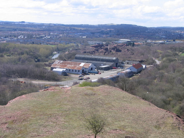
West Lothian ( sco, Wast Lowden; gd, Lodainn an Iar) is one of the 32 council areas of Scotland, and was one of its historic counties. The county was called Linlithgowshire until 1925. The historic county was bounded geographically by the Avon to the west and the Almond to the east. The modern council area occupies a larger area than the historic county. It was reshaped following local government reforms in 1975: some areas in the west were transferred to Falkirk; some areas in the east were transferred to Edinburgh; and some areas that had formerly been part of in Midlothian were added to West Lothian. West Lothian lies on the southern shore of the Firth of Forth and is predominantly rural, though there were extensive coal, iron, and shale oil mining operations in the 19th and 20th centuries. These created distinctive red-spoil heaps (locally known as " bings") throughout the council area. The old county town was the royal burgh of Linlithgow, but the largest town (and the ... [...More Info...] [...Related Items...] OR: [Wikipedia] [Google] [Baidu] |
Scottish Highlands
The Highlands ( sco, the Hielands; gd, a’ Ghàidhealtachd , 'the place of the Gaels') is a historical region of Scotland. Culturally, the Highlands and the Lowlands diverged from the Late Middle Ages into the modern period, when Lowland Scots replaced Scottish Gaelic throughout most of the Lowlands. The term is also used for the area north and west of the Highland Boundary Fault, although the exact boundaries are not clearly defined, particularly to the east. The Great Glen divides the Grampian Mountains to the southeast from the Northwest Highlands. The Scottish Gaelic name of ' literally means "the place of the Gaels" and traditionally, from a Gaelic-speaking point of view, includes both the Western Isles and the Highlands. The area is very sparsely populated, with many mountain ranges dominating the region, and includes the highest mountain in the British Isles, Ben Nevis. During the 18th and early 19th centuries the population of the Highlands rose to around 300, ... [...More Info...] [...Related Items...] OR: [Wikipedia] [Google] [Baidu] |
Nursing Home
A nursing home is a facility for the residential care of elderly or disabled people. Nursing homes may also be referred to as skilled nursing facility (SNF) or long-term care facilities. Often, these terms have slightly different meanings to indicate whether the institutions are public or private, and whether they provide mostly assisted living, or nursing care and emergency medical care. Nursing homes are used by people who do not need to be in a hospital, but cannot be cared for at home. The nursing home facility nurses have the responsibilities of caring for the patients' medical needs and also the responsibility of being in charge of other employees, depending on their ranks. Most nursing homes have nursing aides and skilled nurses on hand 24 hours a day. In the United States, while nearly 1 in 10 residents age 75 to 84 stays in a nursing home for five or more years, nearly 3 in 10 residents in that age group stay less than 100 days, the maximum duration covered by Medicare ... [...More Info...] [...Related Items...] OR: [Wikipedia] [Google] [Baidu] |
Bathgate
Bathgate ( sco, Bathket or , gd, Both Chèit) is a town in West Lothian, Scotland, west of Livingston, Scotland, Livingston and adjacent to the M8 motorway (Scotland), M8 motorway. Nearby towns are Armadale, West Lothian, Armadale, Blackburn, West Lothian, Blackburn, Linlithgow, Livingston, West Calder and Whitburn, West Lothian, Whitburn. Situated south of the ancient Neolithic burial site at Cairnpapple Hill, Bathgate and the surrounding area show signs of habitation since about 3500 BC and the world's oldest known reptile fossil has been found in the town. By the 12th century, Bathgate was a small settlement, with a church at Kirkton and a castle south of the present day town centre. Local mines were established in the 17th century but the town remained small in size until the coming of the industrial revolution. By the Victorian era, Bathgate grew in prominence as an industrial and mining centre, principally associated with the coal and Shale oil extraction, shale oil indu ... [...More Info...] [...Related Items...] OR: [Wikipedia] [Google] [Baidu] |
Airdrie, North Lanarkshire
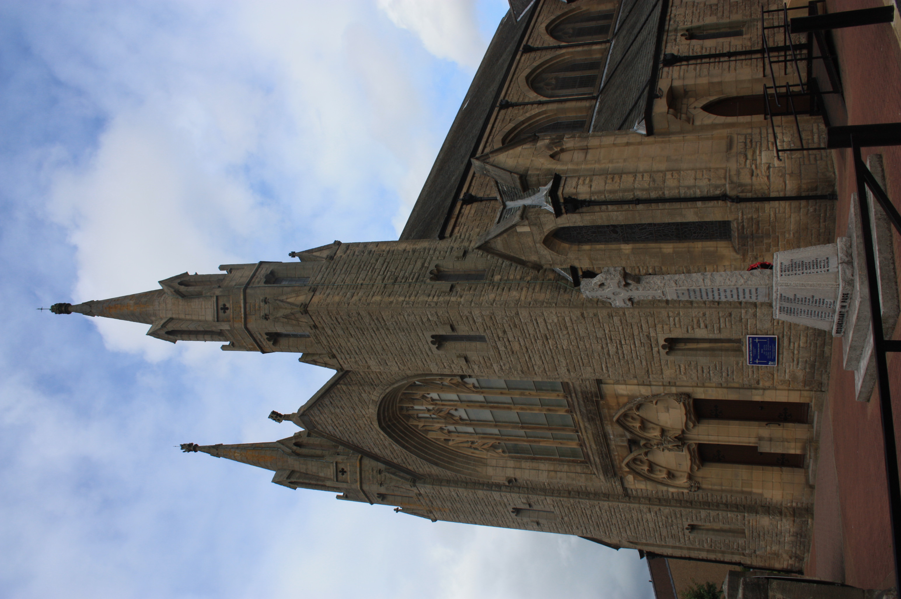
Airdrie (; sco, Airdrie; gd, An t-Àrd Ruigh) is a town in North Lanarkshire, Scotland. It lies on a plateau roughly 400 ft (130 m) above sea level, and is approximately 12 miles (19 km) east of Glasgow city centre. , the town had a population of around 37,130. Historically part of Lanarkshire, Airdrie forms part of a conurbation with its neighbour Coatbridge, in what is commonly known as the Monklands, formerly a district. (population approximately 90,000 including outlying settlements). Name Airdrie's name first appeared in the Register of the Great Seal of Scotland (Registrum Magni Sigilii Regum Scotorum) in 1373 as Ardre. By 1546 it had become Ardry and by 1587 it was known as Ardrie. In 1630 it finally appeared in the Register as Airdrie. Given the topography of the area, the most likely interpretation is that the name derives from the Gaelic ''An Àrd Ruigh'' meaning a level height or high pasture land. Another possibility is that it is from the Gaelic ''An Àr ... [...More Info...] [...Related Items...] OR: [Wikipedia] [Google] [Baidu] |
Romanesque Architecture
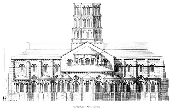
Romanesque architecture is an architectural style of medieval Europe characterized by semi-circular arches. There is no consensus for the beginning date of the Romanesque style, with proposals ranging from the 6th to the 11th century, this later date being the most commonly held. In the 12th century it developed into the Gothic style, marked by pointed arches. Examples of Romanesque architecture can be found across the continent, making it the first pan-European architectural style since Imperial Roman architecture. The Romanesque style in England and Sicily is traditionally referred to as Norman architecture. Combining features of ancient Roman and Byzantine buildings and other local traditions, Romanesque architecture is known by its massive quality, thick walls, round arches, sturdy pillars, barrel vaults, large towers and decorative arcading. Each building has clearly defined forms, frequently of very regular, symmetrical plan; the overall appearance is one of simplic ... [...More Info...] [...Related Items...] OR: [Wikipedia] [Google] [Baidu] |
Lothian Country
Lothian Buses is a major bus operator based in Edinburgh, Scotland. It is the largest municipal bus company in the United Kingdom: the City of Edinburgh Council (through Transport for Edinburgh) owns 91%, Midlothian Council 5%, East Lothian Council 3% and West Lothian Council 1%. Lothian operates the majority of bus services in Edinburgh, and is a significant operator in East Lothian, Midlothian and most recently West Lothian. It operates a comprehensive night bus network, three routes to Edinburgh Airport, and owns the subsidiary companies Lothian Country, East Coast Buses, Edinburgh Bus Tours and Lothian Motorcoaches. History The company can trace its history back to the ''Edinburgh Street Tramways Company'' of 1871, also involving at various times the tramway companies of ''Leith'', ''Musselburgh'' and ''Edinburgh North''. The City Council (''Edinburgh Corporation Tramways'' Department) took over operation of the tramways in 1919, at which time most of the system was c ... [...More Info...] [...Related Items...] OR: [Wikipedia] [Google] [Baidu] |
McGill's Scotland East
McGill's Bus Services is a bus operator based in Greenock, Scotland.Companies House extract company no SC027238 4 October 2013 The company has grown to operate a network of routes covering much of , , , , [...More Info...] [...Related Items...] OR: [Wikipedia] [Google] [Baidu] |
Uphall Railway Station
Uphall railway station serves the village of Uphall Station and some areas of Livingston in West Lothian, Scotland. It is located on the North Clyde Line, 12½ miles (20 km) west of Edinburgh. History The station was opened as Houston by the Edinburgh and Bathgate Railway on 12 November 1849. On 1 August 1856 it was renamed as Uphall. The station closed on 9 January 1956. Uphall Station was a large hub, centred on West Lothian oil production and shale mining. The area has changed beyond recognition in recent years. Before the M8 was constructed, Uphall oil works lay just north of the station, with extensive exchange sidings located next to the station. A branch continued north to Uphall, then swung eastward just south of Ecclesmachan (where a branch from Threemiletown joined). The line continued to the Greendykes area of Broxburn, (Albyn or Albion Oil works) where it connected with the lines from Broxburn junction (Winchburgh) (the Broxburn Railway) and Drumshorela ... [...More Info...] [...Related Items...] OR: [Wikipedia] [Google] [Baidu] |
M8 Motorway (Scotland)
The M8 is the busiest motorway in Scotland and one of the busiest in the United Kingdom. It connects the country's two largest cities, Glasgow and Edinburgh, and serves other large communities including Airdrie, Coatbridge, Greenock, Livingston and Paisley. The motorway is long. A major construction project to build the final section between Newhouse and Baillieston was completed on 30 April 2017. The motorway has one service station, Heart of Scotland Services, previously named Harthill due to its proximity to the village. History With the advent of motorway-building in the United Kingdom in the late 1950s, the M8 was planned as one of a core of new motorways, designed to replace the A8 road as a high-capacity alternative for intercity travel. The motorway was constructed piecemeal in several stages bypassing towns, beginning in 1965 with the opening by Minister of State for Scotland George Willis of the bypass of Harthill. In 1968 the Renfrew Bypass was opened as ... [...More Info...] [...Related Items...] OR: [Wikipedia] [Google] [Baidu] |
A89 Road , Advanced Landing Ground A89 during World War II
{{Letter-NumberCombDisambig ...
A89 or A-89 may refer to: * A89 motorway (France) * A89 road (Scotland) * Dutch Defence, in the Encyclopaedia of Chess Openings * Beauvechain Air Base Beauvechain Air Base is a Belgian Air Component military airfield in Belgium, located south of Beauvechain in Wallonia (Walloon Brabant Province); east-southeast of Brussels. It is home to the 1st Wing, operating A109BA helicopters, and the ... [...More Info...] [...Related Items...] OR: [Wikipedia] [Google] [Baidu] |
Broxburn
Broxburn ( gd, Srath Bhroc, IPA: �s̪ɾaˈvɾɔʰk is a town in West Lothian, Scotland, on the A89 road, from the West End of Edinburgh, from Edinburgh Airport and to the north of Livingston. Etymology The name Broxburn is a corruption of "brock's burn", brock being an old Scots name for a badger whether from the Gaelic ''broc'' or the Pictish/Welsh/Brythonic ''Broch'' and burn being a Scots word for a large stream or small river. The village was earlier known as Easter Strathbrock (Uphall was Wester Strathbrock) with Strath coming either from the Gaelic ''srath'' or the Pictish/Welsh/Brythonic ''ystrad'' meaning a river valley. History The village that later became Broxburn probably originated around 1350 when Margery le Cheyne inherited the eastern half of the Barony of Strathbrock (Easter Strathbrock) on the death of her father, Sir Reginald le Cheyne III. The hamlet that grew up around her residence was then called Eastertoun (eastern town) after the land on which ... [...More Info...] [...Related Items...] OR: [Wikipedia] [Google] [Baidu] |


.jpg)
