|
Ubalá
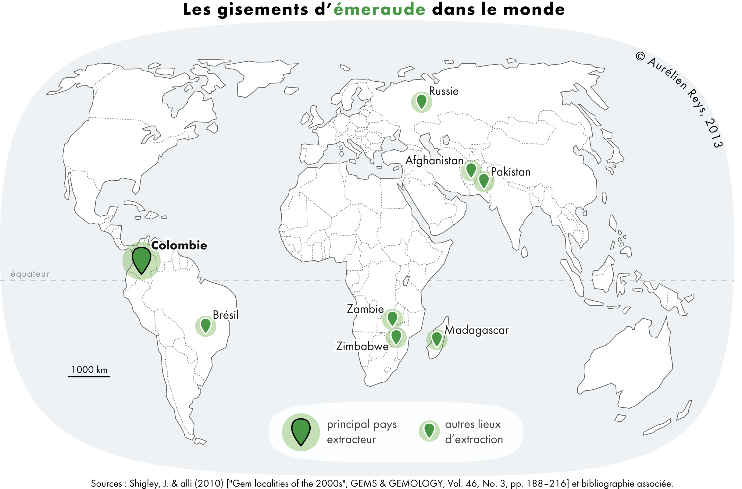
Ubalá is a municipality and town of Colombia in the Departments of Colombia, department of Cundinamarca Department, Cundinamarca. It is located in the Cordillera Oriental (Colombia), Eastern Ranges of the Colombian Andes. It is the only municipality of Cundinamarca that is split in two parts. Climate Etymology In the Chibcha language of the Muisca people, Muisca, Ubalá means "Place on the hillside" or "At the foot of the hillside". History The region west to Ubalá was inhabited by the Muisca people, Muisca before the Spanish conquistadores entered the Altiplano Cundiboyacense. To the east of Ubalá the indigenous Tegua people, Tegua were living and to the south the Guayupe people, Guayupe. Ubalá was properly founded on October 23rd, 1846 by Ospina Rodríguez. Economy Main economical activity of Ubalá is mining, predominantly emeralds, iron ore, sandstones, clay and halite, salt. Gallery File:Ubala.JPG, Church view File:Ubala2015.jpg, Church close-up File:Mina ... [...More Info...] [...Related Items...] OR: [Wikipedia] [Google] [Baidu] |
Muisca Confederation
The Muisca Confederation was a loose confederation of different Muisca rulers (''zaques'', ''zipas'', '' iraca'', and ''tundama'') in the central Andean highlands of present-day Colombia before the Spanish conquest of northern South America. The area, presently called Altiplano Cundiboyacense, comprised the current departments of Boyacá, Cundinamarca and minor parts of Santander. According to some Muisca scholars the Muisca Confederation was one of the best-organized confederations of tribes on the South American continent. Modern anthropologists, such as Jorge Gamboa Mendoza, attribute the present-day knowledge about the confederation and its organization more to a reflection by Spanish chroniclers who predominantly wrote about it a century or more after the Muisca were conquered and proposed the idea of a loose collection of different people with slightly different languages and backgrounds.Gamboa Mendoza, 2016 Geography Climate Muisca Confederation In the time ... [...More Info...] [...Related Items...] OR: [Wikipedia] [Google] [Baidu] |
Guavio Province
The Guavio Province ( es, Provincia del Guavio) is one of the 15 provinces in the Cundinamarca department, Colombia. Guavio borders the Capital District of Bogotá and the Central Savanna Province to the west, to the north the Almeidas Province, to the east the Boyacá Department and Medina Province and to the south the Meta Department and the Eastern Province. The Alberto Lleras Dam is also located in this area. The eastern municipalities Gachalá and Ubalá are rich in emeralds. Subdivision Guavio Province is subdivided into 8 municipalities A municipality is usually a single administrative division having corporate status and powers of self-government or jurisdiction as granted by national and regional laws to which it is subordinate. The term ''municipality'' may also mean the go ...: [...More Info...] [...Related Items...] OR: [Wikipedia] [Google] [Baidu] |
Municipalities Of Colombia
The Municipalities of Colombia are decentralized subdivisions of the Republic of Colombia. Municipalities make up most of the departments of Colombia with 1,122 municipalities (''municipios''). Each one of them is led by a mayor (''alcalde'') elected by popular vote and represents the maximum executive government official at a municipality level under the mandate of the governor of their department which is a representative of all municipalities in the department; municipalities are grouped to form departments. The municipalities of Colombia are also grouped in an association called the ''Federación Colombiana de Municipios'' (Colombian Federation of Municipalities), which functions as a union under the private law and under the constitutional right to free association to defend their common interests. Categories Conforming to the law 1551/12 that modified the sixth article of the law 136/94 Article 7 http://www.alcaldiabogota.gov.co/sisjur/normas/Norma1.jsp?i=48267 the mu ... [...More Info...] [...Related Items...] OR: [Wikipedia] [Google] [Baidu] |
Guayupe People
The Guayupe are an Arawak-speaking indigenous group of people in modern-day Colombia. They inhabit the westernmost parts of the department of Meta. At the time of the Spanish conquest, more than 250,000 Guayupe were living in large parts of Meta. The territories of the Guayupe stretched from the neighbouring Guahibo terrains to the east and north and the Muisca territories to the west over an area of . Knowledge of the Guayupe has been provided by Pedro de Aguado and others. Guayupe territory The territory of the Guayupe before the Spanish conquest stretched from the rivers Upía and Guayabero to the peaks of the Eastern Ranges of the Colombian Andes. Their area covered around . The Guayupe lived mostly around the Ariari River. Municipalities belonging to Guayupe territories Description The first report on the Guayupe nation is from German conquistador Philipp von Hutten, participant of the expedition led by Georg Hohermuth von Speyer from Coro in Venezuela to t ... [...More Info...] [...Related Items...] OR: [Wikipedia] [Google] [Baidu] |
Populated Places Established In 1846
Population typically refers to the number of people in a single area, whether it be a city or town, region, country, continent, or the world. Governments typically quantify the size of the resident population within their jurisdiction using a census, a process of collecting, analysing, compiling, and publishing data regarding a population. Perspectives of various disciplines Social sciences In sociology and population geography, population refers to a group of human beings with some predefined criterion in common, such as location, race, ethnicity, nationality, or religion. Demography is a social science which entails the statistical study of populations. Ecology In ecology, a population is a group of organisms of the same species who inhabit the same particular geographical area and are capable of interbreeding. The area of a sexual population is the area where inter-breeding is possible between any pair within the area and more probable than cross-breeding with ind ... [...More Info...] [...Related Items...] OR: [Wikipedia] [Google] [Baidu] |
Municipalities Of Cundinamarca Department
A municipality is usually a single administrative division having corporate status and powers of self-government or jurisdiction as granted by national and regional laws to which it is subordinate. The term ''municipality'' may also mean the governing body of a given municipality. A municipality is a general-purpose administrative subdivision, as opposed to a special-purpose district. The term is derived from French and Latin . The English word ''municipality'' derives from the Latin social contract (derived from a word meaning "duty holders"), referring to the Latin communities that supplied Rome with troops in exchange for their own incorporation into the Roman state (granting Roman citizenship to the inhabitants) while permitting the communities to retain their own local governments (a limited autonomy). A municipality can be any political jurisdiction, from a sovereign state such as the Principality of Monaco, to a small village such as West Hampton Dunes, New York. The ... [...More Info...] [...Related Items...] OR: [Wikipedia] [Google] [Baidu] |
Halite
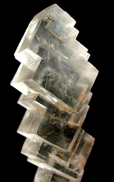
Halite (), commonly known as rock salt, is a type of salt, the mineral (natural) form of sodium chloride ( Na Cl). Halite forms isometric crystals. The mineral is typically colorless or white, but may also be light blue, dark blue, purple, pink, red, orange, yellow or gray depending on inclusion of other materials, impurities, and structural or isotopic abnormalities in the crystals. It commonly occurs with other evaporite deposit minerals such as several of the sulfates, halides, and borates. The name ''halite'' is derived from the Ancient Greek word for "salt", ἅλς (''háls''). Occurrence Halite dominantly occurs within sedimentary rocks where it has formed from the evaporation of seawater or salty lake water. Vast beds of sedimentary evaporite minerals, including halite, can result from the drying up of enclosed lakes and restricted seas. Such salt beds may be hundreds of meters thick and underlie broad areas. Halite occurs at the surface today in playas in regio ... [...More Info...] [...Related Items...] OR: [Wikipedia] [Google] [Baidu] |
Clay
Clay is a type of fine-grained natural soil material containing clay minerals (hydrous aluminium phyllosilicates, e.g. kaolin, Al2 Si2 O5( OH)4). Clays develop plasticity when wet, due to a molecular film of water surrounding the clay particles, but become hard, brittle and non–plastic upon drying or firing. Most pure clay minerals are white or light-coloured, but natural clays show a variety of colours from impurities, such as a reddish or brownish colour from small amounts of iron oxide. Clay is the oldest known ceramic material. Prehistoric humans discovered the useful properties of clay and used it for making pottery. Some of the earliest pottery shards have been dated to around 14,000 BC, and clay tablets were the first known writing medium. Clay is used in many modern industrial processes, such as paper making, cement production, and chemical filtering. Between one-half and two-thirds of the world's population live or work in buildings made with clay, often ... [...More Info...] [...Related Items...] OR: [Wikipedia] [Google] [Baidu] |
Sandstone
Sandstone is a clastic sedimentary rock composed mainly of sand-sized (0.0625 to 2 mm) silicate grains. Sandstones comprise about 20–25% of all sedimentary rocks. Most sandstone is composed of quartz or feldspar (both silicates) because they are the most resistant minerals to weathering processes at the Earth's surface. Like uncemented sand, sandstone may be any color due to impurities within the minerals, but the most common colors are tan, brown, yellow, red, grey, pink, white, and black. Since sandstone beds often form highly visible cliffs and other topographic features, certain colors of sandstone have been strongly identified with certain regions. Rock formations that are primarily composed of sandstone usually allow the percolation of water and other fluids and are porous enough to store large quantities, making them valuable aquifers and petroleum reservoirs. Quartz-bearing sandstone can be changed into quartzite through metamorphism, usually related to ... [...More Info...] [...Related Items...] OR: [Wikipedia] [Google] [Baidu] |
Iron Ore
Iron ores are rocks and minerals from which metallic iron can be economically extracted. The ores are usually rich in iron oxides and vary in color from dark grey, bright yellow, or deep purple to rusty red. The iron is usually found in the form of magnetite (, 72.4% Fe), hematite (, 69.9% Fe), goethite (, 62.9% Fe), limonite (, 55% Fe) or siderite (, 48.2% Fe). Ores containing very high quantities of hematite or magnetite (greater than about 60% iron) are known as "natural ore" or "direct shipping ore", meaning they can be fed directly into iron-making blast furnaces. Iron ore is the raw material used to make pig iron, which is one of the main raw materials to make steel—98% of the mined iron ore is used to make steel. In 2011 the ''Financial Times'' quoted Christopher LaFemina, mining analyst at Barclays Capital, saying that iron ore is "more integral to the global economy than any other commodity, except perhaps oil". Sources Metallic iron is virtually unknown on ... [...More Info...] [...Related Items...] OR: [Wikipedia] [Google] [Baidu] |
Emerald
Emerald is a gemstone and a variety of the mineral beryl (Be3Al2(SiO3)6) colored green by trace amounts of chromium or sometimes vanadium.Hurlbut, Cornelius S. Jr. and Kammerling, Robert C. (1991) ''Gemology'', John Wiley & Sons, New York, p. 203, . Beryl has a hardness of 7.5–8 on the Mohs scale. Most emeralds are highly included, so their toughness (resistance to breakage) is classified as generally poor. Emerald is a cyclosilicate. Etymology The word "emerald" is derived (via fro, esmeraude and enm, emeraude), from Vulgar Latin: ''esmaralda''/''esmaraldus'', a variant of Latin ''smaragdus'', which was a via grc, σμάραγδος (smáragdos; "green gem") from a Semitic language. According to Webster's Dictionary the term emerald was first used in the 14th century. Properties determining value Emeralds, like all colored gemstones, are graded using four basic parameters–the four ''C''s of connoisseurship: ''color'', ''clarity,'' ''cut'' and ''carat weight''. N ... [...More Info...] [...Related Items...] OR: [Wikipedia] [Google] [Baidu] |


Saunders_Quarry-1.jpg)

