|
USS Thomaston (LSD-28)
USS ''Thomaston'' (LSD-28) was the lead ship of her class of dock landing ship of the United States Navy. She was named for Thomaston, Maine, the home of General Henry Knox, the first Secretary of War to serve under the United States Constitution. ''Thomaston'' (LSD-28) was laid down on 3 March 1953 at Pascagoula, Mississippi, by the Ingalls Shipbuilding Corp.; launched on 9 February 1954, sponsored by Mrs. Mathias B. Gardner; and commissioned on 17 September 1954. 1955–1964 Following shakedown in the Caribbean, ''Thomaston'' transited the Panama Canal and joined the Pacific Fleet Amphibious Force. From July through October 1955, ''Thomaston'' participated in the Arctic Resupply Project, provisioning stations on the Distant Early Warning Line before taking part in cold-weather landing exercises in the Aleutians in November 1955 and again in January and February 1956. The landing ship's duties soon took her southward to the warmer climes of the Hawaiian Islands, where s ... [...More Info...] [...Related Items...] OR: [Wikipedia] [Google] [Baidu] |
Ship Naming And Launching
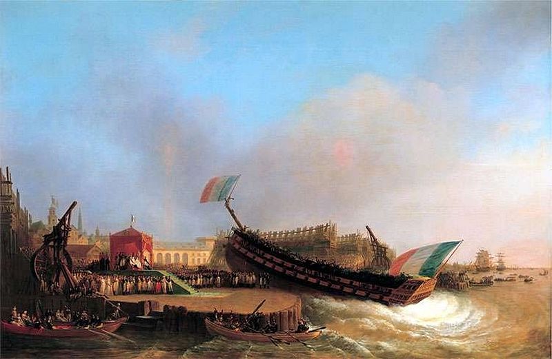
Ceremonial ship launching involves the performance of ceremonies associated with the process of transferring a vessel to the water. It is a nautical tradition in many cultures, dating back thousands of years, to accompany the physical process with ceremonies which have been observed as public celebration and a solemn blessing, usually but not always, in association with the launch itself. Ship launching imposes stresses on the ship not met during normal operation and, in addition to the size and weight of the vessel, represents a considerable engineering challenge as well as a public spectacle. The process also involves many traditions intended to invite good luck, such as christening by breaking a sacrificial bottle of champagne over the bow as the ship is named aloud and launched. Methods There are three principal methods of conveying a new ship from building site to water, only two of which are called "launching". The oldest, most familiar, and most widely used is th ... [...More Info...] [...Related Items...] OR: [Wikipedia] [Google] [Baidu] |
Cuban Missile Crisis
The Cuban Missile Crisis, also known as the October Crisis (of 1962) ( es, Crisis de Octubre) in Cuba, the Caribbean Crisis () in Russia, or the Missile Scare, was a 35-day (16 October – 20 November 1962) confrontation between the United States and the Soviet Union, which escalated into an international crisis when American deployments of missiles in Italy and Turkey were matched by Soviet deployments of similar ballistic missiles in Cuba. Despite the short time frame, the Cuban Missile Crisis remains a defining moment in national security and nuclear war preparation. The confrontation is often considered the closest the Cold War came to escalating into a full-scale nuclear war. In response to the presence of American Jupiter ballistic missiles in Italy and Turkey, the failed Bay of Pigs Invasion of 1961, and Soviet fears of a Cuban drift towards China, Soviet First Secretary Nikita Khrushchev agreed to Cuba's request to place nuclear missiles on the island to deter a ... [...More Info...] [...Related Items...] OR: [Wikipedia] [Google] [Baidu] |
Borneo
Borneo (; id, Kalimantan) is the third-largest island in the world and the largest in Asia. At the geographic centre of Maritime Southeast Asia, in relation to major Indonesian islands, it is located north of Java, west of Sulawesi, and east of Sumatra. The island is politically divided among three countries: Malaysia and Brunei in the north, and Indonesia to the south. Approximately 73% of the island is Indonesian territory. In the north, the East Malaysian states of Sabah and Sarawak make up about 26% of the island. The population in Borneo is 23,053,723 (2020 national censuses). Additionally, the Malaysian federal territory of Labuan is situated on a small island just off the coast of Borneo. The sovereign state of Brunei, located on the north coast, comprises about 1% of Borneo's land area. A little more than half of the island is in the Northern Hemisphere, including Brunei and the Malaysian portion, while the Indonesian portion spans the Northern and Southern hemisph ... [...More Info...] [...Related Items...] OR: [Wikipedia] [Google] [Baidu] |
Camp Pendleton
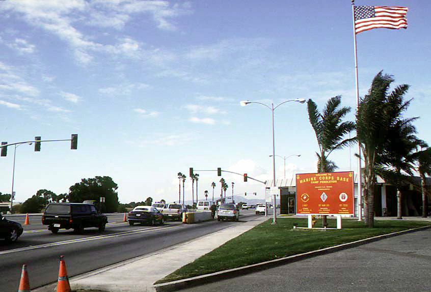
Marine Corps Base Camp Pendleton is the major West Coast base of the United States Marine Corps and is one of the largest Marine Corps bases in the United States. It is on the Southern California coast in San Diego County and is bordered by Oceanside to the south, San Clemente and Orange County to the north, Riverside County to the northeast, and Fallbrook to the east. The base was established in 1942 to train U.S. Marines for service in World War II. By October 1944, Camp Pendleton was declared a "permanent installation," and by 1946 it became the home of the 1st Marine Division. It was named after Major General Joseph Henry Pendleton (1860–1942), who had long advocated setting up a training base for the Marine Corps on the West Coast. Today it is home to myriad Operating Force units, including the I Marine Expeditionary Force and various training commands. History Prior to World War II In 1769, a Spanish expedition led by Captain Gaspar de Portolá explored northward fr ... [...More Info...] [...Related Items...] OR: [Wikipedia] [Google] [Baidu] |
United States Marine Corps
The United States Marine Corps (USMC), also referred to as the United States Marines, is the maritime land force service branch of the United States Armed Forces responsible for conducting expeditionary and amphibious operations through combined arms, implementing its own infantry, artillery, aerial, and special operations forces. The U.S. Marine Corps is one of the eight uniformed services of the United States. The Marine Corps has been part of the U.S. Department of the Navy since 30 June 1834 with its sister service, the United States Navy. The USMC operates installations on land and aboard sea-going amphibious warfare ships around the world. Additionally, several of the Marines' tactical aviation squadrons, primarily Marine Fighter Attack squadrons, are also embedded in Navy carrier air wings and operate from the aircraft carriers. The history of the Marine Corps began when two battalions of Continental Marines were formed on 10 November 1775 in Philadelphia as ... [...More Info...] [...Related Items...] OR: [Wikipedia] [Google] [Baidu] |
Semana Nautica Celebration
''Semana'' (Spanish: ''Week'') is a weekly magazine in Colombia. History ''Semana'' was founded in 1946 by Alberto Lleras Camargo (who would become president of Colombia in 1958) and that folded in 1961. It was relaunched by journalist Felipe López Caballero in 1983. Development , the person who restarted the magazine, took two earlier Colombian magazines as models. One was Camargo's ''Semana''; the other was '' :es:Alternativa'', a left-wing weekly published by Enrique Santos and Gabriel García Márquez. The foreign magazines that he strove to imitate were ''Time'' and ''Newsweek''. Recalling the prestige that had been enjoyed by Lleras's magazine, López asked for, and was given, permission to use the same name. The first issue came out on 12 May 12 1982. Its cover story was about terrorism. Some of ''Semana''s most important reporting has been about Pablo Escobar, the drug trafficking kingpin. In the 1980s, López was one of the two "big whistleblowers and critic ... [...More Info...] [...Related Items...] OR: [Wikipedia] [Google] [Baidu] |
Santa Barbara, California
Santa Barbara ( es, Santa Bárbara, meaning "Saint Barbara") is a coastal city in Santa Barbara County, California, of which it is also the county seat. Situated on a south-facing section of coastline, the longest such section on the West Coast of the United States, the city lies between the steeply rising Santa Ynez Mountains and the Pacific Ocean. Santa Barbara's climate is often described as Mediterranean climate, Mediterranean, and the city has been dubbed "The American Riviera". According to the 2020 United States census, U.S. Census, the city's population was 88,665. In addition to being a popular tourist and resort destination, the city has a diverse economy that includes a large service sector, education, technology, health care, finance, agriculture, manufacturing, and local government. In 2004, the service sector accounted for 35% of local employment. Education in particular is well represented, with four institutions of higher learning nearby: the University of Calif ... [...More Info...] [...Related Items...] OR: [Wikipedia] [Google] [Baidu] |
Hawaiian Islands
The Hawaiian Islands ( haw, Nā Mokupuni o Hawai‘i) are an archipelago of eight major islands, several atolls, and numerous smaller islets in the North Pacific Ocean, extending some from the island of Hawaii in the south to northernmost Kure Atoll. Formerly the group was known to Europeans and Americans as the Sandwich Islands, a name that James Cook chose in honor of the 4th Earl of Sandwich, the then First Lord of the Admiralty. Cook came across the islands by chance when crossing the Pacific Ocean on his Third Voyage in 1778, on board HMS ''Resolution''; he was later killed on the islands on a return visit. The contemporary name of the islands, dating from the 1840s, is derived from the name of the largest island, Hawaii Island. Hawaii sits on the Pacific Plate and is the only U.S. state that is not geographically connected to North America. It is part of the Polynesia subregion of Oceania. The state of Hawaii occupies the archipelago almost in its entirety (includin ... [...More Info...] [...Related Items...] OR: [Wikipedia] [Google] [Baidu] |
Aleutian Islands
The Aleutian Islands (; ; ale, Unangam Tanangin,”Land of the Aleuts", possibly from Chukchi language, Chukchi ''aliat'', "island"), also called the Aleut Islands or Aleutic Islands and known before 1867 as the Catherine Archipelago, are a chain of 14 large volcanic islands and 55 smaller islands. Most of the Aleutian Islands belong to the U.S. state of Alaska, but some belong to the Russian Federal subjects of Russia, federal subject of Kamchatka Krai. They form part of the Aleutian Arc in the Northern Pacific Ocean, occupying a land area of 6,821 sq mi (17,666 km2) and extending about westward from the Alaska Peninsula toward the Kamchatka Peninsula in Russia, and act as a border between the Bering Sea to the north and the Pacific Ocean to the south. Crossing 180th meridian, longitude 180°, at which point east and west longitude end, the archipelago contains both the westernmost part of the United States by longitude (Amatignak Island) and the easternmost by longitude ( ... [...More Info...] [...Related Items...] OR: [Wikipedia] [Google] [Baidu] |
Distant Early Warning Line
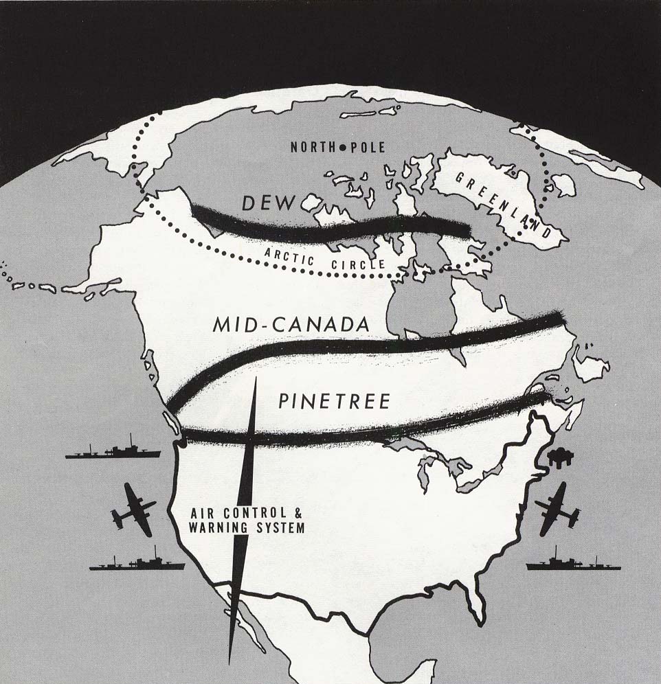
The Distant Early Warning Line, also known as the DEW Line or Early Warning Line, was a system of radar stations in the northern Arctic region of Canada, with additional stations along the north coast and Aleutian Islands of Alaska (see Project Stretchout and Project Bluegrass), in addition to the Faroe Islands, Greenland, and Iceland. It was set up to detect incoming bombers of the Soviet Union during the Cold War, and provide early warning of any sea-and-land invasion. The DEW Line was the northernmost and most capable of three radar lines in Canada and Alaska. The first of these was the joint Canadian-United States Pinetree Line, which ran from Newfoundland to Vancouver Island just north of the Canada–United States border, but even while it was being built there were concerns that it would not provide enough warning time to launch an effective counterattack. The Mid-Canada Line (MCL) was proposed as an inexpensive solution using bistatic radar. This provided a "trip w ... [...More Info...] [...Related Items...] OR: [Wikipedia] [Google] [Baidu] |
Arctic Resupply Project
The Arctic ( or ) is a polar region located at the northernmost part of Earth. The Arctic consists of the Arctic Ocean, adjacent seas, and parts of Canada (Yukon, Northwest Territories, Nunavut), Danish Realm (Greenland), Finland, Iceland, Norway, Russia (Murmansk, Siberia, Nenets Okrug, Novaya Zemlya), Sweden and the United States (Alaska). Land within the Arctic region has seasonally varying snow and ice cover, with predominantly treeless permafrost (permanently frozen underground ice) containing tundra. Arctic seas contain seasonal sea ice in many places. The Arctic region is a unique area among Earth's ecosystems. The cultures in the region and the Arctic indigenous peoples have adapted to its cold and extreme conditions. Life in the Arctic includes zooplankton and phytoplankton, fish and marine mammals, birds, land animals, plants and human societies. Arctic land is bordered by the subarctic. Definition and etymology The word Arctic comes from the Greek word (''arkti ... [...More Info...] [...Related Items...] OR: [Wikipedia] [Google] [Baidu] |


