|
University Heights, Indianapolis
University Heights is a neighborhood area located on the south side of Indianapolis, Indiana, United States. It is adjacent to the University of Indianapolis and contains the southern portion of the campus. Location and boundaries Historically, the original neighborhood is roughly bounded by Hanna Avenue (north), Madison Avenue (west), State Avenue (east), and Lawrence Avenue (south) and located about south of downtown Indianapolis. The "neighborhood area" encompasses a larger geography than the historic neighborhood, which is the basis for sociodemographic data collection. History In the early 20th century, William L. Elder, an Indianapolis real estate developer, offered the Church of the United Brethren in Christ of land southeast of downtown Indianapolis to establish a college in exchange for help selling 446 building parcels in a subdivision platted as Marion Heights. Indiana Central University (now the University of Indianapolis) was chartered in 1902, but instruction did ... [...More Info...] [...Related Items...] OR: [Wikipedia] [Google] [Baidu] |
List Of Indianapolis Neighborhoods
This list of Indianapolis neighborhoods provides a general overview of neighborhoods, districts, and subdivisions located in the city of Indianapolis, Indiana, United States. Nine townships form the broadest geographic divisions within Marion County and Indianapolis. For statistical purposes, the consolidated city-county is organized into 99 smaller "neighborhood areas," some of which overlap township boundaries. Most neighborhood areas contain numerous individual districts, subdivisions, and some semi-autonomous towns. In total, some 500 self-identified neighborhood associations are registered in the City’s Registered Community Organization system. Typical of American cities in the Midwest, Indianapolis urbanized in the late-19th and early-20th centuries, resulting in the development of relatively dense, well-defined neighborhoods clustered around streetcar corridors, especially in Center Township. The economic attainability of private automobiles influenced the city's develop ... [...More Info...] [...Related Items...] OR: [Wikipedia] [Google] [Baidu] |
Indiana
Indiana () is a U.S. state in the Midwestern United States. It is the 38th-largest by area and the 17th-most populous of the 50 States. Its capital and largest city is Indianapolis. Indiana was admitted to the United States as the 19th state on December 11, 1816. It is bordered by Lake Michigan to the northwest, Michigan to the north, Ohio to the east, the Ohio River and Kentucky to the south and southeast, and the Wabash River and Illinois to the west. Various indigenous peoples inhabited what would become Indiana for thousands of years, some of whom the U.S. government expelled between 1800 and 1836. Indiana received its name because the state was largely possessed by native tribes even after it was granted statehood. Since then, settlement patterns in Indiana have reflected regional cultural segmentation present in the Eastern United States; the state's northernmost tier was settled primarily by people from New England and New York, Central Indiana by migrants fro ... [...More Info...] [...Related Items...] OR: [Wikipedia] [Google] [Baidu] |
Interstate 465
Interstate 465 (I-465), also known as the USS ''Indianapolis'' Memorial Highway, is the beltway circling Indianapolis, Indiana, United States. It is roughly rectangular in shape and has a perimeter of approximately . It lies almost completely within the boundaries of Marion County, except for two short sections on the north leg in Boone and Hamilton counties. It intersects with I-65, I-69, I-70, and I-74 and provides additional access to I-65 via I-865. Route description All U.S. and state highways that formerly were routed through the central part of Indianapolis are now routed concurrently with I-465. Only I-65 and I-70 run through Downtown Indianapolis. The affected highways are: *I-74, running counterclockwise from exit 16 to exit 49 * US 31, running counterclockwise from exit 2 to exit 31 * US 36, running counterclockwise from exit 13 to exit 42 * US 40, running counterclockwise from exit 12 to exit 46 * US&n ... [...More Info...] [...Related Items...] OR: [Wikipedia] [Google] [Baidu] |
Interstate 65 In Indiana
Interstate 65 (I-65) in the US state of Indiana traverses from the south-southeastern Falls City area bordering Louisville, Kentucky, through the centrally located capital city of Indianapolis, to the northwestern Calumet Region of the Hoosier State which is part of the Chicago metropolitan area. The Indiana portion of I-65 begins in Jeffersonville after crossing the Ohio River and travels mainly north, passing just west of Columbus prior to reaching the Indianapolis metro area. Upon reaching Indianapolis, the route alignment of I-65 begins to run more to the northwest and subsequently passes Lafayette on that city's east and north sides. Northwest of there, in west-central Jasper County, the route again curves more northward as it approaches the Calumet Region. Shortly after passing a major junction with I-80 and I-94, I-65 reaches its northern national terminus in Gary at I-90 which is carried on the Indiana East–West Toll Road. I-65 covers in the state of Indiana. ... [...More Info...] [...Related Items...] OR: [Wikipedia] [Google] [Baidu] |
Greenwood Park Mall
Greenwood Park Mall is a shopping mall located in Greenwood, Indiana. The mall is the hub of the retail and commercial corridor along U.S. Highway 31 on the south side of the Indianapolis Metropolitan Area. As with several other central Indiana shopping centers, Greenwood Park Mall is owned and operated by Simon Property Group. Greenwood Park Mall has 149 stores. The mall's four anchors are Dick's Sporting Goods, JCPenney, Macy's (originally Lazarus), and Von Maur (originally Blocks, later Montgomery Ward). There is also a Vacant Sears. With of total retail area, Greenwood Park Mall is the fourth largest shopping mall in Indiana, after Castleton Square in Indianapolis, Glenbrook Square in Fort Wayne, and Southlake Mall in Merrillville. The mall is managed by Steve Kempe as of 2022. There was also a JCPenney Home Store located near Macy's, which was a former Woolworth. History Built on an site by Atkinson & Company at a cost of $25 million, the Greenwood Shopping Cen ... [...More Info...] [...Related Items...] OR: [Wikipedia] [Google] [Baidu] |
Bus Rapid Transit
Bus rapid transit (BRT), also called a busway or transitway, is a bus-based public transport system designed to have much more capacity, reliability and other quality features than a conventional bus system. Typically, a BRT system includes roadways that are dedicated to buses, and gives priority to buses at intersections where buses may interact with other traffic; alongside design features to reduce delays caused by passengers boarding or leaving buses, or paying fares. BRT aims to combine the capacity and speed of a light rail or metro system (LRT, HRT) with the flexibility, lower cost and simplicity of a bus system. The world's first BRT system was the Busway in Runcorn New Town, England, which entered service in 1971. , a total of 166 cities in six continents have implemented BRT systems, accounting for of BRT lanes and about 32.2 million passengers every day. The majority of these are in Latin America, where about 19.6 million passengers ride daily, and w ... [...More Info...] [...Related Items...] OR: [Wikipedia] [Google] [Baidu] |
Battery Electric Bus
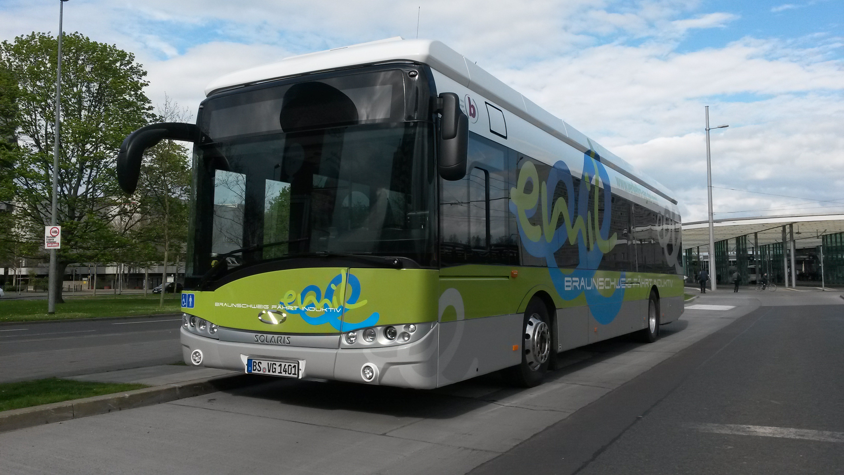
A battery electric bus is an electric bus that is driven by an electric motor and obtains energy from on-board batteries. Many trolleybuses use batteries as an auxiliary or emergency power source. In 2018, the National Renewable Energy Laboratory (NREL) found that total operating costs per mile of an electric bus fleet and a diesel bus fleet in the United States are about equal. History The London Electrobus Company started running the first ever service of battery-electric buses between London's Victoria station and Liverpool Street on 15 July 1907. However, the weight and inefficiency of batteries meant that other propulsion technology - such as electric trolleybuses or diesel buses - became commonplace. The first battery buses were mostly small, mini- or midi- buses. The improvement of battery technology from around 2010 led to the emergence of the battery bus, including heavier units such as standard buses and articulated buses. China was the first country to int ... [...More Info...] [...Related Items...] OR: [Wikipedia] [Google] [Baidu] |
Red Line (IndyGo)
The Red Line of IndyGo is a bus rapid transit line serving parts of central, northern, and southern Indianapolis. The first phase of this transit route entered service on September 1, 2019, and was originally free for the first month; the free service was extended to the second and third months due to problems with the fare collection system. The Red Line links Broad Ripple to the University of Indianapolis via Downtown Indianapolis. Local service continues beyond these endpoints with every other bus continuing on to the respective county lines at either end of Marion County as Route 90. History On May 31, 2018, the Indianapolis Public Transportation Corporation (IndyGo) began construction of the Red Line, the city's first Bus Rapid Transit (BRT) line. The first phase of the system opened on September 1, 2019, after about 15 months of construction and testing. The $96.3 million project included a $75 million grant from the Federal Transit Administration. Two addition ... [...More Info...] [...Related Items...] OR: [Wikipedia] [Google] [Baidu] |
IndyGo
The Indianapolis Public Transportation Corporation, branded as IndyGo, is a public transit agency and municipal corporation of the City of Indianapolis in the U.S. state of Indiana. It operates fixed-route buses, bus rapid transit, microtransit, and paratransit services. IndyGo has managed and operated the city's public bus transit system since 1975. In , the system had a ridership of , or about per weekday as of . History IndyGo's history begins in 1953 when the city's streetcar system was converted to bus routes, most of which followed the same routes as used by the streetcars. The city of Indianapolis took over public transportation in 1975 and established the Indianapolis Public Transportation Corporation to administer bus services. The corporation originally operated buses under the name Metro Bus; the IndyGo name was adopted in 1996. Portions of the system were briefly privatized in the 1990s, but the move proved unpopular, and all operations were ultimately taken o ... [...More Info...] [...Related Items...] OR: [Wikipedia] [Google] [Baidu] |
Church Of The United Brethren In Christ
The Church of the United Brethren in Christ is an evangelical Christian denomination with churches in 17 countries. It is Protestant, with an episcopal structure and Arminian theology, with roots in the Mennonite and German Reformed communities of 18th-century Pennsylvania, as well as close ties to Methodism. It was organized in 1800 by Martin Boehm and Philip William Otterbein and is the first American denomination that was not transplanted from Europe. It emerged from United Brethren churches that were at first unorganized, and not all of which joined this church when it was formally organized in 1800, following a 1789 conference at the Otterbein Church (Baltimore, Maryland). In 1889, a controversy over membership in secret societies such as the Freemasons, the proper way to modify the church's constitution, and other issues split the United Brethren into majority liberal and minority conservative blocs, the latter of which was led by Bishop Milton Wright (father of the ... [...More Info...] [...Related Items...] OR: [Wikipedia] [Google] [Baidu] |
Downtown Indianapolis
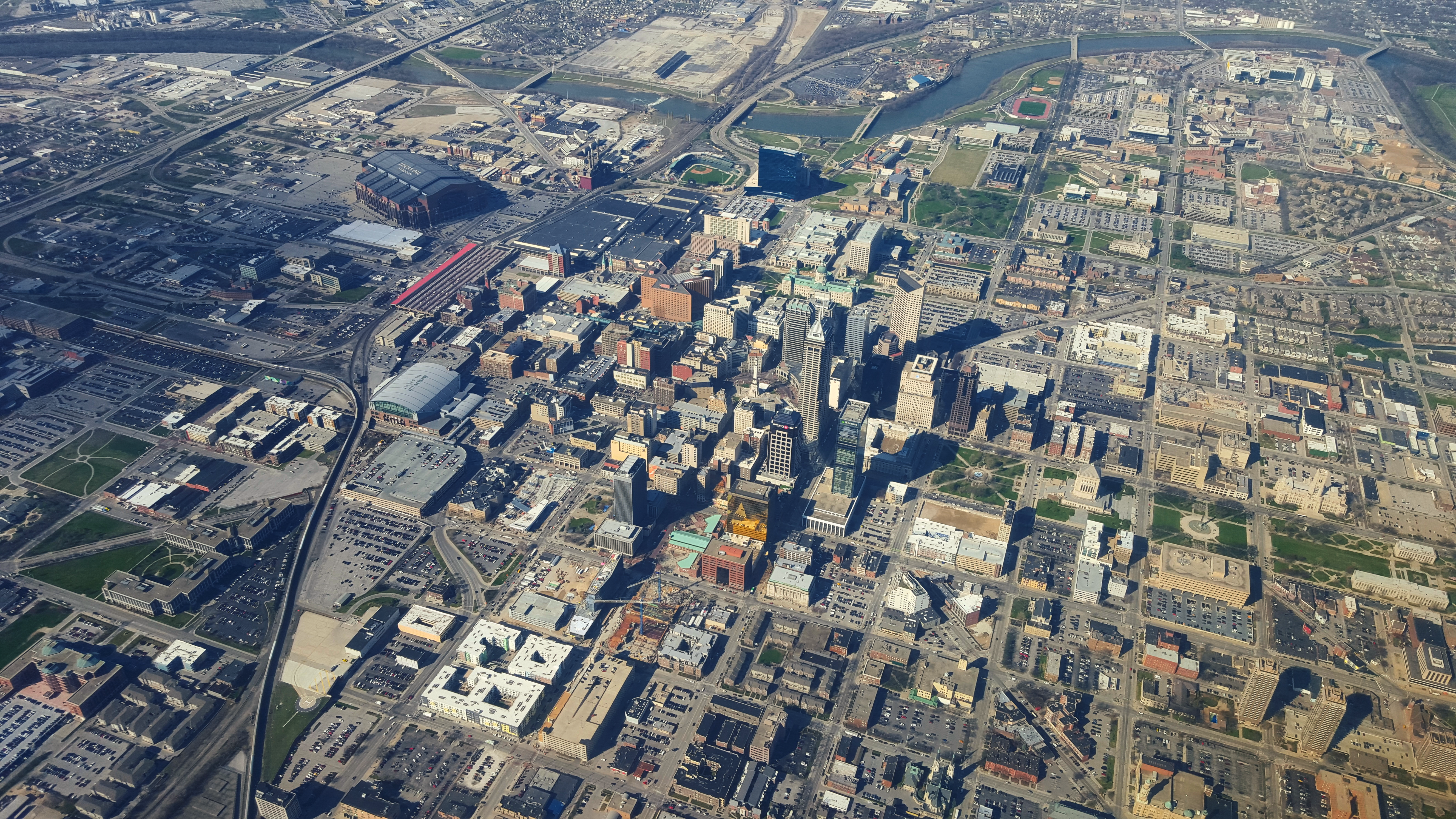
Downtown Indianapolis is a neighborhood area and the central business district of Indianapolis, Indiana, United States. Downtown is bordered by Interstate 65, Interstate 70, and the White River, and is situated near the geographic center of Marion County. Downtown has grown from the original 1821 town plat—often referred to as the ''Mile Square''—to encompass a broader geographic area of central Indianapolis, containing several smaller historic neighborhoods. Downtown Indianapolis is the cultural, political, and economic center of the Indianapolis metropolitan area. Downtown Indianapolis anchors the city's burgeoning tourism and hospitality sector, home to nearly 8,000 hotel rooms and several of the city's major sporting and event facilities. Downtown contains numerous historic districts and properties, most of the city's memorials and monuments, performing arts venues, and museums. Since its founding in 1820, the seats of Indianapolis's local administration and Indiana's ... [...More Info...] [...Related Items...] OR: [Wikipedia] [Google] [Baidu] |
University Of Indianapolis
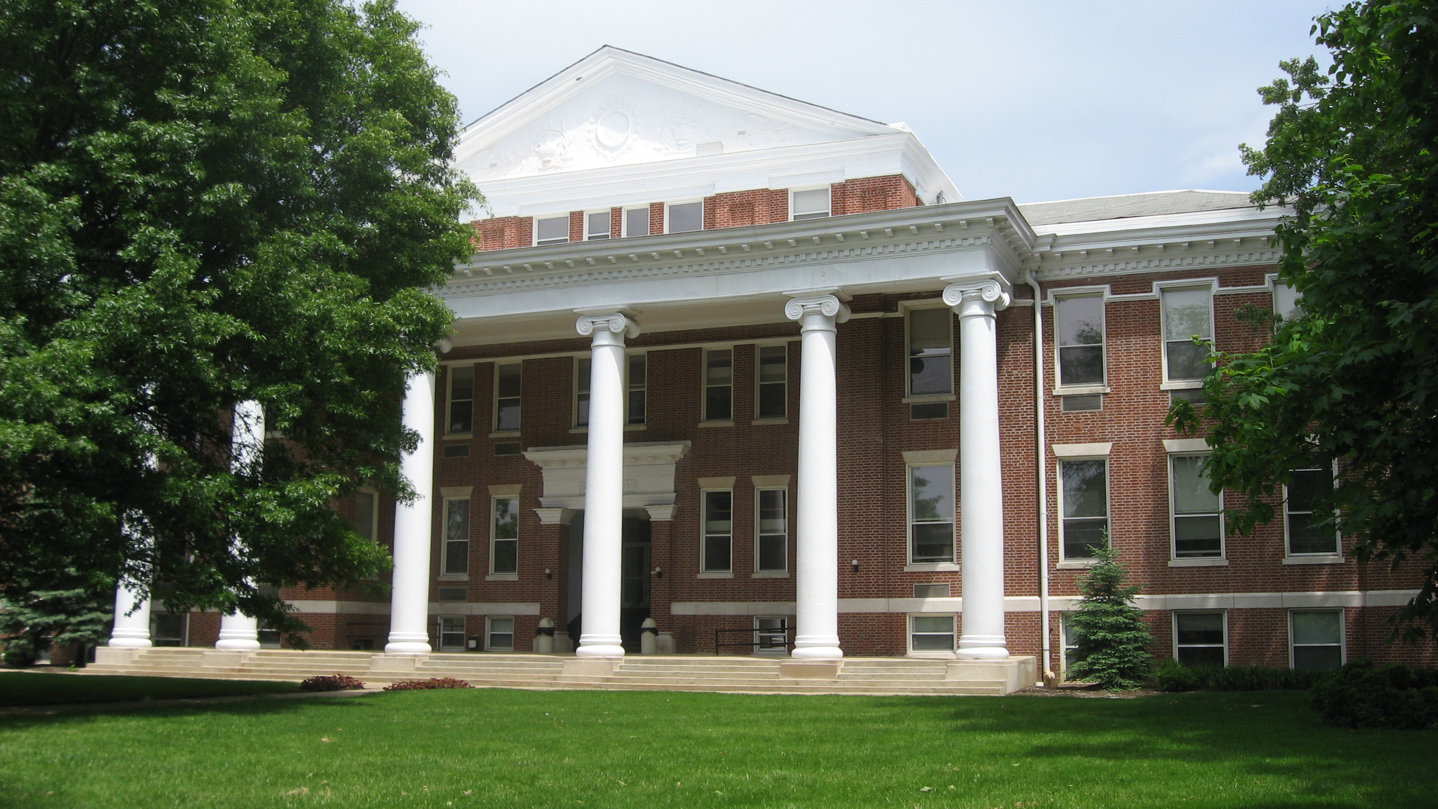
The University of Indianapolis (UIndy) is a private United Methodist Church-affiliated university in Indianapolis, Indiana. It offers Associate, Bachelor's, Master's, and Doctoral degrees. It was founded in 1902 as Indiana Central University and was popularly known as Indiana Central College from 1921 until 1975. In 1986 the name was changed to University of Indianapolis. The main campus is located on the south side of Indianapolis at 1400 East Hanna Avenue, just east of Shelby Street. The campus straddles the Carson Heights and University Heights neighborhoods of Indianapolis. UIndy's international sites include joint programs with Ningbo Institute of Technology, Zhejiang University (China) and Zhejiang Yuexiu University of Foreign Languages (China), and an articulation agreement with University of Nicosia (Cyprus). Previous international sites included the Galen University in Belize. The university's colors are crimson and gray. Its athletic teams, known as the Greyhounds, are ... [...More Info...] [...Related Items...] OR: [Wikipedia] [Google] [Baidu] |


.jpg)


