|
USS Hunting
USS ''Hunting'' (E-AG-398) was built as the ''LSM-398'' at the Charleston Navy Yard and launched in the first week of 1945. After service in the Atlantic as a landing ship the vessel was converted in 1953 to a sonar research vessel for the Naval Research Laboratory. ''Hunting'' was unique among Navy research vessels of the time in having a center well through which large towed "fish" could be transported and lowered to operating depths. The work contributed to sonar improvements and understanding ocean acoustics. After sale by the Navy in 1963 the vessel operated as a dredge until out of documentation in 1983. Landing ship (1945-1953) Launched as the ''LSM-398'' by the Charleston Navy Yard, on 6 January 1945; sponsored by Mrs. T. B. Thompson; and commissioned on 6 August 1945. Based at Little Creek, Virginia, the ship operated as a part of the Amphibious Fleet in the Atlantic, taking part in many training assaults (such as "Exercise Seminole" in 1947) in the Caribbean Sea and on ... [...More Info...] [...Related Items...] OR: [Wikipedia] [Google] [Baidu] |
Center Well
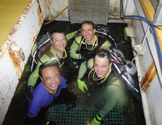
A moon pool is a feature of marine drilling platforms, drillships and diving support vessels, some marine research and underwater exploration or research vessels, and underwater habitats, in which it is also known as a wet porch. It is an opening in the floor or base of the hull, platform, or chamber giving access to the water below, allowing technicians or researchers to lower tools and instruments into the sea. It provides shelter and protection so that even if the ship is in high seas or surrounded by ice, researchers can work in comfort rather than on a deck exposed to the elements. A moon pool also allows divers, diving bells, ROVs, or small submersible craft to enter or leave the water easily and in a more protected environment. Moon pools can be used in chambers below sea level, especially for the use of scuba divers, and their design requires more complex consideration of air and water pressure acting on the moon pool surface. First use in oil drilling at sea Moon po ... [...More Info...] [...Related Items...] OR: [Wikipedia] [Google] [Baidu] |
Portsmouth, Virginia
Portsmouth is an independent city in southeast Virginia and across the Elizabeth River from Norfolk. As of the 2020 census, the population was 97,915. It is part of the Hampton Roads metropolitan area. The Norfolk Naval Shipyard and Naval Medical Center Portsmouth are historic and active U.S. Navy facilities located in Portsmouth. History In 1620, the future site of Portsmouth was recognized as a suitable shipbuilding location by John Wood, a shipbuilder, who petitioned King James I of England for a land grant. The surrounding area was soon settled as a plantation community.City of Portsmouth, Virginia - History [...More Info...] [...Related Items...] OR: [Wikipedia] [Google] [Baidu] |
Project Artemis
Project Artemis was a United States Navy acoustics research and development experiment from the late 1950s into the mid 1960s to test a potential low-frequency active sonar system for ocean surveillance. The at sea testing began in 1960 after research and development in the late 1950s. The project's test requirement was to prove detection of a submerged submarine at . The experiment, covering a number of years, involved a large active element and a massive receiver array. The receiving array was a field of modules forming a three dimensional array laid from 1961 to 1963 on the slopes of a seamount, the Plantagenet Bank (), off Bermuda. The modules, attached to ten lines of cable, were masts with floats on top to keep them upright. Each module mounted sets of hydrophones. The receiving array terminated at Argus Island, built on the seamount's top, with data processed at the laboratory that was also constructed for the project. The laboratory was then the Naval Facility Bermuda#Tud ... [...More Info...] [...Related Items...] OR: [Wikipedia] [Google] [Baidu] |
Virginia Capes
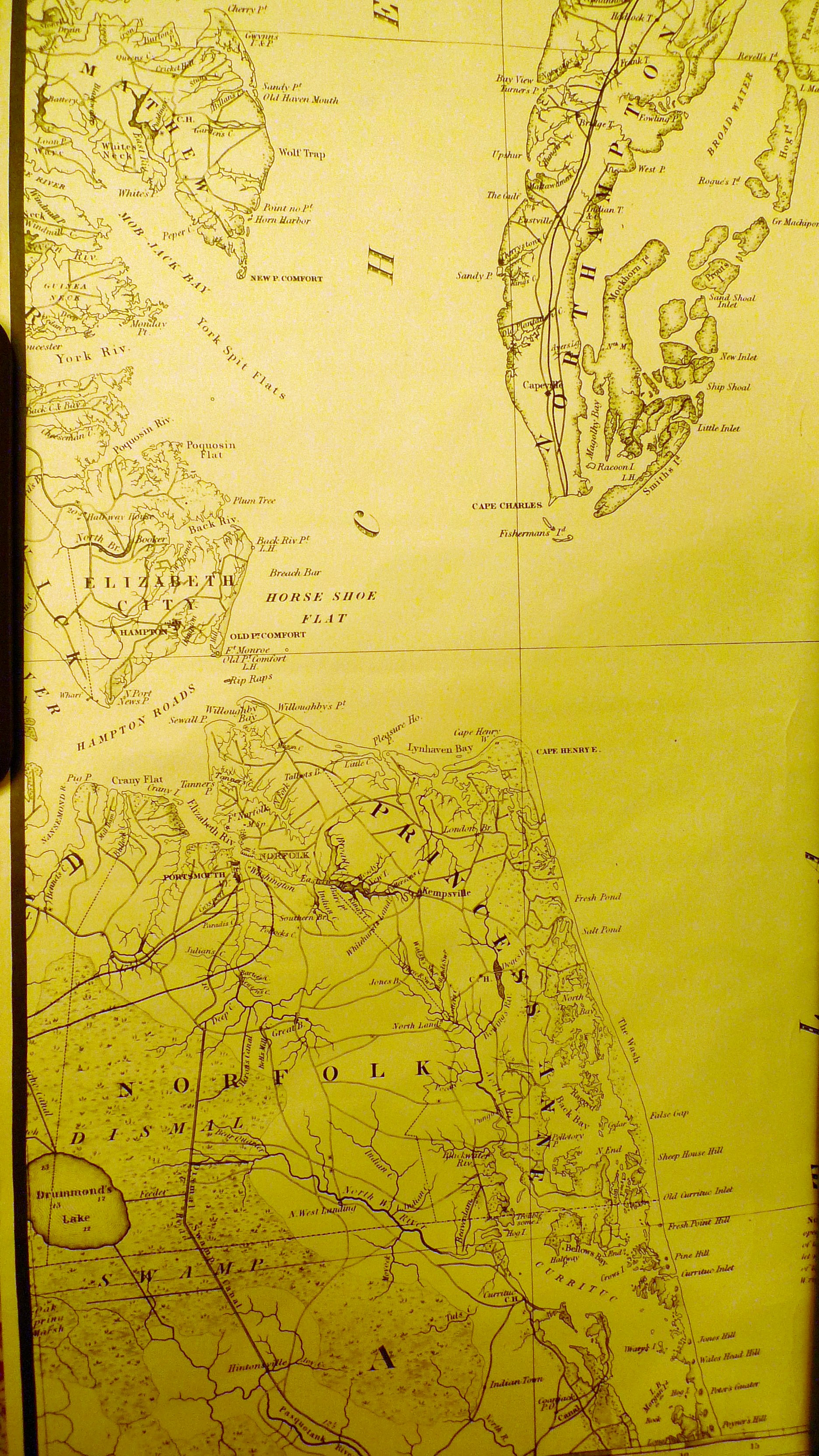
The Virginia Capes are the two capes, Cape Charles to the north and Cape Henry to the south, that define the entrance to Chesapeake Bay on the eastern coast of North America. In 1610, a supply ship learned of the famine at Jamestown when it landed at Cape Henry. "America and West Indies: June 1610." ''Calendar of State Papers Colonial, America and West Indies'': Volume 1, 1574-1660. Ed. W Noel Sainsbury. London: Her Majesty's Stationery Office, 1860. 9-10British History Online.Retrieved 13 June 2019. The importance of Chesapeake Bay in American history has long made the Virginia Capes strategically significant, most notably in the naval Battle of the Chesapeake that was crucial to the American victory at the siege of Yorktown, effectively ending the American Revolutionary War. As a result, the area was heavily garrisoned, beginning with the construction of Fort Monroe and Fort Wool in 1819. During the American Civil War, a pivotal battle between the ironclad warships and w ... [...More Info...] [...Related Items...] OR: [Wikipedia] [Google] [Baidu] |
Chesapeake Bay
The Chesapeake Bay ( ) is the largest estuary in the United States. The Bay is located in the Mid-Atlantic (United States), Mid-Atlantic region and is primarily separated from the Atlantic Ocean by the Delmarva Peninsula (including the parts: the Eastern Shore of Maryland / Eastern Shore of Virginia and the state of Delaware) with its mouth of the Bay at the south end located between Cape Henry and Cape Charles (headland), Cape Charles. With its northern portion in Maryland and the southern part in Virginia, the Chesapeake Bay is a very important feature for the ecology and economy of those two states, as well as others surrounding within its watershed. More than 150 major rivers and streams flow into the Bay's drainage basin, which covers parts of six states (New York, Pennsylvania, Delaware, Maryland, Virginia and West Virginia) and all of District of Columbia. The Bay is approximately long from its northern headwaters in the Susquehanna River to its outlet in the Atlantic Ocea ... [...More Info...] [...Related Items...] OR: [Wikipedia] [Google] [Baidu] |
Washington, D
Washington commonly refers to: * Washington (state), United States * Washington, D.C., the capital of the United States ** A metonym for the federal government of the United States ** Washington metropolitan area, the metropolitan area centered on Washington, D.C. * George Washington (1732–1799), the first president of the United States Washington may also refer to: Places England * Washington, Tyne and Wear, a town in the City of Sunderland metropolitan borough ** Washington Old Hall, ancestral home of the family of George Washington * Washington, West Sussex, a village and civil parish Greenland * Cape Washington, Greenland * Washington Land Philippines *New Washington, Aklan, a municipality *Washington, a barangay in Catarman, Northern Samar *Washington, a barangay in Escalante, Negros Occidental *Washington, a barangay in San Jacinto, Masbate *Washington, a barangay in Surigao City United States * Washington, Wisconsin (other) * Fort Washington (other) ... [...More Info...] [...Related Items...] OR: [Wikipedia] [Google] [Baidu] |
Operational Test And Evaluation Force
The Operational Test and Evaluation Force (OPTEVFOR) serves as an independent and objective agency within the United States Navy for the operational testing and evaluation (OT&E) of naval aviation, surface warfare, submarine warfare, C4I, cryptologic, and space systems in support Navy and U.S. Department of Defense acquisition programs. History OPTEVFOR traces its origins to the final months of World War II when the need arose for an effective means to combat Japanese kamikaze attacks. On 2 July 1945, the Composite Task Force, U.S. Atlantic Fleet, was formed to develop tactics and evaluate equipment to counter the Kamikazes. This force was commanded by Vice Admiral Willis A. Lee, USN, and consisted of miscellaneous types of combatant ships and drone aircraft. Following the end of World War II, the Composite Task Force was consolidated with other fleet units doing development work and in December 1947, was re-designated as the Operational Development Force (OPDEVFOR), with the ... [...More Info...] [...Related Items...] OR: [Wikipedia] [Google] [Baidu] |
Norfolk Naval Shipyard
The Norfolk Naval Shipyard, often called the Norfolk Navy Yard and abbreviated as NNSY, is a U.S. Navy facility in Portsmouth, Virginia, for building, remodeling and repairing the Navy's ships. It is the oldest and largest industrial facility that belongs to the U.S. Navy as well as the most comprehensive. Located on the Elizabeth River, the yard is just a short distance upriver from its mouth at Hampton Roads. It was established as Gosport Shipyard in 1767. Destroyed during the American Revolutionary War, it was rebuilt and became home to the first operational drydock in the United States in the 1830s. Changing hands during the American Civil War, it served the Confederate States Navy until it was again destroyed in 1862, when it was given its current name. The shipyard was again rebuilt, and has continued operation through the present day. History British control The Gosport Shipyard was founded on November 1, 1767 by Andrew Sprowle on the western shore of the Elizabeth Rive ... [...More Info...] [...Related Items...] OR: [Wikipedia] [Google] [Baidu] |
Bureau Of Ships
The United States Navy's Bureau of Ships (BuShips) was established by Congress on 20 June 1940, by a law which consolidated the functions of the Bureau of Construction and Repair (BuC&R) and the Bureau of Engineering (BuEng). The new bureau was to be headed by a chief and deputy-chief, one selected from the Engineering Corps (Marine Engineer) and the other from the Construction Corps (Naval Architect). The chief of the former Bureau of Engineering, Rear Admiral Samuel M. "Mike" Robinson, was named BuShips' first chief, while the former chief of the Bureau of Construction & Repair, Rear Admiral Alexander H. Van Keuren, was named as BuShips' first Deputy-Chief. The bureau's responsibilities included supervising the design, construction, conversion, procurement, maintenance, and repair of ships and other craft for the Navy; managing shipyards, repair facilities, laboratories, and shore stations; developing specifications for fuels and lubricants; and conducting salvage operations. Bu ... [...More Info...] [...Related Items...] OR: [Wikipedia] [Google] [Baidu] |
SOFAR Channel
The SOFAR channel (short for sound fixing and ranging channel), or deep sound channel (DSC), is a horizontal layer of water in the ocean at which depth the speed of sound is at its minimum. The SOFAR channel acts as a waveguide for sound, and low frequency sound waves within the channel may travel thousands of miles before dissipating. An example was reception of coded signals generated by the Navy chartered ocean surveillance vessel ''Cory Chouest'' off Heard Island, located in the southern Indian Ocean (between Africa, Australia and Antarctica), by hydrophones in portions of all five major ocean basins and as distant as the North Atlantic and North Pacific.Figure 1 of the referenc"The Heard Island Feasibility Test"(Munk) shows ray paths to receiving locations. Table 1 lists the sites with one being a Canadian research vessel with a towed array off Cape Cod. This phenomenon is an important factor in ocean surveillance. The deep sound channel was discovered and described independ ... [...More Info...] [...Related Items...] OR: [Wikipedia] [Google] [Baidu] |
East Coast Of The United States
The East Coast of the United States, also known as the Eastern Seaboard, the Atlantic Coast, and the Atlantic Seaboard, is the coastline along which the Eastern United States meets the North Atlantic Ocean. The eastern seaboard contains the coastal states and areas east of the Appalachian Mountains that have shoreline on the Atlantic Ocean, namely, Maine, New Hampshire, Massachusetts, Rhode Island, Connecticut, New York, New Jersey, Delaware, Maryland, Virginia, North Carolina, South Carolina, Georgia, and Florida.General Reference Map , , 2003. Toponymy and composition T ...[...More Info...] [...Related Items...] OR: [Wikipedia] [Google] [Baidu] |


