|
USS Devastator (AM-318)
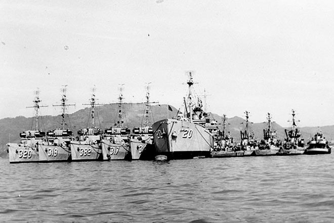
USS ''Devastator'' (AM-318) was an ''Auk''-class minesweeper acquired by the U.S. Navy for the dangerous task of removing naval mines from minefields laid in the water to prevent ships from passing. Construction history ''Devastator'' was launched 19 April 1943 by General Engineering and Dry Dock Co., Alameda, California; sponsored by Mrs. D. A. Shaw; and commissioned 12 January 1944. World War II service ''Devastator'' – the first ship in the U.S. Navy to bear that name—was an auxiliary ship of the United States Navy. She served as an escort vessel during the latter half of the Second World War, and later saw service in the Korean War. ''Devastator'' arrived at Pearl Harbor 30 March 1944 as escort for a convoy. The next day she began convoy escort duty in Majuro and Kwajalein, which continued until 30 July. During 3 to 17 August she swept off French Frigate Shoals, and after one voyage to Eniwetok from 4 to 25 September, served at Pearl Harbor on training duty for t ... [...More Info...] [...Related Items...] OR: [Wikipedia] [Google] [Baidu] |
General Engineering & Dry Dock Company
General Engineering & Dry Dock Company was a shipbuilding and ship repair company in Alameda, California that was active from the 1920s through the 1940s. The company built ships for the Southern Pacific Railroad and the United States Coast Guard in the late 1920s and early 1930s and took part in the World War II shipbuilding boom, making diesel-propelled steel hulled auxiliaries for the United States Navy, primarily oceangoing minesweepers. History At the beginning of World War II, the U.S.Navy started the program for expand the navy. The U.S.Navy used two separate shipbuilding and shiprepair sites to create the Naval Industrial Reserve Shipyard (NIRS) Alameda. The first was the General Engineering and Dry Dock Company. The company worked under contract NObs-344 and built small warships for the U.S. Navy. The shipyard had four shipbuilding ways, which were designed for the simultaneous construction of several ships. In 1946, the U.S. Navy ceased contract with company. The sec ... [...More Info...] [...Related Items...] OR: [Wikipedia] [Google] [Baidu] |
Naval Mines
A naval mine is a self-contained explosive device placed in water to damage or destroy surface ships or submarines. Unlike depth charges, mines are deposited and left to wait until they are triggered by the approach of, or contact with, any vessel or a particular vessel type, akin to anti-infantry vs. anti-vehicle mines. Naval mines can be used offensively, to hamper enemy shipping movements or lock vessels into a harbour; or defensively, to protect friendly vessels and create "safe" zones. Mines allow the minelaying force commander to concentrate warships or defensive assets in mine-free areas giving the adversary three choices: undertake an expensive and time-consuming minesweeping effort, accept the casualties of challenging the minefield, or use the unmined waters where the greatest concentration of enemy firepower will be encountered. Although international law requires signatory nations to declare mined areas, precise locations remain secret; and non-complying individual ... [...More Info...] [...Related Items...] OR: [Wikipedia] [Google] [Baidu] |
Okinawa
is a prefecture of Japan. Okinawa Prefecture is the southernmost and westernmost prefecture of Japan, has a population of 1,457,162 (as of 2 February 2020) and a geographic area of 2,281 km2 (880 sq mi). Naha is the capital and largest city of Okinawa Prefecture, with other major cities including Okinawa, Uruma, and Urasoe. Okinawa Prefecture encompasses two thirds of the Ryukyu Islands, including the Okinawa, Daitō and Sakishima groups, extending southwest from the Satsunan Islands of Kagoshima Prefecture to Taiwan ( Hualien and Yilan Counties). Okinawa Prefecture's largest island, Okinawa Island, is the home to a majority of Okinawa's population. Okinawa Prefecture's indigenous ethnic group are the Ryukyuan people, who also live in the Amami Islands of Kagoshima Prefecture. Okinawa Prefecture was ruled by the Ryukyu Kingdom from 1429 and unofficially annexed by Japan after the Invasion of Ryukyu in 1609. Okinawa Prefecture was officially founded in 1879 by the Empire ... [...More Info...] [...Related Items...] OR: [Wikipedia] [Google] [Baidu] |
Ulithi
Ulithi ( yap, Wulthiy, , or ) is an atoll in the Caroline Islands of the western Pacific Ocean, about east of Yap. Overview Ulithi consists of 40 islets totaling , surrounding a lagoon about long and up to wide—at one of the largest in the world. It is administered by the state of Yap in the Federated States of Micronesia. Ulithi's population was 773 in 2000. There are four inhabited islands on Ulithi Atoll. They are Falalop ( uli, Fl'aalop), Asor ''(Yasor)'', Mogmog ''(Mwagmwog)'', and Fedarai ''(Fedraey)''. Falalop is the most accessible with Ulithi Airport, a small resort hotel, store and one of three public high schools in Yap state. Mogmog is the seat of the high chief of Ulithi Atoll though each island has its own chief. Other important islands are Losiap ( uli, L'oosiyep), Sorlen ''(Sohl'oay)'', and Potangeras ''(Potoangroas)''. The atoll is in the westernmost of the Caroline Islands, southwest of Guam, east of the Philippines and south of Tokyo. It is ... [...More Info...] [...Related Items...] OR: [Wikipedia] [Google] [Baidu] |
Iwo Jima
Iwo Jima (, also ), known in Japan as , is one of the Japanese Volcano Islands and lies south of the Bonin Islands. Together with other islands, they form the Ogasawara Archipelago. The highest point of Iwo Jima is Mount Suribachi at high. Although south of the metropolis of Tokyo on the mainland, this island of 21 km2 (8 square miles) is administered as part of the Ogasawara Subprefecture of Tokyo. Since July 1944, when all the civilians were forcibly evacuated, the island has had a military-only population. The island was the location of the Battle of Iwo Jima between February 1945 and March 1945. This engagement saw some of the fiercest fighting of the Pacific War, with each side suffering over 20,000 casualties in the battle. The island became globally recognized when Joe Rosenthal, of the Associated Press, published his photograph '' Raising the Flag on Iwo Jima'', taken on Mount Suribachi. The US military occupied Iwo Jima until 1968, when it was returned to ... [...More Info...] [...Related Items...] OR: [Wikipedia] [Google] [Baidu] |
Saipan
Saipan ( ch, Sa’ipan, cal, Seipél, formerly in es, Saipán, and in ja, 彩帆島, Saipan-tō) is the largest island of the Northern Mariana Islands, a Commonwealth (U.S. insular area), commonwealth of the United States in the western Pacific Ocean. According to 2020 estimates by the United States Census Bureau, the population of Saipan was 43,385, a decline of 10% from its 2010 count of 48,220. The legislative and executive branches of Commonwealth government are located in the village of Capitol Hill, Saipan, Capitol Hill on the island while the judicial branch is headquartered in the village of Susupe. Since the entire island is organized as a single municipality, most publications designate Saipan as the Commonwealth's capital. As of 2015, Saipan's mayor is David M. Apatang and the governor of the Northern Mariana Islands is Ralph Torres. History Prehistory Traces of human settlements on Saipan have been found by archaeologists ranging over 4,000 years, includ ... [...More Info...] [...Related Items...] OR: [Wikipedia] [Google] [Baidu] |
Battle Of Iwo Jima
The Battle of Iwo Jima (19 February – 26 March 1945) was a major battle in which the United States Marine Corps (USMC) and United States Navy (USN) landed on and eventually captured the island of Iwo Jima from the Imperial Japanese Army (IJA) during World War II. The American invasion, designated Operation Detachment, had the purpose of capturing the island with its two airfields: South Field and Central Field. The Japanese Army positions on the island were heavily fortified, with a dense network of bunkers, hidden artillery positions, and of tunnels. The American ground forces were supported by extensive naval artillery and had complete air supremacy provided by U.S. Navy and Marine Corps aviators throughout the battle. The five-week battle saw some of the fiercest and bloodiest fighting of the Pacific War. The Japanese combat deaths numbered three times the number of American deaths, but uniquely among Pacific War Marine battles, the American total casualties (dead a ... [...More Info...] [...Related Items...] OR: [Wikipedia] [Google] [Baidu] |
Eniwetok
Enewetak Atoll (; also spelled Eniwetok Atoll or sometimes Eniewetok; mh, Ānewetak, , or , ; known to the Japanese as Brown Atoll or Brown Island; ja, ブラウン環礁) is a large coral atoll of 40 islands in the Pacific Ocean and with its 664 people (as of 2011) forms a legislative district of the Ralik Chain of the Marshall Islands. With a land area total less than , it is no higher than and surrounds a deep central lagoon, in circumference. It is the second-westernmost atoll of the Ralik Chain and is west from Bikini Atoll. It was held by the Japanese from 1914 until its capture by the United States in February 1944, during World War II, then became Naval Base Eniwetok. Nuclear testing by the US totaling the equivalent of over 30 megatons of TNT took place during the Cold War; in 1977–1980, a concrete dome (the Runit Dome) was built on Runit Island to deposit radioactive soil and debris. The Runit Dome is deteriorating and could be breached by a typhoon, tho ... [...More Info...] [...Related Items...] OR: [Wikipedia] [Google] [Baidu] |
French Frigate Shoals
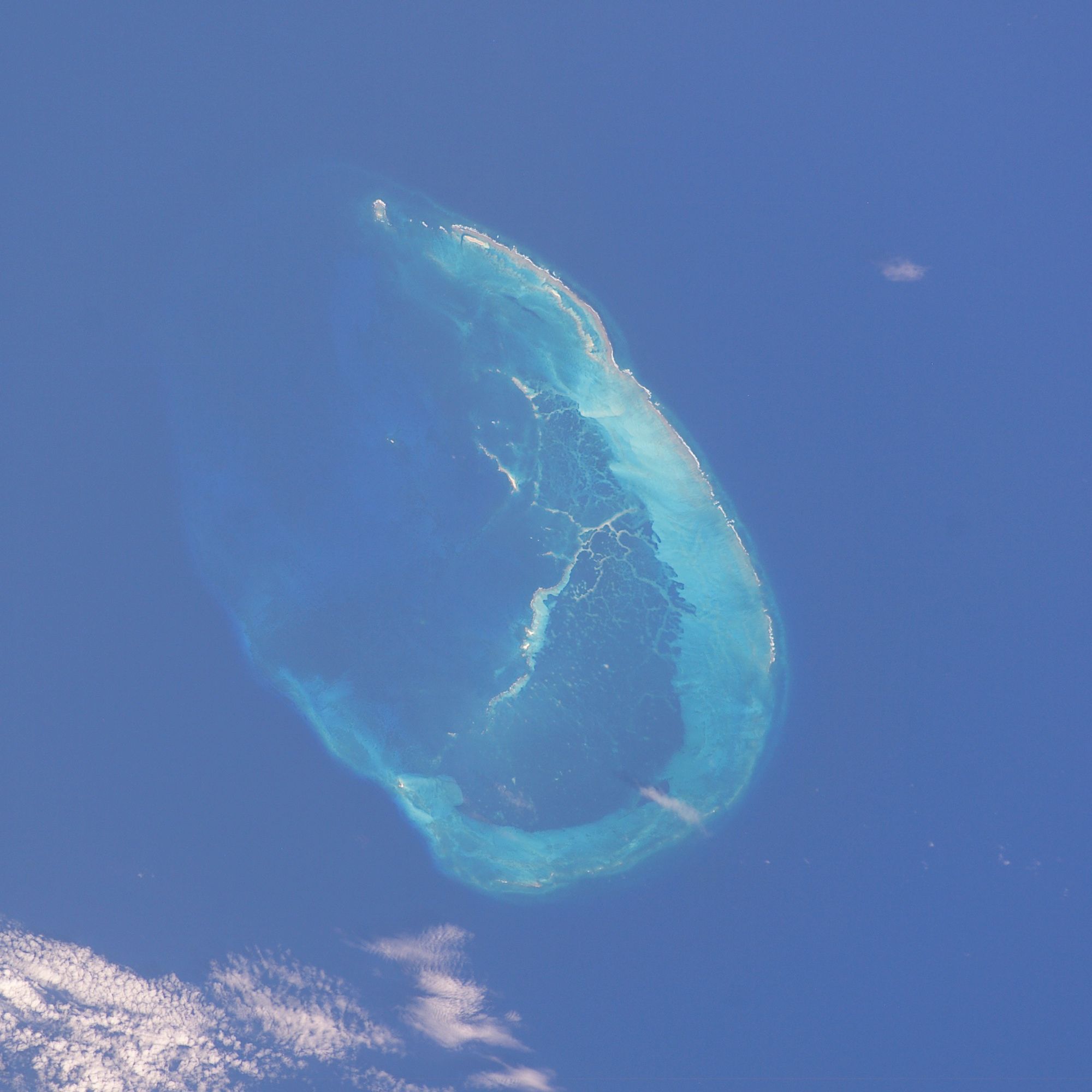
The French Frigate Shoals ( Hawaiian: Kānemilohai) is the largest atoll in the Northwestern Hawaiian Islands. Its name commemorates French explorer Jean-François de La Pérouse, who nearly lost two frigates when attempting to navigate the shoals. It consists of a crescent-shaped reef, twelve sandbars, and the La Perouse Pinnacle, the only remnant of its volcanic origins. The total land area of the islets is . Total coral reef area of the shoals is over . Tern Island, with an area of , has a landing strip and permanent habitations for a small number of people. It is maintained as a field station in the Hawaiian Islands National Wildlife Refuge by the United States Fish and Wildlife Service. The French Frigate Shoals are about northwest of Honolulu. In the 20th century, the shoals were used by the Imperial Japanese Navy as part of an operation to attack Hawaii; afterwards, a small United States Navy base was established there to prevent it from being used again. After t ... [...More Info...] [...Related Items...] OR: [Wikipedia] [Google] [Baidu] |
Kwajalein
Kwajalein Atoll (; Marshallese: ) is part of the Republic of the Marshall Islands (RMI). The southernmost and largest island in the atoll is named Kwajalein Island, which its majority English-speaking residents (about 1,000 mostly U.S. civilian personnel) often use the shortened name, Kwaj . The total land area of the atoll amounts to just over . It lies in the Ralik Chain, southwest of Honolulu, Hawaii. The US Navy has hosted a naval base on Kwajalein Island since World War II. It was the final resting place of the German cruiser '' Prinz Eugen'' after it survived the Operation Crossroads nuclear test in 1946. In the late 1950s, the US Army took over the base as part of their Nike Zeus anti-ballistic missile efforts, and since then the atoll has been widely used for missile tests of all sorts. Today it is part of the Ronald Reagan Ballistic Missile Defense Test Site, with various radars, tracking cameras, missile launchers, and many support systems spread across many is ... [...More Info...] [...Related Items...] OR: [Wikipedia] [Google] [Baidu] |
Majuro
Majuro (; Marshallese: ' ) is the capital and largest city of the Marshall Islands. It is also a large coral atoll of 64 islands in the Pacific Ocean. It forms a legislative district of the Ratak (Sunrise) Chain of the Marshall Islands. The atoll has a land area of and encloses a lagoon of . As with other atolls in the Marshall Islands, Majuro consists of narrow land masses. It has a tropical trade wind climate, with an average temperature of . Majuro has been inhabited by humans for at least 2,000 years and was first settled by the Austronesian ancestors of the modern day Marshallese people. In 1885, the Marshall Islands were annexed by the German Empire and Majuro became their first and primary trading post. The city has also been under Japanese and American administration. After the Marshall Islands broke away from the Federated States of Micronesia in 1978 to form the Republic of the Marshall Islands, Majuro became the new country's capital and meeting place of the Nitij ... [...More Info...] [...Related Items...] OR: [Wikipedia] [Google] [Baidu] |
Convoy
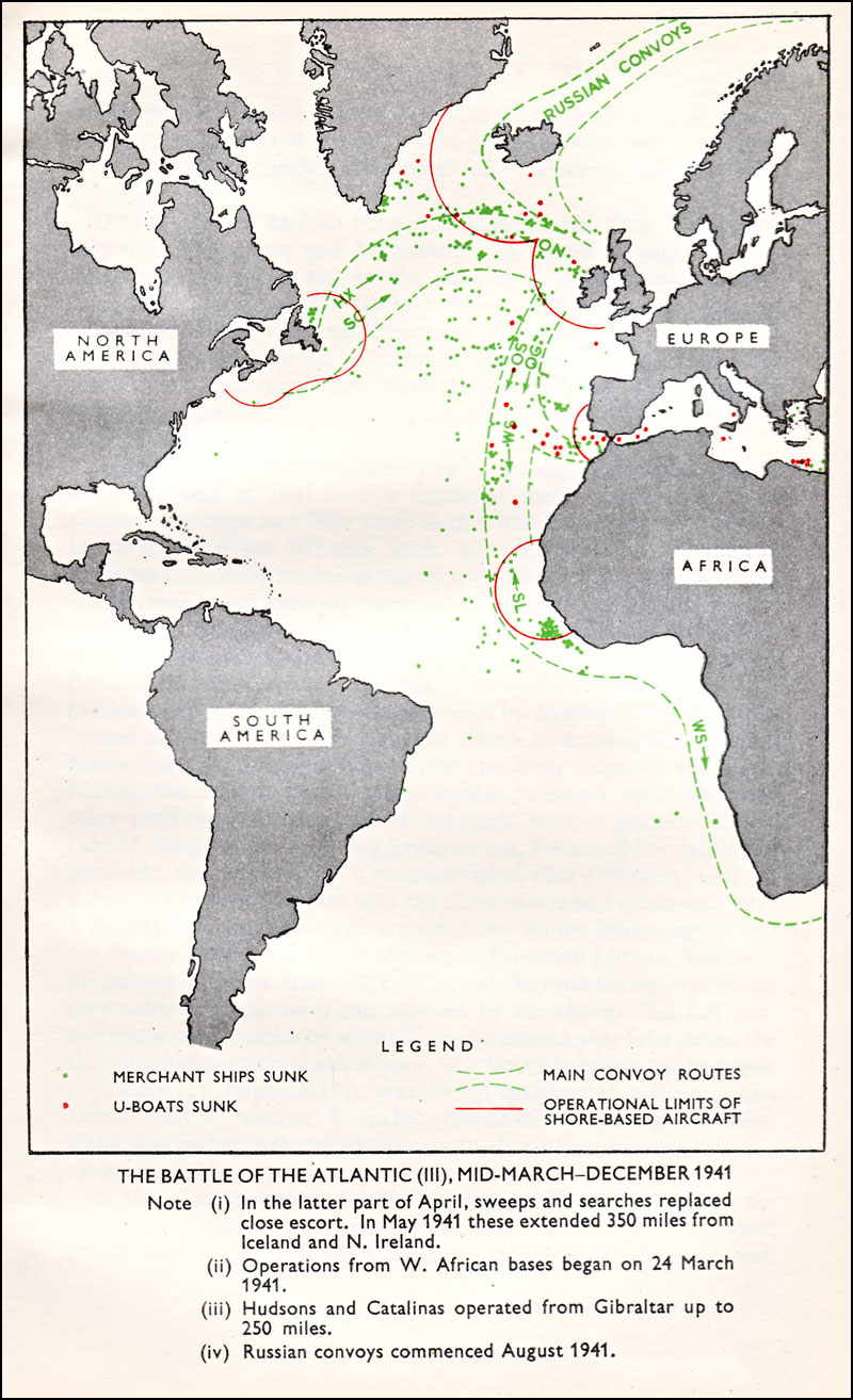
A convoy is a group of vehicles, typically motor vehicles or ships, traveling together for mutual support and protection. Often, a convoy is organized with armed defensive support and can help maintain cohesion within a unit. It may also be used in a non-military sense, for example when driving through remote areas. Naval convoys Age of Sail Naval convoys have been in use for centuries, with examples of merchant ships traveling under naval protection dating to the 12th century. The use of organized naval convoys dates from when ships began to be separated into specialist classes and national navies were established. By the French Revolutionary Wars of the late 18th century, effective naval convoy tactics had been developed to ward off pirates and privateers. Some convoys contained several hundred merchant ships. The most enduring system of convoys were the Spanish treasure fleets, that sailed from the 1520s until 1790. When merchant ships sailed independently, a privateer cou ... [...More Info...] [...Related Items...] OR: [Wikipedia] [Google] [Baidu] |


