|
USRC Dexter (1874)
USRC ''Dexter'' was a cutter of the United States Revenue Cutter Service in commission from 1874 to 1908. She was the second ship of the Revenue Cutter Service to bear the name.Canney, p 14 The other ''Dexter''-class cutters, all commissioned in 1874, were and .Canney, pp 43–44King, p 15 ''Dexter'' was built by the Atlantic Works Company at Boston, Massachusetts. Captain John A. Henriques accepted her for service on 6 June 1874, and she was commissioned into the Revenue Cutter Service on 18 June 1874. Her role in the rescue of passengers from the sinking SS City of Columbus under winter gale winds brought her nationwide popular acclaim. Early service ''Dexter'' was stationed at Newport, Rhode Island. She patrolled the Long Island Sound and east to Nantucket, Massachusetts, enforcing customs laws, patrolling regattas, and assisting mariners in distress, among other duties. She also made annual winter cruises as directed, usually off Edgartown, Massachusetts to Nantucket ... [...More Info...] [...Related Items...] OR: [Wikipedia] [Google] [Baidu] |
Ensign Of The United States Revenue-Marine (1868)
An ensign is the national flag flown on a vessel to indicate nationality. The ensign is the largest flag, generally flown at the stern (rear) of the ship while in port. The naval ensign (also known as war ensign), used on warships, may be different from the civil ensign (merchant ships) or the yacht ensign (recreational boats). Large versions of naval ensigns called battle ensigns are used when a warship goes into battle. The ensign differs from the jack (flag), jack, which is flown from a jackstaff at the bow of a vessel. In its widest sense, an ensign is just a flag or other standard. The European military rank of Ensign (rank), ensign, once responsible for bearing a unit's standard (whether national or regimental), derives from it (in the cavalry, the equivalent rank was Cornet (rank), cornet, named after a type of flag). Ensigns, such as the ancient Roman ensigns in the Arch of Constantine, are not always flags. National ensigns In nautical use, the ensign is flown on a shi ... [...More Info...] [...Related Items...] OR: [Wikipedia] [Google] [Baidu] |
Nantucket Shoals
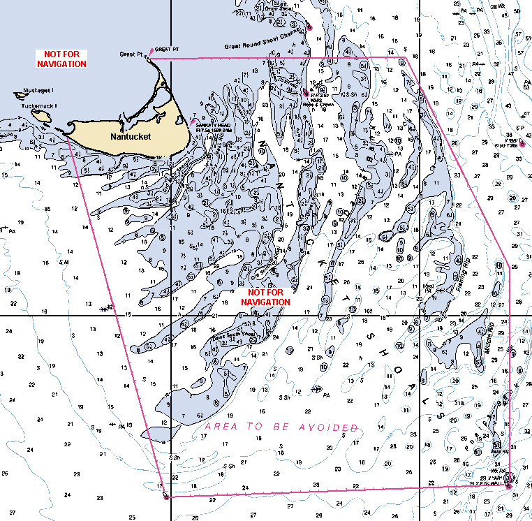
Nantucket Shoals is an area of dangerously shallow water in the Atlantic Ocean that extends from Nantucket Island, Massachusetts, eastward for and southeastward for ; in places water depth can be as shallow as . Depth soundings are unpredictable due to the constant change caused by strong currents, which are rotary rather than reversing. The shoals lie just off of a major transatlantic shipping lane. Numerous ships have been wrecked here, most recently and notably the oil tanker '' Argo Merchant'' in December 1976. Until 1983, the edge of the shoals was guarded by the Nantucket Lightship. Nantucket Shoals is made up of the following features: *Asia Rip *Davis Bank *Fishing Rip *Middle Rip *Phelps Bank According to the 2010 edition of the '' United States Coast Pilot'', the International Maritime Organization has established an "area to be avoided" for the Nantucket Shoals. Vessels transporting oil or hazardous materials and vessels of more than 1,000 gross tons Gross tonnage ... [...More Info...] [...Related Items...] OR: [Wikipedia] [Google] [Baidu] |
Flying Squadron (United States Navy)
The Flying Squadron was a United States Navy force that operated in the Atlantic Ocean, the Gulf of Mexico and the Spanish West Indies during the first half of the Spanish–American War. The squadron included many of America's most modern warships which engaged the Spanish in a blockade of Cuba. Spanish–American War Formation In the spring of 1898, tensions were rising between the United States and Spain over events in Cuba, particularly the explosion and sinking of the armored cruiser in Havana harbor. Although the United States Navy's leadership preferred to concentrate its fleet at Key West, Florida, for operations against Cuba and Puerto Rico in the event of war, the American public and U.S. Government feared that a Spanish Navy squadron might cross the Atlantic from Spain and raid the East Coast of the United States. The political pressure to establish a visible naval defense of the East Coast forced the Navy to reorganize itself to address the public's concerns. Accor ... [...More Info...] [...Related Items...] OR: [Wikipedia] [Google] [Baidu] |
Gulf Of Mexico
The Gulf of Mexico ( es, Golfo de México) is an oceanic basin, ocean basin and a marginal sea of the Atlantic Ocean, largely surrounded by the North American continent. It is bounded on the northeast, north and northwest by the Gulf Coast of the United States; on the southwest and south by the Mexico, Mexican States of Mexico, states of Tamaulipas, Veracruz, Tabasco, Campeche, Yucatan, and Quintana Roo; and on the southeast by Cuba. The Southern United States, Southern U.S. states of Texas, Louisiana, Mississippi, Alabama, and Florida, which border the Gulf on the north, are often referred to as the "Third Coast" of the United States (in addition to its Atlantic and Pacific Ocean, Pacific coasts). The Gulf of Mexico took shape approximately 300 million years ago as a result of plate tectonics.Huerta, A.D., and D.L. Harry (2012) ''Wilson cycles, tectonic inheritance, and rifting of the North American Gulf of Mexico continental margin.'' Geosphere. 8(1):GES00725.1, first p ... [...More Info...] [...Related Items...] OR: [Wikipedia] [Google] [Baidu] |
East Coast Of The United States
The East Coast of the United States, also known as the Eastern Seaboard, the Atlantic Coast, and the Atlantic Seaboard, is the coastline along which the Eastern United States meets the North Atlantic Ocean. The eastern seaboard contains the coastal states and areas east of the Appalachian Mountains that have shoreline on the Atlantic Ocean, namely, Maine, New Hampshire, Massachusetts, Rhode Island, Connecticut, New York, New Jersey, Delaware, Maryland, Virginia, North Carolina, South Carolina, Georgia, and Florida.General Reference Map , , 2003. Toponymy and composition T ...[...More Info...] [...Related Items...] OR: [Wikipedia] [Google] [Baidu] |
Spanish–American War
, partof = the Philippine Revolution, the decolonization of the Americas, and the Cuban War of Independence , image = Collage infobox for Spanish-American War.jpg , image_size = 300px , caption = (clockwise from top left) , date = April 21 – August 13, 1898() , place = , casus = , result = American victory *Treaty of Paris (1898), Treaty of Paris of 1898 *Founding of the First Philippine Republic and beginning of the Philippine–American War * German–Spanish Treaty (1899), Spain sells to Germany the last colonies in the Pacific in 1899 and end of the Spanish Empire in Spanish colonization of the Americas, America and Asia. , territory = Spain relinquishes sovereignty over Cuba; cedes Puerto Rico, Guam and the Philippine Islands to the United States. $20 million paid to Spain by the United States for infrastructure owned by Spain. , combatant1 = United State ... [...More Info...] [...Related Items...] OR: [Wikipedia] [Google] [Baidu] |
Wilmington, North Carolina
Wilmington is a port city in and the county seat of New Hanover County in coastal southeastern North Carolina, United States. With a population of 115,451 at the 2020 census, it is the eighth most populous city in the state. Wilmington is the principal city of the Wilmington Metropolitan Statistical Area, a metropolitan area that includes New Hanover and Pender counties in southeastern North Carolina, which had a population of 301,284 at the 2020 census. Its historic downtown has a Riverwalk, developed as a tourist attraction in the late 20th century. In 2014, Wilmington's riverfront was ranked as the "Best American Riverfront" by readers of ''USA Today''. The National Trust for Historic Preservation selected Wilmington as one of its 2008 Dozen Distinctive Destinations. City residents live between the Cape Fear river and the Atlantic ocean, with four nearby beach communities just outside Wilmington: Fort Fisher, Wrightsville Beach, Carolina Beach and Kure Beach, all wi ... [...More Info...] [...Related Items...] OR: [Wikipedia] [Google] [Baidu] |
Wampanoag People
The Wampanoag , also rendered Wôpanâak, are an Indigenous people of the Northeastern Woodlands based in southeastern Massachusetts and historically parts of eastern Rhode Island,Salwen, "Indians of Southern New England and Long Island," p. 171. Their territory included the islands of Martha's Vineyard and Nantucket. Today there are two federally recognized Wampanoag tribes: * Mashpee Wampanoag Tribe * Wampanoag Tribe of Gay Head (Aquinnah). The Wampanoag language was a dialect of Masschusett, a Southern New England Algonquian language. At the time of their first contact with the English in the 17th century, they were a large confederation of at least 24 recorded tribes. Their population numbered in the thousands; 3,000 Wampanoag lived on Martha's Vineyard alone. From 1615 to 1619, the Wampanoag suffered an epidemic, long suspected to be smallpox. Modern research, however, has suggested that it may have been leptospirosis, a bacterial infection that can develop into Weil's ... [...More Info...] [...Related Items...] OR: [Wikipedia] [Google] [Baidu] |
Massachusetts Humane Society
Captain Joshua James, volunteer The Humane Society of the Commonwealth of Massachusetts, better known as the Massachusetts Humane Society was founded in 1786 by a group of Boston citizens who were concerned about the needless deaths resulting from shipwrecks and drownings and wanted to find ways to save lives. It was based on the Royal Humane Society, a similar organization established in Great Britain in 1774. The Massachusetts Humane Society became the model for the United States Life-Saving Service funded by Congress in 1848 and operated by the United States Coast Guard since 1915. Its first lifesaving activities consisted of publishing procedures for dealing with victims of shipwreck and other water-related accidents, and the placement of lifesaving equipment, lifeboats, and shelters on the islands and coast of Massachusetts Bay. It also offered rewards to individuals who successfully rescued people from the state's waters. By the early 20th century the society operated ... [...More Info...] [...Related Items...] OR: [Wikipedia] [Google] [Baidu] |
Lifeboat (shipboard)
A lifeboat or liferaft is a small, rigid or inflatable boat carried for emergency evacuation in the event of a disaster aboard a ship. Lifeboat drills are required by law on larger commercial ships. Rafts (liferafts) are also used. In the military, a lifeboat may double as a whaleboat, dinghy, or gig. The ship's tenders of cruise ships often double as lifeboats. Recreational sailors usually carry inflatable liferafts, though a few prefer small proactive lifeboats that are harder to sink and can be sailed to safety. Inflatable lifeboats may be equipped with auto-inflation (carbon dioxide or nitrogen) canisters or mechanical pumps. A quick release and pressure release mechanism is fitted on ships so that the canister or pump automatically inflates the lifeboat, and the lifeboat breaks free of the sinking vessel. Commercial aircraft are also required to carry auto-inflating liferafts in case of an emergency water landing; offshore oil platforms also have liferafts. Ship-launche ... [...More Info...] [...Related Items...] OR: [Wikipedia] [Google] [Baidu] |
Martha's Vineyard
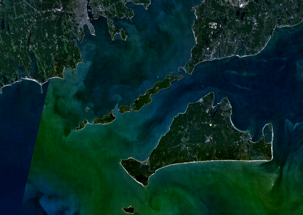
Martha's Vineyard, often simply called the Vineyard, is an island in the Northeastern United States, located south of Cape Cod in Dukes County, Massachusetts, known for being a popular, affluent summer colony. Martha's Vineyard includes the smaller adjacent Chappaquiddick Island, which is usually connected to the Vineyard. The two islands have sometimes been separated by storms and hurricanes, which last occurred from 2007 to 2015. It is the 58th largest island in the U.S., with a land area of about , and the third-largest on the East Coast, after Long Island and Mount Desert Island. Martha's Vineyard constitutes the bulk of Dukes County, which also includes the Elizabeth Islands and the island of Nomans Land (Massachusetts), Nomans Land. The Vineyard was home to one of the earliest known deaf communities in the United States; consequently, a sign language, the Martha's Vineyard Sign Language, emerged on the island among both deaf and hearing islanders. The 2010 census report ... [...More Info...] [...Related Items...] OR: [Wikipedia] [Google] [Baidu] |
Savannah, Georgia
Savannah ( ) is the oldest city in the U.S. state of Georgia (U.S. state), Georgia and is the county seat of Chatham County, Georgia, Chatham County. Established in 1733 on the Savannah River, the city of Savannah became the Kingdom of Great Britain, British British America, colonial capital of the Province of Georgia and later the first state capital of Georgia. A strategic port city in the American Revolution and during the American Civil War, Savannah is today an industrial center and an important Atlantic seaport. It is Georgia's Georgia (U.S. state)#Major cities, fifth-largest city, with a 2020 United States Census, 2020 U.S. Census population of 147,780. The Savannah metropolitan area, Georgia's List of metropolitan areas in Georgia (U.S. state), third-largest, had a 2020 population of 404,798. Each year, Savannah attracts millions of visitors to its cobblestone streets, parks, and notable historic buildings. These buildings include the birthplace of Juliette Gordon Low (f ... [...More Info...] [...Related Items...] OR: [Wikipedia] [Google] [Baidu] |
.png)


