|
USCGC Halibut
USCGC ''Halibut'' is a United States Coast Guard Marine Protector-class coastal patrol boat based in Marina del Rey, California. Her patrol area is the from Morro Bay to Dana Point, California, and several important offshore islands. Like her sister ships, ''Halibut'' was built at the Bollinger Shipyards, in Lockport, Louisiana. Commissioned on April 26, 2002, she replaced the Point-class cutter . She was commissioned on 26 April 2002. In the early morning of 2 December 2012, ''Halibut'' encountered a suspicious vessel and dispatched her pursuit boat to investigate. The crew of the pursuit boat hailed the vessel and attempted to board her for an inspection, upon which the suspicious vessel rammed ''Halibut''′s boat. Senior Chief Petty Officer Terrell Horne, ''Halibut''s executive petty officer, was credited with heroically pushing a colleague to safety at the cost of his own life. In October 2016, ''Halibut'' joined the Coast Guard patrol boat in supporting ope ... [...More Info...] [...Related Items...] OR: [Wikipedia] [Google] [Baidu] |
Halibut
Halibut is the common name for three flatfish in the genera '' Hippoglossus'' and ''Reinhardtius'' from the family of right-eye flounders and, in some regions, and less commonly, other species of large flatfish. The word is derived from ''haly'' (holy) and ''butte'' (flat fish), for its popularity on Catholic holy days. Halibut are demersal fish and are highly regarded as a food fish as well as a sport fish. Species A 2018 cladistic analysis based on genetics and morphology showed that the greenland halibut diverged from a lineage that gave rise to the Atlantic and Pacific halibuts. The common ancestor of all three diverged from a lineage that gave rise to the genus '' Verasper'', comprising the spotted halibut and barfin flounder. * Genus '' Hippoglossus'' ** Atlantic halibut, ''Hippoglossus hippoglossus'' – lives in the North Atlantic ** Pacific halibut, ''Hippoglossus stenolepis'' – lives in the North Pacific Ocean * Genus ''Reinhardtius'' **Greenland halib ... [...More Info...] [...Related Items...] OR: [Wikipedia] [Google] [Baidu] |
Point-class Cutter
The Point-class cutter was a class of 82-foot patrol vessels designed to replace the United States Coast Guard's aging 83-foot wooden hull patrol boat being used at the time. The design utilized a mild steel hull and an aluminum superstructure. The Coast Guard Yard discontinued building the 95-foot to have the capacity to produce the 82-foot ''Point''-class patrol boat in 1960.Coast Guard Historian website Point-Class History Index They served as patrol vessels used in law enforcement and search and rescue along the coasts of the United States and the Caribbean. They also served in Vietnam during the . They were replaced by the 87-foot s beginning in the late 1990s.
|
Point Conception
Point Conception (Chumash: ''Humqaq'') is a headland along the Gaviota Coast in southwestern Santa Barbara County, California. It is the point where the Santa Barbara Channel meets the Pacific Ocean, and as the corner between the mostly north-south trending portion of coast to the north and the east-west trending part of the coast near Santa Barbara, it makes a natural division between Southern and Central California, and is commonly used as such in regional weather forecasts. The Point Conception Lighthouse is at its tip. Toponymy Point Conception was named ''Cabo de Galera'' by Spanish maritime explorer Juan Rodriguez Cabrillo in 1542. In 1602, Sebastian Vizcaíno sailed past again, renaming the protruding headland ''Punta de la Limpia Concepción'' ("Point of the Immaculate Conception"). Vizcaíno's name stuck, and was later anglicized to today's version. Chumash beliefs The Chumash people of the region have traditionally known Point Conception as the "Western Gate", thro ... [...More Info...] [...Related Items...] OR: [Wikipedia] [Google] [Baidu] |
Nautical Mile
A nautical mile is a unit of length used in air, marine, and space navigation, and for the definition of territorial waters. Historically, it was defined as the meridian arc length corresponding to one minute ( of a degree) of latitude. Today the international nautical mile is defined as exactly . The derived unit of speed is the knot, one nautical mile per hour. Unit symbol There is no single internationally agreed symbol, with several symbols in use. * M is used as the abbreviation for the nautical mile by the International Hydrographic Organization. * NM is used by the International Civil Aviation Organization. * nmi is used by the Institute of Electrical and Electronics Engineers and the United States Government Publishing Office. * nm is a non-standard abbreviation used in many maritime applications and texts, including U.S. Government Coast Pilots and Sailing Directions. It conflicts with the SI symbol for nanometre. History The word mile is from the Latin word ... [...More Info...] [...Related Items...] OR: [Wikipedia] [Google] [Baidu] |
Pacific Ocean
The Pacific Ocean is the largest and deepest of Earth's five oceanic divisions. It extends from the Arctic Ocean in the north to the Southern Ocean (or, depending on definition, to Antarctica) in the south, and is bounded by the continents of Asia and Oceania in the west and the Americas in the east. At in area (as defined with a southern Antarctic border), this largest division of the World Ocean—and, in turn, the hydrosphere—covers about 46% of Earth's water surface and about 32% of its total surface area, larger than Earth's entire land area combined .Pacific Ocean . '' Britannica Concise.'' 2008: Encyclopædia Britannica, Inc. The centers of both the |
Remotely Operated Vehicle
A remotely operated underwater vehicle (technically ROUV or just ROV) is a tethered underwater mobile device, commonly called ''underwater robot''. Definition This meaning is different from remote control vehicles operating on land or in the air. ROVs are unoccupied, usually highly maneuverable, and operated by a crew either aboard a vessel/floating platform or on proximate land. They are common in deepwater industries such as offshore hydrocarbon extraction. They are linked to a host ship by a neutrally buoyant tether or, often when working in rough conditions or in deeper water, a load-carrying umbilical cable is used along with a tether management system (TMS). The TMS is either a garage-like device which contains the ROV during lowering through the splash zone or, on larger work-class ROVs, a separate assembly which sits on top of the ROV. The purpose of the TMS is to lengthen and shorten the tether so the effect of cable drag where there are underwater currents is minimize ... [...More Info...] [...Related Items...] OR: [Wikipedia] [Google] [Baidu] |
VideoRay UROVs
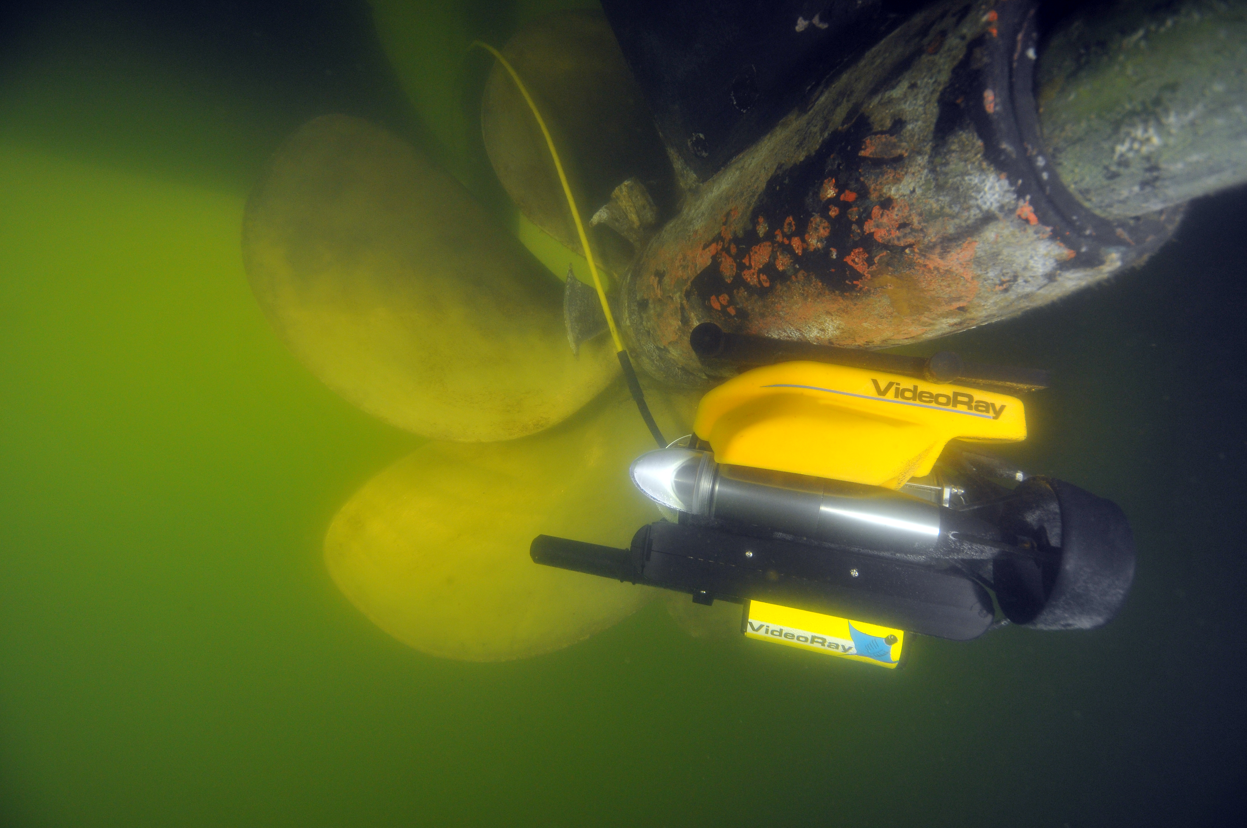
VideoRay ROVs are a series of inspection class underwater submersible remotely operated underwater vehicles (ROV). VideoRay ROVs are operated from a suitcase-sized control panel connected to either a copper or fiber-optic tether which is then connected to the submersible. VideoRay has several different units with depth ratings ranging from up to and are utilized in a variety of underwater applications including: aquaculture & fishery operations; forensics & crime scene investigation; search & rescue missions; port security operations; recreational yachting; sport fishing & underwater marine life observation; shipwreck & treasure exploration; science, research and marine habitat mapping; inland dam inspection; offshore oil & gas rig observation; and various other underwater observation applications. Using attachments such as scanning and imaging sonars, positioning systems and manipulators, the ROVs carry out port security and ship inspections and deep-sea wreck location, filming ... [...More Info...] [...Related Items...] OR: [Wikipedia] [Google] [Baidu] |
R/V Shearwater
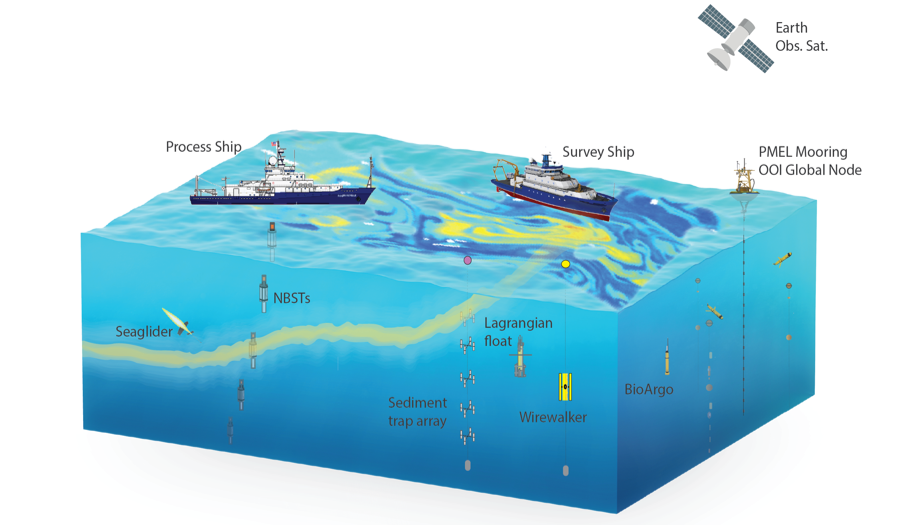
A research vessel (RV or R/V) is a ship or boat designed, modified, or equipped to carry out research at sea. Research vessels carry out a number of roles. Some of these roles can be combined into a single vessel but others require a dedicated vessel. Due to the demanding nature of the work, research vessels may be constructed around an icebreaker hull, allowing them to operate in polar waters. History The research ship had origins in the early voyages of exploration. By the time of James Cook's ''Endeavour'', the essentials of what today we would call a research ship are clearly apparent. In 1766, the Royal Society hired Cook to travel to the Pacific Ocean to observe and record the transit of Venus across the Sun. The ''Endeavour'' was a sturdy vessel, well designed and equipped for the ordeals she would face, and fitted out with facilities for her "research personnel", Joseph Banks. As is common with contemporary research vessels, ''Endeavour'' also carried out mor ... [...More Info...] [...Related Items...] OR: [Wikipedia] [Google] [Baidu] |
Research Vessel
A research vessel (RV or R/V) is a ship or boat designed, modified, or equipped to carry out research at sea. Research vessels carry out a number of roles. Some of these roles can be combined into a single vessel but others require a dedicated vessel. Due to the demanding nature of the work, research vessels may be constructed around an icebreaker hull, allowing them to operate in polar waters. History The research ship had origins in the early voyages of exploration. By the time of James Cook's ''Endeavour'', the essentials of what today we would call a research ship are clearly apparent. In 1766, the Royal Society hired Cook to travel to the Pacific Ocean to observe and record the transit of Venus across the Sun. The ''Endeavour'' was a sturdy vessel, well designed and equipped for the ordeals she would face, and fitted out with facilities for her "research personnel", Joseph Banks. As is common with contemporary research vessels, ''Endeavour'' also carried out more than ... [...More Info...] [...Related Items...] OR: [Wikipedia] [Google] [Baidu] |
Channel Islands National Marine Sanctuary
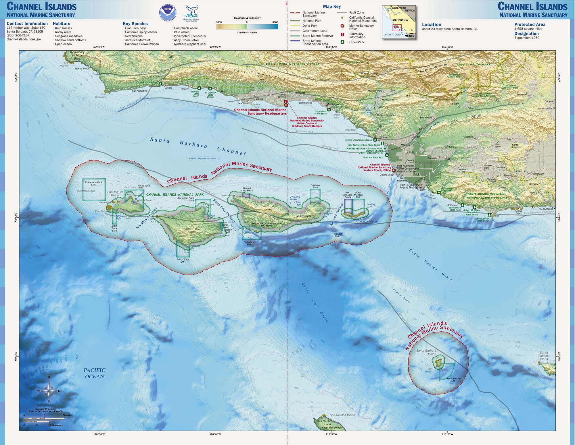
The Channel Islands National Marine Sanctuary is a sanctuary off the Pacific coast of Southern California. The National Marine Sanctuary program is under the administration of the National Oceanic and Atmospheric Administration. Established on May 5, 1980, the sanctuary is located in an area of in the Santa Barbara Channel. Its extension encompasses the waters surrounding the isles of Anacapa, Santa Cruz, Santa Rosa, San Miguel and Santa Barbara Islands. These are five of the eight Channel Islands of California. Ranging from a high tide of approximately 11 km offshore around each of the five islands, the sanctuary is home to many marine species, including whales that come to array each year. It also provides protection to more than 150 historic shipwrecks and is a place of important cultural significance for the Chumash people. Channel Islands National Marine Sanctuary provides protection for its natural and cultural resources through education, conservation, science, and st ... [...More Info...] [...Related Items...] OR: [Wikipedia] [Google] [Baidu] |
National Oceanic And Atmospheric Administration
The National Oceanic and Atmospheric Administration (abbreviated as NOAA ) is an United States scientific and regulatory agency within the United States Department of Commerce that forecasts weather, monitors oceanic and atmospheric conditions, charts the seas, conducts deep sea exploration, and manages fishing and protection of marine mammals and endangered species in the U.S. exclusive economic zone. Purpose and function NOAA's specific roles include: * ''Supplying Environmental Information Products''. NOAA supplies to its customers and partners information pertaining to the state of the oceans and the atmosphere, such as weather warnings and forecasts via the National Weather Service. NOAA's information services extend as well to climate, ecosystems, and commerce. * ''Providing Environmental Stewardship Services''. NOAA is a steward of U.S. coastal and marine environments. In coordination with federal, state, local, tribal and international authorities, NOAA manages the ... [...More Info...] [...Related Items...] OR: [Wikipedia] [Google] [Baidu] |
Petty Officer
A petty officer (PO) is a non-commissioned officer in many navies and is given the NATO rank denotation OR-5 or OR-6. In many nations, they are typically equal to a sergeant in comparison to other military branches. Often they may be superior to a seaman, and subordinate to more senior non-commissioned officers, such as a chief petty officers. Petty officers are usually sailors that have served at least several years in their respective navies. Petty officers represent the junior and mid-grade non-commissioned officer ranks of many naval services, and are generally responsible for the day-to-day supervision of ranks junior to them. They may also serve as technical specialists within their rating (military occupation). Origin The modern petty officer dates back to the Age of Sail in the Royal Navy. Petty officers rank between naval officers (both commissioned and warrant) and most enlisted sailors. These were men with some claim to officer rank, sufficient to distinguish t ... [...More Info...] [...Related Items...] OR: [Wikipedia] [Google] [Baidu] |

.jpg)

.jpg)


