|
U.S. Route 75 In Oklahoma
U.S. Route 75 (US 75) is a major north-south highway that enters the U.S. state of Oklahoma from Texas concurrent with US 69 crossing the Red River. US 75 serves the city of Tulsa, the 2nd largest city in Oklahoma. Route description US 75 enters the state concurrent with US 69 as a freeway. The freeway status drops between Colbert and Calera. The two highways regain their freeway status in Durant. This freeway ends about 12 miles north of Durant. The two highways split in Atoka. Through traffic traveling to Tulsa usually uses US 69 to the Indian Nation Turnpike as a faster route. Leaving Atoka, US 75 serves many small communities and crosses the Canadian River before reaching I-40/ US 62 about 82 miles northwest of Atoka. The three highways travel east to Henryetta. US 62 and US 75 leave I-40 at an interchange with the Indian Nation Turnpike. The two highways serve as a major route through the town. US 62 leaves US 75 in Okmulgee. Coming out of Okmulgee, US 75 st ... [...More Info...] [...Related Items...] OR: [Wikipedia] [Google] [Baidu] |
Durant, Oklahoma
Durant () is a city in Bryan County, Oklahoma, United States that serves as the headquarters of the Choctaw Nation of Oklahoma. The population was 18,589 in the 2020 census. Durant is the principal city of the Durant Micropolitan Statistical Area, which had a population of 46,067 in 2020. The city is the largest in the Choctaw Nation, ranking ahead of McAlester and Poteau. Durant is also part of the Dallas–Fort Worth Combined Statistical Area, anchoring the northern edge. The city was founded by Dixon Durant, a Choctaw who lived in the area,Phipps p. 180 after the MK&T railroad came through the Indian Territory in the early 1870s. It became the county seat of Bryan County in 1907 after Oklahoma statehood. Durant is home to Southeastern Oklahoma State University and the headquarters of the Choctaw Nation. The city is officially known as the Magnolia Capital of Oklahoma. The city and its micropolitan are a major part of the Texoma region. History The Durant area was ... [...More Info...] [...Related Items...] OR: [Wikipedia] [Google] [Baidu] |
Colbert, Oklahoma
Colbert is a town in Bryan County, Oklahoma, United States. The population was 1,140 at the 2010 census, a 7 percent increase over the figure of 1,065 recorded in 2000. It was incorporated in 1939. History Colbert men became prominent leaders among the Chickasaw for most of the 18th and 19th centuries, starting with William "de Blainville" Colbert from France born of Scottish blood. His parents fled during the Glorious Revolution in Scotland; hence, he was born in exile in Blainville-sur-Orne, France. William traveled to the New World to seek a new line of work as a fur trader since the Jacobite uprisings had ruined his entitlements as a "King Baron." These Colberts were also related to Jean Baptiste Colbert, Treasurer to King Louis XIV. There is a chateau named after Jean Baptiste Colbert in the aforementioned French town located on the Atlantic coast; it became a safe haven beginning in 1688. Once in the New World, William Colbert ended up marrying the Chickasaw chief's el ... [...More Info...] [...Related Items...] OR: [Wikipedia] [Google] [Baidu] |
Paul Harvey
Paul Harvey Aurandt (September 4, 1918 – February 28, 2009) was an American radio broadcaster for ABC News Radio. He broadcast ''News and Comment'' on mornings and mid-days on weekdays and at noon on Saturdays and also his famous ''The Rest of the Story'' segments. From 1951 to 2008, his programs reached as many as 24 million people per week. ''Paul Harvey News'' was carried on 1,200 radio stations, on 400 American Forces Network stations, and in 300 newspapers. Early life Harvey was born in Tulsa, Oklahoma, and was the son of a policeman who was killed by robbers in 1921. He made radio receivers as a young boy, and attended Tulsa Central High School, where he was two years ahead of future actor Tony Randall. Teacher Isabelle Ronan was "impressed by his voice." On her recommendation, he started working at KVOO in Tulsa in 1933 helping to clean up when he was 14. He eventually was allowed to fill in on the air by reading commercials and the news. He continued working at KVOO ... [...More Info...] [...Related Items...] OR: [Wikipedia] [Google] [Baidu] |
Kansas
Kansas () is a state in the Midwestern United States. Its capital is Topeka, and its largest city is Wichita. Kansas is a landlocked state bordered by Nebraska to the north; Missouri to the east; Oklahoma to the south; and Colorado to the west. Kansas is named after the Kansas River, which in turn was named after the Kansa Native Americans who lived along its banks. The tribe's name (natively ') is often said to mean "people of the (south) wind" although this was probably not the term's original meaning. For thousands of years, what is now Kansas was home to numerous and diverse Native American tribes. Tribes in the eastern part of the state generally lived in villages along the river valleys. Tribes in the western part of the state were semi-nomadic and hunted large herds of bison. The first Euro-American settlement in Kansas occurred in 1827 at Fort Leavenworth. The pace of settlement accelerated in the 1850s, in the midst of political wars over the slavery deba ... [...More Info...] [...Related Items...] OR: [Wikipedia] [Google] [Baidu] |
Oklahoma State Highway 51
State Highway 51, abbreviated to SH-51 or OK-51, is a major state highway in Oklahoma, United States. It runs for east–west across the state, running from the Texas state line to Arkansas. It is the third-longest state highway in the system. Route description Texas to I-35 SH-51 begins at the Texas line concurrent with US-60 just east of Higgins, Texas. It remains concurrent for 61 miles (98 km) until it reaches US-270/ US-281/ SH-3 at Seiling, Oklahoma. At Seiling, SH-51 joins with those three highways for nine miles (14 km) before splitting off on its own. after splitting off, Highway 51 meets SH-58 in Canton. It then continues east, crossing the North Canadian River and meeting SH-51A before turning northeast toward Okeene, where it intersects SH-8. SH-51 will go for before intersecting another highway. In Hennessey SH-51 meets US-81 before continuing eastward. later, it meets SH-74 north of Crescent. to the east, it shares a brief concurr ... [...More Info...] [...Related Items...] OR: [Wikipedia] [Google] [Baidu] |
Downtown Tulsa
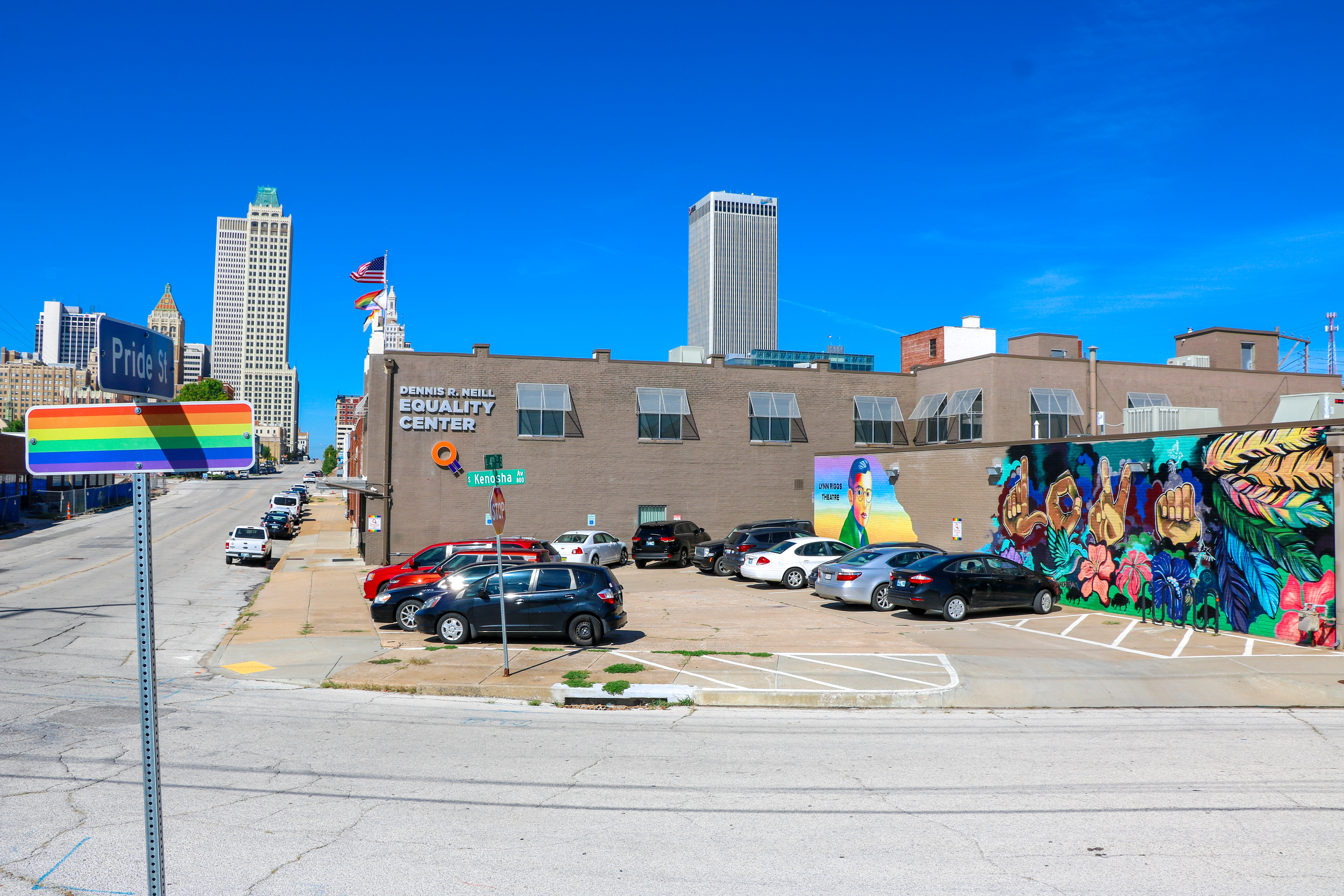
Downtown Tulsa is an area of approximately surrounded by an inner-dispersal loop created by Interstate 244, US 64, and US 75. The area serves as Tulsa's financial and business district, and is the focus of a large initiative to draw tourism, which includes plans to capitalize on the area's historic architecture. Much of Tulsa's convention space is located in downtown, such as the Tulsa Performing Arts Center and the Tulsa Convention Center, and the BOK Center. Prominent downtown sub-districts include the Blue Dome District, the Tulsa Arts District, and the Greenwood Historical District, which includes the site of ONEOK Field, a baseball stadium for the Tulsa Drillers opened in 2010. In 2010, the estimated population of downtown is 4,000. The daytime population is estimated to be 36,000. Downtown districts Tulsa includes many structures built during the Oil Boom in the 1920s and 1930s, including Art Deco buildings such as the Mid-Continent Tower, Boston Avenue Methodist Ch ... [...More Info...] [...Related Items...] OR: [Wikipedia] [Google] [Baidu] |
Interstate 244
Interstate 244 (I-244), also known as the Martin Luther King Jr. Memorial Expressway (in honor of Martin Luther King Jr.) since 1984, the Crosstown Expressway, and the Red Fork Expressway, is a east–west Interstate Highway bypass route of I-44 in Tulsa, Oklahoma. At both I-244's western and eastern terminus, the highway connects with I-44. I-244 runs from the western bank of the Arkansas River, across the river and past downtown Tulsa, before running through the northern half of the city and connecting again with I-44. In downtown Tulsa, I-244 forms the northern and western legs of the "Inner Dispersal Loop". The southern and eastern legs are formed by the unsigned I-444 (signed as U.S. Highway 75 (US-75)). Route description I-244 begins at a stack interchange with I-44 (which is concurrent with State Highway 66 (SH-66) at this point) and a short segment of the Gilcrease Expressway that is disconnected from the rest of that highway. I-244 continues north ... [...More Info...] [...Related Items...] OR: [Wikipedia] [Google] [Baidu] |
Jenks, Oklahoma
Jenks is a city in Tulsa County, Oklahoma, United States, and a suburb of Tulsa, in the northeastern part of the state. It is situated between the Arkansas River and U.S. Route 75. Jenks is one of the fastest-growing cities in Oklahoma. The city's population was 16,924 in the 2010 census, but by 2020, this had grown to 25,949. The Census estimated Jenks' population as 26,661 in 2021. History Jenks began in 1904 as a community site established by the Midland Valley Railroad between Tulsa and Muskogee, alongside the Arkansas River. Though the river could only be utilized by shallow draft steamboats while the water level was up, these two transportation routes proved vital to Jenks' early development. Jenks was named after William Henry Jenks the owner and director of the Midland Valley Railroad. According to a 1957 article in the ''Tulsa Tribune'', an agent for the townsite company was told by the railroad home office to name a town for the director.Davidson, Bridget. ''Encyclo ... [...More Info...] [...Related Items...] OR: [Wikipedia] [Google] [Baidu] |
Creek Turnpike
The Creek Turnpike, also designated State Highway 364 (SH-364), is a freeway-standard toll road that lies entirely in the U.S. state of Oklahoma. The turnpike forms a partial beltway around the south and east sides of Tulsa, Oklahoma's second largest city. The Creek Turnpike's western terminus is at the Turner Turnpike in Sapulpa, while its northeastern terminus is at the Will Rogers Turnpike in Fair Oaks; both ends of the Creek Turnpike connect with Interstate 44 (I-44). Along the way, the highway passes through the cities of Sapulpa, Jenks, Tulsa, and Broken Arrow, and the counties of Creek, Tulsa, Wagoner and Rogers. The road is maintained by the Oklahoma Turnpike Authority (OTA), except for a brief free section shared with U.S. Route 64 (US-64) and US-169. This free section is maintained by the Oklahoma Department of Transportation (ODOT). The first section of the Creek Turnpike, from US-75 in Jenks to US-64/US-169 in Tulsa, was first authorized in 1987, with co ... [...More Info...] [...Related Items...] OR: [Wikipedia] [Google] [Baidu] |
Glenpool, Oklahoma
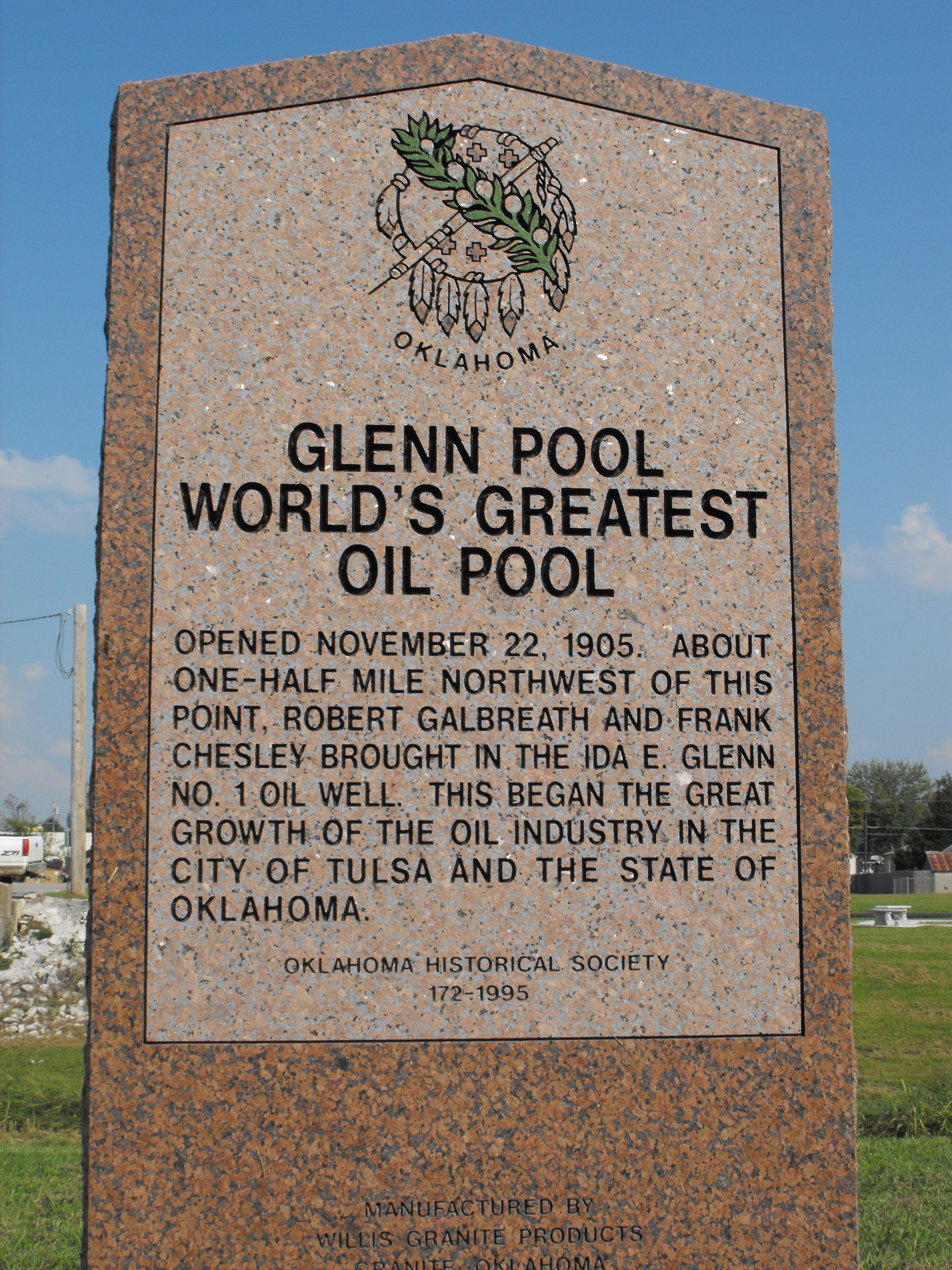
Glenpool is a city in Tulsa County, Oklahoma, United States. It is part of the Tulsa Metropolitan Statistical Area (TMSA). As of 2020, the population was 14,040, which represented an increase of 29.9% since the 2010 census, which reported the total population as 10,808. Glenpool is notable because the discovery of oil in 1905, which caused an economic boom that propelled the growth of Tulsa and its surroundings. Although the Glenn Pool field, for which the city was named, still produces a small amount of oil; the city is now primarily a commuter town for Tulsa. History On November 22, 1905, wildcatters, Robert Galbreath and Frank Chesley (along with, by some accounts, Charles Colcord), drilling for oil on farmland owned by Creek Indian Ida E. Glenn, created the first oil gusher in what would soon be known as the " Glenn Pool". The discovery set off a boom of growth for the area, bringing in hordes of people: lease buyers, producers, millionaires, laborers, tool suppliers, dr ... [...More Info...] [...Related Items...] OR: [Wikipedia] [Google] [Baidu] |
Henryetta, Oklahoma
Henryetta is a city in Okmulgee County, Oklahoma, United States. The population was 5,927 at the 2010 census, down 9.6 percent from the figure of 6,096 recorded in 2000. History Hugh Henry established a ranch on Creek Nation land in 1885. He soon found a deposit of coal, which he began using to fuel the forge at his ranch. Discovery of more coal deposits in the large Henryetta Coal Formation attracted several railroads to develop these mines. A settlement named Furrs grew up around the mines. The name changed to Henryetta when a post office opened on August 28, 1900.Bamburg, Maxine"Henryetta,"''Encyclopedia of Oklahoma History and Culture'', Oklahoma Historical Society, Accessed July 22, 2015. At statehood in 1907, Henryetta had 1,051 residents. The economy was based on agriculture, coal, natural gas and oil. In 1909, the area had fourteen coal mines, producing 65,000 tons per month. By 1910, the population had grown to 1,671. The town added a broom factory, several brick facto ... [...More Info...] [...Related Items...] OR: [Wikipedia] [Google] [Baidu] |
Interstate 40 In Oklahoma
Interstate 40 (I-40) is an Interstate Highway in Oklahoma that runs across the state from Texas to Arkansas. West of Oklahoma City, it parallels and replaces old U.S. Highway 66 (US-66), and, east of Oklahoma City, it parallels US-62, US-266, and US-64. I-40 is the longest Interstate highway in Oklahoma. Cities along the route include Erick, Sayre, Elk City, Clinton, Weatherford, Oklahoma City and its suburbs ( El Reno, Yukon, Del City, and Midwest City), Shawnee, Okemah, Henryetta, Checotah, and Sallisaw. Route description I-40 enters Oklahoma near Texola in Beckham County. It crosses the North Fork of the Red River near Sayre and runs through southern Elk City. It then cuts across northwest Washita County before entering Custer County. There, it passes through Clinton and Weatherford. After leaving Weatherford, I-40 then runs across northern Caddo County. After that, it enters the Oklahoma City metropolitan area at Canadian County. I-40 runs th ... [...More Info...] [...Related Items...] OR: [Wikipedia] [Google] [Baidu] |
.jpg)


