|
U.S. Highway 277
U.S. Route 277 (US 277, US-277) is a north–south United States Highway that is a spur route of U.S. Route 77. It runs for 633 miles (1,019 km) across Oklahoma and Texas. US 277's northern terminus is in Newcastle, Oklahoma at Interstate 44, which is also the northern terminus of the H.E. Bailey Turnpike. Its southern terminus is in Carrizo Springs, Texas at U.S. Route 83. It passes through the states of Oklahoma and Texas. Most of U.S. 277's route through the two states overlaps other U.S. highways. Those include U.S. 62 from Newcastle to Chickasha, Oklahoma, U.S. 62 and U.S. 281 from five miles (8 km) west of Elgin, Oklahoma, to Lawton, U.S. 281 from Lawton to Wichita Falls, Texas, U.S. 82 from Wichita Falls to Seymour, Texas, and U.S. 83 from Anson, Texas to Abilene, Texas. Through the Lawton area and again from Randlett, Oklahoma, to near downtown Wichita Falls, U.S. 277 is also co-signed with I-44. Route description , - , TX , 508.9 , 819.0 , - , OK , ... [...More Info...] [...Related Items...] OR: [Wikipedia] [Google] [Baidu] |
Eagle Pass, Texas
Eagle Pass is a city in and the county seat of Maverick County in the U.S. state of Texas. Its population was 28,130 as of the 2020 census. Eagle Pass borders the city of Piedras Negras, Coahuila, Mexico, which is to the southwest and across the Rio Grande. The Eagle Pass-Piedras Negras metropolitan area (EP-PN) is one of six binational metropolitan areas along the United States-Mexican border. As of January 2008, according to the US census, the EPPN's population was 48,401 people, and the Piedras Negras metropolitan area's population was 169,771. History Eagle Pass was the first American settlement on the Rio Grande. Originally known as Camp Eagle Pass, it served as a temporary outpost for the Texas militia, which had been ordered to stop illegal trade with Mexico during the Mexican–American War.Texas Transportation Commission, ''Texas State Travel Guide, 2008'', p. 232 Eagle Pass is so named because the contour of the hills through which the Rio Grande flows bore a fancied r ... [...More Info...] [...Related Items...] OR: [Wikipedia] [Google] [Baidu] |
Lawton, Oklahoma
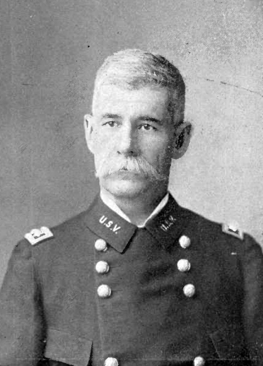
Lawton is a city in and the county seat of Comanche County, in the U.S. state of Oklahoma Oklahoma (; Choctaw language, Choctaw: ; chr, ᎣᎧᎳᎰᎹ, ''Okalahoma'' ) is a U.S. state, state in the South Central United States, South Central region of the United States, bordered by Texas on the south and west, Kansas on the nor .... Located in southwestern Oklahoma, approximately southwest of Oklahoma City, it is the principal city of the Lawton metropolitan area, Lawton, Oklahoma, metropolitan statistical area. According to the 2020 United States Census, 2020 census, Lawton's population was 90,381, making it the sixth-largest city in the state, and the largest in Western Oklahoma. Developed on former Indian reservation, reservation lands of the Kiowa, Comanche, and Fort Sill Apache Tribe, Apache Indians, Lawton was founded by European Americans on 6 August 1901. It was named after Major General Henry Ware Lawton, who served in the Civil War, where he earned the M ... [...More Info...] [...Related Items...] OR: [Wikipedia] [Google] [Baidu] |
Red River Of The South
The Red River, or sometimes the Red River of the South, is a major river in the Southern United States. It was named for its reddish water color from passing through red-bed country in its watershed. It is one of several rivers with that name. Although once a tributary of the Mississippi River, the Red River is now a tributary of the Atchafalaya River, a distributary of the Mississippi that flows separately into the Gulf of Mexico. This confluence is connected to the Mississippi River by the Old River Control Structure. The south bank of the Red River formed part of the US–Mexico border from the Adams–Onís Treaty (in force 1821) until the Texas Annexation and the Treaty of Guadalupe Hidalgo. The Red River is the second-largest river basin in the southern Great Plains. It rises in two branches in the Texas Panhandle and flows east, where it serves as the border between the states of Texas and Oklahoma. It forms a short border between Texas and Arkansas before entering Ar ... [...More Info...] [...Related Items...] OR: [Wikipedia] [Google] [Baidu] |
Burkburnett, Texas
Burkburnett is a city in Wichita County, Texas, United States. It is part of the Wichita Falls, Texas metropolitan statistical area. Its population was 10,811 at the 2010 census. The community newspaper, the ''Burkburnett Informer/Star,'' is published each Thursday. History Originally settled by ranchers as early as 1856, this community was known by some locals as Nesterville. By 1880, the town had a small store with a population of 132. From 1882 until 1903, a post office operated there under the designation Gilbert, named after the North Texas pioneer Mabel Gilbert. In 1906, a nearby wealthy rancher named Samuel Burk Burnett sold more than 16,000 acres (65 km) of his land in northern Wichita County to a group of investors who were seeking to extend into the wheat-growing area of Western Oklahoma the Wichita Falls and Northwestern Railway, one of the Frank Kell/ Joseph A. Kemp properties based in Wichita Falls. Within Burnett's former land near the railroad, lots were auctio ... [...More Info...] [...Related Items...] OR: [Wikipedia] [Google] [Baidu] |
Interstate 44 In Texas
Interstate 44 (I-44) in the US state of Texas has a short, but regionally important, stretch connecting Wichita Falls with Oklahoma. Its entire length runs concurrently with U.S. Highway 277 (US 277) and US 281. I-44 provides access to downtown Wichita Falls and Sheppard Air Force Base. I-44 is known as Central Freeway in Wichita Falls and Red River Expressway in Burkburnett. Route description I-44 begins near exit 1 in Wichita Falls concurrent with US 277, US 281, and US 287. US 281 and US 287 continue to the south while US 277 leaves the concurrency at exit 1, which also provides access to US 82. I-44 heads north through Wichita Falls to an interchange with US 287 and State Highway Spur 325 (Spur 325). US 287 leaves the concurrency as a freeway to the west while Spur 325 leaves the interchange toward the northeast, providing access to Sheppard Air Force Base and Wichita Falls M ... [...More Info...] [...Related Items...] OR: [Wikipedia] [Google] [Baidu] |
Stamford, Texas
Stamford is a city on the border of Jones and Haskell Counties in west-central Texas. The population was 3,124 at the 2010 census, down from 3,636 at the 2000 census. Henry McHarg, president of the Texas Central Railroad, named the site in 1900 for his hometown of Stamford, Connecticut. The city is home to the Texas Cowboy Reunion. Stamford is on U.S. Highway 277 and State Highway 6. Most of the city is in Jones County. The portion of the city within Jones County is part of the Abilene, Texas metropolitan area. History While the town was named by Henry King McHarg for Stamford, Connecticut, the townsite was donated by the family of Swante Magnus Swenson. Mr. Swenson was the first Swedish immigrant to Texas. He became one of the largest landowners in Texas, and by 1860, his holdings in West Texas approached . These ranches, which spread across 12 Texas counties, became known as the SMS Ranches. Later reorganized as the Swenson Land and Cattle Company, it is headquartered in Stam ... [...More Info...] [...Related Items...] OR: [Wikipedia] [Google] [Baidu] |
Aspermont, Texas
Aspermont is a town in the U.S. state of Texas, and is the county seat of Stonewall County. The population was 835 at the 2019 census. History The town was established in 1889. Aspermont means "rough mountain" in Latin, and is probably a reference to the nearby Double Mountains. The city was founded by A. L. Rhomberg of Swiss-Austrian descent, who might have been a descendant of the noble family Aspermont from Graubünden, which is known to have relocated to Dornbirn in the Austrian part of the Rhine Valley and changed the name to Rhomberg. Marshall Formby, later a Texas state senator, operated the ''Aspermont Star'' weekly newspaper in the middle 1930s. The paper is now known as the ''Double Mountain Chronicle ''. File:Stonewall County, TX, Courthouse IMG_6233.JPG, Stonewall County Courthouse in Aspermont File:Downtown Aspermont, TX IMG_6237.JPG, Downtown Aspermont File:First Baptist Church, Aspermont, TX IMG_6232.JPG, First Baptist Church of Aspermont Geography According ... [...More Info...] [...Related Items...] OR: [Wikipedia] [Google] [Baidu] |
Eldorado, Texas
Eldorado ( , -) is a city in and the county seat of Schleicher County, Texas, United States. The population was 1,951 at the 2010 census. Eldorado is located on U.S. Highway 277 some north of Sonora and south of San Angelo, Texas. Geography Eldorado is located at (30.860746, −100.598329). According to the United States Census Bureau, the city has a total area of 1.4 square miles (3.6 km), all of it land. Demographics 2020 census As of the 2020 United States census, there were 1,574 people, 791 households, and 544 families residing in the city. 2000 census As of the census of 2000, 1,951 people, 712 households, and 513 families resided in the city. The population density was 1,407.5 people per square mile (541.9/km). There were 838 housing units at an average density of 604.6 per square mile (232.8/km). The racial makeup of the city was 70.63% White, 2.15% African American, 0.10% Native American, 0.26% Asian, 0.05% Pacific Islander, 24.24% from othe ... [...More Info...] [...Related Items...] OR: [Wikipedia] [Google] [Baidu] |
Interstate 10 In Texas
Interstate 10 (I-10) is the major east–west Interstate Highway in the Southern United States. In the U.S. state of Texas, it runs east from Anthony, at the border with New Mexico, through El Paso, San Antonio, and Houston to the border with Louisiana in Orange, Texas. At just under , the Texas segment of I-10, maintained by the Texas Department of Transportation, is the longest continuous untolled freeway in North America that is operated by a single authority. It is also the longest stretch of Interstate Highway with a single designation within a single state. U.S. Highway 83 is about longer than I-10 within Texas. Mile marker 880 and its corresponding exit number in Orange, Texas, are the highest numbered mile marker and exit on any freeway in North America. After widening was completed in 2008, a portion of the highway west of Houston is now also believed to be the widest in the world, at 26 lanes when including feeders. More than a third of I-10's length i ... [...More Info...] [...Related Items...] OR: [Wikipedia] [Google] [Baidu] |
Amistad National Recreation Area
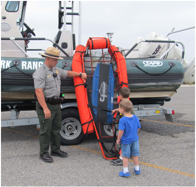
Amistad National Recreation Area is a national recreation area managed by National Park Service (NPS) that includes the area around the Amistad Reservoir at the confluence of the Rio Grande, the Devils River, and the Pecos River near Del Rio in Val Verde County, Texas. The reservoir was created by the Amistad Dam (''Presa de la Amistad'' in Spanish), completed in 1969, located on the Rio Grande at the United States-Mexico border across from the city of Ciudad Acuña in the Mexican state of Coahuila. Amistad, Spanish for "friendship," refers broadly to the close relationship and shared history between Ciudad Acuña and Del Rio. Recreational activities The lake given its location is the backdrop for year-round, water-based recreation opportunities, including boating, fishing, swimming, scuba diving and water-skiing. Houseboats and other boating equipment can be rented from the park unit's concessionaires. Amistad National Recreation Area in addition provides opportunities for p ... [...More Info...] [...Related Items...] OR: [Wikipedia] [Google] [Baidu] |
Rio Grande Do Norte
Rio Grande do Norte (, , ) is one of the states of Brazil. It is located in the northeastern region of the country, forming the northeasternmost tip of the South American continent. The name literally translates as "Great Northern River", referring to the mouth of the Potengi River. The capital and largest city is Natal. The state has 410 km (254 mi) of sandy beaches and contains Rocas Atoll, the only atoll the Atlantic Ocean. The main economic activity is tourism, followed by the extraction of petroleum (the second largest producer in the country), agriculture, fruit growing and extraction of minerals, including considerable production of seasalt, among other economic activities. The state is home to 1.7% of the Brazilian population and produces 1% of the country's GDP. In 2000-17 the murder rate rose by 655%, making Rio Grande do Norte the state with the highest murder rate in Brazil: 63.9 per 100,000. Tourist attractions in the state include the Cashew of Pirang ... [...More Info...] [...Related Items...] OR: [Wikipedia] [Google] [Baidu] |
Laredo, Texas
Laredo ( ; ) is a city in and the county seat of Webb County, Texas, United States, on the north bank of the Rio Grande in South Texas, across from Nuevo Laredo, Tamaulipas, Mexico. Laredo has the distinction of flying seven flags (the flag of the former Republic of the Rio Grande, which is now the flag of the city, in addition to the Six Flags of Texas). Founded in 1755, Laredo grew from a village to the capital of the short-lived Republic of the Rio Grande to the largest inland port on the Mexican border. Laredo's economy is primarily based on international trade with the United States largest trading partner Mexico, and as a major hub for three areas of transportation: land, rail, and air cargo. The city is on the southern end of I-35, which connects manufacturers in northern Mexico through Interstate 35 as a major route for trade throughout the U.S. It has four international bridges and one railway bridge. According to the 2010 census, the city population was 236,091, ma ... [...More Info...] [...Related Items...] OR: [Wikipedia] [Google] [Baidu] |


