|
Tyr, Russia
Tyr (russian: Тыр) is a settlement in Ulchsky District of Khabarovsk Krai, Russia, located on the right bank of the Amur River, near the mouth of the Amgun River, about upstream from Nikolayevsk-on-Amur. Tyr has been known as a historically Nivkh ("Gilyak") village, since no later than the mid-19th century.E. G. Ravenstein. The Russians on the Amur'. London, 1861. ( E. G. Ravenstein did not visit the area himself, but compiled his book based on the accounts of mostly Russian expeditions in the area from the 1850s) Tyr's main claim to fame is that its location had been visited by both Yuan and Ming Dynasty expeditions, which sailed down the Sungari and Amur Rivers to establish a foothold in this region. Both times the visitors built temples and monuments on the spectacular Tyr Cliff south of today's settlement. The remains of the Yuan era temple unearthed at the site by modern archaeologists date to the 1260s, while the two Ming temples, built ... [...More Info...] [...Related Items...] OR: [Wikipedia] [Google] [Baidu] |
Brockhaus And Efron Encyclopedic Dictionary
The ''Brockhaus and Efron Encyclopaedic Dictionary'' (Russian: Энциклопедический словарь Брокгауза и Ефрона, abbr. ЭСБЕ, tr. ; 35 volumes, small; 86 volumes, large) is a comprehensive multi-volume encyclopaedia in Russian. It contains 121,240 articles, 7,800 images, and 235 maps. It was published in Imperial Russia in 1890–1907, as a joint venture of Leipzig and St Petersburg publishers. The articles were written by the prominent Russian scholars of the period, such as Dmitri Mendeleev and Vladimir Solovyov. Reprints have appeared following the dissolution of the Soviet Union. History In 1889, the owner of one of the St. Petersburg printing houses, Ilya Abramovich Efron, at the initiative of Semyon Afanasyevich Vengerov, entered into an agreement with the German publishing house F. A. Brockhaus for the translation into Russian of the large German encyclopaedic dictionary ( de) into Russian as , published by the same publi ... [...More Info...] [...Related Items...] OR: [Wikipedia] [Google] [Baidu] |
Yongning Temple Stele
The Yongning Temple Stele () is a stele erected by the Chinese Ming dynasty in 1413 with a trilingual inscription to commemorate the founding of the Yongning Temple (永寧寺) in the Nurgan outpost, near the mouth of the Amur River, by the eunuch Yishiha. The location of the temple is the village of Tyr near Nikolayevsk-on-Amur in Russia. This stele is renowned both as the latest known example of a monumental inscription in the Jurchen script, and also for the inscription of the Buddhist ''mantra'' Om mani padme hum in four different scripts on its sides. A stele with a monolingual Chinese inscription, commemorating the repair of the temple by Yishiha, was erected in 1433. Both monuments are now held at the Arsenyev Museum in Vladivostok. Background The Ming government under the Yongle Emperor (reigned 1402–1424) attempted to expand its influence in the far north and defend itself against the Mongols by setting up a system of guards and posts in the territory of the Haixi J ... [...More Info...] [...Related Items...] OR: [Wikipedia] [Google] [Baidu] |
Yishiha
Yishiha (; also Išiqa or Isiha; Jurchen: ) (fl. 1409–1451) was a Jurchen eunuch of the Ming dynasty of China. He served the Ming emperors who commissioned several expeditions down the Songhua and Amur Rivers during the period of Ming rule of Manchuria, and is credited with the construction of the only two Ming dynasty Buddhist temples ever built on the territory of present-day Russia. Early life It is believed that Yishiha was a Haixi Jurchen by origin, and was captured by the Ming forces in the late 14th century. He worked under two important eunuchs, Wang Zhen and Cao Jixiang. It is speculated by modern historians that he rose to prominence by participating in imperial court politics and serving the Yongle Emperor's concubines of Manchu (Jurchen) origin. Amur expeditions Yishiha's Amur expeditions belong to the same period of the Yongle Emperor's reign (1402–1424) which saw another eunuch admiral, Zheng He, sail across the Indian Ocean, and Chinese ambassador Chen ... [...More Info...] [...Related Items...] OR: [Wikipedia] [Google] [Baidu] |
Songhua River
The Songhua or Sunghwa River (also Haixi or Xingal, russian: Сунгари ''Sungari'') is one of the primary rivers of China, and the longest tributary of the Amur. It flows about from the Changbai Mountains on the China–North Korea border through China's northeastern Jilin and Heilongjiang provinces. The river drains of land, and has an annual discharge of to . The extreme flatness of the Northeast China Plain has caused the river to meander over time, filling the wide plain with oxbow lakes, as remnants of the previous paths of the river. Geography The Songhua rises south of Heaven Lake, near the China-North Korea border. From there it flows north, to be interrupted by the Baishan, Hongshi and Fengman hydroelectric dams. The Fengman Dam forms a lake that stretches for . Below the dam, the Second Songhua flows north through Jilin, then northwest until it is joined by its largest tributary, the Nen River, near Da'an, to create the Songhua proper. The Songhu ... [...More Info...] [...Related Items...] OR: [Wikipedia] [Google] [Baidu] |
Ming Dynasty
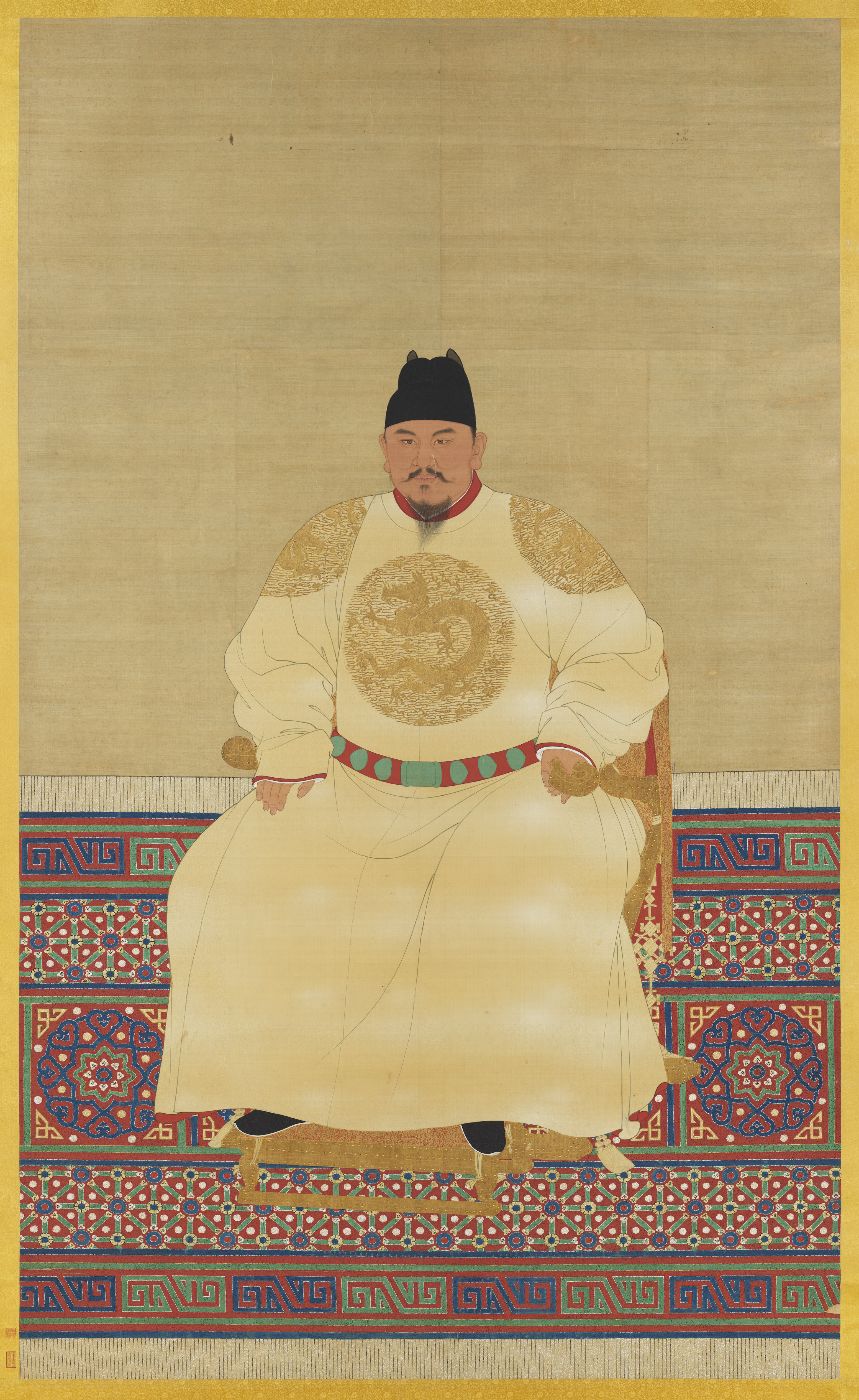
The Ming dynasty (), officially the Great Ming, was an imperial dynasty of China, ruling from 1368 to 1644 following the collapse of the Mongol-led Yuan dynasty. The Ming dynasty was the last orthodox dynasty of China ruled by the Han people, the majority ethnic group in China. Although the primary capital of Beijing fell in 1644 to a rebellion led by Li Zicheng (who established the short-lived Shun dynasty), numerous rump regimes ruled by remnants of the Ming imperial family—collectively called the Southern Ming—survived until 1662. The Ming dynasty's founder, the Hongwu Emperor (r. 1368–1398), attempted to create a society of self-sufficient rural communities ordered in a rigid, immobile system that would guarantee and support a permanent class of soldiers for his dynasty: the empire's standing army exceeded one million troops and the navy's dockyards in Nanjing were the largest in the world. He also took great care breaking the power of the court eunuchs and ... [...More Info...] [...Related Items...] OR: [Wikipedia] [Google] [Baidu] |
Yuan Dynasty
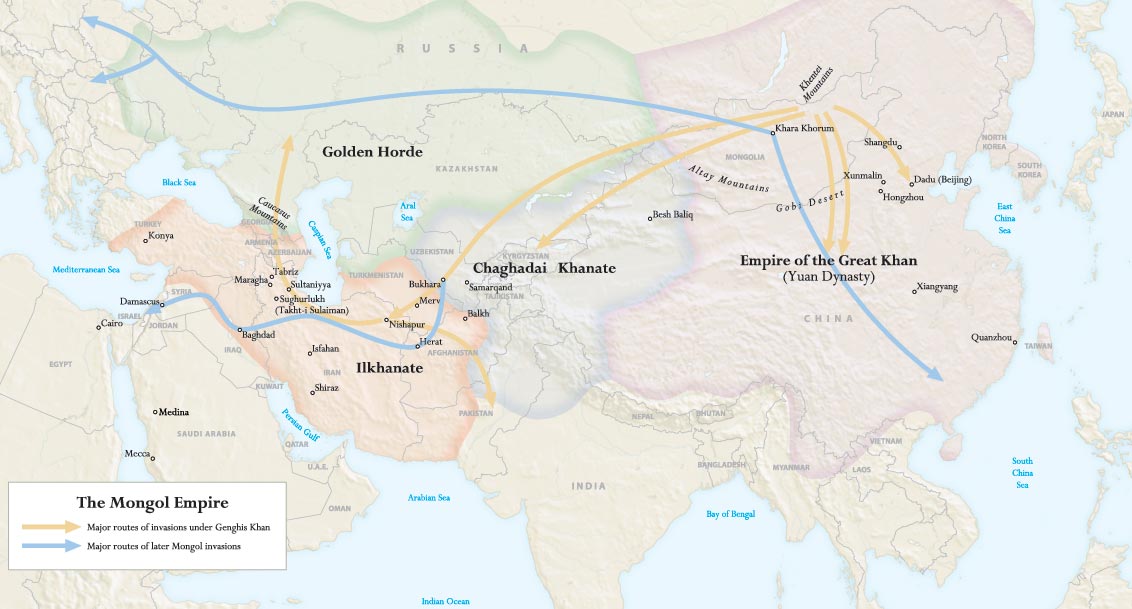
The Yuan dynasty (), officially the Great Yuan (; xng, , , literally "Great Yuan State"), was a Mongol-led imperial dynasty of China and a successor state to the Mongol Empire after its division. It was established by Kublai, the fifth khagan-emperor of the Mongol Empire from the Borjigin clan, and lasted from 1271 to 1368. In orthodox Chinese historiography, the Yuan dynasty followed the Song dynasty and preceded the Ming dynasty. Although Genghis Khan had been enthroned with the Han-style title of Emperor in 1206 and the Mongol Empire had ruled territories including modern-day northern China for decades, it was not until 1271 that Kublai Khan officially proclaimed the dynasty in the traditional Han style, and the conquest was not complete until 1279 when the Southern Song dynasty was defeated in the Battle of Yamen. His realm was, by this point, isolated from the other Mongol-led khanates and controlled most of modern-day China and its surrounding areas, inc ... [...More Info...] [...Related Items...] OR: [Wikipedia] [Google] [Baidu] |
Ernst Georg Ravenstein
Ernst Georg Ravenstein (Ernest George) (30 December 1834 – 13 March 1913) was a German-English geographer and cartographer. As a geographer he was less of a traveller than a researcher; his studies led mainly in the direction of cartography and the history of geography. Ravenstein was born in Frankfurt am Main, Germany, to a family of cartographers. He spent most of his adult life in England in a house at Lorn Road, Lambeth, but he died in Germany, his country of birth, on 13 March 1913. Work on geography When he was 18 years old he became a pupil of Dr. August Heinrich Petermann. After moving to England, Ravenstein became a naturalised British Subject and was in the service of the Topographical Department of the British War Office for 20 years, from 1855 to 1875. A long-serving member of the councils of the Royal Statistical and Royal Geographical Societies, he was also Professor of Geography at Bedford College in 1882–83. He was the first to receive the Victoria gol ... [...More Info...] [...Related Items...] OR: [Wikipedia] [Google] [Baidu] |
Nivkh People
The Nivkh, or Gilyak (also Nivkhs or Nivkhi, or Gilyaks; ethnonym: Нивхгу, ''Nʼivxgu'' (Amur) or Ниғвңгун, ''Nʼiɣvŋgun'' (E. Sakhalin) "the people"), are an indigenous ethnic group inhabiting the northern half of Sakhalin Island and the lower Amur River and coast on the adjacent Russian mainland and historically possibly parts of Manchuria. Nivkh were traditionally fishermen, hunters, and dog breeders. They were semi-nomadic, living near the coasts in the summer and wintering inland along streams and rivers to catch salmon. The land the Nivkh inhabit is characterized as taiga forest with cold snow-laden winters and mild summers with sparse tree cover. The Nivkh are believed to be the original inhabitants of the region, and to derive from a proposed Neolithic people that migrated from the Transbaikal region during the Late Pleistocene.Fitzhugh, William, and Durbreui pp.39, 40 The Nivkh had long maintained trade and cultural relations with neighboring China a ... [...More Info...] [...Related Items...] OR: [Wikipedia] [Google] [Baidu] |
Types Of Inhabited Localities In Russia
The classification system of inhabited localities in Russia and some other post- Soviet states has certain peculiarities compared with those in other countries. Classes During the Soviet time, each of the republics of the Soviet Union, including the Russian SFSR, had its own legislative documents dealing with classification of inhabited localities. After the dissolution of the Soviet Union, the task of developing and maintaining such classification in Russia was delegated to the federal subjects.Articles 71 and 72 of the Constitution of Russia do not name issues of the administrative and territorial structure among the tasks handled on the federal level or jointly with the governments of the federal subjects. As such, all federal subjects pass their own laws establishing the system of the administrative-territorial divisions on their territories. While currently there are certain peculiarities to classifications used in many federal subjects, they are all still largely ... [...More Info...] [...Related Items...] OR: [Wikipedia] [Google] [Baidu] |
Nikolayevsk-on-Amur
Nikolayevsk-on-Amur (russian: Никола́евск-на-Аму́ре, translit=Nikoláyevsk-na-Amúrye) is a town in Khabarovsk Krai, Russia located on the Amur River close to its liman in the Pacific Ocean. Population: Geography The town is situated on the left bank of the Amur River, from where it flows into the Amur estuary, north of Khabarovsk and from the Komsomolsk-on-Amur railway station. It is the closest significant settlement to the Strait of Tartary separating the mainland from Sakhalin. History Medieval and early-modern history In the late Middle Ages, the people living along the lower course of the Amur ( Nivkh, Oroch, Evenki) were collectively known in China as the "wild Jurchen". The Yuan Dynasty Mongols sent expeditions to this area with an eye toward using the region as a base for attack on Japan, or for defending against the Sakhalin Ainus. According to the History of Yuan, in 1264 the Nivkhs recognized the Mongol sovereignty. In 1263, the Mongols set ... [...More Info...] [...Related Items...] OR: [Wikipedia] [Google] [Baidu] |
Amgun River
The Amgun () is a river in Khabarovsk Krai, Russia that flows northeast and joins the river Amur from the left, 146 km upstream from its outflow into sea. The length of the river is . The area of its basin is . The Amgun is formed by the confluence of the Ayakit and Suluk. Its main tributary is the Nimelen. The Amgun teems with fish, such as Siberian salmon, humpback salmon, sturgeon, and [...More Info...] [...Related Items...] OR: [Wikipedia] [Google] [Baidu] |


