|
Truro Rural District
Truro Rural District was a local government division of Cornwall in England, UK, between 1894 and 1974. Established under the Local Government Act 1894 in 1934, the rural district was enlarged by the abolition of East Kerrier Rural District, Redruth Rural District and St Columb Major Rural District, but was reduced to enlarge Truro Municipal Borough. In 1974, the district was abolished under the Local Government Act 1972, forming part of the new Carrick district. Civil parishes The civil parishes within the district were: * Chacewater * Cubert * Cuby * Feock * Gerrans * Gwennap * Kea * Kenwyn * Ladock * Mylor * Perranarworthal * Perranzabuloe * Philleigh * Probus * Ruanlanihorne * St Agnes * St Allen * St Clement * St Erme * St Just in Roseland * St Michael Penkevil * St Newlyn East St Newlyn East ( kw, Eglosniwlin) is a civil parish and village in Cornwall, England, United Kingdom. The village is approximately three miles (5 km) south of Newquay ... [...More Info...] [...Related Items...] OR: [Wikipedia] [Google] [Baidu] |
Cornwall
Cornwall (; kw, Kernow ) is a historic county and ceremonial county in South West England. It is recognised as one of the Celtic nations, and is the homeland of the Cornish people. Cornwall is bordered to the north and west by the Atlantic Ocean, to the south by the English Channel, and to the east by the county of Devon, with the River Tamar forming the border between them. Cornwall forms the westernmost part of the South West Peninsula of the island of Great Britain. The southwesternmost point is Land's End and the southernmost Lizard Point. Cornwall has a population of and an area of . The county has been administered since 2009 by the unitary authority, Cornwall Council. The ceremonial county of Cornwall also includes the Isles of Scilly, which are administered separately. The administrative centre of Cornwall is Truro, its only city. Cornwall was formerly a Brythonic kingdom and subsequently a royal duchy. It is the cultural and ethnic origin of the Cornish dias ... [...More Info...] [...Related Items...] OR: [Wikipedia] [Google] [Baidu] |
Gerrans
Gerrans ( kw, Gerens) is a coastal civil parish and village on the Roseland Peninsula in Cornwall, England, United Kingdom. The village adjoins Portscatho (the villages have almost merged into one but retain their identities) on the east side of the peninsula. The village is situated approximately seven miles (11 km) south-southeast of Truro. The name Gerrans derives from ''Gerent'', a 6th-century Cornish saint. The parish runs north–south along the eastern side of the Roseland peninsula. It is bounded to the south and east by the sea, to the west by St Just in Roseland parish, and to the north by Philleigh parish. The population was 933 in the 2001 census, GENUKI website: Gerrans. retrieved May 2010 reducing to 794 at the 2011 census. |
St Clement, Cornwall
St Clement ( kw, Klemens) is a civil parish and village in Cornwall, England, United Kingdom. It is situated southeast of Truro in the valley of the Tresillian River. Other notable villages within the parish are the much larger Tresillian 1.4 miles (2.3 km) to the north east of St Clement village itself and another village at Malpas to the south of the parish. The urban part of the parish of St Clement was incorporated into Truro in 1895. The remainder of the parish had a population of 1,064 at the 2011 census. From 2009 to 2021, St Clement was covered by the Ladock, St Clement and St Erme division. From the 2021 local elections, it will be within the Truro Tregolls division. St Clement is attractive for tourists: aside from the natural beauty of the surrounding countryside they come to see the village church and its associated conservation projects that are maintained by members of the local community. Unlike some other villages in the district, the village of St Cle ... [...More Info...] [...Related Items...] OR: [Wikipedia] [Google] [Baidu] |
St Allen
St Allen ( kw, Eglosalan (hamlet), Pluw Alan (parish)) is a civil parish in Cornwall, England, United Kingdom. The church town of St Allen is an isolated hamlet and the main settlement in the parish is Zelah which is situated on the A30 trunk road four miles (6.5 km) north of Truro. The population in the 2001 census was 435 people and the parish occupies of land. The population had increased to 495 at the 2011 census. History The manor of Cargoll included St Allen and it was in the possession of the bishops of Exeter from 1269 (the manor house was at Lanner). From 1287 the patrons of the living were the canons of Glasney College). St Allen parish church was built in the Norman period but enlarged by the addition of the south aisle in the 15th century (the dedication is to St Alunus). Little is known of this saint but he has been identified with the Breton bishop Alan of Quimper Saint Alain of Quimper (Alan in Breton) was the Bishop of Cornouaille and the fourth Bi ... [...More Info...] [...Related Items...] OR: [Wikipedia] [Google] [Baidu] |
St Agnes, Cornwall
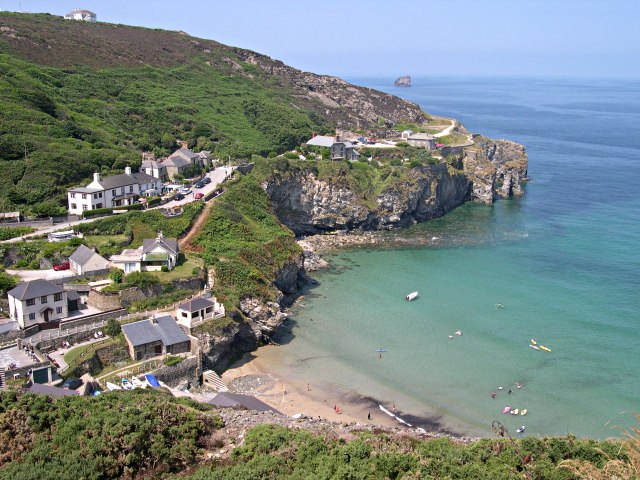
St Agnes ( kw, Breanek) is a civil parish and a large village on the north coast of Cornwall, UK. The village is about five miles (8 km) north of Redruth and ten miles (16 km) southwest of Newquay. ''and'' An electoral ward exists stretching as far south as Blackwater. The population at the 2011 census was 7,565. The village of St Agnes, a popular coastal tourist spot, lies on a main road between Redruth and Perranporth. It was a prehistoric and modern centre for mining of copper, tin and arsenic until the 1920s. Local industry has also included farming, fishing and quarrying, and more recently tourism. The St Agnes district has a heritage of industrial archaeology and much of the landscape is of considerable geological interest. There are also stone-age remains in the parish. The manor of Tywarnhaile was one of the 17 Antiqua maneria of the Duchy of Cornwall. Geography St Agnes, on Cornwall's north coast along the Atlantic Ocean, is in the Pydar hundred ... [...More Info...] [...Related Items...] OR: [Wikipedia] [Google] [Baidu] |
Ruan Lanihorne
Ruan Lanihorne is a civil parish and village in south Cornwall, England, United Kingdom. The village is situated approximately four miles (6.5 km) east-southeast of Truro between the River Fal and its tributary the Ruan River.Ordnance Survey: Landranger map sheet 204 ''Truro & Falmouth'' History and geography Ruan Lanihorne lies within the Cornwall Area of Outstanding Natural Beauty (AONB). Ruanlanihorne, as the name of the parish is spelled, is entirely rural in character with wooded areas in the river valleys. It is bounded to the north by Tregony parish, to the east by Veryan parish, to the south by Philleigh parish and to the west by St Michael Penkevil parish. Cornwall Council online mapping. Retrieved May 2010 Apart from the church town of Ruan Lanihorne, the only other settlements of any size are in the south of the parish: Treworga and Ruan High Lanes which is right on the parish's boundary with Veryan. The parish is in the Truro Registration District and th ... [...More Info...] [...Related Items...] OR: [Wikipedia] [Google] [Baidu] |
Probus, Cornwall
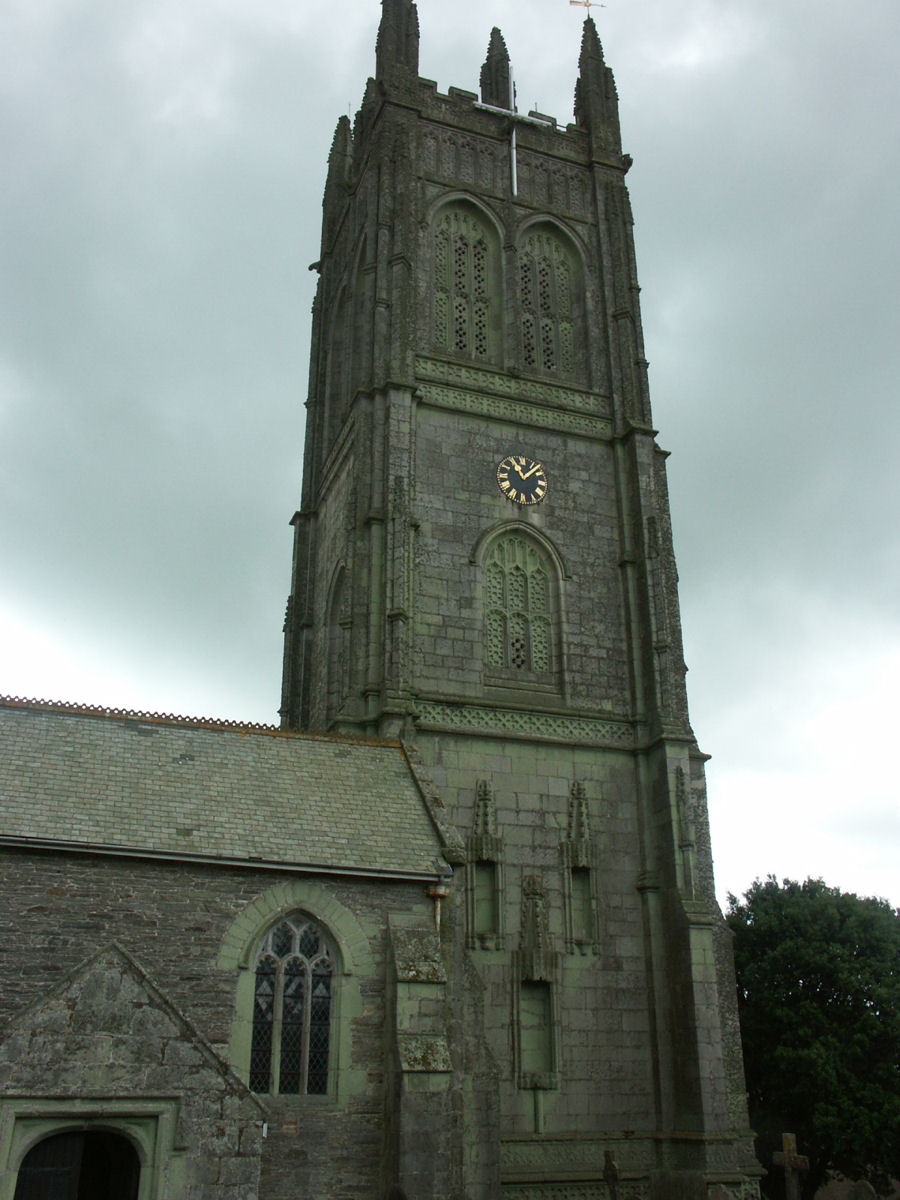
Probus ('' Cornish: Lannbrobus'') is a civil parish and village in Cornwall, England, in the United Kingdom. It has the tallest church tower in Cornwall. The tower is high, and richly decorated with carvings. The place name originates from the church's dedication to Saint Probus. The parish population at the 2011 census was 2,299, whereas the ward population taken at the same census was 3,953. History There was a monastery here before the Norman Conquest which continued to exist until the reign of Henry I. King Henry gave the church of Probus to Exeter Cathedral and the clergy of Probus thereafter were a dean and five canons (the deanery was abolished in 1268 and the canonries in 1549). The first vicar was instituted in 1312; the parish had dependent chapelries at Cornelly and Merther. The church was built mainly in the 15th century but the tower was still under construction in 1523. In the church is the brass of John Wulvedon and his wife, 1512. In the early years of the 19th c ... [...More Info...] [...Related Items...] OR: [Wikipedia] [Google] [Baidu] |
Philleigh
Philleigh ( kw, Eglosros) is a civil parish and village in Cornwall, England, in the United Kingdom; one of the four in the Roseland Peninsula. Philleigh lies within the Cornwall Area of Outstanding Natural Beauty (AONB). Almost a third of Cornwall has AONB designation, with similar status and protection as a National Park. The village is the home of Roseland Rugby Club which was formed in 1971. History The Manor of Eglosrose is mentioned in the Domesday Book and the remainder of the parish was in the episcopal Manor of Tregear. The manor of Eglosrose was one of several held by Thurstan from Robert, Count of Mortain. There was one virgate of land and land for 2 ploughs. There were half a plough, 3 serfs, 3 smallholders, 20 acres of pasture. The value of the manor was 10 shillings. The parish church is dedicated to St Fili or Filius. Fili probably came from Wales and is said to have been a companion of St Kea. The church has a west tower, a north transept and a south aisle; ... [...More Info...] [...Related Items...] OR: [Wikipedia] [Google] [Baidu] |
Perranzabuloe
Perranzabuloe (; kw, Pyran yn Treth) is a coastal civil parish and a hamlet in Cornwall, England, United Kingdom. Perranzabuloe parish is bordered to the west by the Atlantic coast and St Agnes parish, to the north by Cubert parish, to the east by St Newlyn East and St Allen parishes and to the south by Kenwyn parish. The hamlet (containing the parish church) is situated just over a mile (2 km) south of the principal settlement of the parish, Perranporth; the hamlet is also seven miles (11 km) south-southwest of Newquay. Other settlements in the parish include Perrancoombe, Goonhavern, Mount and Callestick. The parish population was 5,382 in the 2001 census, increasing to 5,486 at the 2011 census. The name of the parish derives from the medieval Latin ''Perranus in Sabulo'' meaning Piran in the sand. It refers to Saint Piran (the patron saint of Cornwall) who founded an oratory church in the seventh century near the coast north of Perranporth. In medieval times the ... [...More Info...] [...Related Items...] OR: [Wikipedia] [Google] [Baidu] |
Perranarworthal
Perranarworthal ( kw, Peran ar Wodhel) is a civil parish and village in Cornwall, England, United Kingdom. The village is about four miles (6.5 km) northwest of Falmouth and five miles (8 km) southwest of Truro. Perranarworthal parish is bordered on the north by Kea parish, on the east by Restronguet Creek and Mylor parish, on the south by St Gluvias and Stithians parishes and on the west by Gwennap parish. The parish population at the 2011 census was 1,496. The name derives from the Manor of Arworthal which has had a number of spellings in the past including Hareworthal (1187), Arwoethel and Arwythel. By the 18th-century two names appear on maps "Perran Arworthal" meaning St Piran's by the creek or estuary. William Penaluna described the settlement in 1838. Perranwell railway station is on the Maritime Line. Perran Wharf is the area of the parish beside the River Kennall (a tributary of Restronguet Creek) where there were wharves and a quay. This is currentl ... [...More Info...] [...Related Items...] OR: [Wikipedia] [Google] [Baidu] |
Mylor, Cornwall
Mylor is a civil parishes in England, civil parish in Cornwall, England, United Kingdom. It is situated approximately five miles north of Falmouth, Cornwall, Falmouth.Ordnance Survey: Landranger map sheet 204 ''Truro & Falmouth'' The Churchtown, Cornwall, church town of the ecclesiastical parish is Mylor Churchtown: however, Mylor Bridge is the largest village in the parish.GENUKI website Mylor. Retrieved April 2010 Other settlements include Angarrick, Carclew, Flushing, Cornwall, Flushing and Restronguet Passage.Cornwall Council online mapping ; Retrieved May 2010 Geography Mylor is a maritime parish and is bounded by water on three sides: Restron ...[...More Info...] [...Related Items...] OR: [Wikipedia] [Google] [Baidu] |
Ladock
Ladock ( kw, Egloslajek) is a village and civil parish in Cornwall, England, United Kingdom. It is about six miles (9.5 km) north-east of Truro. Historically, Ladock was two small settlements; Bissick by the river and Ladock on the hill. Notable features include the church, the school, the village hall and the Falmouth Arms pub. At the 2011 census the total population was 4,241. The village had a station, Probus and Ladock halt, on the Cornish Main Line railway but services to the station ended in 1957. Parish church The parish church of St Ladoca has a fine west tower built of granite blocks. The north side of the church is 13th-century in date while the south aisle is 15th-century and the chancel was much altered by George Street in 1862–1864. Interesting features include the carved base of the rood screen and the font of Catacleuse stone. The feast traditionally celebrated in the parish is held on the Sunday after the first Thursday in January. Sustainable village ... [...More Info...] [...Related Items...] OR: [Wikipedia] [Google] [Baidu] |


