|
Torrey, Utah
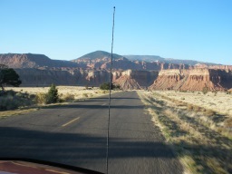
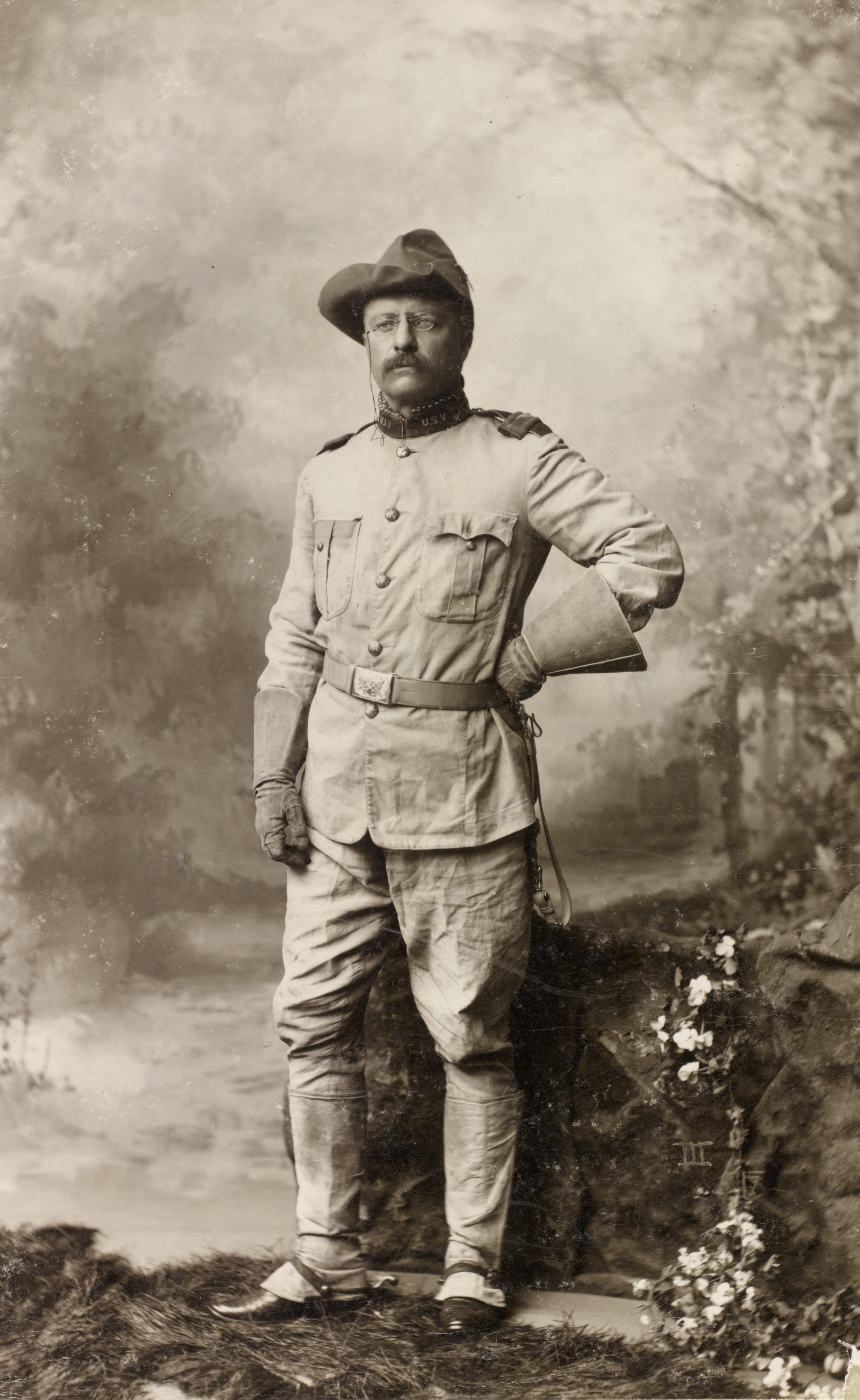
Torrey is a town located on State Route 24 in Wayne County, Utah, United States, from Capitol Reef National Park. As of the 2010 census, the town had a population of 182. History The town was established in the 1880s by settlers of the Church of Jesus Christ of Latter-day Saints, and was initially known as Youngtown, after John Willard Young. The town is generally held to be named after Jay L. Torrey from Pittsfield, Illinois. Torrey was a member of the Wyoming legislature, who, upon the advent of the Spanish–American War, achieved national attention by proposing the creation of what became three volunteer cavalry regiments, made up of cowboys and stockmen. Torrey was commissioned Colonel of the 2nd Regiment, the "Rocky Mountain Riders"; the 1st Regiment, the only regiment to see action, was better known as the Rough Riders. Geography Torrey is located on the north bank of the Fremont River between Boulder Mountain to the southwest and Capitol Reef National Park to th ... [...More Info...] [...Related Items...] OR: [Wikipedia] [Google] [Baidu] |
Town
A town is a human settlement. Towns are generally larger than villages and smaller than cities, though the criteria to distinguish between them vary considerably in different parts of the world. Origin and use The word "town" shares an origin with the German word , the Dutch word , and the Old Norse . The original Proto-Germanic word, *''tūnan'', is thought to be an early borrowing from Proto-Celtic *''dūnom'' (cf. Old Irish , Welsh ). The original sense of the word in both Germanic and Celtic was that of a fortress or an enclosure. Cognates of ''town'' in many modern Germanic languages designate a fence or a hedge. In English and Dutch, the meaning of the word took on the sense of the space which these fences enclosed, and through which a track must run. In England, a town was a small community that could not afford or was not allowed to build walls or other larger fortifications, and built a palisade or stockade instead. In the Netherlands, this space was a garden, mor ... [...More Info...] [...Related Items...] OR: [Wikipedia] [Google] [Baidu] |
John Willard Young
John Willard Young (October 1, 1844 – February 12, 1924) was a leader in the Church of Jesus Christ of Latter-day Saints (LDS Church). He is one of the few individuals to have been an LDS Church apostle and member of the First Presidency without ever being a member of the Quorum of the Twelve Apostles. Early life and apostolic ordination Young was born in Nauvoo, Illinois to Brigham Young and Mary Ann Angell. As a young boy, John traveled with the Mormon pioneers from Illinois to the Salt Lake Valley. Young was privately ordained an apostle by his father on November 22, 1855, when he was eleven, without a public announcement or being added to the Quorum of the Twelve Apostles. Young's ordination was reconfirmed on February 4, 1864, when his brothers Brigham Young, Jr. and Joseph Angell Young were ordained apostles by their father. However, none of them became members of the Quorum of the Twelve Apostles upon their ordination because the Quorum already had twelve members. Al ... [...More Info...] [...Related Items...] OR: [Wikipedia] [Google] [Baidu] |
Grover, Utah
Grover is an unincorporated community in southwestern Wayne County, Utah, United States. Originally known as Carcass Creek, Grover is a small ranching community off the county's main recreational corridor. Geography Grover lies some southeast of Torrey, on State Route 12. It sits just outside Dixie National Forest, at the northeastern flank of Boulder Mountain. To the east is Capitol Reef National Park. The community is small and scattered, but roughly bounded by two small streams, tributaries of the Fremont River. Fish Creek is on the west, Carcass Creek on the east. Carcass Creek was so named due to its steep banks, which proved hazardous to livestock. The former State Route 117 runs west and north from Grover to Teasdale, another small unincorporated community whose post office serves Grover. History The first settlers on Carcass Creek were experienced Wayne County ranchers who arrived in 1880. In 1881, more cattlemen settled along Fish Creek. A small number of residen ... [...More Info...] [...Related Items...] OR: [Wikipedia] [Google] [Baidu] |
Teasdale, Utah
Teasdale is a census-designated place in western Wayne County, Utah, United States, between the Dixie and Fishlake National Forests and near Capitol Reef National Park. The population was 191 at the 2010 census. Teasdale lies along local roads south of State Route 24, southeast of the town of Loa, the county seat of Wayne County. Teasdale has a post office with the ZIP code 84773. History The town was founded by LDS settlers. They called it Bullberry Creek named after the creek adjacent to the town. In the early 1900s, the community was named for George Teasdale, a member of the Quorum of the Twelve Apostles of The Church of Jesus Christ of Latter-day Saints (LDS Church). Demographics As of the census of 2010, there were 191 people living in the CDP. There were 123 housing units. The racial makeup of the town was 95.3% White, 2.6% American Indian and Alaska Native, 1.0% Asian, 0.5% Native Hawaiian and Other Pacific Islander, and 0.5% from two or more races. Hispanic or Lat ... [...More Info...] [...Related Items...] OR: [Wikipedia] [Google] [Baidu] |
Boulder Mountain (Utah)
Boulder Mountain (also known as Bluebell Knoll and Boulder Top) in Utah, USA makes up half of the Aquarius Plateau of South Central Utah in Wayne and Garfield counties. The mountain rises to the west of Capitol Reef National Park and consists of steep slopes and cliffs with over 50,000 acres (200 km²) of rolling forest and meadowlands on the top. The mountain has a nearly flat summit of roughly 70 square miles. The mountain is the highest timbered plateau in North America and is part of the Dixie National Forest. Highway 12 Utah Scenic Byway 12 traverses the eastern side of the mountain from Torrey through Boulder and on to Escalante. A series of unpaved backcountry roads and jeep trails provide access to the top during the brief snow-free time, usually only a few months from July to September. These jeep trails were originally created as the main route for wagons traveling between Escalante and Boulder.BLM RAMP.Canyones of Escalante:History of Boulder, Utah. (1990). R ... [...More Info...] [...Related Items...] OR: [Wikipedia] [Google] [Baidu] |
Fremont River
The Fremont River is a long river in southeastern Utah, United States that flows from the Johnson Valley Reservoir, which is located on the Wasatch Plateau near Fish Lake, southeast through Capitol Reef National Park to the Muddy Creek near Hanksville where the two rivers combine to form the Dirty Devil River, a tributary of the Colorado River. Course The Johnson Valley Reservoir is fed by Sevenmile Creek (from the north) and Lake Creek (from the southwest). The Fremont River passes through Fremont, Loa, Lyman, Bicknell, Teasdale, and Torrey and provides year-round irrigation for the agricultural lands of Rabbit Valley and Caineville. Then it heads through Hanksville and afterward to its mouth. Miscellaneous The Fremont River has a drainage area of fed by spring snowmelt off Thousand Lake Mountain, Boulder Mountain, and the northern Henry Mountains. The river is named after John Charles Frémont. It gives its name to the Fremont culture, a Precolumbian archaeological c ... [...More Info...] [...Related Items...] OR: [Wikipedia] [Google] [Baidu] |
Rough Riders
The Rough Riders was a nickname given to the 1st United States Volunteer Cavalry, one of three such regiments raised in 1898 for the Spanish–American War and the only one to see combat. The United States Army was small, understaffed, and disorganized in comparison to its status during the American Civil War roughly thirty years prior. Following the sinking of , President William McKinley needed to muster a strong ground force swiftly, which he did by calling for 125,000 volunteers to assist in the war. The U.S. had gone to war in opposition to Spanish colonial policies in Cuba, which was then torn by a rebellion. The regiment was also nicknamed "Wood's Weary Walkers" for its first commander, Colonel Leonard Wood. This reflected their dissatisfaction that despite being cavalry, they ended up fighting in Cuba as infantry, since their horses were not sent there with them. Wood's second in command was former Assistant Secretary of the Navy Theodore Roosevelt, a strong advocate for ... [...More Info...] [...Related Items...] OR: [Wikipedia] [Google] [Baidu] |
Ranch
A ranch (from es, rancho/Mexican Spanish) is an area of land, including various structures, given primarily to ranching, the practice of raising grazing livestock such as cattle and sheep. It is a subtype of a farm. These terms are most often applied to livestock-raising operations in Mexico, the Western United States and Western Canada, though there are ranches in other areas.For terminologies in Australia and New Zealand, see Station (Australian agriculture) and Station (New Zealand agriculture). People who own or operate a ranch are called ranchers, cattlemen, or stockgrowers. Ranching is also a method used to raise less common livestock such as horses, elk, American bison, ostrich, emu, and alpaca.Holechek, J.L., Geli, H.M., Cibils, A.F. and Sawalhah, M.N., 2020. Climate Change, Rangelands, and Sustainability of Ranching in the Western United States. ''Sustainability'', ''12''(12), p.4942. Ranches generally consist of large areas, but may be of nearly any size. In the west ... [...More Info...] [...Related Items...] OR: [Wikipedia] [Google] [Baidu] |
Cowboy
A cowboy is an animal herder who tends cattle on ranches in North America, traditionally on horseback, and often performs a multitude of other ranch-related tasks. The historic American cowboy of the late 19th century arose from the '' vaquero'' traditions of northern Mexico and became a figure of special significance and legend.Malone, J., p. 1. A subtype, called a wrangler, specifically tends the horses used to work cattle. In addition to ranch work, some cowboys work for or participate in rodeos. Cowgirls, first defined as such in the late 19th century, had a less-well documented historical role, but in the modern world work at identical tasks and have obtained considerable respect for their achievements. Cattle handlers in many other parts of the world, particularly South America and Australia, perform work similar to the cowboy. The cowboy has deep historic roots tracing back to Spain and the earliest European settlers of the Americas. Over the centuries, differences ... [...More Info...] [...Related Items...] OR: [Wikipedia] [Google] [Baidu] |
Cavalry
Historically, cavalry (from the French word ''cavalerie'', itself derived from "cheval" meaning "horse") are soldiers or warriors who fight mounted on horseback. Cavalry were the most mobile of the combat arms, operating as light cavalry in the roles of reconnaissance, screening, and skirmishing in many armies, or as heavy cavalry for decisive shock attacks in other armies. An individual soldier in the cavalry is known by a number of designations depending on era and tactics, such as cavalryman, horseman, trooper, cataphract, knight, hussar, uhlan, mamluk, cuirassier, lancer, dragoon, or horse archer. The designation of ''cavalry'' was not usually given to any military forces that used other animals for mounts, such as camels or elephants. Infantry who moved on horseback, but dismounted to fight on foot, were known in the early 17th to the early 18th century as '' dragoons'', a class of mounted infantry which in most armies later evolved into standard cavalry while ... [...More Info...] [...Related Items...] OR: [Wikipedia] [Google] [Baidu] |
Spanish–American War
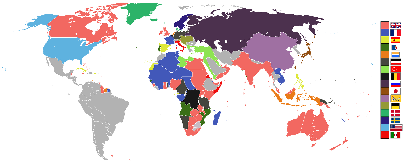
, partof = the Philippine Revolution, the decolonization of the Americas, and the Cuban War of Independence , image = Collage infobox for Spanish-American War.jpg , image_size = 300px , caption = (clockwise from top left) , date = April 21 – August 13, 1898() , place = , casus = , result = American victory *Treaty of Paris (1898), Treaty of Paris of 1898 *Founding of the First Philippine Republic and beginning of the Philippine–American War * German–Spanish Treaty (1899), Spain sells to Germany the last colonies in the Pacific in 1899 and end of the Spanish Empire in Spanish colonization of the Americas, America and Asia. , territory = Spain relinquishes sovereignty over Cuba; cedes Puerto Rico, Guam and the Philippine Islands to the United States. $20 million paid to Spain by the United States for infrastructure owned by Spain. , combatant1 = United State ... [...More Info...] [...Related Items...] OR: [Wikipedia] [Google] [Baidu] |
Wyoming
Wyoming () is a U.S. state, state in the Mountain states, Mountain West subregion of the Western United States. It is bordered by Montana to the north and northwest, South Dakota and Nebraska to the east, Idaho to the west, Utah to the southwest, and Colorado to the south. With a population of 576,851 in the 2020 United States census, Wyoming is the List of U.S. states and territories by population, least populous state despite being the List of U.S. states and territories by area, 10th largest by area, with the List of U.S. states by population density, second-lowest population density after Alaska. The state capital and List of municipalities in Wyoming, most populous city is Cheyenne, Wyoming, Cheyenne, which had an estimated population of 63,957 in 2018. Wyoming's western half is covered mostly by the ranges and rangelands of the Rocky Mountains, while the eastern half of the state is high-elevation prairie called the High Plains (United States), High Plains. It is drier ... [...More Info...] [...Related Items...] OR: [Wikipedia] [Google] [Baidu] |
.jpg)


