|
Toronto Transit Commission Fares
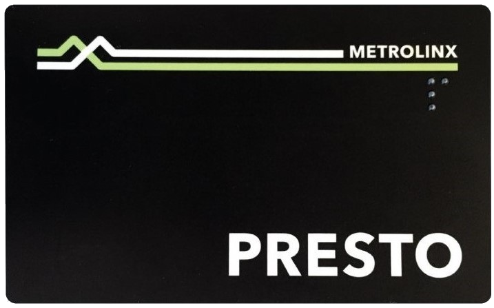
Fares to use the Toronto Transit Commission (TTC) transit system in Toronto, Ontario, Canada, can be paid with various media. The price of fares varies according to age (concessions for seniors and youth, free for children 12 years of age and under), occupation (discounts for post-secondary students), and income level of riders (Fair Pass program). For the payment of fares, the TTC principally uses Presto fare media, specifically Presto cards (multiple-use, stored-value, electronic fare cards) and Presto tickets (single-use, electronic paper tickets), both of which use Presto readers to charge fares and validate transfers. Legacy fare media (cash, tokens and legacy tickets) are still accepted to pay fares but tokens and legacy tickets are no longer sold to the general public. In September 2022, Metrolinx and the TTC started to upgrade Presto readers in order to support open payment using credit and debit cards or mobile devices. Existing readers on Wheel-Trans vehicles were replac ... [...More Info...] [...Related Items...] OR: [Wikipedia] [Google] [Baidu] |
Presto Reader & Notice On A TTC Streetcar
Presto may refer to: Computing * Presto (browser engine), an engine previously used in the Opera web browser * Presto (operating system), a Linux-based OS by Xandros * Presto (SQL query engine), a distributed query engine * Presto (animation software), the in-house proprietary 3D animation software created and used by Disney and Pixar Music * ''Presto'' (music), a fast tempo marking * ''Presto'' (album), or the title track, 1989 * "Presto" (song), by No Money Enterprise, 2020 * Presto! Recording Studios, a studio in Nebraska, United States Companies and organizations * Presto (restaurant technology platform) * Presto (streaming company), an Australian streaming company * Presto (UK supermarket), a grocery chain in the U.K. from the 1960s to 1998 * Presto! Recording Studios, in Lincoln, Nebraska * Presto Studios, a computer game development company * National Presto Industries, manufacturer of kitchen appliances * Great Taste Coffee Makers, a.k.a. Presto, a Philippine Baske ... [...More Info...] [...Related Items...] OR: [Wikipedia] [Google] [Baidu] |
GO Transit
GO Transit is a regional public transit system serving the Greater Golden Horseshoe region of Ontario, Canada. With its hub at Union Station in Toronto, GO Transit's green-and-white trains and buses serve a population of more than seven million across an area over stretching from London in the west to Peterborough in the east, and from Barrie in the north to Niagara Falls in the south. In , the system had a ridership of . GO Transit operates diesel-powered double-decker trains and coach buses, on routes that connect with all local and some long-distance inter-city transit services in its service area. GO Transit began regular passenger service on May 23, 1967, as a part of the Ontario Ministry of Transportation. Since then, it has grown from a single train line to seven lines, and expanded to include complementary bus service. GO Transit has been constituted in a variety of public-sector configurations. Today, it is an operating division of Metrolinx, a provincial Crown a ... [...More Info...] [...Related Items...] OR: [Wikipedia] [Google] [Baidu] |
Vaughan Metropolitan Centre Station
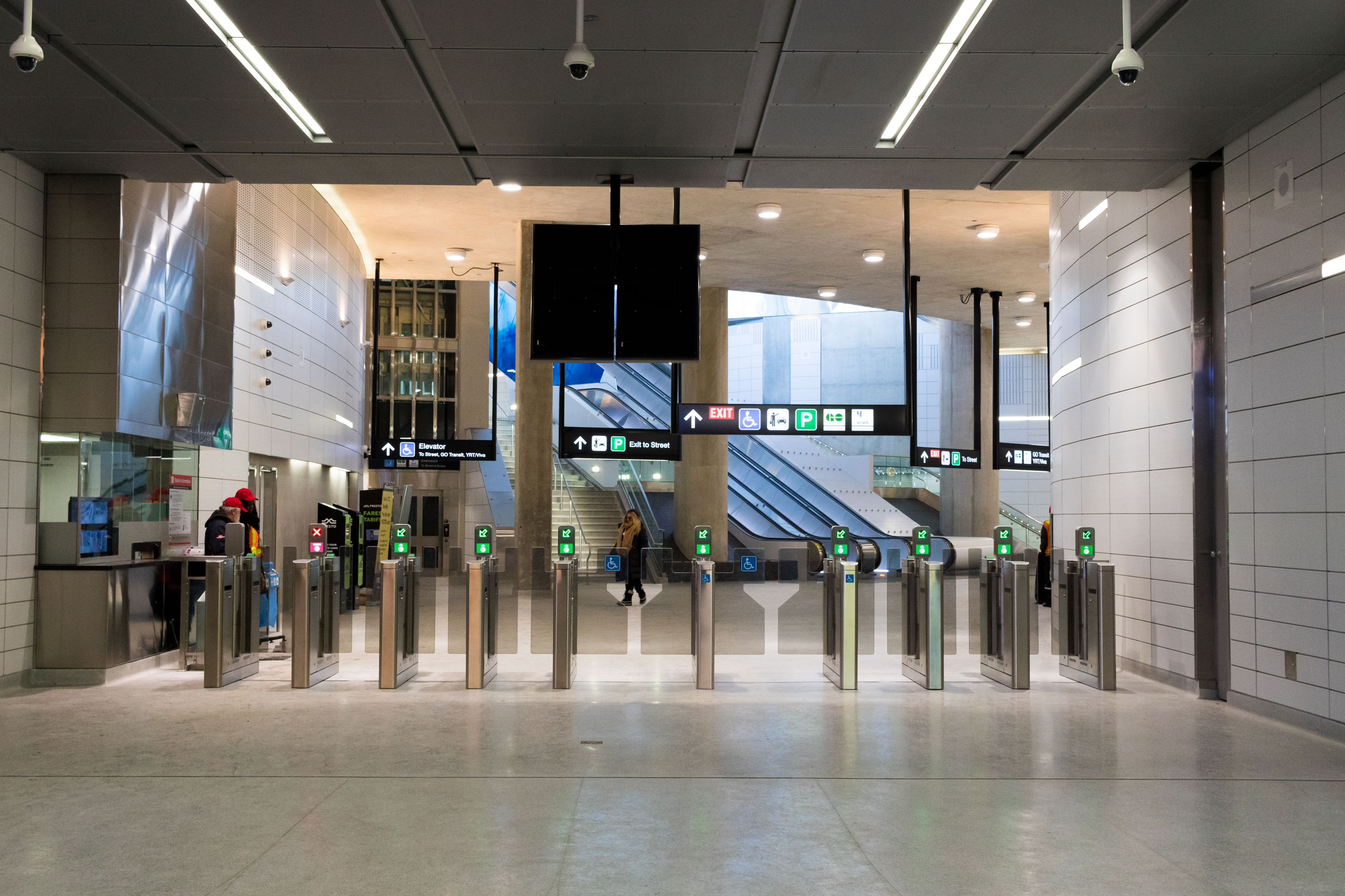
Vaughan Metropolitan Centre (also known as Vaughan, Vaughan Metro Centre or VMC) is a rapid transit station in Vaughan, Ontario, Canada. Opened on December 17, 2017, it is the north terminus of the western section of the Toronto subway's Line 1 Yonge–University. It is operated by the Toronto Transit Commission (TTC) and is one of two subway stations in the system outside of Toronto's city limits. It provides connections to Viva Rapid Transit's Highway 7 Rapidway, which is also used by Brampton Transit's Züm buses, as well as local bus routes of York Region Transit (YRT). Located in Vaughan Metropolitan Centre, the suburban city's future central business district, the station is designated by Metrolinx as a mobility hub, one of several multimodal transit terminals in the Greater Toronto and Hamilton Area. The station has a 900-space park-and-ride lot, which is privately owned and operated by SmartCentres, unlike other TTC rapid transit station parking lots which are owned an ... [...More Info...] [...Related Items...] OR: [Wikipedia] [Google] [Baidu] |
Highway 407 Station
Highway 407 is a Toronto Transit Commission (TTC) subway station on Line 1 Yonge–University of the Toronto subway. It is located at the southwest quadrant of the Jane Street and Highway 407 interchange, in Vaughan, Ontario, Canada. It is one of two Toronto subway stations that are outside the city of Toronto, the other being Vaughan Metropolitan Centre station. Description The design team for the station was AECOM as the prime consultant, Aedas as design architect, and Parsons Brinckerhoff as design engineers. The station is an intermodal transit facility providing connections to York Region Transit (YRT), GO Transit buses, and Ontario Northland intercity coaches. It will also connect to a future Highway 407 Transitway. The station has a 550-space commuter parking lot and a large 18-bay regional bus terminal. This station has been engineered and positioned for the construction of underground bus platforms for the proposed Highway 407 Transitway. The station has an open design, ... [...More Info...] [...Related Items...] OR: [Wikipedia] [Google] [Baidu] |
City Limits
City limits or city boundaries refer to the defined boundary or border of a city. The area within the city limit can be called the city proper. Town limit/boundary and village limit/boundary apply to towns and villages. Similarly, corporate limit is a legal name that refers to the boundary of municipal corporations. In some countries, the limit of a municipality may be expanded through annexation. United Kingdom In the UK, city boundaries are more difficult to define, since British cities are defined as any town or local authority area, regardless of area or population size, that has been granted letters patent as a royal prerogative. In smaller cities, such as Wells (pop. approx. 10,000) or Gloucester (pop. approx. 100,000), the boundary will be that governed by the city council, though in certain cases such as Carlisle, this may include large rural and even uninhabited areas which are largely distinct from the main settlement. In the case of larger cities, such as Birmingham ... [...More Info...] [...Related Items...] OR: [Wikipedia] [Google] [Baidu] |
Line 1 Yonge–University
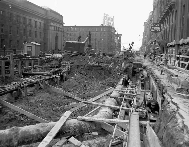
Line 1 Yonge–University is a rapid transit line on the Toronto subway. It serves Toronto and the neighbouring city of Vaughan in Ontario, Canada. It is operated by the Toronto Transit Commission, has 38 stations and is in length, making it the longest line on the subway system. It opened as the "Yonge subway" in 1954 as Canada's first underground passenger rail line, and was extended multiple times between 1963 and 2017. Averaging over 790,000 riders per weekday, Line 1 is the busiest rapid transit line in Canada, and one of the busiest lines in North America. Route description The line forms a rough 'U' shape, with two portions running generally north–south that meet at in the southern part of the city's downtown, and then gradually spreading farther apart as they proceed northward. From Union station, the eastern portion of the line runs straight under or nearby Yonge Street, sometimes in an uncovered trench, for to its northeastern terminus at Finch Avenue, connecting ... [...More Info...] [...Related Items...] OR: [Wikipedia] [Google] [Baidu] |
Metro Vancouver Regional District
The Metro Vancouver Regional District (MVRD), or simply Metro Vancouver, is a Canadian political subdivision and corporate entity representing the metropolitan area of Greater Vancouver, designated by provincial legislation as one of the 28 regional districts of British Columbia, regional districts in British Columbia. The organization was known as the Regional District of Fraser–Burrard for nearly one year upon incorporating in 1967, and as the Greater Vancouver Regional District (GVRD) from 1968 to 2017. Metro Vancouver borders Whatcom County, Washington, to the south, the Fraser Valley Regional District to the east, the Squamish-Lillooet Regional District to the north, and the Nanaimo Regional District and Cowichan Valley Regional District across the Strait of Georgia to the west. The MVRD is under the direction of 23 local authorities and delivers regional services, sets policy and acts as a political forum. The regional district's most populous city is Vancouver, and M ... [...More Info...] [...Related Items...] OR: [Wikipedia] [Google] [Baidu] |
Compass Card (British Columbia)
The Compass card is a contactless smart card automated fare collection system used primarily for public transit in Metro Vancouver, British Columbia, Canada. Compass card readers were first implemented as a beta in September 2013. Due to delays, full implementation to the general public began in August 2015. The system is operated by Cubic Transportation Systems and is managed by TransLink, the transportation authority for the region. Compass cards and tickets have been required for all trips taken by SkyTrain, SeaBus, and West Coast Express since April 8, 2016. By June 2016, TransLink reported that more than 915,000 customers had switched to using Compass, which included 95% of customers who could have used other fare media such as cash or paper-based FareSaver tickets. Riders are able to purchase Compass cards and add fare value online, by phone, or at Compass vending machines located at SeaBus terminals, SkyTrain stations, and West Coast Express stations. Compass vending ma ... [...More Info...] [...Related Items...] OR: [Wikipedia] [Google] [Baidu] |
Quebec City
Quebec City ( or ; french: Ville de Québec), officially Québec (), is the capital city of the Provinces and territories of Canada, Canadian province of Quebec. As of July 2021, the city had a population of 549,459, and the Communauté métropolitaine de Québec, metropolitan area had a population of 839,311. It is the eleventhList of the largest municipalities in Canada by population, -largest city and the seventhList of census metropolitan areas and agglomerations in Canada, -largest metropolitan area in Canada. It is also the List of towns in Quebec, second-largest city in the province after Montreal. It has a humid continental climate with warm summers coupled with cold and snowy winters. The Algonquian people had originally named the area , an Algonquin language, AlgonquinThe Algonquin language is a distinct language of the Algonquian languages, Algonquian language family, and is not a misspelling. word meaning "where the river narrows", because the Saint Lawrence River na ... [...More Info...] [...Related Items...] OR: [Wikipedia] [Google] [Baidu] |
Greater Montreal
Greater Montreal (french: Grand Montréal) is the most populous metropolitan area in Quebec and the second most populous in Canada after Greater Toronto. In 2015, Statistics Canada identified Montreal's Census Metropolitan Area (CMA) as with a population of 4,027,100, almost half that of the province. A smaller area of is governed by the Montreal Metropolitan Community (MMC) (french: Communauté métropolitaine de Montréal, CMM). This level of government is headed by a president (currently Montreal mayor Valérie Plante). The inner ring is composed of densely populated municipalities located in close proximity to Downtown Montreal. It includes the entire Island of Montreal, Laval, and the Urban Agglomeration of Longueuil. Due to their proximity to Montreal's downtown core, some additional suburbs on the South Shore (Brossard, Saint-Lambert, and Boucherville) are usually included in the inner ring, despite their location on the mainland. The outer ring is composed of low ... [...More Info...] [...Related Items...] OR: [Wikipedia] [Google] [Baidu] |
OPUS Card
OPUS is a rechargeable, dual interface (contact/ contactless) stored-value smart card using the Calypso Standard and is used by major public transit operators in Greater Montreal and Quebec City, Quebec, Canada. It complies with the ISO/IEC 14443 standard for smartcards, and can be read by smartphones with an NFC antenna. The name of the card in French, ''Carte OPUS'', is a pun on the word in French for smart cards with embedded chips, ''carte à puce''. Fares An advantage to the smart card compared to the previous system is the seamless integration with other transit networks of neighbouring cities. Another advantage relates to the speed at which users can access the system. As opposed to the magnetic stripe cards previously in use, the contactless smart card is more user-friendly in that the card does not risk becoming demagnetized and rendered useless, and also does not require patrons to slide the card in a particular way — proximity to the contactless reader will ... [...More Info...] [...Related Items...] OR: [Wikipedia] [Google] [Baidu] |
Ottawa
Ottawa (, ; Canadian French: ) is the capital city of Canada. It is located at the confluence of the Ottawa River and the Rideau River in the southern portion of the province of Ontario. Ottawa borders Gatineau, Quebec, and forms the core of the Ottawa–Gatineau census metropolitan area (CMA) and the National Capital Region (NCR). Ottawa had a city population of 1,017,449 and a metropolitan population of 1,488,307, making it the fourth-largest city and fourth-largest metropolitan area in Canada. Ottawa is the political centre of Canada and headquarters to the federal government. The city houses numerous foreign embassies, key buildings, organizations, and institutions of Canada's government, including the Parliament of Canada, the Supreme Court, the residence of Canada's viceroy, and Office of the Prime Minister. Founded in 1826 as Bytown, and incorporated as Ottawa in 1855, its original boundaries were expanded through numerous annexations and were ultimately ... [...More Info...] [...Related Items...] OR: [Wikipedia] [Google] [Baidu] |


