|
Toronto Aerodrome
Toronto Aerodrome, also known as Canadian Air Express Airport, was an aerodrome located in Toronto, Ontario, Canada. One of the historical airfields of Canada, operated from 1928 to 1939, it was situated at the current Sheppard West station on Dufferin Street and Sheppard Avenue West. Toronto Aerodrome was one of several small airfields established in the Toronto area during the 1920s and 1930s. This aerodrome served as the principal custom entry point for aircraft coming to Toronto until 1939, when Malton airfield, now Toronto Pearson International Airport, became operational. The aerodrome shared the site with the Toronto Flying Club (located at Dufferin Street and Wilson Avenue). The Toronto Flying Club's site is now the south end of Downsview Airport, TTC Wilson Complex. Following the end of World War II into the 1960s, parts of the former airfield and surrounding farmland were developed into the residential neighbourhood of Wilson Heights and mixed commercial-industrial ... [...More Info...] [...Related Items...] OR: [Wikipedia] [Google] [Baidu] |
Toronto
Toronto ( ; or ) is the capital city of the Canadian province of Ontario. With a recorded population of 2,794,356 in 2021, it is the most populous city in Canada and the fourth most populous city in North America. The city is the anchor of the Golden Horseshoe, an urban agglomeration of 9,765,188 people (as of 2021) surrounding the western end of Lake Ontario, while the Greater Toronto Area proper had a 2021 population of 6,712,341. Toronto is an international centre of business, finance, arts, sports and culture, and is recognized as one of the most multicultural and cosmopolitan cities in the world. Indigenous peoples have travelled through and inhabited the Toronto area, located on a broad sloping plateau interspersed with rivers, deep ravines, and urban forest, for more than 10,000 years. After the broadly disputed Toronto Purchase, when the Mississauga surrendered the area to the British Crown, the British established the town of York in 1793 and later designat ... [...More Info...] [...Related Items...] OR: [Wikipedia] [Google] [Baidu] |
List Of East–west Roads In Toronto
The following is a list of the east–west expressways and arterial thoroughfares in Toronto, Ontario, Canada. The city is organized in a grid pattern dating back to the plan laid out by Augustus Jones between 1793 and 1797. Most streets are aligned in the north–south or east–west direction, based on the shoreline of Lake Ontario. In other words, major north–south roads are generally perpendicular to the Lake Ontario shoreline and major east–west roads are generally parallel to the lake's shoreline. The Toronto road system is also influenced by its topography as some roads are aligned with the old Lake Iroquois shoreline, or the deep valleys. Minor streets with documented history or etymology are listed in a separate section. Roads are listed south to north. Expressways Gardiner Expressway The Frederick G. Gardiner Expressway, known locally as "the Gardiner", is an expressway connecting downtown with the western suburbs. Running close to the sho ... [...More Info...] [...Related Items...] OR: [Wikipedia] [Google] [Baidu] |
Transport In Toronto
Transportation in the Canadian city of Toronto forms the hub of the road, rail and air networks in the Greater Toronto Area and much of southern Ontario. There are many forms of transport in the city, including railways, highways, and public transit. Toronto also has an extensive network of bicycle lanes and multi-use trails and paths. Railways Toronto is a major rail transportation hub in Canada and central North America, with most commercial rail freight operations carried out by two Class I railroad, Class I railways, Canadian National Railway and Canadian Pacific Railway. Both companies operate major yards and Intermodal freight transport, intermodal facilities in various parts of Toronto to serve manufacturing and logistics customers. Although at one time, both railways saw most of their operations based out of the waterfront area, over time they have shifted to facilities in suburban Toronto or adjacent municipalities. Most waterfront trackage has been scaled back and aba ... [...More Info...] [...Related Items...] OR: [Wikipedia] [Google] [Baidu] |
Defunct Airports In Ontario
{{Disambiguation ...
Defunct (no longer in use or active) may refer to: * ''Defunct'' (video game), 2014 * Zombie process or defunct process, in Unix-like operating systems See also * * :Former entities * End-of-life product * Obsolescence Obsolescence is the state of being which occurs when an object, service, or practice is no longer maintained or required even though it may still be in good working order. It usually happens when something that is more efficient or less risky r ... [...More Info...] [...Related Items...] OR: [Wikipedia] [Google] [Baidu] |
List Of Airports In The Greater Toronto Area
The Greater Toronto Area (GTA) contains ten airports, eight heliports, and one water aerodrome. These aviation facilities are situated within and around Toronto and its neighbouring cities, serving airline passengers, regional air travel and commercial cargo transportation. Toronto Pearson International Airport, located mainly in Mississauga, is the busiest airport in Canada and hosts international travel with various airlines. Billy Bishop Toronto City Airport on the Toronto Islands is a regional airport, providing regular services to United States destinations. John C. Munro Hamilton International Airport in Hamilton is a base for low-cost carriers that fly domestic and transatlantic routes. Pearson, Bishop, and Hamilton combined served over 53 million passengers in 2018, making Toronto the world's 31st busiest city airport system in the world. Heliports and water aerodromes are mostly for private use only, mainly by institutions and medical services. Airports Sched ... [...More Info...] [...Related Items...] OR: [Wikipedia] [Google] [Baidu] |
List Of Defunct Airports In Canada
This is an alphabetical list of abandoned airports in Canada that were at one time important enough to warrant an article. Most of these also appear in :Defunct airports in Canada. This list is sorted by province or territory. Alberta List of airports in Alberta * Acme Airport * Andrew Airport * Bjorgum Farm Airport * Cadotte Airport * Caroline Aerodrome * Chinchaga Airport * Conklin Airport * Cowpar Airport * Didsbury (Vertical Extreme Skydiving) Aerodrome * Edmonton City Centre (Blatchford Field) Airport * Edmonton/St. Albert Airport * Embarras Airport * Fontas Airport * Fitzgerald (Fort Smith) Water Aerodrome * Forestburg Airport * Fort Chipewyan/Small Lake Water Aerodrome * Grande Cache Airport * Grist Lake Airport * Hamburg Aerodrome * High Level/Footner Lake Water Aerodrome * RCAF Station High River * Lethbridge/Anderson Aerodrome * Liege/CNRL Aerodrome * RCAF Station Lincoln Park * Milk River (Madge) Airport * Olds/North 40 Ranch Aerodrome * RCAF Station Pearc ... [...More Info...] [...Related Items...] OR: [Wikipedia] [Google] [Baidu] |
Downsview, Toronto
Downsview is a neighbourhood in the north end of Toronto, Ontario, Canada, located in the district of North York. The area takes its name from the Downs View farm established around 1842 near the present-day intersection of Keele Street and Wilson Avenue. It now extends beyond the intersection of Sheppard Avenue and Dufferin Street (the latter which is bypassed by Allen Road in the vicinity of the intersection), though it is popularly seen as including the areas to the north right up to the Toronto city limit at Steeles Avenue. The area includes several large post-World War II subdivisions. Within the area is Downsview Airport, the former site of Canadian Forces Base Downsview, which has since been largely converted following the end of the Cold War into an urban park known as Downsview Park. The airport is still used as a manufacturing and testing facility for Bombardier Aerospace. Description From the east side of Dufferin Street to areas to the east, the area is primarily res ... [...More Info...] [...Related Items...] OR: [Wikipedia] [Google] [Baidu] |
Clanton Park, Toronto
Clanton Park (sometimes referred to as Dublin Heights or Wilson Heights) is a neighbourhood in Toronto, Ontario, Canada. Located in the district of North York, it is part of federal and provincial electoral district York Centre, and Toronto electoral wards 9: York Centre (West) and 10: York Centre (East). In 2006, it had a population of 13,035. It is bordered on the north by Sheppard Avenue West, on the west by the Downsview Airport whose border includes Wilson Heights Boulevard (north part) and Dufferin Street (south part), on the east by Bathurst Street, and on the south by Highway 401. Clanton Park is sandwiched between Downsview Park, formerly CFB Downsview, and Earl Bales Park, named after a former reeve of North York. It also contains several smaller parks. History William Duncan, a linen merchant from Ireland, settled a farm near the crossroads of Sheppard Avenue and Dufferin Street in 1827. A crossroads village was named Dublin after this farm. A general store was ... [...More Info...] [...Related Items...] OR: [Wikipedia] [Google] [Baidu] |
Downsview Airport
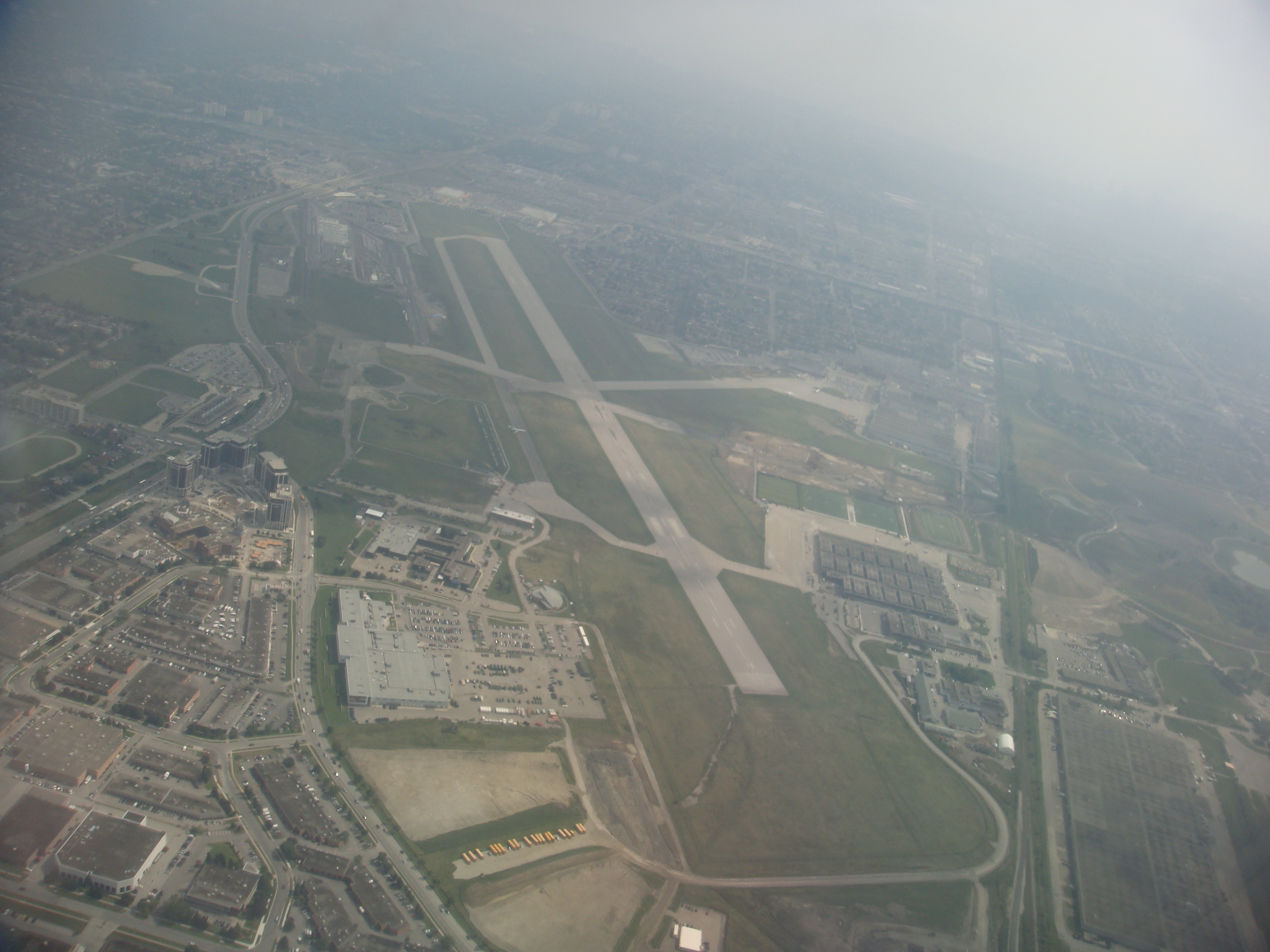
Downsview Airport was located in the North York district of Toronto, Ontario, Canada. An air field, then air force base, it had been a testing facility for Bombardier Aerospace from 1994 to 2018. Bombardier has sold the facility and manufacturing plant and its future is uncertain. Downsview Airport had its own fire service ( Bombardier Aerospace Emergency Services) which covers airport operations (using two airport fire rescue vehicles) and plant operations (using two SUV emergency vehicles). Bombardier Emergency Services employees were cross-trained as firefighters, first responders and airport security. History Downsview Airfield Downsview Airfield opened in 1929 as general aviation airfield and one of two airports in the area. It was built by de Havilland Canada for testing aircraft at the plant at the site. The site was expanded during World War II by the Royal Canadian Air Force and renamed RCAF Station Downsview. Downsview Airport The Downsview Airport was developed in ... [...More Info...] [...Related Items...] OR: [Wikipedia] [Google] [Baidu] |
Toronto Pearson International Airport
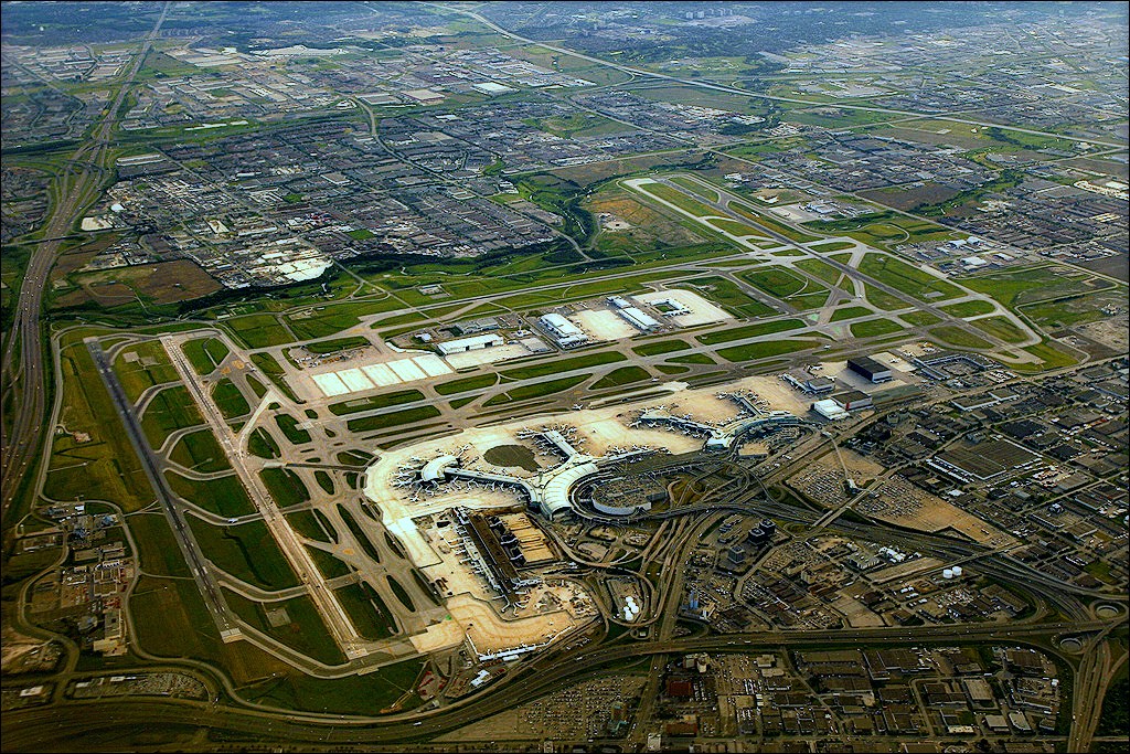
Lester B. Pearson International Airport , commonly known as Toronto Pearson International Airport, is an international airport located in Mississauga, Ontario, Canada. It is the main airport serving Toronto, its metropolitan area, and the surrounding region known as the Golden Horseshoe. The airport is named in honour of Lester B. Pearson, who served as the 14th Prime minister of Canada and received the Nobel Peace Prize in 1957. Toronto Pearson is located northwest of Downtown Toronto with the majority of the airport situated in Mississauga and a small portion of the airfield, along Silver Dart Drive north of Renforth Drive, extending into Toronto's western district of Etobicoke. It has five runways and two passenger terminals along with numerous cargo and maintenance facilities on a site that covers . It is the largest and busiest airport in Canada, handling 50.5 million passengers in 2019. As of 2019, it was the second-busiest international air passenger gateway in the A ... [...More Info...] [...Related Items...] OR: [Wikipedia] [Google] [Baidu] |
Ontario
Ontario ( ; ) is one of the thirteen provinces and territories of Canada.Ontario is located in the geographic eastern half of Canada, but it has historically and politically been considered to be part of Central Canada. Located in Central Canada, it is Canada's most populous province, with 38.3 percent of the country's population, and is the second-largest province by total area (after Quebec). Ontario is Canada's fourth-largest jurisdiction in total area when the territories of the Northwest Territories and Nunavut are included. It is home to the nation's capital city, Ottawa, and the nation's most populous city, Toronto, which is Ontario's provincial capital. Ontario is bordered by the province of Manitoba to the west, Hudson Bay and James Bay to the north, and Quebec to the east and northeast, and to the south by the U.S. states of (from west to east) Minnesota, Michigan, Ohio, Pennsylvania, and New York. Almost all of Ontario's border with the United States f ... [...More Info...] [...Related Items...] OR: [Wikipedia] [Google] [Baidu] |
Malton, Mississauga
Malton is a neighbourhood in the northeastern part of the city of Mississauga, Ontario, Canada, located to the northwest of Toronto. Malton is bounded by Highway 427 to the east, the Brampton city limits (a Canadian National Railway (CN) rail line) to the north, Airport Road to the west, and a second CN line and Toronto Pearson International Airport to the south. Malton is unique in that it does not adjoin any other Mississauga neighbourhood, being separated by the airport and extensive industrial areas. All of the roads in this area are named after cities in the United Kingdom. Mimico Creek flows through Malton. The oldest portion of Malton is located on the northwest corner of Airport and Derry Roads. Together, the Malton and Britannia Woods areas compose Ward 5. History 1820–1936 The Second Purchase from the Mississauga Indians on Wednesday, October 28, 1818, was for 648,000 acres. Toronto Township received 34,556 acres, increasing its total acreage to 64,125. The Tor ... [...More Info...] [...Related Items...] OR: [Wikipedia] [Google] [Baidu] |


.jpg)


