|
Tornadoes Of 1955
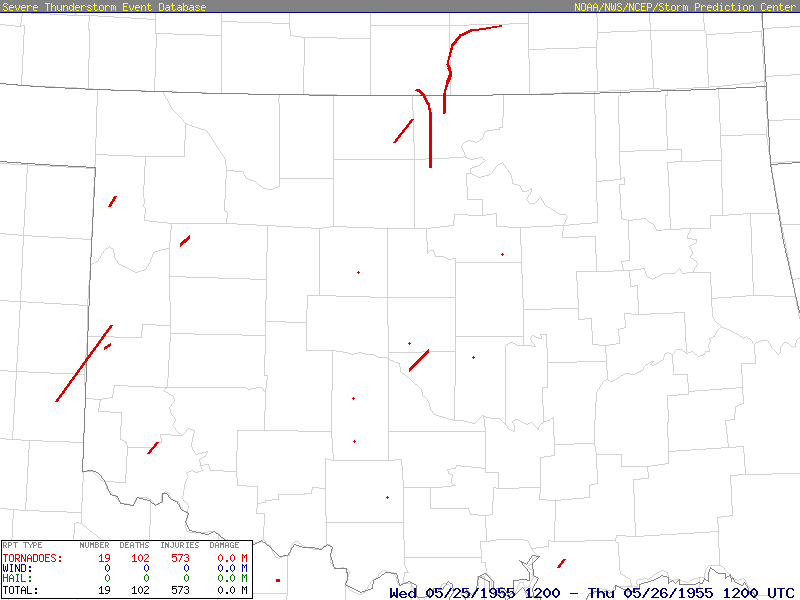
This page documents the tornadoes and tornado outbreaks of 1955, primarily in the United States. Most tornadoes form in the U.S., although some events may take place internationally. Tornado statistics for older years like this often appear significantly lower than modern years due to fewer reports or confirmed tornadoes. Events Several unusual events occurred during the 1955 tornado season. May 25 saw two F5 tornadoes on the ground at the same time in the same general area of Northern Oklahoma and Southern Kansas, both of which caused catastrophic damage and hundreds of casualties. In addition, 1955 saw five people killed by F0 tornadoes, with four of them being in Georgia alone. This was the most deaths from F0/EF0 tornadoes in a single year at the time. United States yearly total January There were 3 tornadoes confirmed in the US in January. January 18 A rare F1 tornado moved through areas just west of Downtown Los Angeles. There were no casualtie ... [...More Info...] [...Related Items...] OR: [Wikipedia] [Google] [Baidu] |
Blackwell, Oklahoma
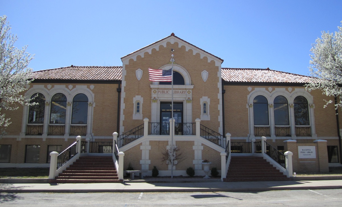
Blackwell is a city in Kay County, Oklahoma, United States, located at the intersection of U.S. Highway 177 and State Highway 11 along Interstate 35 (exit #222). The population was 7,092 at the 2010 census and 6,085 in the 2020 Census. Blackwell was established following the September 16, 1893 Cherokee Outlet land run by A. J. Blackwell.Wilson, Linda Blackwell, OklahomaOklahoma Historical Society Blackwell has an agricultural and fossil fuel based economy. History Founding Blackwell came into existence during the Cherokee Outlet Opening on September 16, 1893 in the run known as the Cherokee Strip Land Run. The town is named for A. J. Blackwell, who was the dominant force in its founding. Andrew Blackwell had settled in the area in 1882, having married the former Rosa Vaught who was of Cherokee descent, he was eligible to found the city. Blackwell served as Justice of the Peace and Mayor of Blackwell."Blackwell, Andrew Jackson," ''Herringshaw's Encyclopedia of American Biogra ... [...More Info...] [...Related Items...] OR: [Wikipedia] [Google] [Baidu] |
Indiana
Indiana () is a U.S. state in the Midwestern United States. It is the 38th-largest by area and the 17th-most populous of the 50 States. Its capital and largest city is Indianapolis. Indiana was admitted to the United States as the 19th state on December 11, 1816. It is bordered by Lake Michigan to the northwest, Michigan to the north, Ohio to the east, the Ohio River and Kentucky to the south and southeast, and the Wabash River and Illinois to the west. Various indigenous peoples inhabited what would become Indiana for thousands of years, some of whom the U.S. government expelled between 1800 and 1836. Indiana received its name because the state was largely possessed by native tribes even after it was granted statehood. Since then, settlement patterns in Indiana have reflected regional cultural segmentation present in the Eastern United States; the state's northernmost tier was settled primarily by people from New England and New York, Central Indiana by migrants fro ... [...More Info...] [...Related Items...] OR: [Wikipedia] [Google] [Baidu] |
Black Creek, North Carolina
Black Creek is a town in Wilson County, North Carolina, United States. The population was 769 at the 2010 census. History The Manalcus Aycock House, Black Creek Rural Historic District, and Dr. H. D. Lucas House were listed on the National Register of Historic Places in 1986. Geography Black Creek is located at (35.635976, -77.933252). According to the United States Census Bureau, the town has a total area of , all land. Demographics As of the census of 2000, there were 714 people, 279 households, and 210 families residing in the town. The population density was . There were 296 housing units at an average density of . The racial makeup of the town was 77.73% White, 18.91% African American, 0.28% Asian, 0.70% from other races, and 2.38% from two or more races. Hispanic or Latino of any race were 2.24% of the population. There were 279 households, out of which 38.0% had children under the age of 18 living with them, 53.0% were married couples living together, 17.2% had a ... [...More Info...] [...Related Items...] OR: [Wikipedia] [Google] [Baidu] |
Cleaton, Kentucky
Cleaton is an unincorporated community and census-designated place in Muhlenberg County, Kentucky, United States. As of the 2020 census, it had a population of 168. History A post office called Cleaton has been in operation since 1901. The name Cleaton was the middle name of the wife of the postmaster. Geography Cleaton is in eastern Muhlenberg County northeast of U.S. Route 431, which forms the western edge of the community. The neighborhood of Holt is in the northern part of the CDP, while Bevier is in the southern part. US 431 leads northwest to Central City and southeast to Drakesboro. Greenville, the county seat, is to the southwest. According to the U.S. Census Bureau, the Cleaton CDP has an area of , of which , or 0.48%, are water. The community is drained to the southeast by a tributary of Pond Creek, which flows north to the Green River Green River may refer to: Rivers Canada * Green River (British Columbia), a tributary of the Lillooet River *Green River, a ... [...More Info...] [...Related Items...] OR: [Wikipedia] [Google] [Baidu] |
Caldwell County, Missouri
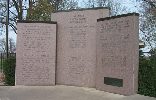
Caldwell County is a County (United States), county located in Missouri, United States. As of the 2020 United States Census, 2020 census, the county's population was 9,424. It is part of the Kansas City metropolitan area. Its county seat is Kingston, Missouri, Kingston. The county was organized December 29, 1836 and named by Alexander Doniphan to honor John Caldwell (Kentucky politician), John Caldwell, who participated in George Rogers Clark's Native American Campaign of 1786 and was the second Lieutenant Governor of Kentucky. Caldwell County was originally established as a haven for Mormons, who had been driven from Jackson County, Missouri, Jackson County in November 1833 and had been refugees in adjacent Clay County, Missouri, Clay County since. The county was one of the principal settings of the Mormon War (1838), 1838 Missouri Mormon War, which led to the expulsion of all Latter Day Saint movement, Latter Day Saints from Missouri, following the issuance of an "Missouri Exec ... [...More Info...] [...Related Items...] OR: [Wikipedia] [Google] [Baidu] |
Clinton County, Missouri
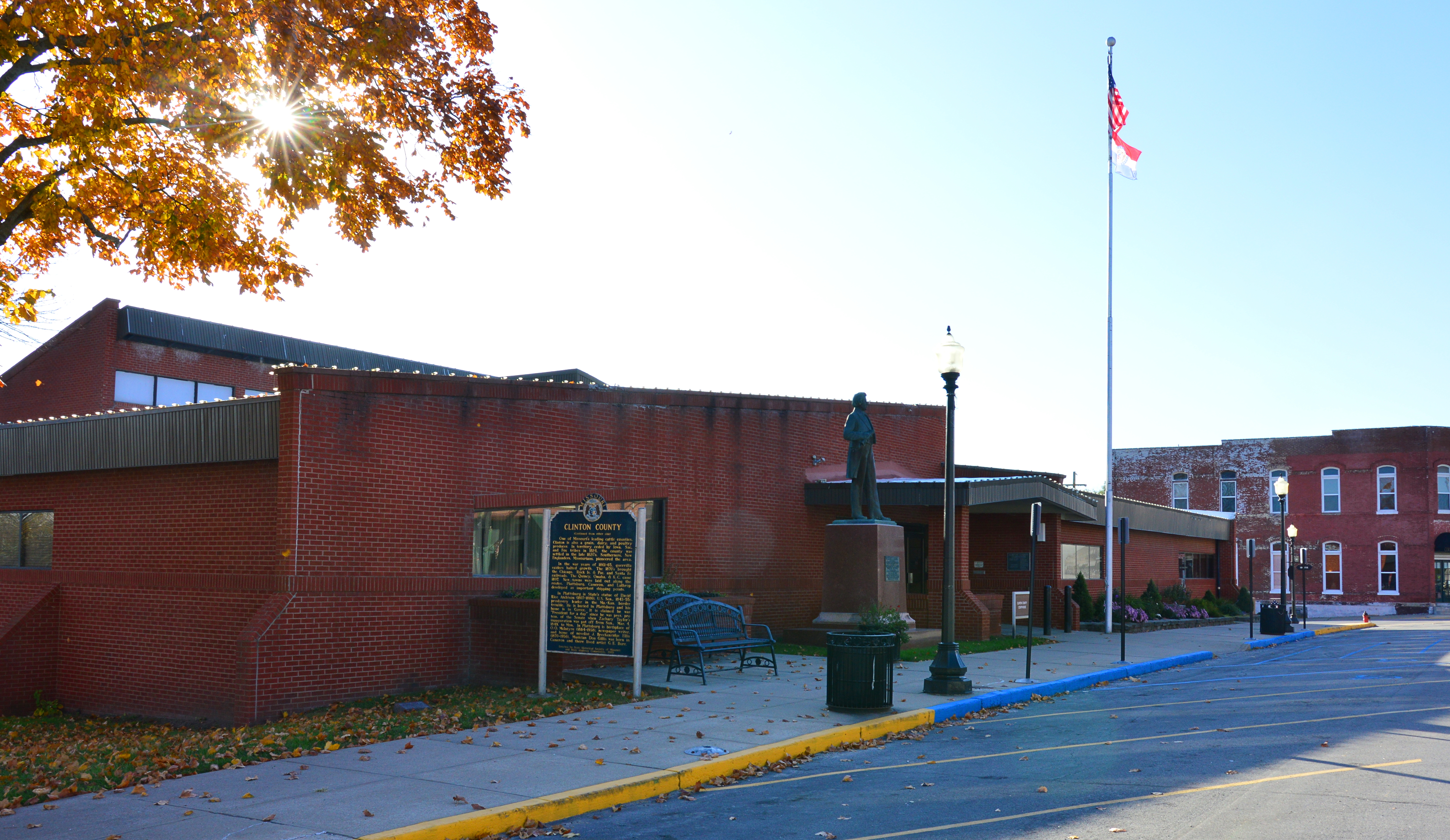
Clinton County is a county located in the U.S. state of Missouri and is part of the Kansas City metropolitan area. As of the 2010 U.S. Census, the county had a population of 20,743. Its county seat is Plattsburg. The county was organized January 2, 1833 and named for Governor DeWitt Clinton of New York. The county seat of Plattsburg derives its name from a town of a similar name that is the county seat of Clinton County, New York, which was also named for the Governor. Geography According to the U.S. Census Bureau, the county has a total area of , of which is land and (1.1%) is water. Adjacent counties *DeKalb County (north) * Caldwell County (east) * Ray County (southeast) *Clay County (south) * Platte County (southwest) * Buchanan County (west) Major highways * Interstate 35 * U.S. Route 69 * U.S. Route 169 * Route 33 * Route 116 Demographics As of the census of 2017, there were 20,554 people, 8,990 households, and 8,299 families residing in the county. The populatio ... [...More Info...] [...Related Items...] OR: [Wikipedia] [Google] [Baidu] |
Monetta, South Carolina
Monetta is a town in Aiken and Saluda counties, South Carolina, United States. The population was 236 at the 2010 census. The Aiken County portion of Monetta is part of the Augusta, Georgia metropolitan area. The Saluda County portion of Monetta is part of the Columbia, SC Metropolitan Area. Geography Monetta is located at (33.849642, -81.608200), near the southern corner of Saluda County and the northern corner of Aiken County. U.S. Route 1 passes through the town, leading northeast to Batesburg-Leesville and then Columbia, the state capital, and southwest to Aiken. According to the United States Census Bureau, the town has a total area of , all land. Demographics As of the census of 2000, there were 220 people, 92 households, and 64 families living in the town. The population density was . There were 108 housing units at an average density of . The racial makeup of the town was 73.64% White, 24.55% African American, and 1.82% from two or more races. Hispanic or Latino ... [...More Info...] [...Related Items...] OR: [Wikipedia] [Google] [Baidu] |
Ridge Spring, South Carolina
Ridge Spring is a town in Saluda County, South Carolina, United States. The population was 737 at the 2010 census. It is part of the Columbia, SC Metropolitan Statistical Area. The Mayor-Elect is Ms. Qwendolyn Etheredge. History Ridge Hill High School was added to the National Register of Historic Places in 2010. Geography Ridge Spring is located at (33.845942, -81.660845). According to the United States Census Bureau, the town has a total area of , of which are land and (1.08%) is covered by water. Demographics As of the census of 2000, 823 people, 321 households, and 217 families resided in the town. The population density was . The 368 housing units averaged . The racial makeup of the town was 33.90% White, 63.91% Black, 0.12% Native American, 0.61% from other races, and 1.46% from two or more races. Hispanics or Latinos of any race were 2.55% of the population. Of the 321 households, 26.2% had children under the age of 18 living with them, 40.5% were married couples li ... [...More Info...] [...Related Items...] OR: [Wikipedia] [Google] [Baidu] |
North Carolina
North Carolina () is a state in the Southeastern region of the United States. The state is the 28th largest and 9th-most populous of the United States. It is bordered by Virginia to the north, the Atlantic Ocean to the east, Georgia and South Carolina to the south, and Tennessee to the west. In the 2020 census, the state had a population of 10,439,388. Raleigh is the state's capital and Charlotte is its largest city. The Charlotte metropolitan area, with a population of 2,595,027 in 2020, is the most-populous metropolitan area in North Carolina, the 21st-most populous in the United States, and the largest banking center in the nation after New York City. The Raleigh-Durham-Cary combined statistical area is the second-largest metropolitan area in the state and 32nd-most populous in the United States, with a population of 2,043,867 in 2020, and is home to the largest research park in the United States, Research Triangle Park. The earliest evidence of human occupation i ... [...More Info...] [...Related Items...] OR: [Wikipedia] [Google] [Baidu] |
Kentucky
Kentucky ( , ), officially the Commonwealth of Kentucky, is a state in the Southeastern region of the United States and one of the states of the Upper South. It borders Illinois, Indiana, and Ohio to the north; West Virginia and Virginia to the east; Tennessee to the south; and Missouri to the west. Its northern border is defined by the Ohio River. Its capital is Frankfort, and its two largest cities are Louisville and Lexington. Its population was approximately 4.5 million in 2020. Kentucky was admitted into the Union as the 15th state on June 1, 1792, splitting from Virginia in the process. It is known as the "Bluegrass State", a nickname based on Kentucky bluegrass, a species of green grass found in many of its pastures, which has supported the thoroughbred horse industry in the center of the state. Historically, it was known for excellent farming conditions for this reason and the development of large tobacco plantations akin to those in Virginia and North Carolina i ... [...More Info...] [...Related Items...] OR: [Wikipedia] [Google] [Baidu] |
Missouri
Missouri is a U.S. state, state in the Midwestern United States, Midwestern region of the United States. Ranking List of U.S. states and territories by area, 21st in land area, it is bordered by eight states (tied for the most with Tennessee): Iowa to the north, Illinois, Kentucky and Tennessee to the east, Arkansas to the south and Oklahoma, Kansas and Nebraska to the west. In the south are the Ozarks, a forested highland, providing timber, minerals, and recreation. The Missouri River, after which the state is named, flows through the center into the Mississippi River, which makes up the eastern border. With more than six million residents, it is the List of U.S. states and territories by population, 19th-most populous state of the country. The largest urban areas are St. Louis, Kansas City, Missouri, Kansas City, Springfield, Missouri, Springfield and Columbia, Missouri, Columbia; the Capital city, capital is Jefferson City, Missouri, Jefferson City. Humans have inhabited w ... [...More Info...] [...Related Items...] OR: [Wikipedia] [Google] [Baidu] |
South Carolina
)''Animis opibusque parati'' ( for, , Latin, Prepared in mind and resources, links=no) , anthem = " Carolina";" South Carolina On My Mind" , Former = Province of South Carolina , seat = Columbia , LargestCity = Charleston , LargestMetro = Greenville (combined and metro) Columbia (urban) , BorderingStates = Georgia, North Carolina , OfficialLang = English , population_demonym = South Carolinian , Governor = , Lieutenant Governor = , Legislature = General Assembly , Upperhouse = Senate , Lowerhouse = House of Representatives , Judiciary = South Carolina Supreme Court , Senators = , Representative = 6 Republicans1 Democrat , postal_code = SC , TradAbbreviation = S.C. , area_rank = 40th , area_total_sq_mi = 32,020 , area_total_km2 = 82,932 , area_land_sq_mi = 30,109 , area_land_km2 = 77,982 , area_water_sq_mi = 1,911 , area_water_km2 = 4,949 , area_water_percent = 6 , population_rank = 23rd , population_as_of = 2022 , 2010Pop = 5282634 , population ... [...More Info...] [...Related Items...] OR: [Wikipedia] [Google] [Baidu] |


