|
Time In Samoa
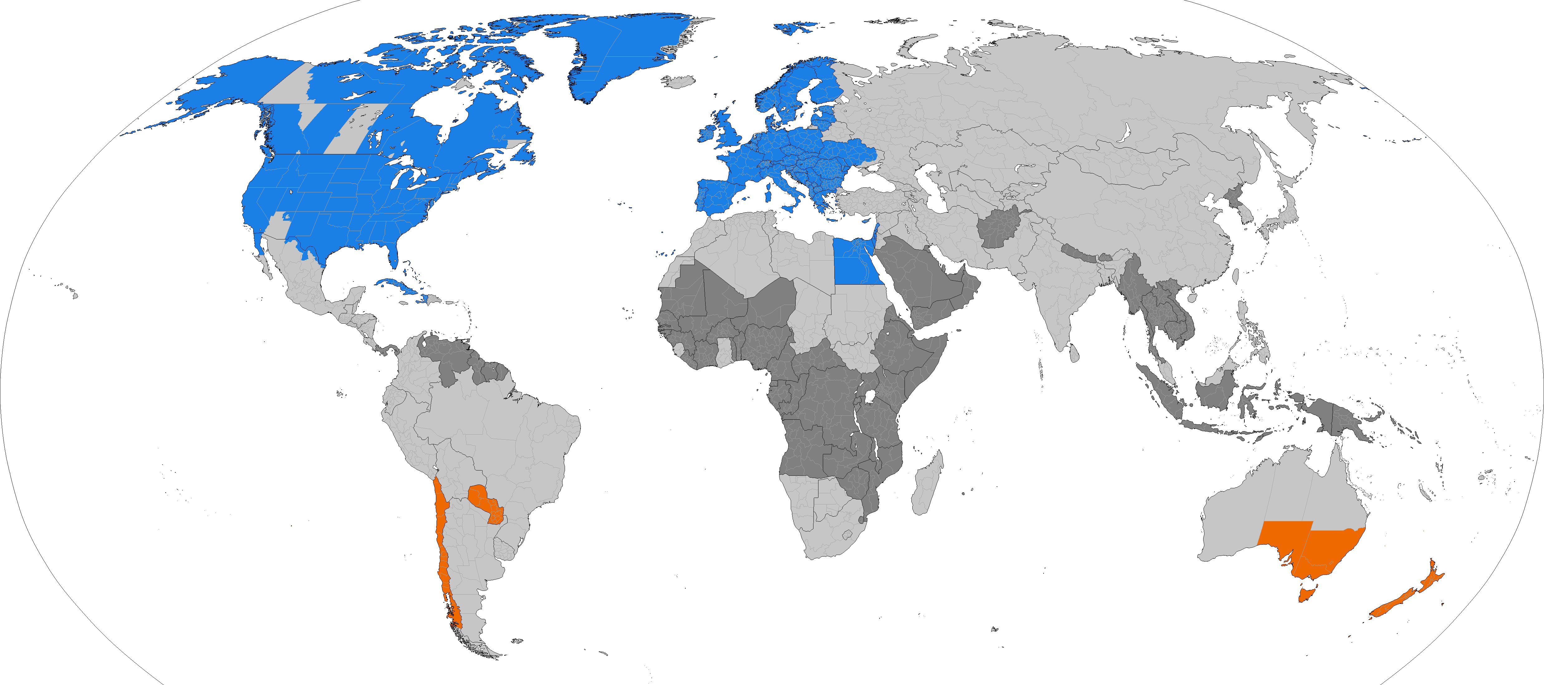
Samoa uses UTC+13:00 as standard time. It observed daylight saving time from 2010 to 2021, which it observed during summer in the Southern Hemisphere. In 2011, daylight saving time ended on Saturday, 2 April 2011, 04:00 local daylight time and started on Saturday, 24 September 2011, 03:00 local standard time. Because it is located near the equator, Samoa traditionally did not observe daylight saving time. The introduction of daylight saving time was initially planned for 2009 but was postponed for one year in the aftermath of the 2009 Samoa tsunami. As it is located just west of the International Date Line, Samoa is among the first places on earth to see each new day, along with Tonga, Tokelau (during standard time), and parts of Kiribati. IANA time zone database The IANA time zone database in the file zone.tab contains one zone for Samoa, named "Pacific/Apia". 2011 time zone change Until the end of 2011, Samoa lay east of the International Date Line, observing UTC−11:00 ( ... [...More Info...] [...Related Items...] OR: [Wikipedia] [Google] [Baidu] |
Samoa
Samoa, officially the Independent State of Samoa; sm, Sāmoa, and until 1997 known as Western Samoa, is a Polynesian island country consisting of two main islands (Savai'i and Upolu); two smaller, inhabited islands (Manono Island, Manono and Apolima); and several smaller, uninhabited islands, including the Aleipata Islands (Nu'utele, Nu'ulua, Fanuatapu and Namua). Samoa is located west of American Samoa, northeast of Tonga (closest foreign country), northeast of Fiji, east of Wallis and Futuna, southeast of Tuvalu, south of Tokelau, southwest of Hawaii, and northwest of Niue. The capital city is Apia. The Lapita culture, Lapita people discovered and settled the Samoan Islands around 3,500 years ago. They developed a Samoan language and Samoan culture, Samoan cultural identity. Samoa is a Unitary state, unitary Parliamentary system, parliamentary democracy with 11 Administrative divisions of Samoa, administrative divisions. It is a sovereign state and a member of the ... [...More Info...] [...Related Items...] OR: [Wikipedia] [Google] [Baidu] |
Daylight Saving Time
Daylight saving time (DST), also referred to as daylight savings time or simply daylight time (United States, Canada, and Australia), and summer time (United Kingdom, European Union, and others), is the practice of advancing clocks (typically by one hour) during warmer months so that darkness falls at a later clock time. The typical implementation of DST is to set clocks forward by one hour in the spring ("spring forward"), and to set clocks back by one hour in the fall ("fall back") to return to standard time. As a result, there is one 23-hour day in early spring and one 25-hour day in the middle of autumn. The idea of aligning waking hours to daylight hours to conserve candles was first proposed in 1784 by U.S. polymath Benjamin Franklin. In a satirical letter to the editor of ''The Journal of Paris'', Franklin suggested that waking up earlier in the summer would economize on candle usage; and calculated considerable savings. In 1895, New Zealand entomologist and astronome ... [...More Info...] [...Related Items...] OR: [Wikipedia] [Google] [Baidu] |
2009 Samoa Earthquake And Tsunami
The 2009 Samoa earthquake and tsunami took place on 29 September 2009 in the southern Pacific Ocean adjacent to the Kermadec-Tonga subduction zone. The submarine earthquake occurred in an extensional environment and had a moment magnitude of 8.1 and a maximum Mercalli intensity of VI (''Strong''). It was the largest earthquake of 2009. The earthquake initiated with a normal-faulting event with a magnitude of 8.1. Within two minutes of the earthquake rupture, two large magnitude 7.8 earthquakes occurred on the subduction zone interface. The two magnitude 7.8 earthquakes had a combined magnitude equivalent to 8.0. The event can be considered a doublet earthquake. Normal and thrust faulting triggered a tsunami which caused substantial damage and loss of life in Samoa, American Samoa, and Tonga. The Pacific Tsunami Warning Center recorded a rise in sea levels near the epicenter, and New Zealand scientists determined that the waves measured at their highest on the Samoan coast. The ... [...More Info...] [...Related Items...] OR: [Wikipedia] [Google] [Baidu] |
International Date Line
The International Date Line (IDL) is an internationally accepted demarcation on the surface of Earth, running between the South and North Poles and serving as the boundary between one calendar day and the next. It passes through the Pacific Ocean, roughly following the 180° line of longitude and deviating to pass around some territories and island groups. Crossing the date line eastbound decreases the date by one day, while crossing the date line westbound increases the date. Geography Circumnavigating the globe People traveling westward around the world must set their clocks: *Back by one hour for every 15° of longitude crossed, and *Forward by 24 hours upon crossing the International Date Line. People traveling eastward must set their clocks: *Forward by one hour for every 15° of longitude crossed, and *Back by 24 hours upon crossing the International Date Line. Failing to do this would make their time inaccurate to the local time. The Arab geographer Abulfed ... [...More Info...] [...Related Items...] OR: [Wikipedia] [Google] [Baidu] |
Tonga
Tonga (, ; ), officially the Kingdom of Tonga ( to, Puleʻanga Fakatuʻi ʻo Tonga), is a Polynesian country and archipelago. The country has 171 islands – of which 45 are inhabited. Its total surface area is about , scattered over in the southern Pacific Ocean. As of 2021, according to Johnson's Tribune, Tonga has a population of 104,494, 70% of whom reside on the main island, Tongatapu. The country stretches approximately north-south. It is surrounded by Fiji and Wallis and Futuna (France) to the northwest; Samoa to the northeast; New Caledonia (France) and Vanuatu to the west; Niue (the nearest foreign territory) to the east; and Kermadec (New Zealand) to the southwest. Tonga is about from New Zealand's North Island. First inhabited roughly 2,500 years ago by the Lapita civilization, Tonga's Polynesian settlers gradually evolved a distinct and strong ethnic identity, language, and culture as the Tongan people. They were quick to establish a powerful footing acr ... [...More Info...] [...Related Items...] OR: [Wikipedia] [Google] [Baidu] |
Tokelau
Tokelau (; ; known previously as the Union Islands, and, until 1976, known officially as the Tokelau Islands) is a dependent territory of New Zealand in the southern Pacific Ocean. It consists of three tropical coral atolls: Atafu, Nukunonu, and Fakaofo. They have a combined land area of . The capital rotates yearly among the three atolls. In addition to these three, Swains Island, which forms part of the same archipelago, is the subject of an ongoing territorial dispute; it is currently administered by the United States as part of American Samoa. Tokelau lies north of the Samoan Islands, east of Tuvalu, south of the Phoenix Islands, southwest of the more distant Line Islands, and northwest of the Cook Islands. Tokelau has a population of approximately 1,500 people; it has the fourth-smallest population of any sovereign state or dependency in the world. As of the 2016 census, around 45% of its residents had been born overseas, mostly in Samoa or New Zealand. The populace has ... [...More Info...] [...Related Items...] OR: [Wikipedia] [Google] [Baidu] |
Kiribati
Kiribati (), officially the Republic of Kiribati ( gil, ibaberikiKiribati),Kiribati ''The World Factbook''. Europa (web portal). Retrieved 29 January 2016. is an in in the central . The permanent population is over 119,000 (2020), more than half of whom live on |
IANA Time Zone Database
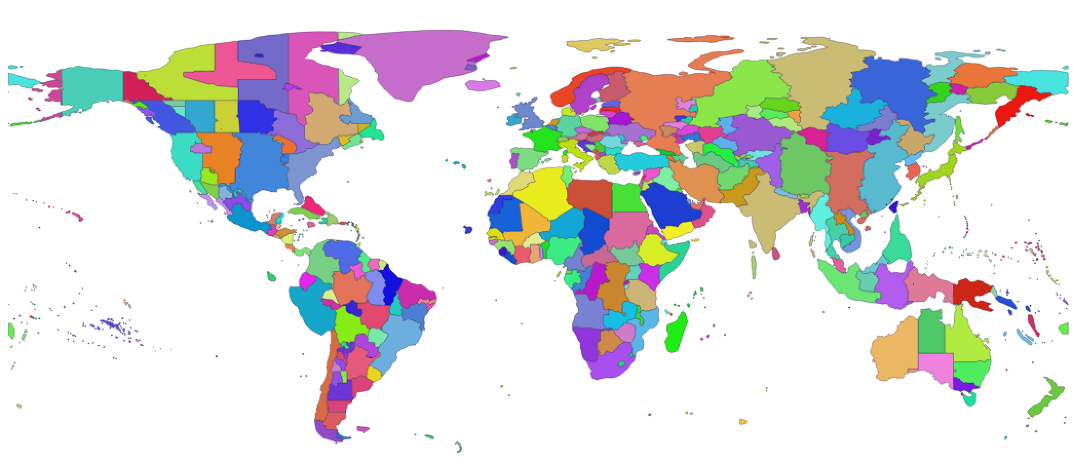
The tz database is a collaborative compilation of information about the world's time zones, primarily intended for use with computer programs and operating systems. Paul Eggert is its current editor and maintainer, with the organizational backing of ICANN. The tz database is also known as tzdata, the zoneinfo database or IANA time zone database, and occasionally as the Olson database, referring to the founding contributor, Arthur David Olson. Its uniform naming convention for time zones, such as ''America/New_York'' and ''Europe/Paris'', was designed by Paul Eggert. The database attempts to record historical time zones and all civil changes since 1970, the Unix time epoch. It also includes transitions such as daylight saving time, and also records leap seconds. The database, as well as some reference source code, is in the public domain. New editions of the database and code are published as changes warrant, usually several times per year. Data structure File formats The ... [...More Info...] [...Related Items...] OR: [Wikipedia] [Google] [Baidu] |
Zone
Zone or The Zone may refer to: Places Climate and altitude zones * Death zone (originally the lethal zone), altitudes above a certain point where the amount of oxygen is insufficient to sustain human life for an extended time span * Frigid zone, a geographical zone on Earth * Hardiness zone, a geographically defined zone in which a specific category of plant life is capable of growing * Temperate zone, a geographical zone on Earth * Torrid zone, a geographical zone on Earth Military zones * Zone, any of the divisions of France during the World War II German occupation * Zone, any of the divisions of Germany during the post-World War II Allied occupation *DMZ or DZ or demilitarized zone, an area in which treaties or agreements between nations, military powers, or contending groups forbid military installations, activities, or personnel * Green Zone, a military zone in Baghdad, Iraq * Korean Demilitarized Zone Place-names * Administrative divisions of India, known as Zones * Ca ... [...More Info...] [...Related Items...] OR: [Wikipedia] [Google] [Baidu] |
American Samoa
American Samoa ( sm, Amerika Sāmoa, ; also ' or ') is an unincorporated territory of the United States located in the South Pacific Ocean, southeast of the island country of Samoa. Its location is centered on . It is east of the International Date Line, while Samoa is west of the Line. The total land area is , slightly more than Washington, D.C. American Samoa is the southernmost territory of the United States and one of two U.S. territories south of the Equator, along with the uninhabited Jarvis Island. Tuna products are the main exports, and the main trading partner is the rest of the United States. American Samoa consists of five main islands and two coral atolls. The largest and most populous island is Tutuila, with the Manuʻa Islands, Rose Atoll and Swains Island also included in the territory. All islands except for Swains Island are part of the Samoan Islands, west of the Cook Islands, north of Tonga, and some south of Tokelau. To the west are the islands of the Wall ... [...More Info...] [...Related Items...] OR: [Wikipedia] [Google] [Baidu] |
Samoa Time Zone
250px, SST is UTC-11:00 The Samoa Time Zone or Samoa Standard Time (SST) observes standard time by subtracting eleven hours from Coordinated Universal Time ( UTC-11:00). The clock time in this zone is based on the mean solar time of the 165th meridian west of the Greenwich Observatory. The zone includes the U.S. territory of American Samoa, as well as the Midway Islands and the uninhabited islands of Jarvis, Palmyra, and Kingman Reef. It also includes the country of Niue. The zone is one hour behind Hawaii-Aleutian Time Zone and one hour ahead of the Howland and Baker islands, and 23 hours behind Wake Island Time Zone. The nation of Samoa also observed the same time as the Samoa Time Zone until it moved across the International Date Line at the end of 29 December 2011; it is now 24 hours (25 hours in southern hemisphere summer) ahead of American Samoa.{{cite web, url=http://www.heraldsun.com.au/news/breaking-news/samoa-to-move-the-international-dateline/story-e6frf7jx-12260 ... [...More Info...] [...Related Items...] OR: [Wikipedia] [Google] [Baidu] |


