|
The Pipers
The Pipers are a pair of standing stones near The Hurlers stone circles, located on Bodmin Moor near the village of Minions, Cornwall, UK. They share the name with another pair of standing stones near the Merry Maidens to the south of the village of St Buryan, also in Cornwall. Description The Pipers are approximately 2 metres high and the width between them is about the same distance. They are situated about 120 metres west-south-west of the central Hurlers circle. According to folklore they represent musicians playing for three circles of dancers who were turned to stone for engaging in festivities on a holy day. The area around the Pipers is notable in archaeology for the discovery of a bronze dagger and gold beaker along with some beads and flint at Rillaton Barrow Rillaton Barrow ( kw, Krug Reslegh) is a Bronze Age round barrow in Cornwall, UK. The site is on the eastern flank of Bodmin Moor in the parish of Linkinhorne about four miles (6 km) north of Lisk ... [...More Info...] [...Related Items...] OR: [Wikipedia] [Google] [Baidu] |
Stowe's Hill
Stowe's Hill is an elongated hill, high, located on the eastern edge of Bodmin Moor in the county of Cornwall, England.Ordnance Survey 1:25,000 ''Explorer'' map series, No. 109 Stowe's Hill is a prominent granite ridge located about 1500 metres north of Minions, the highest village in Cornwall. It is dominated by Stowe's Pound, a huge tor enclosure comprising two massive stone-walls. The smaller enclosure surrounds the tors at the southern end of the hill; the larger one encircles the rest of the ridge. At the southern end is a large, disused quarry, but the hill is best known as the site of the Cheesewring, the extraordinary granite formation that gave the quarry its name. Inside Stowe's Pound are two Bronze Age cairns, a stone round house and over 100 house platforms. The site is thought to be Neolithic or Bronze Age The Bronze Age is a historic period, lasting approximately from 3300 BC to 1200 BC, characterized by the use of bronze, the presence of writing in some ... [...More Info...] [...Related Items...] OR: [Wikipedia] [Google] [Baidu] |
Bodmin Moor
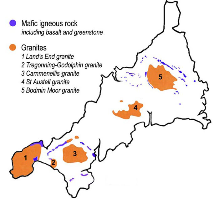
Bodmin Moor ( kw, Goon Brenn) is a granite moorland in north-eastern Cornwall, England. It is in size, and dates from the Carboniferous period of geological history. It includes Brown Willy, the highest point in Cornwall, and Rough Tor, a slightly lower peak. Many of Cornwall's rivers have their sources here. It has been inhabited since at least the Neolithic era, when primitive farmers started clearing trees and farming the land. They left their megalithic monuments, hut circles and cairns, and the Bronze Age culture that followed left further cairns, and more stone circles and stone rows. By medieval and modern times, nearly all the forest was gone and livestock rearing predominated. The name Bodmin Moor is relatively recent. An early mention is in the ''Royal Cornwall Gazette'' of 28 November 1812. The upland area was formerly known as Fowey Moor after the River Fowey, which rises within it. Geology Bodmin Moor is one of five granite plutons in Cornwall that make up pa ... [...More Info...] [...Related Items...] OR: [Wikipedia] [Google] [Baidu] |
Cornwall
Cornwall (; kw, Kernow ) is a historic county and ceremonial county in South West England. It is recognised as one of the Celtic nations, and is the homeland of the Cornish people. Cornwall is bordered to the north and west by the Atlantic Ocean, to the south by the English Channel, and to the east by the county of Devon, with the River Tamar forming the border between them. Cornwall forms the westernmost part of the South West Peninsula of the island of Great Britain. The southwesternmost point is Land's End and the southernmost Lizard Point. Cornwall has a population of and an area of . The county has been administered since 2009 by the unitary authority, Cornwall Council. The ceremonial county of Cornwall also includes the Isles of Scilly, which are administered separately. The administrative centre of Cornwall is Truro, its only city. Cornwall was formerly a Brythonic kingdom and subsequently a royal duchy. It is the cultural and ethnic origin of the Cornish dias ... [...More Info...] [...Related Items...] OR: [Wikipedia] [Google] [Baidu] |
Standing Stone
A menhir (from Brittonic languages: ''maen'' or ''men'', "stone" and ''hir'' or ''hîr'', "long"), standing stone, orthostat, or lith is a large human-made upright rock (geology), stone, typically dating from the European middle Bronze Age. They can be found individually as monoliths, or as part of a group of similar stones. Menhirs' size can vary considerably, but they often taper toward the top. They are widely distributed across Europe, Africa and Asia, but are most numerous in Western Europe; particularly in Ireland, Great Britain, and Brittany, where there are about 50,000 examples, and northwestern France, where there are some 1,200 further examples. Standing stones are usually difficult to date. They were constructed during many different periods across pre-history as part of the larger megalithic cultures in Europe and near areas. Some menhirs stand next to buildings that have an early or current religious significance. One example is the South Zeal Menhir in Devon, ... [...More Info...] [...Related Items...] OR: [Wikipedia] [Google] [Baidu] |
The Hurlers (stone Circles)
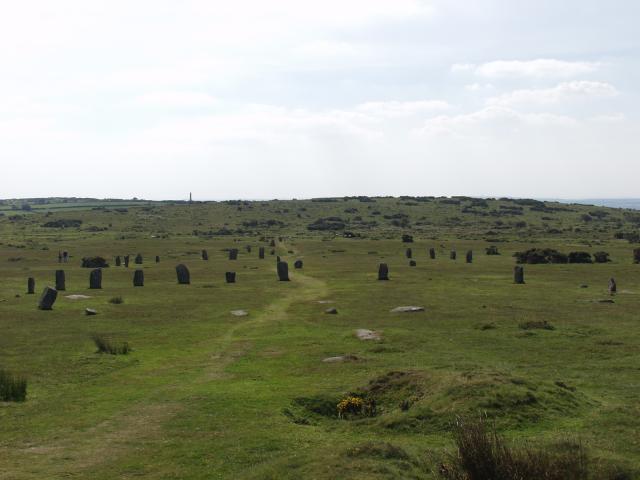
The Hurlers ( Cornish: ''An Hurlysi'') is a group of three stone circles in the civil parish of St Cleer, Cornwall, England, UK. The site is half-a-mile (0.8 km) west of the village of Minions on the eastern flank of Bodmin Moor, and approximately four miles (6 km) north of Liskeard at . Location The Hurlers are north of Liskeard near the village of Minions on the southern edge of Bodmin Moor in east Cornwall. Just to the west of the circles are two standing stones known as the Pipers. Nearby are Rillaton Barrow and Trethevy Quoit, an entrance grave from the Neolithic period. The Hurlers are managed by the Cornwall Heritage Trust on behalf of English Heritage. Origin of the name The name "Hurlers" derives from a legend, in which men were playing Cornish hurling on a Sunday and were magically transformed into stones as punishment.Westwood, Jennifer (1985), ''Albion. A Guide to Legendary Britain''. London : Grafton Books. . p. 21. The "Pipers" are supposed to be th ... [...More Info...] [...Related Items...] OR: [Wikipedia] [Google] [Baidu] |
Minions, Cornwall
Minions ( kw, Menyon) is a village in Cornwall, England, United Kingdom. It is situated on the eastern flank of Bodmin Moor northwest of Caradon Hill approximately four miles (6 km) north of Liskeard.Ordnance Survey: Landranger map sheet 201 ''Plymouth & Launceston'' Minions is first recorded in 1613 and its meaning is unknown. A stone circle known as the Hurlers is located on the west side of the village. Several other tumuli are also in the area, including Rillaton round barrow, where a Bronze Age gold beaker was discovered. The Cheesewring, a distinctive rock formation, is a mile northwest. The village has embraced the coincidence that its name is now shared with the characters from the ''Despicable Me'' franchise. Geography Minions is in the former Caradon administrative district and in the parish of Linkinhorne. At it is said to be the highest village in Cornwall. The village is dominated by Caradon Hill, standing at high, on which there is a TV transmission ma ... [...More Info...] [...Related Items...] OR: [Wikipedia] [Google] [Baidu] |
United Kingdom
The United Kingdom of Great Britain and Northern Ireland, commonly known as the United Kingdom (UK) or Britain, is a country in Europe, off the north-western coast of the continental mainland. It comprises England, Scotland, Wales and Northern Ireland. The United Kingdom includes the island of Great Britain, the north-eastern part of the island of Ireland, and many smaller islands within the British Isles. Northern Ireland shares a land border with the Republic of Ireland; otherwise, the United Kingdom is surrounded by the Atlantic Ocean, the North Sea, the English Channel, the Celtic Sea and the Irish Sea. The total area of the United Kingdom is , with an estimated 2020 population of more than 67 million people. The United Kingdom has evolved from a series of annexations, unions and separations of constituent countries over several hundred years. The Treaty of Union between the Kingdom of England (which included Wales, annexed in 1542) and the Kingdom of Scotland in 170 ... [...More Info...] [...Related Items...] OR: [Wikipedia] [Google] [Baidu] |
Merry Maidens
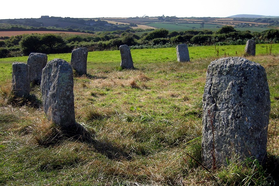
The Merry Maidens (), also known as Dawn's Men (a likely corruption of the Cornish ''Dons Men'' "Stone Dance") is a late neolithic stone circle located 2 miles (3 km) to the south of the village of St Buryan, in Cornwall, United Kingdom. A pair of standing stones, The Pipers is associated both geographically and in legend. Description The circle, which is thought to be complete, comprises nineteen granite megaliths and is situated in a field alongside the B3315 between Newlyn and Land's End. The stones are approximately 1.2 metres high, with the tallest standing 1.4 metres. They are spaced three to four metres apart with a larger gap between the stones on the east side. The circle is approximately twenty-four metres in diameter. To the south is another stone which suggests a possible north-south orientation. In earlier times there was another stone circle located 200 metres away, but this had been destroyed by the end of the 19th century. 300 metres to the northeast are ... [...More Info...] [...Related Items...] OR: [Wikipedia] [Google] [Baidu] |
St Buryan
St Buryan ( kw, Pluwveryan) is a village and former civil parish, now in the parish of St Buryan, Lamorna and Paul in Cornwall, England, United Kingdom. The village of St Buryan is situated approximately west of Penzance along the B3283 towards Land's End. Three further minor roads also meet at St Buryan, two link the village with the B3315 towards Lamorna, and the third rejoins the A30 at Crows-an-Wra. St Buryan parish encompassed the villages of St. Buryan, Lamorna, and Crows-an-Wra and shared boundaries with the parishes of Sancreed and St Just to the north, Sennen and St Levan (with which it has close ties) to the west, with Paul to the east and by the sea in the south. An electoral parish also exists stretching from Land's End to the north coast but avoiding St Just. The population of this ward at the 2011 census was 4,589. Named after the Irish Saint Buriana, the parish is situated in an area of outstanding natural beauty and is a popular tourist destination. It ha ... [...More Info...] [...Related Items...] OR: [Wikipedia] [Google] [Baidu] |
Hurlers
The Hurlers ( Cornish: ''An Hurlysi'') is a group of three stone circles in the civil parish of St Cleer, Cornwall, England, UK. The site is half-a-mile (0.8 km) west of the village of Minions on the eastern flank of Bodmin Moor, and approximately four miles (6 km) north of Liskeard at . Location The Hurlers are north of Liskeard near the village of Minions on the southern edge of Bodmin Moor in east Cornwall. Just to the west of the circles are two standing stones known as the Pipers. Nearby are Rillaton Barrow and Trethevy Quoit, an entrance grave from the Neolithic period. The Hurlers are managed by the Cornwall Heritage Trust on behalf of English Heritage. Origin of the name The name "Hurlers" derives from a legend, in which men were playing Cornish hurling on a Sunday and were magically transformed into stones as punishment.Westwood, Jennifer (1985), ''Albion. A Guide to Legendary Britain''. London : Grafton Books. . p. 21. The "Pipers" are supposed to be th ... [...More Info...] [...Related Items...] OR: [Wikipedia] [Google] [Baidu] |
Rillaton Gold Cup
Rillaton ( kw, Reslegh) is a hamlet in the parish of Linkinhorne in Cornwall, England. Nearby is the Bronze Age round barrow where the Rillaton Gold Cup was found in 1837. Rillaton was the head manor of the hundred of East WivelshireThorn, Caroline, et al. (eds.) (1979) ''Cornwall''. Chichester: Phillimore and one of the Antiqua maneria, the original 17 manors belonging to the Earldom of Cornwall. Stara Bridge, a surviving clapper bridge, provides evidence of the economic importance of Rillaton in the late middle ages The Late Middle Ages or Late Medieval Period was the Periodization, period of European history lasting from AD 1300 to 1500. The Late Middle Ages followed the High Middle Ages and preceded the onset of the early modern period (and in much of Eur .... See also * Stara Woods References Hamlets in Cornwall Manors in Cornwall {{Cornwall-geo-stub ... [...More Info...] [...Related Items...] OR: [Wikipedia] [Google] [Baidu] |
Aubrey Burl
Harry Aubrey Woodruff Burl HonFSA Scot (24 September 1926 – 8 April 2020) was a British archaeologist best known for his studies into megalithic monuments and the nature of prehistoric rituals associated with them. Before retirement he was Principal Lecturer in Archaeology, Hull College, East Riding of Yorkshire. Burl received a volume edited in his honour. He was called by ''The New York Times'', "the leading authority on British stone circles". Burl's work, while considering the astronomical roles of many megalithic monuments, was cautious of embracing the more tenuous claims of archaeoastronomy. In ''Prehistoric Avebury'' Burl proposed that Circles and Henge monuments, far from being astronomical observatories for a class of "astronomer priests" were more likely used for ritualistic practices, connected with death and fertility rites, and ancestor worship, similar to practices observed in other agricultural cultures (in particular the rituals of Native North American Tribes ... [...More Info...] [...Related Items...] OR: [Wikipedia] [Google] [Baidu] |


