|
The Mounts
The Mounts is a small hamlet, containing only 17 houses, situated on the A381 road between Totnes and Kingsbridge in Devon, England. It is part of the parish of East Allington, and lies about one mile away from the main village. Although The Mounts' postcode indicates it to be part of Totnes, it in fact lies much nearer to Kingsbridge. Historically, The Mounts was on the border of the area which was evacuated during World War II so that secret rehearsals for the D-Day landings ("Exercise Tiger") could be carried out, using Slapton Sands Slapton is a village and civil parish in the South Hams district of Devon, England. It is located near the A379 road between Kingsbridge and Dartmouth, and lies within the South Devon Area of Outstanding Natural Beauty (AONB). The nearby be .... Properties on the east side of the A381 were evacuated, whereas properties on the west side were allowed to remain occupied. It was in St. Andrew's Church, East Allington, that the announcement of ... [...More Info...] [...Related Items...] OR: [Wikipedia] [Google] [Baidu] |
South Hams (UK Parliament Constituency)
South Hams was a county constituency based on the South Hams district of Devon. It returned one Member of Parliament (MP) to the House of Commons of the Parliament of the United Kingdom. The constituency was created for the 1983 general election, and abolished for the 1997 general election. The constituency covered a vast part of the English Riviera on the south Devon coast. History This was a safe seat for the Conservative Party. During the fourteen years and three parliaments of its existence, it was held by a single member, Anthony Steen. In the 1987 general election the well-known Labour MP and staunch republican Willie Hamilton contested the seat, finishing third. Boundaries The District of South Hams wards of Avon and Harbourne, Avonleigh, Bickleigh and Shaugh, Brixton, Charterlands, Cornwood and Harford, Dart Valley, Dartington, Dartmouth Clifton, Dartmouth Hardness, Erme Valley, Garabrook, Ivybridge, Kingsbridge, Kingswear, Malborough, Marldon, Modbury, Newton and ... [...More Info...] [...Related Items...] OR: [Wikipedia] [Google] [Baidu] |
East Allington
East Allington is a village and civil parish in the South Hams district of Devon, England, south of Halwell and just off the A381 road. It lies about from Kingsbridge and about from Totnes. The coast at Slapton Sands is about to the south-east. Also in the parish is the hamlet of The Mounts, about away. The parish is surrounded clockwise from the north by the parishes of Halwell, Blackawton, Slapton, Stokenham, Frogmore and Sherford, Buckland-Tout-Saints and Woodleigh. Its population at 2001 was 596, up from 396 in 1901. The village is also part of the electoral ward named Allington and Loddiswell with a population at the 2011 census of 2,265. Historically, East Allington formed part of Stanborough Hundred, and for ecclesiastical purposes, it falls within Woodleigh Deanery. The church, dedicated to St. Andrew, overlooks the village from a hillside position. The first rector here was presented in 1268, and Bishop Grandisson dedicated the altar in 1333. The prese ... [...More Info...] [...Related Items...] OR: [Wikipedia] [Google] [Baidu] |
South Hams
South Hams is a local government district on the south coast of Devon, England. Services divide between those provided by its own Council headquartered in Totnes, and those provided by Devon County Council headquartered in the city of Exeter. Beside Totnes are its towns of Dartmouth, Kingsbridge, Salcombe, and Ivybridge — the most populous with 11,851 residents, as at the 2011 Census. To the north, it includes part of Dartmoor National Park, to the east borders Torbay, and to the west Plymouth. It contains some of the most unspoilt coastline on the south coast, including the promontories of Start Point and Bolt Head. The entire coastline, along with the lower Avon and Dart valleys, form most of the South Devon Area of Outstanding Natural Beauty. The South Hams, along with nearby Broadsands in Paignton, is the last British refuge of the cirl bunting. History The South Hams were formerly part of the Brythonic (Celtic) Kingdom of Dumnonia later reduced to the modern boun ... [...More Info...] [...Related Items...] OR: [Wikipedia] [Google] [Baidu] |
Devon
Devon ( , historically known as Devonshire , ) is a ceremonial and non-metropolitan county in South West England. The most populous settlement in Devon is the city of Plymouth, followed by Devon's county town, the city of Exeter. Devon is a coastal county with cliffs and sandy beaches. Home to the largest open space in southern England, Dartmoor (), the county is predominately rural and has a relatively low population density for an English county. The county is bordered by Somerset to the north east, Dorset to the east, and Cornwall to the west. The county is split into the non-metropolitan districts of East Devon, Mid Devon, North Devon, South Hams, Teignbridge, Torridge, West Devon, Exeter, and the unitary authority areas of Plymouth, and Torbay. Combined as a ceremonial county, Devon's area is and its population is about 1.2 million. Devon derives its name from Dumnonia (the shift from ''m'' to ''v'' is a typical Celtic consonant shift). During the Briti ... [...More Info...] [...Related Items...] OR: [Wikipedia] [Google] [Baidu] |
A381 Road
A381 may refer to: * The A381 road in Devon, England * The Autovía A-381, a motorway in Andalucia, Spain * The RMAS ''Cricklade'' (A381), a fleet tender to the United Kingdom's Royal Navy {{Letter-NumberCombDisambig ... [...More Info...] [...Related Items...] OR: [Wikipedia] [Google] [Baidu] |
Totnes
Totnes ( or ) is a market town and civil parishes in England, civil parish at the head of the estuary of the River Dart in Devon, England, within the South Devon Area of Outstanding Natural Beauty. It is about west of Paignton, about west-southwest of Torquay and about east-northeast of Plymouth. It is the administrative centre of the South Hams District Council. Totnes has a long recorded history, dating back to 907, when its first castle was built. By the twelfth century it was already an important market town, and its former wealth and importance may be seen from the number of merchants' houses built in the sixteenth and seventeenth centuries. Today, the town has a sizeable alternative and "New Age" community, and is known as a place where one can live a Bohemianism, bohemian lifestyle. Two electoral wards mention ''Totnes'' (Bridgetown and Town). Their combined populations at the 2011 UK Census was 8,076. History Ancient and medieval history According to the ''Histori ... [...More Info...] [...Related Items...] OR: [Wikipedia] [Google] [Baidu] |
Kingsbridge
Kingsbridge is a market town and tourist hub in the South Hams district of Devon, England, with a population of 6,116 at the 2011 census. Two electoral wards bear the name of ''Kingsbridge'' (East & North). Their combined population at the above census was 4,381. It is situated at the northern end of the Kingsbridge Estuary, a ria that extends to the sea six miles south of the town. It is the third largest settlement in the South Hams and is 17 miles (27 km) southwest of Torquay and 17 miles (27 km) southeast of Plymouth. History The town formed around a bridge which was built in or before the 10th century between the royal estates of Alvington, to the west, and Chillington, to the east, hence giving it the name of Kyngysbrygge ("King's bridge"). In 1219 W. G. Hoskins, ''Devon'', 1954 the Abbot of Buckfast was granted the right to hold a market there, and by 1238 the settlement had become a borough. The manor remained in possession of the abbot until the Diss ... [...More Info...] [...Related Items...] OR: [Wikipedia] [Google] [Baidu] |
World War II
World War II or the Second World War, often abbreviated as WWII or WW2, was a world war that lasted from 1939 to 1945. It involved the vast majority of the world's countries—including all of the great powers—forming two opposing military alliances: the Allies and the Axis powers. World War II was a total war that directly involved more than 100 million personnel from more than 30 countries. The major participants in the war threw their entire economic, industrial, and scientific capabilities behind the war effort, blurring the distinction between civilian and military resources. Aircraft played a major role in the conflict, enabling the strategic bombing of population centres and deploying the only two nuclear weapons ever used in war. World War II was by far the deadliest conflict in human history; it resulted in 70 to 85 million fatalities, mostly among civilians. Tens of millions died due to genocides (including the Holocaust), starvation, ma ... [...More Info...] [...Related Items...] OR: [Wikipedia] [Google] [Baidu] |
D-Day (military Term)
In the military, D-Day is the day on which a combat attack or operation is to be initiated. The best-known D-Day is during World War II, on June 6, 1944—the day of the Normandy landings—initiating the Western Allied effort to liberate western Europe from Nazi Germany. However, many other invasions and operations had a designated D-Day, both before and after that operation. The terms D-Day and H-Hour are used for the day and hour on which a combat attack or operation is to be initiated. They designate the day and hour of the operation when the day and hour have not yet been determined, or where secrecy is essential. For a given operation, the same D-Day and H-Hour apply for all units participating in it. When used in combination with numbers, and plus or minus signs, these terms indicate the point of time following or preceding a specific action, respectively. Thus, H−3 means 3 hours before H-Hour, and D+3 means 3 days after D-Day. (By extension, H+75 minutes is used ... [...More Info...] [...Related Items...] OR: [Wikipedia] [Google] [Baidu] |
Exercise Tiger
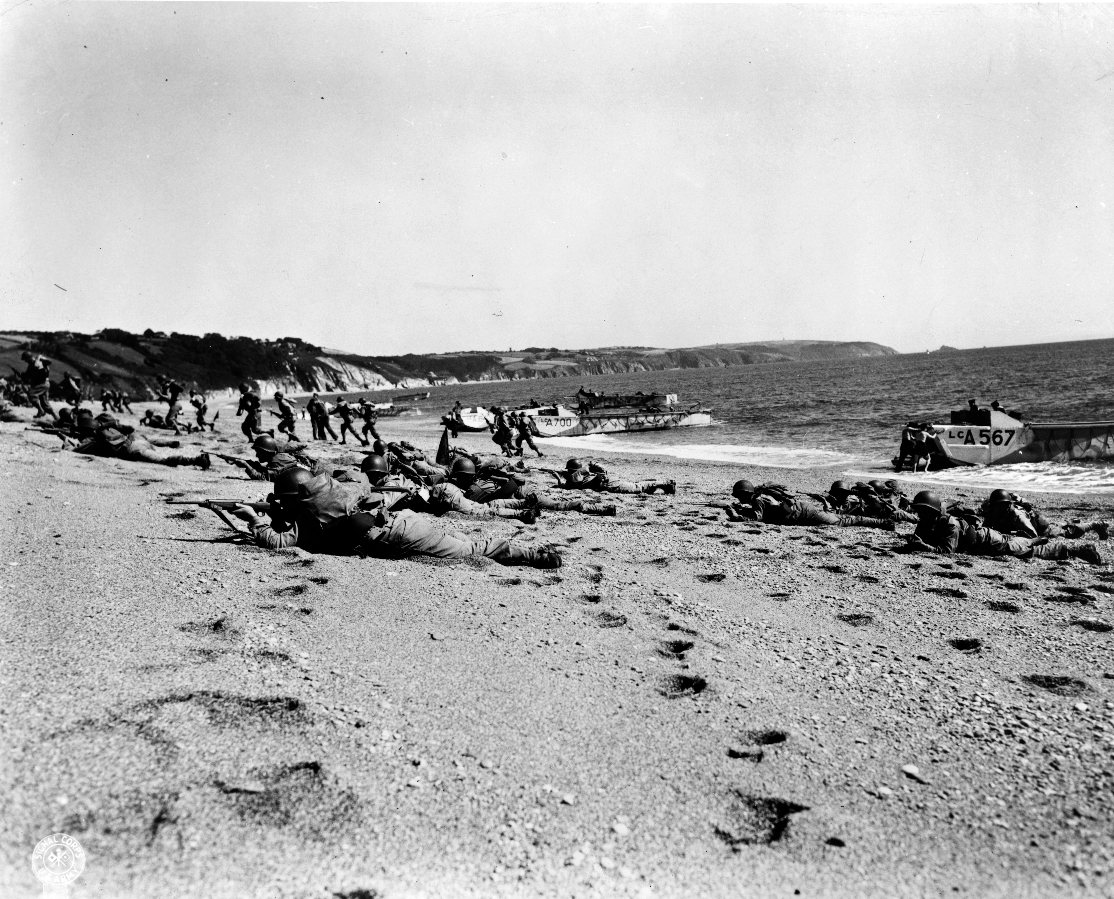
Exercise Tiger, or Operation Tiger, was one of a series of large-scale rehearsals for the D-Day invasion of Normandy, which took place in April 1944 on Slapton Sands in Devon. Coordination and communication problems resulted in friendly fire injuries during the exercise, and an Allied convoy positioning itself for the landing was attacked by E-boats of Nazi Germany's ''Kriegsmarine'', resulting in the deaths of at least 749 American servicemen. Because of the impending invasion of Normandy, the incident was under the strictest secrecy at the time and was only minimally reported afterwards. Exercise Landing operations In late 1943, as part of the build-up to D-day, the British government set up a training ground at Slapton Sands, Devon, to be used by Force "U", the American forces tasked with landing on Utah Beach. Slapton Beach was selected for its similarity to Utah Beach: a gravel beach, followed by a strip of land and then a lake. Approximately 3,000 local residents in ... [...More Info...] [...Related Items...] OR: [Wikipedia] [Google] [Baidu] |
Slapton, Devon
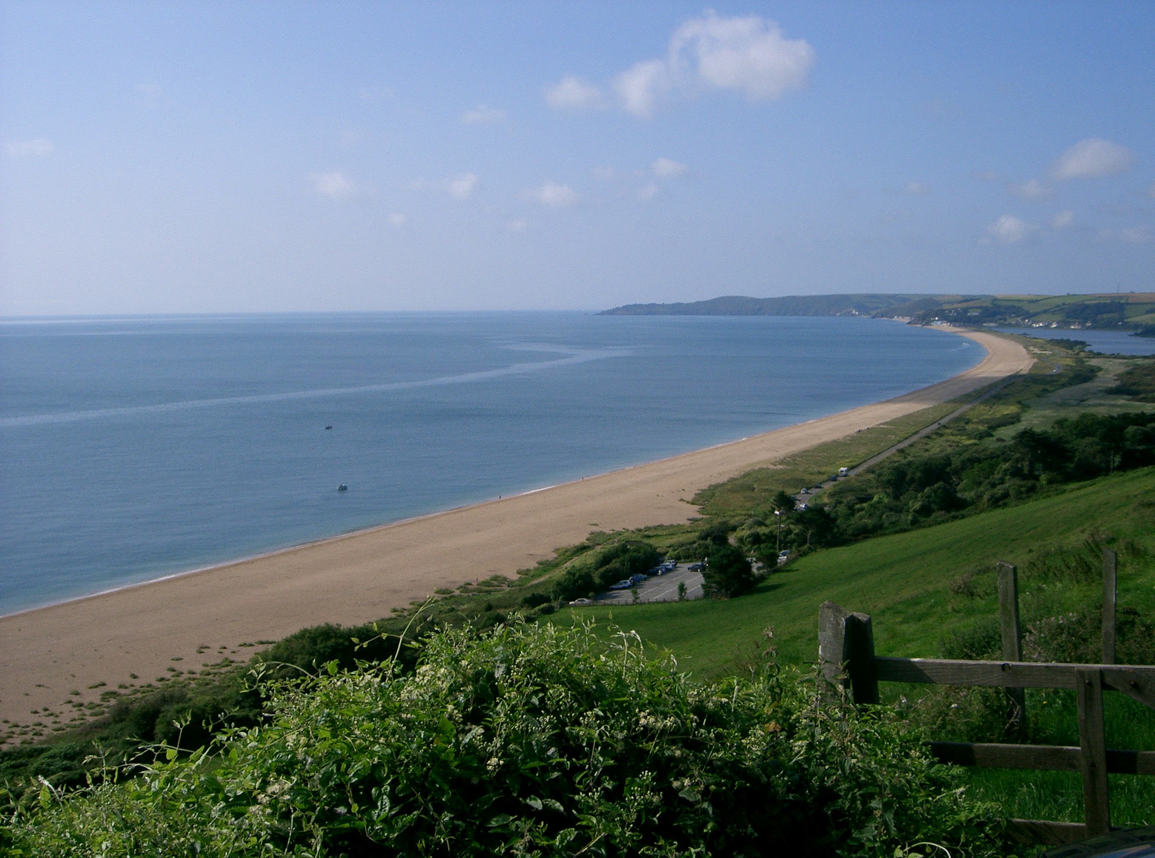
Slapton is a village and civil parish in the South Hams district of Devon, England. It is located near the A379 road between Kingsbridge and Dartmouth, and lies within the South Devon Area of Outstanding Natural Beauty (AONB). The nearby beach is Slapton Sands; despite its name, it is not a sandy beach but a shingle one. In 1901 the population of the civil parish was 527, decreasing to 473 in 2001, and decreasing further to 434 at the 2011 census. The parish is surrounded clockwise from the north by the parishes of Blackawton, Strete, Stokenham and East Allington. History Slapton was recorded in the Domesday Book of 1086 as ''Sladone''. The Collegiate Chantry of St Mary was founded in 1372 or 1373 by Sir Guy de Brian. The Tower Inn and West tower remain and the tower has been designated by English Heritage as a grade I listed building. The Church of St James dates from the late 13th or early 14th century, and is also grade I listed. The nearby beach is a coastal bar (s ... [...More Info...] [...Related Items...] OR: [Wikipedia] [Google] [Baidu] |


