|
Texas State Highway 288
State Highway 288 (SH 288) is a north–south highway in the southeastern portion of the U.S. state of Texas, between I-45 in downtown Houston and Freeport, where it terminates on FM 1495. The route was originally designated by 1939, replacing the southern portion of SH 19. Route description In Harris County, SH 288 is the South Freeway, a divided freeway known for having one of the widest medians of the local road system. It begins as freeway status from its northern terminus at Interstate 69/ U.S. Route 59 just south of downtown southward through south Houston. It reaches an intersection with I-610 and continues south through newer subdivisions. It reaches an intersection with State Highway 6, after which it loses its freeway status. From the Harris- Brazoria County Line to Freeport, it is referred to as the Nolan Ryan Expressway, in recognition of Baseball Hall of Fame pitcher Nolan Ryan who grew up in Alvin, Texas, which is not directly on this road. ... [...More Info...] [...Related Items...] OR: [Wikipedia] [Google] [Baidu] |
Freeport, Texas
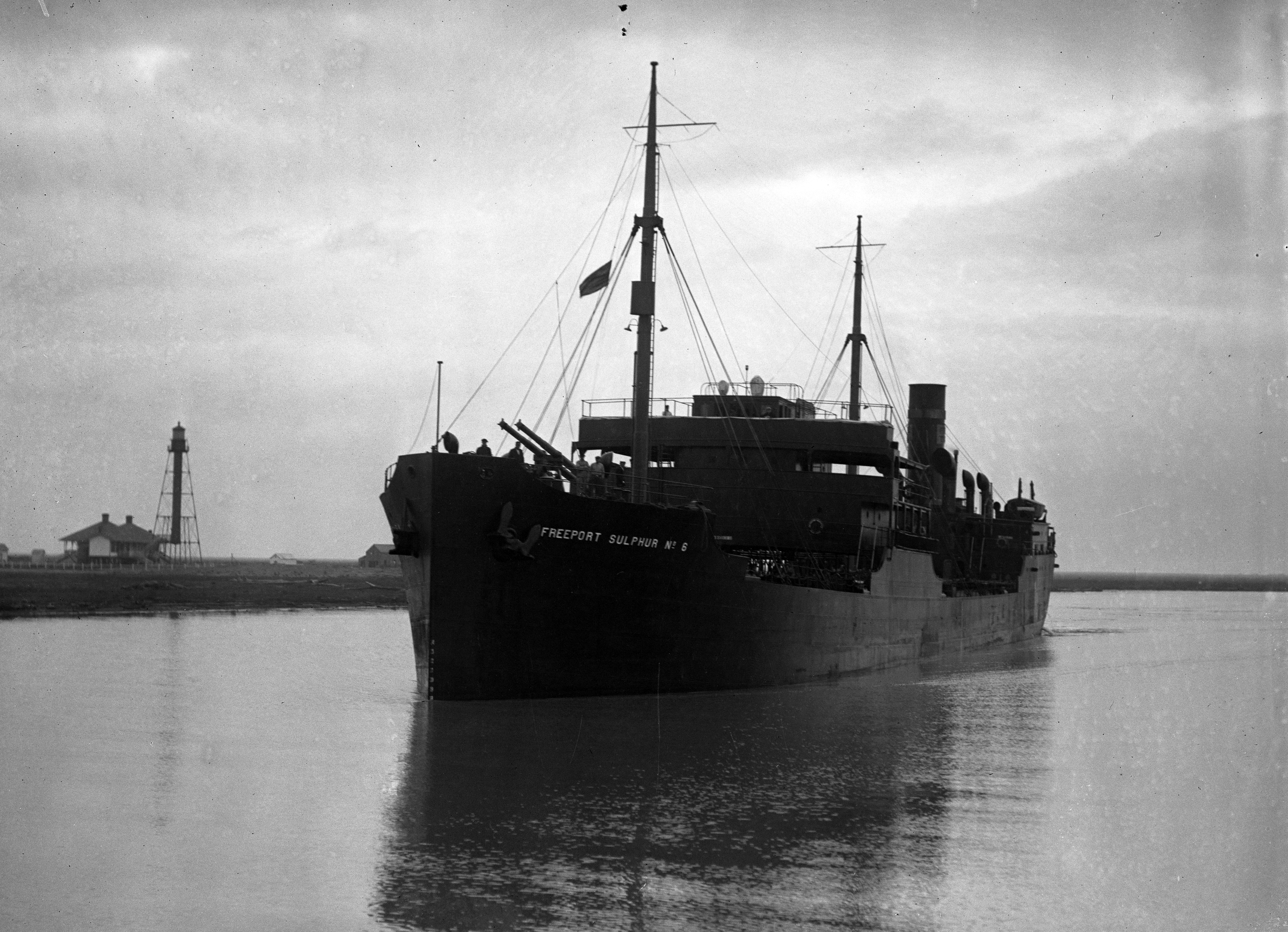
Freeport is a city in Brazoria County, Texas, United States, located on the Gulf of Mexico. According to the 2020 census, the city population was 10,696, down from 12,049 in 2010. History Freeport was founded as a European-American settlement in November 1912 by the Freeport Sulphur Company. The population was 300. However, by 1929, that population had grown to 3,500, and to 4,100 by 1939, influencing a steady increase of economic expansion in Freeport.Freeport, TX , Retrieved 12 August 2007. By 1937, a Freeport School District had been established, consisting of several segr ... [...More Info...] [...Related Items...] OR: [Wikipedia] [Google] [Baidu] |
Harris County Toll Road Authority
The Harris County Toll Road Authority (HCTRA, pronounced "HECK-trah") maintains and operates a toll road system in the Greater Houston area. Its headquarters are located in Houston's Fairbanks/Northwest Crossing neighborhood. History HCTRA came into existence in September 1983 when Harris County voters approved a referendum by a 7-3 margin to release up to $900 million in bonds to create two toll roads - the Hardy Toll Road and the Sam Houston Tollway, to improve the regional mobility and reduce traffic congestion in the Greater Houston area, an area known for rapid population growth. The need for a county-run toll road system came from TxDOT's budget shortfall and its inability to authorize funding to upgrade the second loop around the city, Beltway 8, which had been on planning maps since the 1950s. The Texas Turnpike Authority turned down the opportunity to improve the road as well, leaving the county to upgrade the road to freeway standards. However, Harris County could no ... [...More Info...] [...Related Items...] OR: [Wikipedia] [Google] [Baidu] |
Bonney, Texas
Bonney is a village in Brazoria County, Texas, United States. The population was 310 at the 2010 census, making it the smallest village in Texas. Bonney is around fifteen times larger than the smallest city and the smallest town in Texas, though. Geography Bonney is located in north-central Brazoria County at (29.311069, –95.450918). It is north of Angleton, the county seat, and south of Arcola. Texas State Highway 288, a four-lane freeway, passes east of the village, leading north to downtown Houston. According to the United States Census Bureau, Bonney has a total area of , all of it land. Demographics As of the census of 2000, there were 384 people, 126 households, and 101 families residing in the village. The population density was . There were 136 housing units at an average density of . The racial makeup of the village was 69.53% White, 10.16% African American, 1.04% Native American, 1.30% Asian, 14.32% from other races, and 3.65% from two or more races. Hispa ... [...More Info...] [...Related Items...] OR: [Wikipedia] [Google] [Baidu] |
Houston Southwest Airport
Houston Southwest Airport or Houston-Southwest Airport is a public-use airport located in Arcola, a city in Fort Bend County, Texas, United States, 15 miles (24 km) southwest of the central business district of Houston. It is privately owned by James Griffith, Jr. Although most U.S. airports use the same three-letter location identifier for the FAA and IATA, Houston Southwest Airport is assigned AXH by the FAA but has no designation from the IATA. Facilities and aircraft Houston-Southwest Airport covers an area of which contains one runway designated 9/27 with a 5,002 x 100 ft (1,525 x 30 m) asphalt surface. For the 12-month period ending April 11, 2023, the airport had 42,624 aircraft operations, an average of 117 per day: 93% general aviation, 7% air taxi An air taxi is a small commercial aircraft that makes short flights on demand. In 2001 air taxi operations were promoted in the United States by a NASA and aerospace industry study on the potential Smal ... [...More Info...] [...Related Items...] OR: [Wikipedia] [Google] [Baidu] |
Fresno, Texas
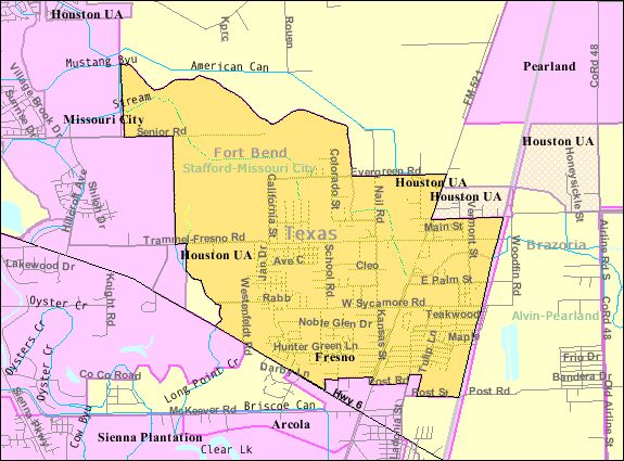
Fresno is an unincorporated community and census-designated place (CDP) in Fort Bend County, Texas, United States. The local population was 24,486 as of the 2020 census, up from 19,069 at the 2010 census, and 6,603 at the 2000 census. Fresno is located in the extra-territorial jurisdiction (ETJ) of Houston, which is the fourth largest city in the nation in population. Fresno is bordered by Houston to the north, the suburban Fort Bend County cities of Missouri City to the west and northwest, Arcola to the south and southwest, and the Brazoria County city of Pearland to the east. Geography Fresno is located in eastern Fort Bend County at (29.526728, -95.459849). The eastern edge of Fresno is the Brazoria County line. Downtown Houston is to the north, the center of Missouri City is to the northwest, the center of Pearland is to the east, and Manvel is to the southeast. According to the United States Census Bureau, the Fresno CDP has a total area of , of which of it is land ... [...More Info...] [...Related Items...] OR: [Wikipedia] [Google] [Baidu] |
KPRC-TV
KPRC-TV (channel 2) is a television station in Houston, Houston, Texas, United States, affiliated with NBC and owned by Graham Media Group. Its studios are located on Southwest Freeway (Interstate 69 in Texas, I-69/U.S. Route 59 in Texas#Interstate 37 to Houston, US 59) in the Southwest Management District (formerly Greater Sharpstown),Districts ." Greater Sharpstown Management District. Retrieved on August 15, 2009. and its transmitter is located near Missouri City, Texas, Missouri City, in unincorporated area#United States, unincorporated northeastern Fort Bend County, Texas, Fort Bend County. Houston is the second-largest media market, television market (after WXIA-TV in Atlanta) where the NBC station is not owned-and-operated station, owned and operated by the network. History The station first sign-on, s ...[...More Info...] [...Related Items...] OR: [Wikipedia] [Google] [Baidu] |
TollTag
The North Texas Tollway Authority (NTTA) is an organization that maintains and operates toll roads, bridges, and tunnels in the North Texas area. Functioning as a political subdivision of the State of Texas under Chapter 366 of the Transportation Code, the NTTA is empowered to acquire, construct, maintain, repair and operate turnpike projects; to raise capital for construction projects through the issuance of turnpike revenue bonds; and to collect tolls to operate, maintain and pay debt service on those projects. The NTTA is governed by a nine-member board of directors, two appointed by each of the four counties in its service area: Collin County, Dallas County, Denton County and Tarrant County as well as one appointed by the Texas Governor. North Texas Tollway Authority is a non-profit entity, and performs many of the same functions as the Texas Department of Transportation, but is limited solely to facilities that it operates for revenue. Board of Directors There are ... [...More Info...] [...Related Items...] OR: [Wikipedia] [Google] [Baidu] |
TxTag
TxTag , operated by the Texas Department of Transportation (TxDOT), is one of three interoperable electronic toll collection systems in Texas. The system is also interoperable with the K-TAG system used in Kansas and the Pikepass system used in Oklahoma. Current system status The TxTag brand name is used on the following highways: * Operated by TxDOT: **the Central Texas Turnpike System, which encompasses SH 130, bypassing Austin to the east, SH 45, an east–west road roughly straddling the Austin-Round Rock boundary, and the northern portion of Loop 1 (Mopac) on Austin's north side ** Loop 49, bypass of Tyler. ** SH 99 a.k.a.. Grand Parkway the third loop around Houston (partial). * Operated by the Central Texas Regional Mobility Authority: ** 183A, a toll bypass of US 183 through Leander. CTRMA is planning several other toll road projects throughout the Austin metropolitan area, which are planned to accept TxTag. Interoperability In 2003, all Greater Houston area tol ... [...More Info...] [...Related Items...] OR: [Wikipedia] [Google] [Baidu] |
EZ Tag
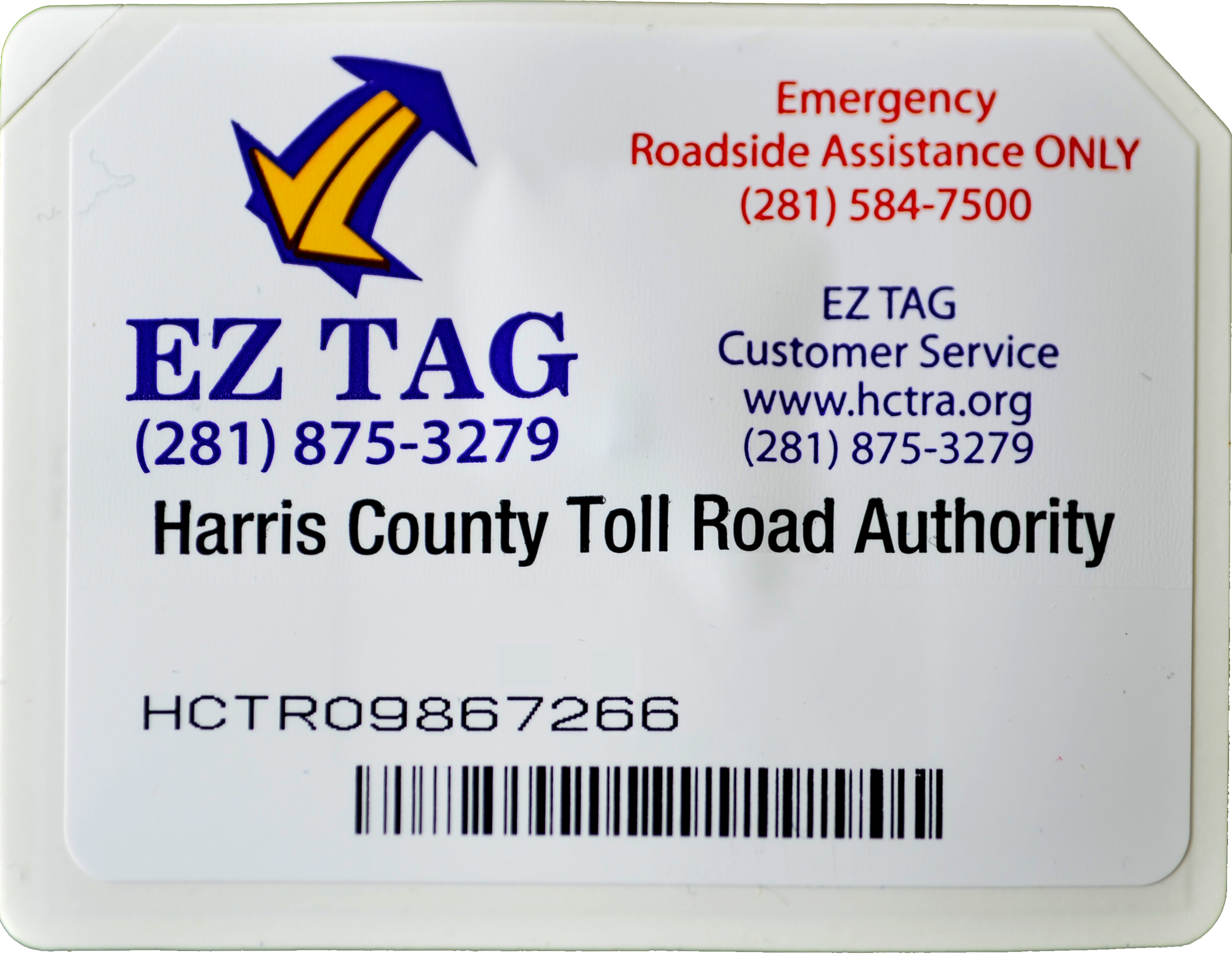
EZ TAG is an electronic toll collection system in Houston, Texas, United States, that allows motorists to pay tolls without stopping at toll booths. Motorists with the tags are allowed to use lanes reserved exclusively for them on all Harris County Toll Road Authority (HCTRA) roads. As of late 2003, the EZ TAG can also be used on all lanes of tolled roadways in Texas that accommodate electronic toll collection. How it works To participate, a driver signs up through the EZ TAG website, via telephone, or at one of the store locations. Next, the customer receives a small, white radio frequency transponder which must be affixed to the inside of their windshield behind their rear view mirror. Finally, when passing through a toll plaza, the driver chooses lanes specially equipped with sensors that can read EZ TAG transmitters and deduct the appropriate amount from their accounts. Houston Transtar uses EZ TAG sensors, which are placed at numerous points across Greater Houston, for ... [...More Info...] [...Related Items...] OR: [Wikipedia] [Google] [Baidu] |
TxDot
The Texas Department of Transportation (TxDOT ) is a government agency in the United States, American state of Texas. Though the public face of the agency is generally associated with the construction and maintenance of the state's immense state highway system, the agency is also responsible for overseeing aviation, Rail transport, rail, and public transportation systems in the state. At one time, TxDOT also administered vehicle registration; but this function transferred to the Texas Department of Motor Vehicles, a state agency which began operations in November 2009. The agency has been headquartered in the Dewitt C. Greer State Highway Building, Dewitt C. Greer Building at 125 East 11th Street in Downtown Austin, Texas, since 1933. History The Texas Legislature created the Texas Highway Department in 1916 to administer federal highway construction and maintenance. In 1975, its responsibilities increased when the agency merged with the Texas Mass Transportation Commission, ... [...More Info...] [...Related Items...] OR: [Wikipedia] [Google] [Baidu] |
Farm To Market Road 2234
A farm (also called an agricultural holding) is an area of land that is devoted primarily to agricultural processes with the primary objective of producing food and other crops; it is the basic facility in food production. The name is used for specialized units such as arable farms, vegetable farms, fruit farms, dairy, pig and poultry farms, and land used for the production of natural fiber, biofuel and other commodities. It includes ranches, feedlots, orchards, plantations and estates, smallholdings and hobby farms, and includes the farmhouse and agricultural buildings as well as the land. In modern times the term has been extended so as to include such industrial operations as wind farms and fish farms, both of which can operate on land or sea. There are about 570 million farms in the world, most of which are small and family-operated. Small farms with a land area of fewer than 2 hectares operate about 1% of the world's agricultural land, and family farms comprise ... [...More Info...] [...Related Items...] OR: [Wikipedia] [Google] [Baidu] |
Texas State Highway 99
State Highway 99 (SH 99), also known as the Grand Parkway, is a ring road in the U.S. state of Texas. Its first section opened on August 31, 1994. When the route is completed, it will be the longest beltway in the U.S., the world's seventh-longest ring road, and the third (outer) loop of the Houston–The Woodlands–Sugar Land metropolitan area, with Interstate 610 being the first (inner) loop and Beltway 8 (Sam Houston Tollway) being the second (middle) loop. The proposed loop has been divided into 11 separate segments for construction and funding purposes. In May 2019, the Texas Department of Transportation gave the Grand Parkway a secondary designation as the Mayor Bob Lanier Memorial Parkway, honoring Bob Lanier, who served as the mayor of Houston from 1992 to 1998 and who had spearheaded the creation of the Grand Parkway. History A previous route designated SH 99 was established on August 18, 1924, from San Angelo to Fort Stockton. On June 25, 1929, SH 99 was ext ... [...More Info...] [...Related Items...] OR: [Wikipedia] [Google] [Baidu] |


