|
Terra Cimmeria
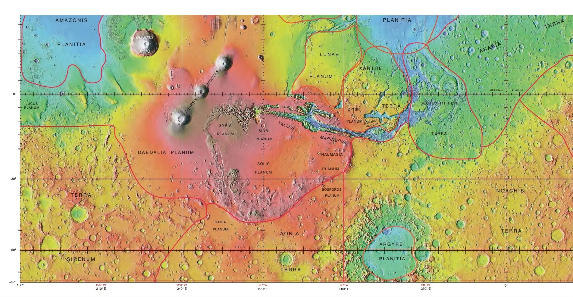
Terra Cimmeria is a large Martian region, centered at and covering at its broadest extent. It covers latitudes 15 N to 75 S and longitudes 170 to 260 W. It lies in the Eridania quadrangle. Terra Cimmeria is one part of the heavily cratered, southern highland region of the planet. The Spirit rover landed near the area. The word Cimmerium comes from an ancient Thracian seafaring people. The land was always covered in clouds and mist. A high altitude visual phenomena, probably a condensation cloud, was seen above this region in late March 2012. NASA tried to observe it with some of its Mars orbiters, including the THEMIS instrument on the 2001 Mars Odyssey spacecraft and MARCI on the Mars Reconnaissance Orbiter. Martian gullies Terra Cimmeria is the location of gullies that may be due to recent flowing water. Gullies occur on steep slopes, especially on the walls of craters. Gullies are believed to be relatively young because they have few if any craters. Moreover, they lie o ... [...More Info...] [...Related Items...] OR: [Wikipedia] [Google] [Baidu] |
Terra Sirenum
Terra Sirenum is a large region in the southern hemisphere of the planet Mars. It is centered at and covers 3900 km at its broadest extent. It covers latitudes 10 to 70 South and longitudes 110 to 180 W. Terra Sirenum is an upland area notable for massive cratering including the large Newton Crater. Terra Sirenum is in the Phaethontis quadrangle and the Memnonia quadrangle of Mars. A low area in Terra Sirenum is believed to have once held a lake that eventually drained through Ma'adim Vallis. Terra Sirenum is named after the Sirens, who were birds with the heads of girls. In the ''Odyssey'' these girls captured passing seamen and killed them. Chloride deposits Evidence of deposits of chloride based minerals in Terra Sirenum was discovered by the 2001 Mars Odyssey orbiter's Thermal Emission Imaging System in March 2008. The deposits are approximately 3.5 to 3.9 billion years old. This suggests that near-surface water was widespread in early Martian history, which ha ... [...More Info...] [...Related Items...] OR: [Wikipedia] [Google] [Baidu] |
Water On Mars
Almost all water on Mars today exists as ice, though it also exists in small quantities as vapor in the atmosphere. What was thought to be low-volume liquid brines in shallow Martian soil, also called recurrent slope lineae, may be grains of flowing sand and dust slipping downhill to make dark streaks.Recurring Martian Streaks: Flowing Sand, Not Water? Nasa.org 2017-11-20 The only place where water ice is visible at the surface is at the north polar ice cap. Abundant water ice is also present beneath the permanent |
Martian Gullies
Martian gullies are small, incised networks of narrow channels and their associated downslope sediment deposits, found on the planet of Mars. They are named for their resemblance to terrestrial gullies. First discovered on images from Mars Global Surveyor, they occur on steep slopes, especially on the walls of craters. Usually, each gully has a dendritic ''alcove'' at its head, a fan-shaped ''apron'' at its base, and a single thread of incised ''channel'' linking the two, giving the whole gully an hourglass shape. They are estimated to be relatively young because they have few, if any craters. A subclass of gullies is also found cut into the faces of sand dunes, that are themselves considered to be quite young. Linear dune gullies are now considered recurrent seasonal features. Most gullies occur 30 degrees poleward in each hemisphere, with greater numbers in the southern hemisphere. Some studies have found that gullies occur on slopes that face all directions; others have found t ... [...More Info...] [...Related Items...] OR: [Wikipedia] [Google] [Baidu] |
Geography Of Mars
Areography, also known as the geography of Mars, is a subfield of planetary science that entails the delineation and characterization of regions on Mars. Areography is mainly focused on what is called physical geography on Earth; that is the distribution of physical features across Mars and their cartographic representations. History The first detailed observations of Mars were from ground-based telescopes. The history of these observations are marked by the oppositions of Mars, when the planet is closest to Earth and hence is most easily visible, which occur every couple of years. Even more notable are the perihelic oppositions of Mars which occur approximately every 16 years, and are distinguished because Mars is closest to earth and Jupiter perihelion making it even closer to Earth. In September 1877, (a perihelic opposition of Mars occurred on September 5), Italian astronomer Giovanni Schiaparelli published the first detailed map of Mars. These maps notably contained feat ... [...More Info...] [...Related Items...] OR: [Wikipedia] [Google] [Baidu] |
Barchan
A barchan or barkhan dune (from Kazakh бархан ) is a crescent-shaped dune. The term was introduced in 1881 by Russian naturalist Alexander von Middendorf, based on their occurrence in Turkestan and other inland desert regions. Barchans face the wind, appearing convex and are produced by wind action predominantly from one direction. They are a very common landform in sandy deserts all over the world and are arc-shaped, markedly asymmetrical in cross section, with a gentle slope facing toward the wind sand ridge, comprising well-sorted sand. This type of dune possesses two "horns" that face downwind, with the steeper slope known as the slip face, facing away from the wind, downwind, at the angle of repose of the sand in question, approximately 30–35 degrees for medium-fine dry sand. The upwind side is packed by the wind, and stands at about 15 degrees. Barchans may be high and wide at the base measured perpendicular to the wind. Simple barchan dunes may appear ... [...More Info...] [...Related Items...] OR: [Wikipedia] [Google] [Baidu] |
Basalt
Basalt (; ) is an aphanite, aphanitic (fine-grained) extrusive igneous rock formed from the rapid cooling of low-viscosity lava rich in magnesium and iron (mafic lava) exposed at or very near the planetary surface, surface of a terrestrial planet, rocky planet or natural satellite, moon. More than 90% of all volcanic rock on Earth is basalt. Rapid-cooling, fine-grained basalt is chemically equivalent to slow-cooling, coarse-grained gabbro. The eruption of basalt lava is observed by geologists at about 20 volcanoes per year. Basalt is also an important rock type on other planetary bodies in the Solar System. For example, the bulk of the plains of volcanism on Venus, Venus, which cover ~80% of the surface, are basaltic; the lunar mare, lunar maria are plains of flood-basaltic lava flows; and basalt is a common rock on the surface of Mars. Molten basalt lava has a low viscosity due to its relatively low silica content (between 45% and 52%), resulting in rapidly moving lava flo ... [...More Info...] [...Related Items...] OR: [Wikipedia] [Google] [Baidu] |
Cruls Crater
Cruls is an impact crater in the Eridania quadrangle on Mars at 42.91° S and 163.03° E. and is 87.89 km in diameter. Its name was assigned in 1973 by the International Astronomical Union, in honor of Brazilian astronomer Luís Cruls. Evidence of previous glacial activity is evident in images. Glacial Features Glaciers, loosely defined as patches of currently or recently flowing ice, are thought to be present across large but restricted areas of the modern Martian surface, and are inferred to have been more widely distributed at times in the past."The Surface of Mars" Series: Cambridge Planetary Science (No. 6) Michael H. Carr, United States Geological Survey, Menlo Park File:Glacial Flow Features in Cruls Crater.HiRISE.jpg, Close-up of Glacial Flow Features in Cruls Crater, HiRISE, Mars Reconnaissance Orbiter File:Wikicruls.jpg, Cruls Crater, as seen by CTX camera (on Mars Reconnaissance Orbiter). Arrows indicate old glaciers. File:WikicrulsESP 034057 1375flows.jpg, ... [...More Info...] [...Related Items...] OR: [Wikipedia] [Google] [Baidu] |
HiWish Program
HiWish is a program created by NASA so that anyone can suggest a place for the HiRISE camera on the Mars Reconnaissance Orbiter to photograph. It was started in January 2010. In the first few months of the program 3000 people signed up to use HiRISE. The first images were released in April 2010. Over 12,000 suggestions were made by the public; suggestions were made for targets in each of the 30 quadrangles of Mars. Selected images released were used for three talks at the 16th Annual International Mars Society Convention. Below are some of the over 4,224 images that have been released from the HiWish program as of March 2016. Glacial features Some landscapes look just like glaciers moving out of mountain valleys on Earth. Some have a hollowed-out appearance, looking like a glacier after almost all the ice has disappeared. What is left are the moraines—the dirt and debris carried by the glacier. The center is hollowed out because the ice is mostly gone. These supposed alp ... [...More Info...] [...Related Items...] OR: [Wikipedia] [Google] [Baidu] |
Glaciers On Mars
Glaciers, loosely defined as patches of currently or recently flowing ice, are thought to be present across large but restricted areas of the modern Martian surface, and are inferred to have been more widely distributed at times in the past."The Surface of Mars" Series: Cambridge Planetary Science (No. 6) Michael H. Carr, United States Geological Survey, Menlo Park Lobate convex features on the surface known as viscous flow features and lobate debris aprons, which show the characteristics of non-Newtonian flow, are now almost unanimously regarded as true glaciers. However, a variety of other features on the surface have also been interpreted as directly linked to flowing ice, such as fretted terrain, lineated valley fill, concentric crater fill, and arcuate ridges. A variety of surface textures seen in imagery of the midlatitudes and polar regions are also thought to be linked to sublimation of glacial ice. Today, features interpreted as glaciers are largely restricted to la ... [...More Info...] [...Related Items...] OR: [Wikipedia] [Google] [Baidu] |
Hematite
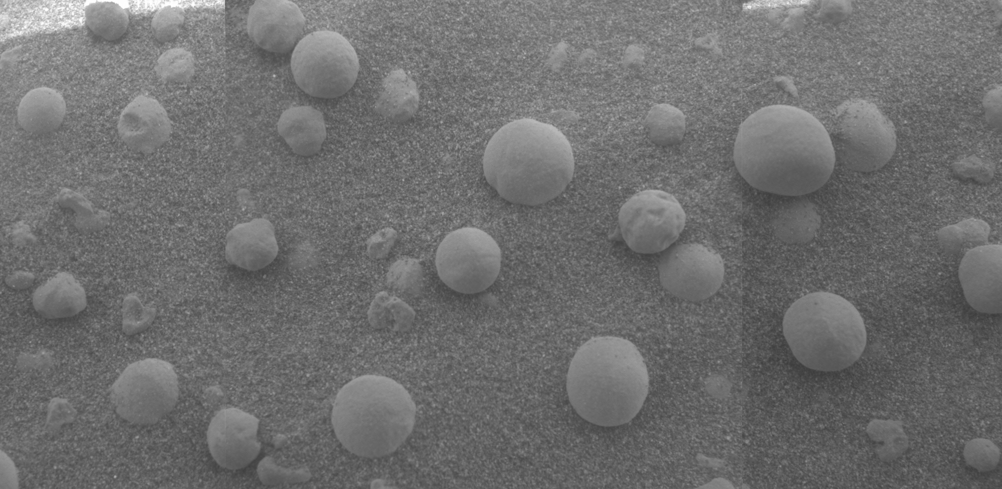
Hematite (), also spelled as haematite, is a common iron oxide compound with the formula, Fe2O3 and is widely found in rocks and soils. Hematite crystals belong to the rhombohedral lattice system which is designated the alpha polymorph of . It has the same crystal structure as corundum () and ilmenite (). With this it forms a complete solid solution at temperatures above . Hematite naturally occurs in black to steel or silver-gray, brown to reddish-brown, or red colors. It is mined as an important ore mineral of iron. It is electrically conductive. Hematite varieties include ''kidney ore'', ''martite'' (pseudomorphs after magnetite), ''iron rose'' and ''specularite'' (specular hematite). While these forms vary, they all have a rust-red streak. Hematite is not only harder than pure iron, but also much more brittle. Maghemite is a polymorph of hematite (γ-) with the same chemical formula, but with a spinel structure like magnetite. Large deposits of hematite are found in ... [...More Info...] [...Related Items...] OR: [Wikipedia] [Google] [Baidu] |
Crustal Magnetism
Crustal magnetism is the magnetic field of the crust of a planetary body. The crustal magnetism of Earth has been studied; in particular, various magnetic crustal anomalies have been studied. Two examples of crustal magnetic anomalies on Earth that have been studied in the Americas are the Brunswick magnetic anomaly (BMA) and East Coast magnetic anomaly (ECMA). Also, there can be a correlation between physical geological features and certain readings from crustal magnetism on Earth. Below the surface of the Earth, the crustal magnetism is lost because the temperature rises above the curie temperature of the materials producing the field. On Mars the crustal magnetic fields have been noted as affecting its ionosphere. (See also Atmosphere of Mars) The magnetic fields on Mars from its rocks and crust are thought to come from ferromagnetism and if the material is heated above its curie temperature the magnetic imprint is un-done. The Mars Global Surveyor (MGS) discovered magnetic stri ... [...More Info...] [...Related Items...] OR: [Wikipedia] [Google] [Baidu] |


