|
Tembien
Tembien (Tigrigna: ተምቤን) is a historic region in Tigray Region and former provinces of Ethiopia. It is a mountainous area of that country. During the reforms in 1994–95, the old provinces were replaced with regions, zones and woredas. The area of the former province is now split over the woredas of Dogua Tembien and Kola Tembien. It was located east of the Semien Province and north of Abergele, a historic district of the Begemder province. On the east, it was bordered by the Enderta Province. The original capital of the province was Melfa, west of the current town of Hagere Selam; later on Abiy Addi, nowadays located in Kola Tembien (''Lower Tembien''), became the capital. The region reached a highpoint in the Tsatsen mountains at 2828 meters above sea level, just south of Hagere Selam. Prehistory Tembien holds numerous prehistoric sites, which have been dated to the Middle Stone Age in Ayninbirkekin, or Pastoral Neolithic in Aregen and Menachek. The Dabo Zellel ... [...More Info...] [...Related Items...] OR: [Wikipedia] [Google] [Baidu] |
Tembien Province
Tembien (Tigrigna: ተምቤን) is a historic region in Tigray Region and former provinces of Ethiopia. It is a mountainous area of that country. During the reforms in 1994–95, the old provinces were replaced with regions of Ethiopia, regions, zones of Ethiopia, zones and woredas. The area of the former province is now split over the woredas of Dogua Tembien and Kola Tembien. It was located east of the Semien Province and north of Abergele (woreda), Abergele, a historic district of the Begemder province. On the east, it was bordered by the Enderta Province. The original capital of the province was Melfa (Dogu'a Tembien), Melfa, west of the current town of Hagere Selam (Degua Tembien), Hagere Selam; later on Abiy Addi, nowadays located in Kola Tembien (''Lower Tembien''), became the capital. The region reached a highpoint in the Tsatsen mountains at 2828 meters above sea level, just south of Hagere Selam. Prehistory Tembien holds numerous prehistoric sites, which have been d ... [...More Info...] [...Related Items...] OR: [Wikipedia] [Google] [Baidu] |
Ayninbirkekin
Ayninbirkekin is a ''tabia'' or municipality in the Degua Tembien, Dogu'a Tembien district of the Tigray Region of Ethiopia. Literal meaning of Ayninbirkekin in Tigrinya is "We will not bend". The ''tabia'' centre is in Halah village, located approximately 8 km to the east of the ''woreda'' town Hagere Selam (Degua Tembien), Hagere Selam. Main town is Ala'isa, situated on the ridge overseeing the Giba valley. Geography The ''tabia'' is located astride a main water divide (that is followed by the main road) and stretches down towards May Zegzeg river at the south and upper Tsaliet River at the north. Three highest places (at around 2600 m a.s.l.) are Meri’a Ziban in the west, Imba Ra’isot in the centre and the escarpment to Arebay at the north. The lowest places are the confluence of May Zegzeg and May Be’ati Rivers (1970 m a.s.l.) in the south and in the north May Leiba River near Iyesus church (2240 m a.s.l.). Geology From the higher to the lower ... [...More Info...] [...Related Items...] OR: [Wikipedia] [Google] [Baidu] |
Tigray Region
The Tigray Region, officially the Tigray National Regional State, is the northernmost regional state in Ethiopia. The Tigray Region is the homeland of the Tigrayan, Irob, and Kunama people. Its capital and largest city is Mekelle. Tigray is the fifth-largest by area, the fifth-most populous, and the fifth-most densely populated of the 11 regional states. Tigray's official language is Tigrinya, similar to that spoken in Eritrea just to the North. The estimated population as of 2019 is 5,443,000. The majority of the population (c. 80%) are farmers, contributing 46% to the regional gross domestic product (2009). The highlands have the highest population density, especially in eastern and central Tigray. The much less densely populated lowlands comprise 48% of Tigray's area. Like many parts of Africa, Tigray is far from a religious monolith. Despite the historical identification of Ethiopia with Orthodox Christianity, the presence of Islam in Ethiopia is as old as the religion ... [...More Info...] [...Related Items...] OR: [Wikipedia] [Google] [Baidu] |
Melfa (Dogu'a Tembien)
Dogu'a Tembien Melfa is a ''tabiya'' or municipality in the Dogu'a Tembien district of the Tigray Region of Ethiopia and ancient capital of Tembien. The ''tabia'' centre is Melfa village itself, located approximately 3 km to the west of the ''woreda'' town Hagere Selam. Geography The ''tabia'' stretches down from the ridge at 2700 m a.s.l. towards Zelekwa/Ruba Dirho River (2150 m a.s.l.). Geology From the higher to the lower locations, the following geological formations are present: * Upper basalt * Interbedded lacustrine deposits * Lower basalt * Amba Aradam Formation * Antalo Limestone Geomorphology and soils The main geomorphic unit is the Hagere Selam Highlands. Corresponding soil types are: * Associated soil types ** shallow soils with high stone contents (Skeletic Cambisol, Leptic Cambisol, Skeletic Regosol) ** moderately deep dark stony clays with good natural fertility (Vertic Cambisol) ** deep, dark cracking clays, temporarily waterlogged during th ... [...More Info...] [...Related Items...] OR: [Wikipedia] [Google] [Baidu] |
Aregen
Aregen is a ''tabia'' or municipality in the Dogu'a Tembien district of the Tigray Region of Ethiopia. The ''tabia'' centre is in Addi Gotet village, located approximately to the west-southwest of the ''woreda'' town Hagere Selam. Geography The ''tabia'' occupies an elongated ridge between the gorges of Upper Tanqwa and Tsech'i Rivers. The highest peak is near Aregen village ( a.s.l.) and the lowest place at the confluence of the two rivers ( a.s.l.). Geology From the higher to the lower locations, the following geological formations are present: * Lower basalt * Amba Aradam Formation * Antalo Limestone * Adigrat Sandstone Geomorphology and soils The main geomorphic units, with corresponding soil types are: * Hagere Selam Highlands, along the central basalt and sandstone ridge ** Associated soil types *** shallow soils with high stone contents (Skeletic Cambisol, Leptic Cambisol, Skeletic Regosol) *** moderately deep dark stony clays with good natural fertility (Ver ... [...More Info...] [...Related Items...] OR: [Wikipedia] [Google] [Baidu] |
Menachek
Menachek is a ''tabia'' or municipality in the Tanqua Millash district of the Tigray Region of Ethiopia. The ''tabia'' centre is in Addi Bayro village (also called "Debre Birhan"). Until January 2020 it belonged to the Dogu'a Tembien district. Geography The ''tabia'' occupies the flanks of the valley of the Tsech'i River that drains Dogu'a Tembien to the west. The highest peak is near Welekhlekha (almost 2700 m a.s.l.) and the lowest place in the lower Tsech'i gorge (1920 m a.s.l.). Geology From the higher to the lower locations, the following geological formations are present: * Upper basalt * Interbedded lacustrine deposits * Lower basalt * Amba Aradam Formation * Adigrat Sandstone Geomorphology and soils The main geomorphic units, with corresponding soil types are: * Hagere Selam Highlands, along the central basalt and sandstone ridge ** Associated soil types *** shallow soils with high stone contents (Skeletic Cambisol, Leptic Cambisol, Skeletic Reg ... [...More Info...] [...Related Items...] OR: [Wikipedia] [Google] [Baidu] |
Kola Tembien
Kola Tembien (, "Lower Tembien") is a woreda in Tigray Region, Ethiopia. It is named in part after the former province of Tembien. Part of the Mehakelegnaw Zone, Kola Tembien is bordered on the south by Abergele, on the west by the Tekezé River which separates it from the Semien Mi'irabawi (North Western) Zone, on the north by the Wari River which separates it from Naeder Adet and Werie Lehe, on the east by Misraqawi (Eastern) Zone, and on the southeast by Degua Tembien. Towns in Kola Tembien include Guya and Werkamba. The town of Abiy Addi is surrounded by Kola Tembien. Demographics Based on the 2007 national census conducted by the Central Statistical Agency of Ethiopia (CSA), this woreda has a total population of 134,336, an increase of 28.13% over the 1994 census, of whom 66,925 are men and 67,411 women; 0 or 0.00% are urban inhabitants. With an area of 2,538.39 square kilometers, Kola Tembien has a population density of 52.92, which is 56.29 than the Zone average ... [...More Info...] [...Related Items...] OR: [Wikipedia] [Google] [Baidu] |
Tsech'i River
Tsech'i is a river of the Nile basin. Rising in the mountains of Dogu’a Tembien in northern Ethiopia, it flows westward to empty finally in Giba and Tekezé River. Characteristics It is a confined ephemeral river, locally meandering in its narrow alluvial plain, with an average slope gradient of 46 metres per kilometre. With its tributaries, the river has cut a deep gorge. Flash floods and flood buffering Runoff mostly happens in the form of high runoff discharge events that occur in a very short period (called flash floods). These are related to the steep topography, often little vegetation cover and intense convective rainfall. The peaks of such flash floods have often a 50 to 100 times larger discharge than the preceding baseflow. The magnitude of floods in this river has however been decreased due to interventions in the catchment. On steep slopes, exclosures have been established; the dense vegetation largely contributes to enhanced infiltration, less flooding and be ... [...More Info...] [...Related Items...] OR: [Wikipedia] [Google] [Baidu] |
Hagere Selam (Degua Tembien)
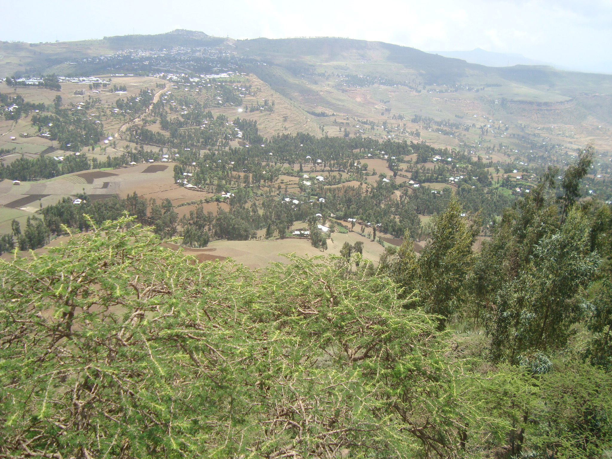
Hagere Selam (meaning ''place of peace'') is a town in northern Ethiopia. Located on the Mekelle-Abiy Addi regional road, it is located at an elevation of 2650 metres above sea level. The town is the administrative center of the Dogu'a Tembien woreda. The weekly market is on Saturdays. Hagere Selam is located on the saddle point between two of the higher points in Tigray (Imba Zuw'ala and Tsatsen). The regional road from Mekelle to Abiy Addi climbs towards Hagere Selam, before going down to the Abergele lowlands. The area is categorized as highland or ''dega''. The local economy is dependent on trading, agriculture, with barley being the main crop grown in the area, and on milk production and apiculture. Demographics Based on figures from the census in 2007, Hagere Selam had a total population of 8130, of whom 3702 were men and 4428 were women. The 1994 census reported a total population of 3932. The functional agglomeration of Hagere Selam is larger than its administrative b ... [...More Info...] [...Related Items...] OR: [Wikipedia] [Google] [Baidu] |
Abergele (Ethiopian District)
Tanqua Abergele ( ti, ጣንቋ ኣበርገለ, amh, አበርገሌ) is one of the Districts of Ethiopia, or ''woredas'', in the Tigray Region of Ethiopia. Part of the Mehakelegnaw Zone, Abergele is bordered on the south by the Wag Hemra Zone of Amhara Region, then by the Tekezé River on the west which separates it from North Gondar Zone of Amhara Region, on the north by Kola Tembien, on the east by Degua Tembien Dogu'a Tembien (, "Upper Tembien", sometimes transliterated as Degua Tembien) is a woreda in Tigray Region, Ethiopia. It is named in part after the former province of Tembien. Nowadays, the mountainous district is part of the Southeastern Tigray ... and on the southeast by the Debub Misraqawi Zone, Debub Misraqawi (South Eastern) Zone. The administrative center of this woreda is Yechila; other towns in Abergele include Agbe, Sele and Jijike. Abergele is one of the low lying districts of central Tigray Region, Tigray and the Tanqua River, which originates near Hagere ... [...More Info...] [...Related Items...] OR: [Wikipedia] [Google] [Baidu] |
Abergele (woreda)
Tanqua Abergele ( ti, ጣንቋ ኣበርገለ, amh, አበርገሌ) is one of the Districts of Ethiopia, or ''woredas'', in the Tigray Region of Ethiopia. Part of the Mehakelegnaw Zone, Abergele is bordered on the south by the Wag Hemra Zone of Amhara Region, then by the Tekezé River on the west which separates it from North Gondar Zone of Amhara Region, on the north by Kola Tembien, on the east by Degua Tembien and on the southeast by the Debub Misraqawi (South Eastern) Zone. The administrative center of this woreda is Yechila; other towns in Abergele include Sele and Jijike. Abergele is one of the low lying districts of central Tigray and the Tanqua River, which originates near Hagere Selam, flows through this woreda and joins the Geba just north of Jijike. It further feeds the Tekezé River. The Tekezé Dam is also located in this woreda. History It was a constituent of the old Tembien awrajja. Historically, Abergele seems to have formed a province since early tim ... [...More Info...] [...Related Items...] OR: [Wikipedia] [Google] [Baidu] |
Wari River
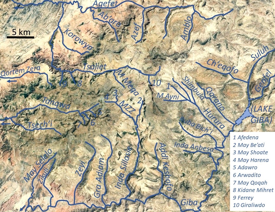
Wari River is a river of northern Ethiopia and a tributary of the Tekezé River. It rises in the Gar'alta and flows to the southwest into the Tekezé at . Tributaries of the Wari include the Assam, Chemit, Meseuma, Tsedia, Agefet and Tsaliet rivers. The general drainage is westward, to the Tekezze River. Main tributaries in Dogu’a Tembien district are, from upstream to downstream * Agefet River ** Amblo River, in ''tabia'' Addi Walka ** Azef River, at the border of ''tabias'' Addi Walka and Haddinnet ** Ab'aro River, in ''tabia'' Haddinnet and ''woreda'' Kola Tembien * May Leiba, in ''tabia'' Ayninbirkekin, which becomes Tinsehe R. in Selam and Mahbere Sillasie, and Tsaliet River, downstream from the Dabba Selama monastery ** Khunale River, in ''tabia'' Selam ** Harehuwa River, in ''tabia'' Mahbere Sillasie ** Kidan Mihret River, in ''tabia'' Mahbere Sillasie ** Ferrey River, at the border of ''tabias'' Mahbere Sillasie and Degol Woyane See also * List of rivers of Ethiopi ... [...More Info...] [...Related Items...] OR: [Wikipedia] [Google] [Baidu] |

.jpg)


