|
Tarímbaro
Tarímbaro is a municipality in the Mexican state of Michoacán. Valtazar Gaona is the mayor. The municipality has an area of 258.57 square kilometres (0.43% of the surface of the state) and is bordered to the north by Copándaro, Meson Nuevo and Cuitzeo, to the east by Álvaro Obregón, to the south by Morelia and Charo, and to the west by Chucándiro. The municipality had a population of 51,479 inhabitants according to the 2005 census. Its municipal seat is the city of the same name. The economy of the municipality is mostly based on agriculture and ranching. In pre-Hispanic times the region of present-day Tarímbaro was inhabited by the semi- nomadic Chichimeca (who knew the area "place of the willows") and the Purépecha people of Central Mexico. As of March 3, 2021, the municipality had reported 625 confirmed cases and 77 deaths from the COVID-19 pandemic in Mexico The COVID-19 pandemic in Mexico is part of the ongoing worldwide pandemic of coronavirus disease ... [...More Info...] [...Related Items...] OR: [Wikipedia] [Google] [Baidu] |
Morelia
Morelia (; from 1545 to 1828 known as Valladolid) is a city and municipal seat of the municipality of Morelia in the north-central part of the state of Michoacán in central Mexico. The city is in the Guayangareo Valley and is the capital and largest city of the state. The main pre-Hispanic cultures here were the Purépecha and the Matlatzinca, but no major cities were founded in the valley during this time. The Spanish took control of the area in the 1520s. The Spanish under Viceroy Antonio de Mendoza founded a settlement here in 1541 with the name of Valladolid, which became rival to the nearby city of Pátzcuaro for dominance in Michoacán. In 1580, this rivalry ended in Valladolid's favor and it became the capital of the viceregal province. After the Mexican War of Independence, the city was renamed Morelia in honor of José María Morelos, who hailed from the city. In 1991, the city was declared a UNESCO World Heritage Site for its well-preserved historical buildings and layo ... [...More Info...] [...Related Items...] OR: [Wikipedia] [Google] [Baidu] |
Charo, Michoacán
Charo is a Municipalities of Mexico, municipality located in the Mexico, Mexican Mexican state, state of Michoacán. The municipality has an area of 322.50 square kilometres (0.29% of the surface of the state) and is bordered to the north by Tarímbaro (municipality), Tarímbaro and Álvaro Obregón (municipality), Álvaro Obregón, to the east by Indaparapeo (municipality), Indaparapeo, to the south by Tzitzio, and to the west and southwest by Morelia. The municipality had a population of 19,417 inhabitants according to the 2005 census. Its municipal seat is the city of the same name. The economy of the municipality is mostly based on ranching and agriculture, with maize, carrots and beans the main crops. In pre-Hispanic times the area was inhabited by the Matlaltzingas, who were allies of the Purépecha people, Purépecha, the dominant force in the region at the time. A portion of Insurgente José María Morelos y Pavón National Park lies in the municipality. References [Baidu] |
Copándaro
Copándaro is a municipality located in the Mexican state of Michoacán. The municipality has an area of 173.52 square kilometres (0.21% of the surface of the state) and is bordered to the north by Huandacareo and Cuitzeo, to the east and south by Tarímbaro, and to the west by Chucándiro. The municipality had a population of 8,131 inhabitants according to the 2005 census. Its municipal seat is the city of Copándaro de Galeana. The main communities found in the municipality are Copándaro de Galeana, San Agustín del Maíz, Santa Rita, El Nispo, Arúmbaro, Congotzio, La Canada, y las Canoas. First Website ''Copandaro'' just recently has had a new website at https://web.archive.org/web/20090419101814/http://www.micopandaro.com/. It has become the first ever Copandaro de Galeana-based website on the net. The website is run by Luis, and is owned by the Urbalado Media Productions company. Origin of Copandaro The word Copándaro is of Purépecha language Purépecha (also ''P ... [...More Info...] [...Related Items...] OR: [Wikipedia] [Google] [Baidu] |
Cuitzeo
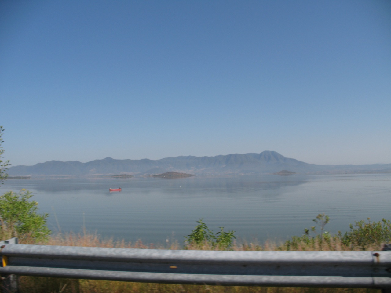
Cuitzeo () is a municipality located in the north of the Mexican state of Michoacán. The municipal seat is the town of Cuitzeo del Porvenir It is located in a relatively flat depression around Lake Cuitzeo, a large, very shallow lake, which is in danger of disappearing. The town was officially founded in 1550, with the founding of a large Augustinian monastery, which still stands. Today, the town is the seat of a rural municipality, providing local government to surrounding communities. The Town of Cuitzeo del Porvenir The town of Cuitzeo is located just over thirty km north of Morelia, on the north shore of Lake Cuitzeo. It is a quiet, rural town, with narrow streets and buildings of white facades with thatched or tile roofs. The streets are mostly traveled by people and pack animals and most of the ambient noise comes from birds in overhead trees, especially in the main plaza. Its main activities are agriculture, livestock, commerce and fishing with a population of 8,760 (2010 ... [...More Info...] [...Related Items...] OR: [Wikipedia] [Google] [Baidu] |
Municipalities Of Mexico
Municipalities (''municipios'' in Spanish language, Spanish) are the second-level administrative divisions of Mexico, where the first-level administrative division is the ''states of Mexico, state'' (Spanish: estado). They should not be confused with cities or towns that may share the same name as they are distinct entities and do not share geographical boundaries. As of January 2021, there are 2,454 municipalities in Mexico, excluding the 16 Boroughs of Mexico City, boroughs of Mexico City. Since the 2015 Intercensal Survey, two municipalities have been created in Campeche, three in Chiapas, three in Morelos, one in Quintana Roo and one in Baja California. The internal political organization and their responsibilities are outlined in the 115th article of the Constitution of Mexico, 1917 Constitution and detailed in the constitutions of the states to which they belong. are distinct from , a form of Mexican Localities of Mexico, locality, and are divided into ''Colonia (Mexico ... [...More Info...] [...Related Items...] OR: [Wikipedia] [Google] [Baidu] |
Purépecha People
The Purépecha (endonym pua, P'urhepecha ) are a group of indigenous people centered in the northwestern region of Michoacán, Mexico, mainly in the area of the cities of Cherán and Pátzcuaro. They are also known by the pejorative "Tarascan", an exonym, applied by outsiders and not one they use for themselves. The Purépecha occupied most of Michoacán but also some of the lower valleys of both Guanajuato and Jalisco. Celaya, Acambaro, Cerano, and Yurirapundaro. Now, the Purépecha live mostly in the highlands of central Michoacán, around Lakes Patzcuaro and Cuitzeo. History Prehispanic history It was one of the major empires of the Pre-Columbian era. The capital city was Tzintzuntzan. Purépecha architecture is noted for step pyramids in the shape of the letter "T". Pre-Columbian Purépecha artisans made feather mosaics that extensively used hummingbird feathers, which were highly regarded as luxury goods throughout the region. During the Pre-Colonial era, the Pur� ... [...More Info...] [...Related Items...] OR: [Wikipedia] [Google] [Baidu] |
Chichimeca
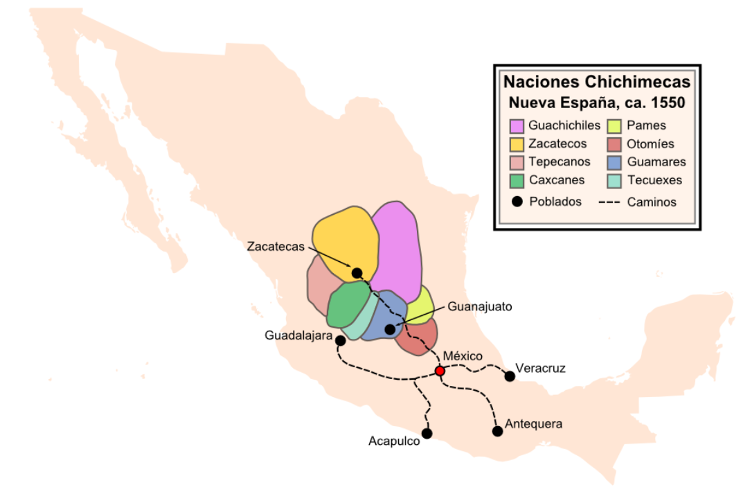
Chichimeca () is the name that the Nahua peoples of Mexico generically applied to nomadic and semi-nomadic peoples who were established in present-day Bajio region of Mexico. Chichimeca carried the meaning as the Roman term "barbarian" that described Germanic tribes. The name, with its pejorative sense, was adopted by the Spanish Empire. For the Spanish, in the words of scholar Charlotte M. Gradie, "the Chichimecas were a wild, nomadic people who lived north of the Valley of Mexico. They had no fixed dwelling places, lived by hunting, wore little clothes and fiercely resisted foreign intrusion into their territory, which happened to contain silver mines the Spanish wished to exploit." In spite of not having temples or idols, they practiced animal sacrifice, and they were feared for their expertise and brutality in war. The Spanish invasion resulted in a "drastic population decline of all the peoples known collectively as Chichimecas, and to the eventual disappearance as peoples ... [...More Info...] [...Related Items...] OR: [Wikipedia] [Google] [Baidu] |
Nomadic
A nomad is a member of a community without fixed habitation who regularly moves to and from the same areas. Such groups include hunter-gatherers, pastoral nomads (owning livestock), tinkers and trader nomads. In the twentieth century, the population of nomadic pastoral tribes slowly decreased, reaching an estimated 30–40 million nomads in the world . Nomadic hunting and gathering—following seasonally available wild plants and game—is by far the oldest human subsistence method. Pastoralists raise herds of domesticated livestock, driving or accompanying them in patterns that normally avoid depleting pastures beyond their ability to recover. Nomadism is also a lifestyle adapted to infertile regions such as steppe, tundra, or ice and sand, where mobility is the most efficient strategy for exploiting scarce resources. For example, many groups living in the tundra are reindeer herders and are semi-nomadic, following forage for their animals. Sometimes also described as "nomad ... [...More Info...] [...Related Items...] OR: [Wikipedia] [Google] [Baidu] |


