|
Tanah Merah, Malaysia
Tanah Merah District (meaning ''Red Land'' or ''Laterite'', Kelantanese: ''Tanoh Meghoh''; Jawi: تانه ميره) is a district (jajahan) in the state of Kelantan in northeast Malaysia. The urban area of Tanah Merah is situated along the Kelantan River. It is bordered by Pasir Mas District in the north, Machang District to the East, Kuala Krai District to the South East, Jeli District to the South West and Thailand in the West. Historically it used to be a capital of a kingdom called Chi Tu. Chinese Sui Dynasty annals of the 7th century describe an advanced kingdom called Chi Tu ("Red Earth") in the area now called Kelantan. The ancient name for Kelantan was "Raktamrittika", meaning "Red Earth" — this was later changed to "Sri Wijaya Mala". Education Several types of school can be found in Tanah Merah. Among the schools in Tanah Merah are *Maahad Ahmadi, Padang Siam, 17500 Tanah Merah (Sekolah agama yang perlukan bantuan) *Sekolah Menengah Kebangsaan Alor Pa ... [...More Info...] [...Related Items...] OR: [Wikipedia] [Google] [Baidu] |
Jawi Script
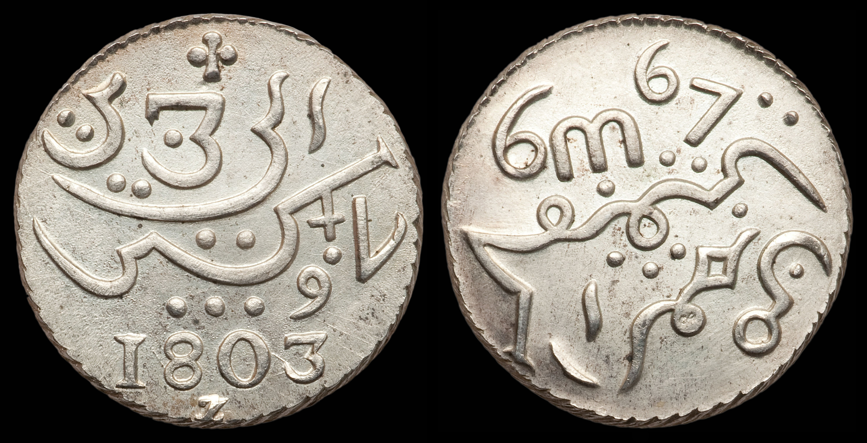
Jawi (; ace, Jawoë; Kelantan-Pattani Malay, Kelantan-Pattani: ''Yawi''; ) is a writing system used for writing several languages of Southeast Asia, such as Acehnese language, Acehnese, Banjar language, Banjarese, Kerinci language, Kerinci, Maguindanao language, Maguindanaon, Malay language, Malay, Minangkabau language, Minangkabau, Tausug language, Tausūg, and Ternate language, Ternate. Jawi is based on the Arabic script, consisting of all of the original 31 Arabic letters, and six additional letters constructed to fit the phonemes native to Malay, and an additional phoneme used in foreign loanwords, but not found in Classical Arabic, which are ''ca'' ( ), ''nga'' ( ), ''pa'' ( ), ''ga'' ( ), ''va'' ( ), and ''nya'' ( ). Jawi was developed from the Spread of Islam in Southeast Asia, advent of Islam in the Maritime Southeast Asia, supplanting the earlier Brahmic scripts used during Hindu-Buddhist era. The oldest evidence of Jawi writing can be found on the 14th century Tere ... [...More Info...] [...Related Items...] OR: [Wikipedia] [Google] [Baidu] |
Pasir Mas District
Pasir Mas District is a district (jajahan) in Kelantan, Malaysia. The district covers an area of 614.15 square kilometers and is bordered by the districts of Tumpat District to the north, Tanah Merah District to the south, Kota Bharu District to the east, and the Thai district of Su-ngai Kolok ( ms, Sungai Golok) to the west. Due to its geographical location, it acts as the main gateway of the East Coast of Malaysia to Thailand and is also traversed by major road transport routes from the West Coast to the state capital of Kota Bharu. The district of Pasir Mas was originally part of the district of Kota Bharu. In 1918, the town of Pasir Mas and its surrounding areas were separated from Kota Bharu and granted its own local government. The seat of this district is the town of Pasir Mas. Transportation Rail A railway station operated by Keretapi Tanah Melayu (KTM) is located here. The station is part of KTM Intercity's Rantau Panjang Line and interchanges with the East Co ... [...More Info...] [...Related Items...] OR: [Wikipedia] [Google] [Baidu] |
Perikatan Nasional
The National Alliance ( ms, Perikatan Nasional; abbrev: PN) is a political coalition composed of the Malaysian United Indigenous Party (BERSATU), Malaysian Islamic Party (PAS) and Parti Gerakan Rakyat Malaysia (GERAKAN). This coalition was preceded by the Malaysian Party Alliance Association, also known as the ''Persatuan Perikatan Parti Malaysia (PPPM)''. Perikatan Nasional was formed early in the 2020 Malaysian political crisis with the intention to replace the then-ruling Pakatan Harapan government. The 16th Yang di-Pertuan Agong, Abdullah of Pahang, appointed Muhyiddin Yassin, then the de-facto leader of PN, as the 8th Prime Minister of Malaysia, bringing the informal political alliance into government. The coalition was the ruling government of Malaysia from March 2020 until August 2021, when Muhyiddin Yassin resigned as Prime Minister after the United Malays National Organisation (UMNO) withdrew its support, depriving PN of its majority in parliament. As of December 20 ... [...More Info...] [...Related Items...] OR: [Wikipedia] [Google] [Baidu] |
Ikmal Hisham Abdul Aziz
Dato' Sri Ikmal Hisham Bin Abdul Aziz ( ms, أكمل هشام بن عبد العزيز, label= Jawi, script=arab, italic=unset) is a Malaysian politician who served as Deputy Minister of Defence for the second term in the Barisan Nasional (BN) administration under former Prime Minister Ismail Sabri Yaakob and former Minister Hishammuddin Hussein from August 2021 to November 2022. He served his first term in the Perikatan Nasional (PN) administration under former Prime Minister Muhyiddin Yassin and former Minister Ismail Sabri Yaakob from March 2020 to August 2021 and Member of Parliament (MP) for Tanah Merah since May 2013. He is a member of the Malaysian United Indigenous Party (BERSATU), a component party of the PN and formerly Pakatan Harapan (PH) coalitions and was a member of the United Malays National Organisation (UMNO), a component party of the Barisan Nasional (BN) coalition. After the defeat of BN to PH in 2018 general election, he resigned from UMNO in 2018 and ... [...More Info...] [...Related Items...] OR: [Wikipedia] [Google] [Baidu] |
Tanah Merah (federal Constituency)
Tanah Merah is a federal constituency in Tanah Merah District, Kelantan, Malaysia, that has been represented in the Dewan Rakyat The Dewan Rakyat (English: 'House of Representatives'; ) is the lower house of the bicameral Parliament, the federal legislature of Malaysia. The chamber and its powers are established by Article 44 of the Constitution of Malaysia. The Dewan ... since 1959. The federal constituency was created in the 1958 redistribution and is mandated to return a single member to the Dewan Rakyat under the first past the post voting system. Demographics https://live.chinapress.com.my/ge15/parliament/KELANTAN History Polling districts According to the federal gazette issued on 31 October 2022, the Tanah Merah constituency is divided into 33 polling districts. Representation history State constituency Current state assembly members Local governments Election results ... [...More Info...] [...Related Items...] OR: [Wikipedia] [Google] [Baidu] |
Ulu Kusial
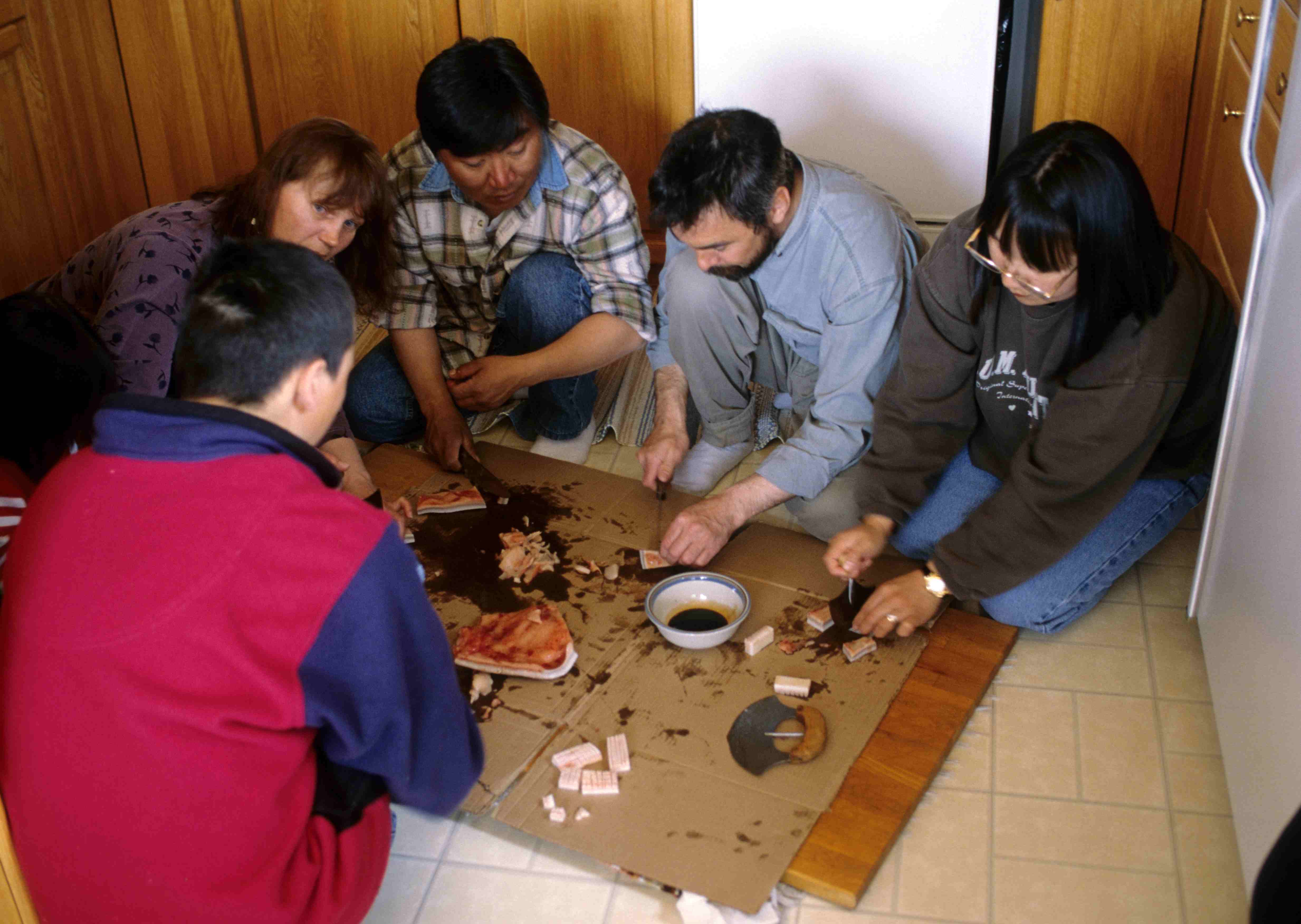
An ulu ( iu, ᐅᓗ, plural: ''uluit'', 'woman's knife') is an all-purpose knife traditionally used by Inuit, Iñupiat, Yupik, and Aleut women. It is utilized in applications as diverse as skinning and cleaning animals, cutting a child's hair, cutting food and, if necessary, trimming blocks of snow and ice used to build an igloo. Name In the Nunatsiavummiutut variety of Inuttitut, which is spoken in Nunatsiavut (Northern Labrador), the word is spelled , and in Tunumiit (East Greenlandic) it is or . The following chart lists both Eskimo-Aleut terms as well as two terms for the same tool in Athabaskan languages, which are an unrelated language family spoken by non-Inuit-Iñupiat-Aleut Alaska Natives. Materials Traditionally the ulu was made with a caribou antler, muskox horn or walrus ivory handle and slate cutting surface, due to the lack of metal smelting technology in the Arctic. The handle could also be carved from bone, and wood was sometimes used when it was availab ... [...More Info...] [...Related Items...] OR: [Wikipedia] [Google] [Baidu] |
Map Of Tanah Merah District, Kelantan
A map is a symbolic depiction emphasizing relationships between elements of some space, such as objects, regions, or themes. Many maps are static, fixed to paper or some other durable medium, while others are dynamic or interactive. Although most commonly used to depict geography, maps may represent any space, real or fictional, without regard to context or scale, such as in brain mapping, DNA mapping, or computer network topology mapping. The space being mapped may be two dimensional, such as the surface of the earth, three dimensional, such as the interior of the earth, or even more abstract spaces of any dimension, such as arise in modeling phenomena having many independent variables. Although the earliest maps known are of the heavens, geographic maps of territory have a very long tradition and exist from ancient times. The word "map" comes from the , wherein ''mappa'' meant 'napkin' or 'cloth' and ''mundi'' 'the world'. Thus, "map" became a shortened term referring to ... [...More Info...] [...Related Items...] OR: [Wikipedia] [Google] [Baidu] |
Sui Dynasty
The Sui dynasty (, ) was a short-lived imperial dynasty of China that lasted from 581 to 618. The Sui unified the Northern and Southern dynasties, thus ending the long period of division following the fall of the Western Jin dynasty, and laying the foundations for the much longer lasting Tang dynasty. Founded by Emperor Wen of Sui, the Sui dynasty capital was Chang'an (which was renamed Daxing, modern Xi'an, Shaanxi) from 581–605 and later Luoyang (605–18). Emperors Wen and his successor Yang undertook various centralized reforms, most notably the equal-field system, intended to reduce economic inequality and improve agricultural productivity; the institution of the Five Departments and Six Board (五省六曹 or 五省六部) system, which is a predecessor of Three Departments and Six Ministries system; and the standardization and re-unification of the coinage. They also spread and encouraged Buddhism throughout the empire. By the middle of the dynasty, the newly unifi ... [...More Info...] [...Related Items...] OR: [Wikipedia] [Google] [Baidu] |
Chi Tu
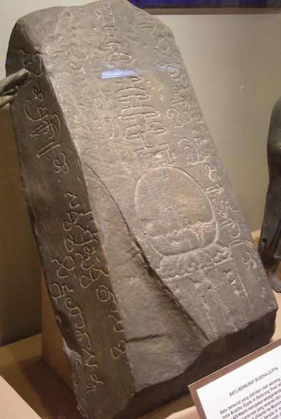
Chi Tu (other alternative spellings include Chihtu, Chitu or Ch-ih-t'u; Sanskrit: Raktamaritika or Raktamrittika; ; Malay language: ''Tanah Merah'') was an ancient kingdom mentioned in the history of China. The Sui Dynasty annals describe an advanced kingdom called Chi Tu in 607, when Chang Chun was sent as an ambassador there. The location of Chi Tu was disputed; proposals for its location include areas in the states of Kelantan or Pahang in Malaysia, or in Songkhla and Pattani Province of southern Thailand. The best evidence to support the Kelantan theory was when the envoys left Chi Tu, the sail took 10 days to reach Champa, this indicates the kingdom was located somewhere 'red earth' around the main river of Kelantan. The inscribed Buddhagupta Stone found in Kedah mentioned a Raktamrttika, meaning "red earth land". History The Chi Tu kingdom is believed to have existed as early as 100 BC to the 6th century AD. The royal family's name was Chu-dan (which means Gautama Buddh ... [...More Info...] [...Related Items...] OR: [Wikipedia] [Google] [Baidu] |
Thailand
Thailand ( ), historically known as Siam () and officially the Kingdom of Thailand, is a country in Southeast Asia, located at the centre of the Indochinese Peninsula, spanning , with a population of almost 70 million. The country is bordered to the north by Myanmar and Laos, to the east by Laos and Cambodia, to the south by the Gulf of Thailand and Malaysia, and to the west by the Andaman Sea and the extremity of Myanmar. Thailand also shares maritime borders with Vietnam to the southeast, and Indonesia and India to the southwest. Bangkok is the nation's capital and largest city. Tai peoples migrated from southwestern China to mainland Southeast Asia from the 11th century. Indianised kingdoms such as the Mon, Khmer Empire and Malay states ruled the region, competing with Thai states such as the Kingdoms of Ngoenyang, Sukhothai, Lan Na and Ayutthaya, which also rivalled each other. European contact began in 1511 with a Portuguese diplomatic mission to Ayutthaya, w ... [...More Info...] [...Related Items...] OR: [Wikipedia] [Google] [Baidu] |


