|
Tambelan Archipelago
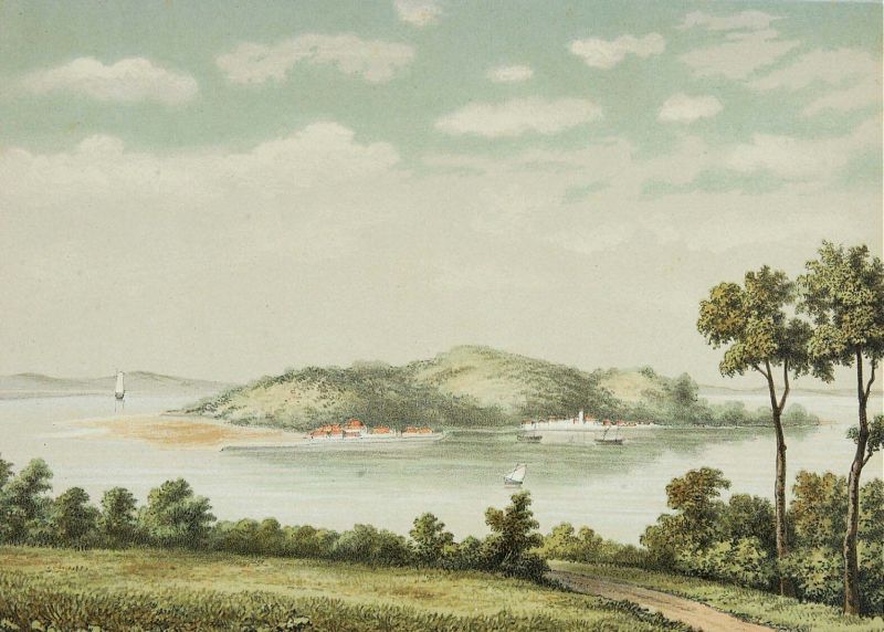
Tambelan archipelago is a group of 68 islands off the west coast of West Kalimantan, (Borneo), Indonesia, just north of the equator. The archipelago is located on the north opening of Karimata Strait which separates Borneo and Belitung island. Geographically it is part of the Tudjuh Archipelago, and administratively forms a district (''kecamatan'') of Bintan Regency within the Riau Islands Province. It covers a land area of 90.4 km2 and had a population of 4,975 at the 2010 Census.Biro Pusat Statistik, Jakarta, 2011. Major islands include Big Tambelan (Tambelan Besar), Mendarik, Uwi, Benua, and Pejantan. The islands are divided into eight administrative villages (''kelurahan'') - Batu Lepuk, Kampung Hilir, Kampung Melayu, Kukup, Pengikik, Pulau Mentebung, Pulau Pinang and Teluk Sekuni. See also * Anambas Islands * Badas Islands * Natuna Islands ''(Sacred Ocean, Fortune Land) , image_map = , pushpin_map = Indonesia Riau Islands#Indonesia Sumatra#I ... [...More Info...] [...Related Items...] OR: [Wikipedia] [Google] [Baidu] |
West Kalimantan
West Kalimantan ( id, Kalimantan Barat) is a province of Indonesia. It is one of five Indonesian provinces comprising Kalimantan, the Indonesian part of the island of Borneo. Its capital city is Pontianak, Indonesia, Pontianak. The province has an area of 147,307 km2, and had a population of 4,395,983 at the 2010 CensusBiro Pusat Statistik, Jakarta, 2011. and 5,414,390 at the 2020 Census. Ethnic groups include the Dayak people, Dayak, Malay people, Malay, Chinese Indonesians, Chinese, Javanese people, Javanese, Bugis, and Madurese people, Madurese. The borders of West Kalimantan roughly trace the mountain ranges surrounding the vast watershed of the Kapuas River, which drains most of the province. The province shares land borders with Central Kalimantan to the southeast, East Kalimantan to the east, and the Malaysian territory of Sarawak to the north. West Kalimantan is an area that could be dubbed "The Province of a Thousand Rivers". The nickname is aligned with the geograp ... [...More Info...] [...Related Items...] OR: [Wikipedia] [Google] [Baidu] |
Borneo
Borneo (; id, Kalimantan) is the third-largest island in the world and the largest in Asia. At the geographic centre of Maritime Southeast Asia, in relation to major Indonesian islands, it is located north of Java, west of Sulawesi, and east of Sumatra. The island is politically divided among three countries: Malaysia and Brunei in the north, and Indonesia to the south. Approximately 73% of the island is Indonesian territory. In the north, the East Malaysian states of Sabah and Sarawak make up about 26% of the island. The population in Borneo is 23,053,723 (2020 national censuses). Additionally, the Malaysian federal territory of Labuan is situated on a small island just off the coast of Borneo. The sovereign state of Brunei, located on the north coast, comprises about 1% of Borneo's land area. A little more than half of the island is in the Northern Hemisphere, including Brunei and the Malaysian portion, while the Indonesian portion spans the Northern and Southern hemisph ... [...More Info...] [...Related Items...] OR: [Wikipedia] [Google] [Baidu] |
Equator
The equator is a circle of latitude, about in circumference, that divides Earth into the Northern and Southern hemispheres. It is an imaginary line located at 0 degrees latitude, halfway between the North and South poles. The term can also be used for any other celestial body that is roughly spherical. In spatial (3D) geometry, as applied in astronomy, the equator of a rotating spheroid (such as a planet) is the parallel (circle of latitude) at which latitude is defined to be 0°. It is an imaginary line on the spheroid, equidistant from its poles, dividing it into northern and southern hemispheres. In other words, it is the intersection of the spheroid with the plane perpendicular to its axis of rotation and midway between its geographical poles. On and near the equator (on Earth), noontime sunlight appears almost directly overhead (no more than about 23° from the zenith) every day, year-round. Consequently, the equator has a rather stable daytime temperature throug ... [...More Info...] [...Related Items...] OR: [Wikipedia] [Google] [Baidu] |
Karimata Strait
The Karimata Strait (alternatively, Carimata or Caramata; id, Selat Karimata) is a wide strait that connects the South China Sea to the Java Sea, separating the Indonesian islands of Belitung to the west and Borneo (Kalimantan) to the east. It is the widest strait between the South China Sea and the Java Sea (other straits include the Bangka Strait, Bangka and Gaspar Strait, Gaspar straits), but its numerous islands and reefs reduce its navigability. Its weather and current is influenced by the annual southeast and northwest monsoon. It was used as an invasion route by the British fleet in the Invasion of Java (1811), 1811 Invasion of Java in the Dutch East Indies. More recently, it was the site of the crash of Indonesia AirAsia Flight 8501, and the location of the 2016 edition of Sail Indonesia (dubbed "Sail Karimata Strait"). Geography The strait is about wide from the east coast of Belitung (also known as Billiton) to the west coast of Borneo (Kalimantan). The much narro ... [...More Info...] [...Related Items...] OR: [Wikipedia] [Google] [Baidu] |
Tudjuh Archipelago
The Tudjuh Archipelago (, lit. "Seven Islands") Geographical Names (Information Technology Associates) is a large group of islands in north-western , off the west and north-west coast of the island of Borneo in the . Administratively the islands belong to the of |
Bintan Regency
Bintan Regency (formerly Riau Islands Regency; id, Kabupaten Kepulauan Riau) is an administrative area in the Riau Islands Province of Indonesia. Bintan Regency includes all of Bintan Island (except for the city of Tanjung Pinang which is separately administered as an autonomous area of the island) and also includes many outlying islands including the Tambelan Archipelago and Badas Islands situated between Bintan and West Kalimantan. Location The Island is located 40 kilometres from Singapore, with an area of 1,462.77 km2, and it has a population of around 330,000 at the 2010 Census (including Tanjung Pinang), which by the 2020 Census had risen to 387,181. These population figures include outlying islands and archipelagoes that are included within Bintan Regency. Famous places in Bintan include Trikora Beach, on the east coast, and the international Bintan Resorts. Administration The Regency (excluding the city of Tanjung Pinang) is divided into ten districts (''kecamata ... [...More Info...] [...Related Items...] OR: [Wikipedia] [Google] [Baidu] |
Riau Islands
The Riau Islands ( id, Kepulauan Riau) is a province of Indonesia. It comprises a total of 1,796 islands scattered between Sumatra, Malay Peninsula, and Borneo including the Riau Archipelago. Situated on one of the world's busiest shipping lanes along the Malacca Strait and the South China Sea, the province shares water borders with neighboring countries such as Singapore, Malaysia, and Brunei. The Riau Islands also has a relatively large potential of mineral resources, energy, as well as marine resources. The capital of the province is Tanjung Pinang and the largest city is Batam. The Riau archipelago was once part of the Johor Sultanate, which was later partitioned between the Dutch East Indies and British Malaya after the Anglo-Dutch Treaty of 1824, in which the archipelago fell under Dutch influence. A Dutch protectorate, the Riau-Lingga Sultanate, was established in the region between 1824 and 1911 before being directly ruled by the Dutch East Indies. The archipelago be ... [...More Info...] [...Related Items...] OR: [Wikipedia] [Google] [Baidu] |
Anambas Islands
Anambas Islands Regency ( id, Kabupaten Kepulauan Anambas) is a small archipelago of Indonesia, located northeast of Batam Island in the North Natuna Sea between the Malaysian mainland to the west and the island of Borneo to the east. Geographically part of the Tudjuh Archipelago, it is administratively a regency within the Riau Islands Province. It covers a land area of and had a population of 37,411 at the 2010 Census and 47,402 at the 2020 Census. The administrative centre is at Tarempa on Siantan Island. Islands Main islands The principal islands are Siantan (on which is situated the main town of Tarempa), Matak, Mubur, Jemaja and Kiabu (Air Bini). Matak island The Anambas archipelago contains a large reserve of natural gas that is exported to countries such as Singapore and Malaysia. The island of Matak is the main base for oil exploration. Pulau Bawah Pulau Bawah, formerly known as Leeward Islands (other), Leeward island, is a clustered archipelago of ... [...More Info...] [...Related Items...] OR: [Wikipedia] [Google] [Baidu] |
Badas Islands
Badas Islands is a group of islands in the Tudjuh Archipelago in the South China Sea between the Malaysian mainland to the west and the island of Borneo to the east. Administratively it is part of Bintan Regency within the Riau Islands province of Indonesia under island district/''kecamatan'' of Tambelan. The Badas Islands are located between 0°30'N and 0°39'N latitude, and between 106°58'E and 107°12'E longitude. They are 56 km southwest of the Tambelan archipelago (of which district they are administratively part), and lie outside the usual shipping lanes. The southwesternmost island of the group is Anakawur Island (Pulau Anakawur) () which rises to 94 m and has a sandy beach on its southwestern side, but otherwise has a rugged coastline. Pejamu Island (Pulau Pejamu) () which lies 17 km east-southeast of Anakawur, is densely forested and rises to 42 m. There is a sandy beach on its east side. Kepahiang Island (Pulau Kepahiang) () is the largest and northernmo ... [...More Info...] [...Related Items...] OR: [Wikipedia] [Google] [Baidu] |
Natuna Islands
''(Sacred Ocean, Fortune Land) , image_map = , pushpin_map = Indonesia Riau Islands#Indonesia Sumatra#Indonesia#South China Sea , pushpin_map_caption = Location in Riau Islands##Location in Sumatra##Location in Indonesia##Location in South China Sea , map_caption = Interactive map , pushpin_label = , pushpin_label_position = left , coordinates = , coor_pinpoint = , coordinates_footnotes = [Baidu] |
Landforms Of The Riau Islands
A landform is a natural or anthropogenic land feature on the solid surface of the Earth or other planetary body. Landforms together make up a given terrain, and their arrangement in the landscape is known as topography. Landforms include hills, mountains, canyons, and valleys, as well as shoreline features such as bays, peninsulas, and seas, including submerged features such as mid-ocean ridges, volcanoes, and the great ocean basins. Physical characteristics Landforms are categorized by characteristic physical attributes such as elevation, slope, orientation, stratification, rock exposure and soil type. Gross physical features or landforms include intuitive elements such as berms, mounds, hills, ridges, cliffs, valleys, rivers, peninsulas, volcanoes, and numerous other structural and size-scaled (e.g. ponds vs. lakes, hills vs. mountains) elements including various kinds of inland and oceanic waterbodies and sub-surface features. Mountains, hills, plateaux, and plains are the fo ... [...More Info...] [...Related Items...] OR: [Wikipedia] [Google] [Baidu] |


.jpg)