|
Ta Nei
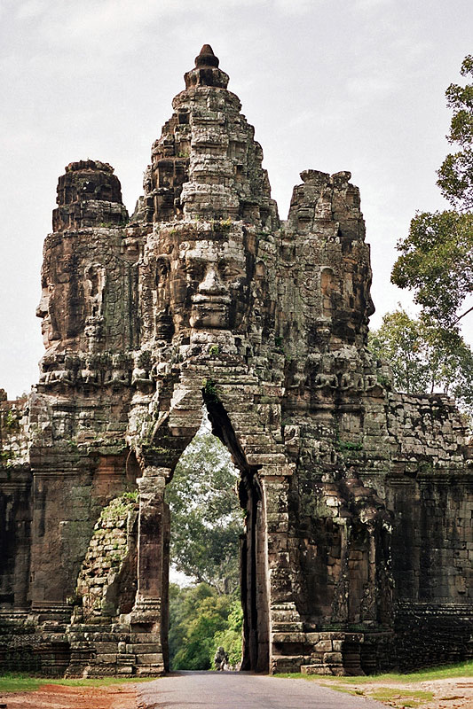
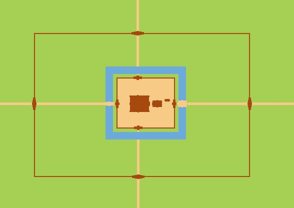
Ta Nei () is a late 12th century stone temple in Angkor, Cambodia. Built during the reign of King Jayavarman VII, it is near the northwest corner of the East Baray, a large holy reservoir. It was dedicated to the Buddha. Plan Ta Nei was extended initially toward the east and then enlarged with three small gopuras on the north, west and south and a large east gopura that is essentially a part of the inner, galleried enclosure. As at Ta Prohm, city walls were begun but were probably never finished. Today only two outer gopuras exist to the west and east. The length of the urban enclosure was 190m. Inside are two long, narrow tank moats on the north and south. The original east gopura now stands isolated, and the original northeast and southeast corner towers are now part of the gallery. There is a small library near the south side and a chamber connects the sanctuary to the north gopura.''Ancient Angkor'', Michael Freeman and Claude Jacques, p. 131, 2003. Gallery See also * ... [...More Info...] [...Related Items...] OR: [Wikipedia] [Google] [Baidu] |
Cambodia
Cambodia (; also Kampuchea ; km, កម្ពុជា, UNGEGN: ), officially the Kingdom of Cambodia, is a country located in the southern portion of the Indochinese Peninsula in Southeast Asia, spanning an area of , bordered by Thailand to the northwest, Laos to the north, Vietnam to the east, and the Gulf of Thailand to the southwest. The capital and largest city is Phnom Penh. The sovereign state of Cambodia has a population of over 17 million. Buddhism is enshrined in the constitution as the official state religion, and is practised by more than 97% of the population. Cambodia's minority groups include Vietnamese, Chinese, Chams and 30 hill tribes. Cambodia has a tropical monsoon climate of two seasons, and the country is made up of a central floodplain around the Tonlé Sap lake and Mekong Delta, surrounded by mountainous regions. The capital and largest city is Phnom Penh, the political, economic and cultural centre of Cambodia. The kingdom is an elective co ... [...More Info...] [...Related Items...] OR: [Wikipedia] [Google] [Baidu] |
Angkor
Angkor ( km, អង្គរ , 'Capital city'), also known as Yasodharapura ( km, យសោធរបុរៈ; sa, यशोधरपुर),Headly, Robert K.; Chhor, Kylin; Lim, Lam Kheng; Kheang, Lim Hak; Chun, Chen. 1977. ''Cambodian-English Dictionary''. Bureau of Special Research in Modern Languages. The Catholic University of America Press. Washington, D.C. Chuon Nath Khmer Dictionary (1966, Buddhist Institute, Phnom Penh). was the capital city of the Khmer Empire. The city and empire flourished from approximately the 9th to the 15th centuries. The city houses the Angkor Wat, one of Cambodia's most popular tourist attractions. The name ''Angkor'' is derived from ''nokor'' (), a Khmer word meaning "kingdom" which in turn derived from Sanskrit ''nagara'' (), meaning "city". The Angkorian period began in AD 802, when the Khmer Hindu monarch Jayavarman II declared himself a "universal monarch" and "god-king", and lasted until the late 14th century, first falling under ... [...More Info...] [...Related Items...] OR: [Wikipedia] [Google] [Baidu] |
Khmer Architecture
Khmer architecture ( km, ស្ថាបត្យកម្មខ្មែរ), also known as Angkorian architecture ( km, ស្ថាបត្យកម្មសម័យអង្គរ), is the architecture produced by the Khmer people, Khmers during the Angkor period of the Khmer Empire from approximately the later half of the 8th century CE to the first half of the 15th century CE. The Indian rock-cut architecture, architecture of the Indian rock-cut temples, particularly in sculpture, had an influence on Southeast Asia and was widely adopted into the Indianization of Southeast Asia, Indianised architecture of Cambodian (Khmer), Names of Vietnam, Annamese and Javanese temples (of the Greater India). Evolved from Indian influences, Khmer architecture became clearly distinct from that of the Indian sub-continent as it developed its own special characteristics, some of which were created independently and others of which were incorporated from neighboring cultural traditions, re ... [...More Info...] [...Related Items...] OR: [Wikipedia] [Google] [Baidu] |
Bayon
The Bayon ( km, ប្រាសាទបាយ័ន, ) is a richly decorated Khmer temple related to Buddhism at Angkor in Cambodia. Built in the late 12th or early 13th century as the state temple of the King Jayavarman VII ( km, ព្រះបាទជ័យវរ្ម័នទី ៧), the Bayon stands at the centre of Jayavarman's capital, Angkor Thom ( km, អង្គរធំ).Higham, C., 2001, The Civilization of Angkor, London: Weidenfeld & Nicolson, , p.121Higham, C., 2014, Early Mainland Southeast Asia, Bangkok: River Books Co., Ltd., pp.378-382 The Bayon's most distinctive feature is the multitude (4 on each tower pointing to the 4 sides) of serene and smiling stone faces of Brahma on the many towers which jut out from the upper terrace and cluster around its central peak.Freeman and Jacques, p.78. The main conservatory body, the Japanese Government Team for the Safeguarding of Angkor (the JSA) has described the temple as "the most striking expression of the ba ... [...More Info...] [...Related Items...] OR: [Wikipedia] [Google] [Baidu] |
Jayavarman VII
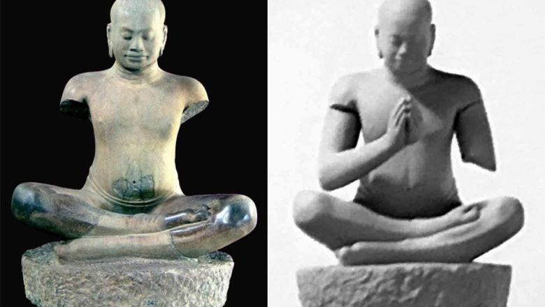
Jayavarman VII, posthumous name of Mahaparamasaugata ( km, ជ័យវរ្ម័នទី៧, c. 1122–1218), was king of the Khmer Empire. He was the son of King Dharanindravarman II (r. 1150–1160) and Queen Sri Jayarajacudamani. He was the first king devoted to Buddhism, as only one prior Khmer king was a Buddhist. He then built the Bayon as a monument to Buddhism. Jayavarman VII is generally considered the most powerful of the Khmer monarchs by historians. His government built many projects including hospitals, highways, rest houses and temples. With Buddhism as his motivation, King Jayavarman VII is credited with introducing a welfare state that served the physical and spiritual needs of the Khmer people. Defeat of the Cham and coronation In 1177 and again in 1178, the Cham invaded the Khmer Empire. In 1177, Champa King Jaya Indravarman IV launched a surprise attack on the Khmer capital by sailing a fleet up the Mekong River, across Lake Tonlé Sap, and then up ... [...More Info...] [...Related Items...] OR: [Wikipedia] [Google] [Baidu] |
Indravarman II
Indravarman II ( km, ឥន្ទ្រវរ្ម័នទី២) was the ruler of the Khmer Empire, son of Jayavarman VII.Higham, C., 2001, The Civilization of Angkor, London: Weidenfeld & Nicolson, There is some dispute regarding the actual period of his reign, even because his successor, Jayavarman VIII, probably destroyed historical records about him, but the only inscription which directly mention him reports that he died in 1243.Recently a new Sanskrit inscription was discovered, which could possibly change this datin/ref> He was a Buddhist and was also credited with having enlarged (or completed) some of Jayavarman VII's temple. During his peaceful kingdom, the Khmers lost control of Champa and the newborn Sukhothai Kingdom under Indraditya took possession of some western territories. David P. Chandler hypothesized that Indravarman II was possibly the ''Leper King'' of Khmer legends. References *David P. Chandler David Porter Chandler (born 1933) is an American ... [...More Info...] [...Related Items...] OR: [Wikipedia] [Google] [Baidu] |
East Baray
The East Baray ( km, បារាយណ៍ខាងកើត), or Yashodharatataka, is a now-dry baray, or artificial body of water, at Angkor, Cambodia, oriented east-west and located just east of the walled city Angkor Thom. It was built around the year 900 AD during the reign of King Yasovarman. Fed by the Siem Reap River flowing down from the Kulen Hills, it was the second-largest baray in the Angkor region (after the West Baray) and one of the largest handcut water reservoirs on Earth, measuring roughly 3.6 kilometers by 870 m and holding over 50 million cubic meters of water. Stones bearing inscriptions that mark the construction of the baray have been found at all four of its corners.Higham, C., 2001, The Civilization of Angkor, London: Weidenfeld & Nicolson, The labour and organization necessary for its construction were staggering: Its dikes contain roughly 8 million cubic meters of fill. Scholars are divided on the purpose of this and other barays. By some theories, th ... [...More Info...] [...Related Items...] OR: [Wikipedia] [Google] [Baidu] |
Gautama Buddha
Siddhartha Gautama, most commonly referred to as the Buddha, was a wandering ascetic and religious teacher who lived in South Asia during the 6th or 5th century BCE and founded Buddhism. According to Buddhist tradition, he was born in Lumbini, in what is now Nepal, to royal parents of the Shakya clan, but renounced his home life to live as a wandering ascetic ( sa, śramaṇa). After leading a life of begging, asceticism, and meditation, he attained enlightenment at Bodh Gaya in what is now India. The Buddha thereafter wandered through the lower Indo-Gangetic Plain, teaching and building a monastic order. He taught a Middle Way between sensual indulgence and severe asceticism, leading to Nirvana, that is, freedom from ignorance, craving, rebirth, and suffering. His teachings are summarized in the Noble Eightfold Path, a training of the mind that includes meditation and instruction in Buddhist ethics such as right effort, mindfulness, and '' jhana''. He di ... [...More Info...] [...Related Items...] OR: [Wikipedia] [Google] [Baidu] |
Gopura
A ''gopuram'' or ''gopura'' ( Tamil: கோபுரம், Malayalam: ഗോപുരം, Kannada: ಗೋಪುರ, Telugu: గోపురం) is a monumental entrance tower, usually ornate, at the entrance of a Hindu temple, in the South Indian architecture of the Southern Indian states of Tamil Nadu, Andhra Pradesh, Kerala, Karnataka, and Telangana, and Sri Lanka. In other areas of India they are much more modest, while in Southern Indian temples they are very often by far the highest part of the temple. Ancient and early medieval temples feature smaller ''gopuram'', while in later temples they are a prominent feature of Hindu Dravidian style; in many cases the temple compound was expanded and new larger gopuram built along the new boundary. They are topped by the ''kalasam'', a bulbous stone finial. They function as gateways through the walls that surround the temple complex. Another towering structure located towards the center of the temple is the Vimanam. Both of th ... [...More Info...] [...Related Items...] OR: [Wikipedia] [Google] [Baidu] |
Ta Prohm
Ta Prohm ( km, ប្រាសាទតាព្រហ្ម, UNGEGN: , ALA-LC: ; "Ancestor Brahma") is the modern name of the temple in Siem Reap, Cambodia, built in the Bayon style largely in the late 12th and early 13th centuries and originally called Rajavihara ( km, រាជវិហារ, UNGEGN: , ALA-LC: ; "Royal Monastery"). Located approximately one kilometre east of Angkor Thom and on the southern edge of the East Baray, it was founded by the Khmer King Jayavarman VIIHigham, C., 2001, The Civilization of Angkor, London: Weidenfeld & Nicolson, Higham, C., 2014, Early Mainland Southeast Asia, Bangkok: River Books Co., Ltd., as a Mahayana Buddhist monastery and university. Unlike most Angkorian temples, Ta Prohm is in much the same condition in which it was found: the photogenic and atmospheric combination of trees growing out of the ruins and the jungle surroundings have made it one of Angkor's most popular temples with visitors. UNESCO inscribed Ta Prohm on ... [...More Info...] [...Related Items...] OR: [Wikipedia] [Google] [Baidu] |
Banteay Kdei
Banteay Kdei ( km, ប្រាសាទបន្ទាយក្តី; Prasat Banteay Kdei), meaning "A Citadel of Chambers", also known as "Citadel of Monks' cells", is a Buddhist temple in Angkor, Cambodia. It is located southeast of Ta Prohm and east of Angkor Thom. Built in the mid-12th to early 13th centuries AD during the reign of Jayavarman VII (who was posthumously given the title "Maha paramasangata pada"), it is in the Bayon architectural style, similar in plan to Ta Prohm and Preah Khan, but less complex and smaller. Its structures are contained within two successive enclosure walls, and consist of two concentric galleries from which emerge towers, preceded to the east by a cloister. This Buddhist monastic complex is currently dilapidated due to faulty construction and poor quality of sandstone used in its buildings, and is now undergoing renovation. Banteay Kdei had been occupied by monks at various intervals over the centuries until the 1960s. Geography The Bant ... [...More Info...] [...Related Items...] OR: [Wikipedia] [Google] [Baidu] |


.jpg)
_2019_03.jpg)
