|
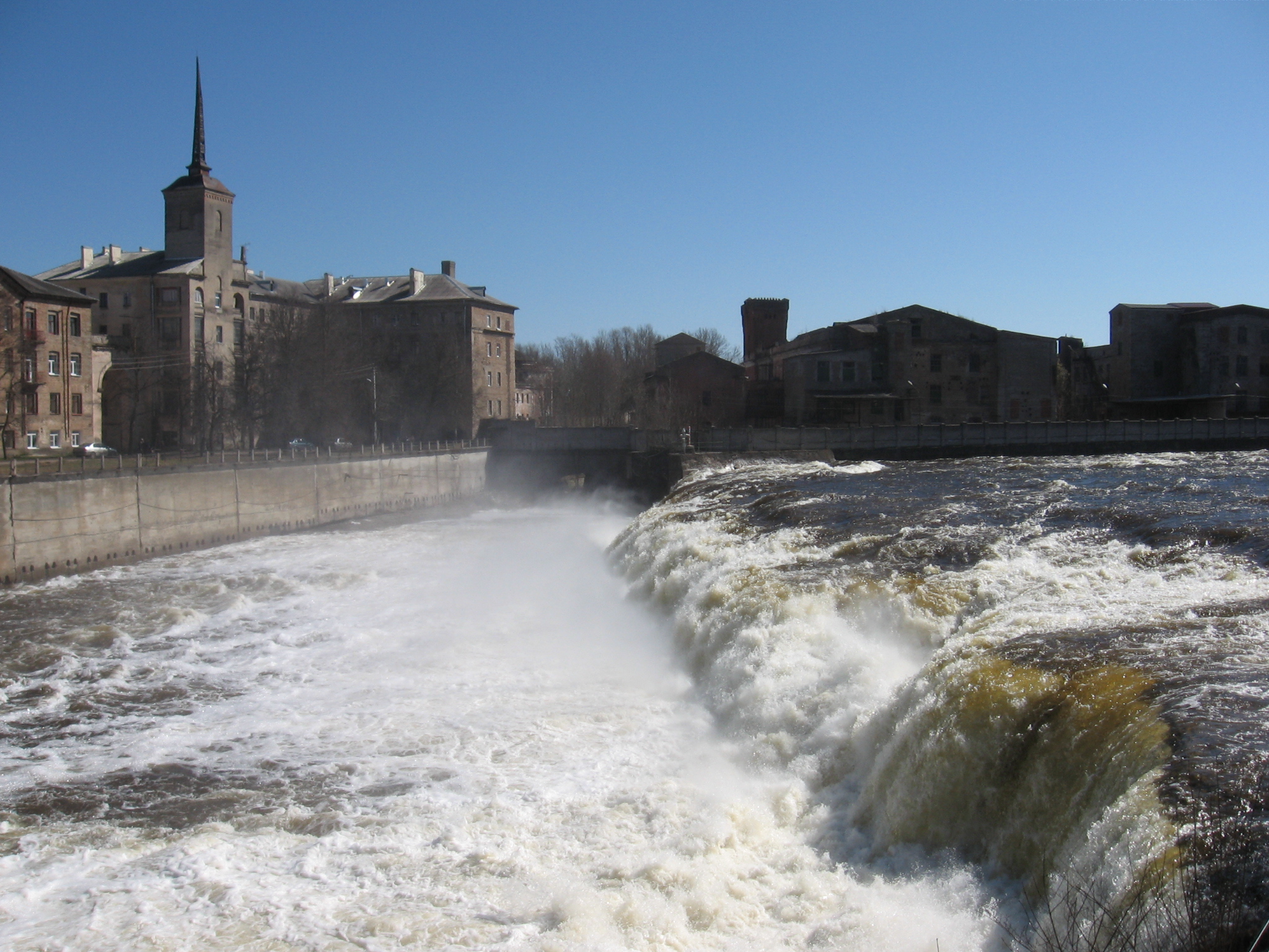
Tõrvajõgi River
The Tõrvajõgi is a river in Ida-Viru County, Estonia. The river is 16.1 km long, and its basin size is 43.7 km2. It discharges into the Narva River The Narva, formerly also Narwa or Narova, flows north into the Baltic Sea and is the largest Estonian river by discharge. A similar length of land far to the south, together with it and a much longer intermediate lake, Lake Peipus, all togeth .... Tõrvajõgi Falls is located on the river. The name ''Tõrvajõgi'' means 'tar river' (from Estonian ''tõrv'' 'tar'), referring to the dark color of the water. References Rivers of Estonia Ida-Viru County {{Estonia-river-stub ... [...More Info...] [...Related Items...] OR: [Wikipedia] [Google] [Baidu] |
Narva River
The Narva, formerly also Narwa or Narova, flows north into the Baltic Sea and is the largest Estonian river by discharge. A similar length of land far to the south, together with it and a much longer intermediate lake, Lake Peipus, all together nowadays form the international border between Estonia and Russia. The river gives its name to the archaeological (Neolithic) Narva culture, as well as the city of Narva. Narva is the third most populous urban area in Estonia, and nowadays faces the Russian town of Ivangorod right across the border over the river. At the coast the river passes part of the resort of Narva-Jõesuu. Its mouth opens into WNW-facing Narva Bay of the Gulf of Finland. Narva gives the second-greatest discharge into the Gulf of Finland (the greatest discharge comes from the Neva River). Etymology The etymology of the toponym ''Narva'' is not clear. According to one hypothesis it is related to the Finnic word ''narva'' which, for example, in Veps mean ... [...More Info...] [...Related Items...] OR: [Wikipedia] [Google] [Baidu] |
Estonia
Estonia, officially the Republic of Estonia, is a country in Northern Europe. It is bordered to the north by the Gulf of Finland across from Finland, to the west by the Baltic Sea across from Sweden, to the south by Latvia, and to the east by Russia. The territory of Estonia consists of the mainland, the larger islands of Saaremaa and Hiiumaa, and over 2,300 other islands and islets on the east coast of the Baltic Sea. Its capital Tallinn and Tartu are the two largest List of cities and towns in Estonia, urban areas. The Estonian language is the official language and the first language of the Estonians, majority of its population of nearly 1.4 million. Estonia is one of the least populous members of the European Union and NATO. Present-day Estonia has been inhabited since at least 9,000 BC. The Ancient Estonia#Early Middle Ages, medieval indigenous population of Estonia was one of the last pagan civilisations in Europe to adopt Christianity following the Northern Crusades in the ... [...More Info...] [...Related Items...] OR: [Wikipedia] [Google] [Baidu] |
Ida-Viru County
Ida-Viru County ( or ; ) is one of the 15 counties of Estonia. It is the most northeastern part of the country. The county contains large deposits of oil shale the main mineral mined in Estonia. Oil shale is used in the production of shale oil and in thermal power plants. The capital of the county is the town of Jõhvi which is administratively united with the Jõhvi Parish; nevertheless, Narva is the largest town in the county in terms of population and at the same time the third largest city in Estonia after Tallinn and Tartu. In January 2019 Ida-Viru County had a population of 136,240 – constituting 10.3% of the total population in Estonia. It borders Lääne-Viru County in the west, Jõgeva County in the southwest and Russia (Leningrad Oblast) in the east. It is the only county in Estonia where Russians constitute the majority of population (73.1% in 2010), the second highest being Harju (28%). History During the latter part of the period of Soviet rule of Esto ... [...More Info...] [...Related Items...] OR: [Wikipedia] [Google] [Baidu] |
Drainage Basin
A drainage basin is an area of land in which all flowing surface water converges to a single point, such as a river mouth, or flows into another body of water, such as a lake or ocean. A basin is separated from adjacent basins by a perimeter, the drainage divide, made up of a succession of elevated features, such as ridges and hills. A basin may consist of smaller basins that merge at river confluences, forming a hierarchical pattern. Other terms for a drainage basin are catchment area, catchment basin, drainage area, river basin, water basin, and impluvium. In North America, they are commonly called a watershed, though in other English-speaking places, " watershed" is used only in its original sense, that of the drainage divide line. A drainage basin's boundaries are determined by watershed delineation, a common task in environmental engineering and science. In a closed drainage basin, or endorheic basin, rather than flowing to the ocean, water converges toward the ... [...More Info...] [...Related Items...] OR: [Wikipedia] [Google] [Baidu] |
Rivers Of Estonia ...
Rivers of Estonia are short and mostly have a small discharge. Only 10 rivers are longer than 100 km. The largest river is the Narva (length 77 km) on the Estonian–Russian border, whose average discharge is larger than that of all other rivers combined. Longest rivers List of rivers ''List is incomplete.'' ReferencesEstonica: The hydrographic network* {{List of rivers of Europe Estonia Rivers A river is a natural stream of fresh water that flows on land or inside caves towards another body of water at a lower elevation, such as an ocean, lake, or another river. A river may run dry before reaching the end of its course if it ru ... [...More Info...] [...Related Items...] OR: [Wikipedia] [Google] [Baidu] |


