|
Typhoon Noul (2015)
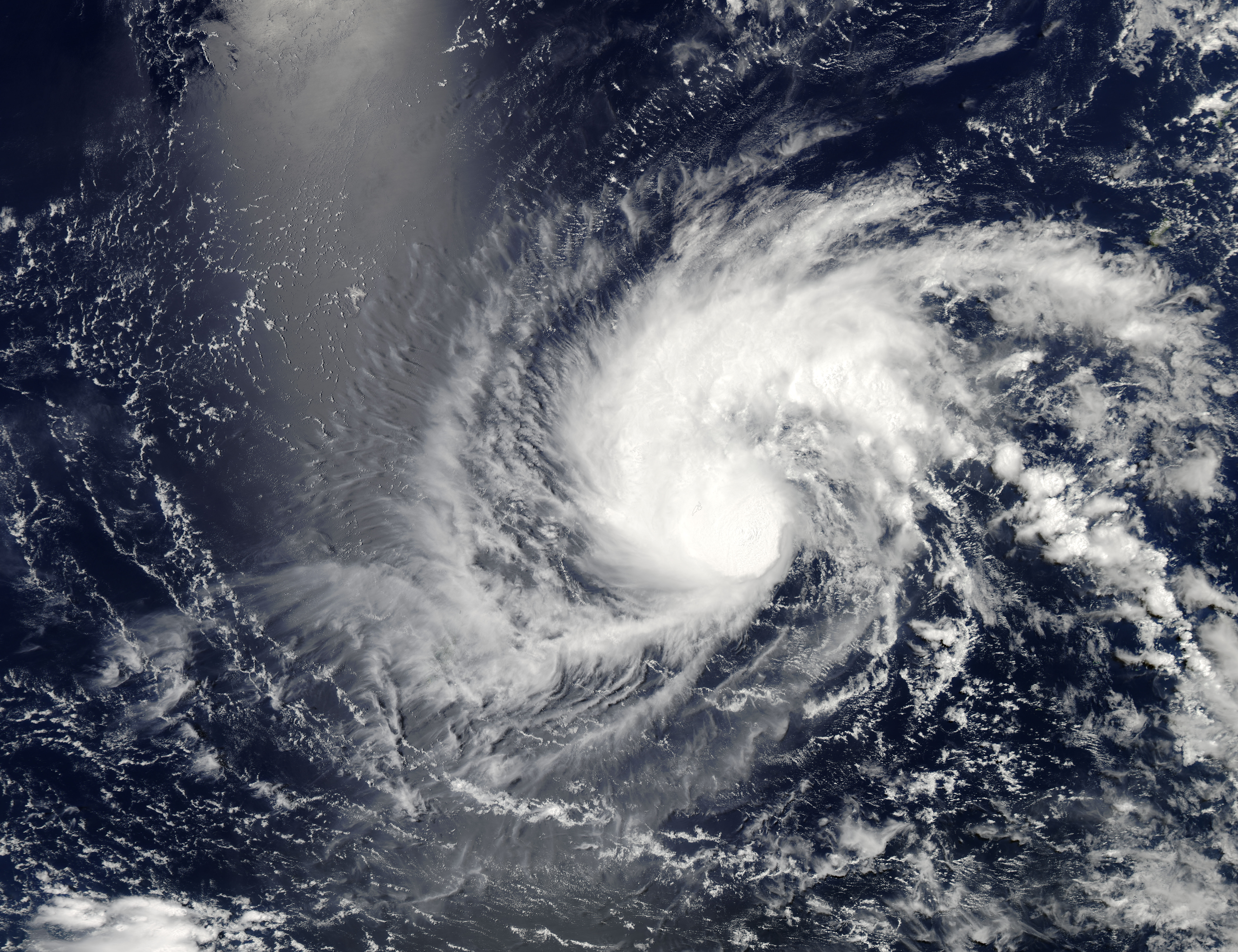
Typhoon Noul (), known in the Philippines as Typhoon Dodong, was a relatively small but powerful tropical cyclone that affected several areas but caused minor damage. The sixth named storm and third typhoon of the annual typhoon season, Noul formed as a tropical depression over the eastern Caroline Islands on May 2, 2015. It moved generally to the west and west-northwest, gradually intensifying into a tropical storm and later typhoon. On May 9, Noul began rapid deepening as it developed a well-defined eye. Early the next day, the Japan Meteorological Agency (JMA) estimated peak 10 minute sustained winds of , while the American-based Joint Typhoon Warning Center (JTWC) estimated peak 1 minute winds of , equivalent to Category 5 on the Saffir–Simpson hurricane wind scale. Noul struck northeastern Luzon in the Philippines at that intensity and greatly weakened. After passing east of Taiwan, the typhoon accelerated to the northeast and weakened due to unfavor ... [...More Info...] [...Related Items...] OR: [Wikipedia] [Google] [Baidu] |
Caroline Islands
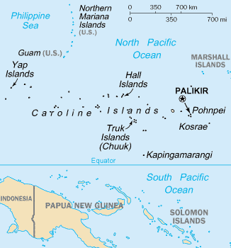
The Caroline Islands (or the Carolines) are a widely scattered archipelago of tiny islands in the western Pacific Ocean, to the north of New Guinea. Politically, they are divided between the Federated States of Micronesia (FSM) in the central and eastern parts of the group, and Palau at the extreme western end. Historically, this area was also called ''Nuevas Filipinas'' or New Philippines, because they were part of the Spanish East Indies and were governed from Manila in the Philippines. The Carolines are scattered across a distance of approximately 3,540 kilometers (2,200 miles), from the westernmost island, Tobi (island), Tobi, in Palau, to the easternmost island, Kosrae, a Administrative divisions of the Federated States of Micronesia, state of the FSM. Description The group consists of about 500 small coral islands, east of the Philippines, in the Pacific Ocean. The distance from Yap (one of the larger Caroline islands) to Manila is . Most of the islands are made up of ... [...More Info...] [...Related Items...] OR: [Wikipedia] [Google] [Baidu] |
Philippine Peso
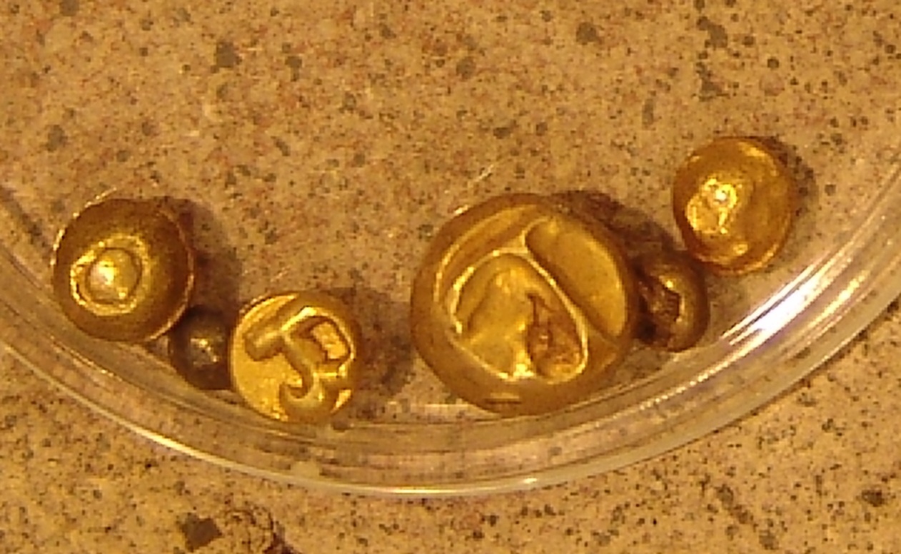
The Philippine peso, also referred to by its Tagalog name ''piso'' (Philippine English: , , plural pesos; tl, piso ; sign: ₱; code: PHP), is the official currency of the Philippines. It is subdivided into 100 ''sentimo'', also called centavos. The Philippine peso sign is denoted by the symbol "₱", introduced under American rule in place of the original peso sign "$" used throughout Spanish America. Alternative symbols used are "PHP", "PhP", "Php", or just "P". The monetary policy of the Philippines is conducted by the Bangko Sentral ng Pilipinas (BSP), established on July 3, 1993, as its central bank. It produces the country's banknotes and coins at its Security Plant Complex, which is set to move to New Clark City in Capas, Tarlac."Overview of the BSP" Bangko Sentral ng Pilipinas (BSP) Official Website. Retrieved on October 1, ... [...More Info...] [...Related Items...] OR: [Wikipedia] [Google] [Baidu] |
Subtropical Ridge
The horse latitudes are the latitudes about 30 degrees north and south of the Equator. They are characterized by sunny skies, calm winds, and very little precipitation. They are also known as Subtropics, subtropical ridges, or highs. It is a high-pressure area at the divergence of trade winds and the westerlies. Origin of the term A likely and documented explanation is that the term is derived from the "dead horse" ritual of seamen (see Flogging a dead horse#Earlier meaning, Beating a dead horse). In this practice, the seaman paraded a straw-stuffed effigy of a horse around the deck before throwing it overboard. Seamen were paid partly in advance before a long voyage, and they frequently spent their pay all at once, resulting in a period of time without income. If they got advances from the ship's paymaster, they would incur debt. This period was called the "dead horse" time, and it usually lasted a month or two. The seaman's ceremony was to celebrate having worked off the "d ... [...More Info...] [...Related Items...] OR: [Wikipedia] [Google] [Baidu] |
Coordinated Universal Time
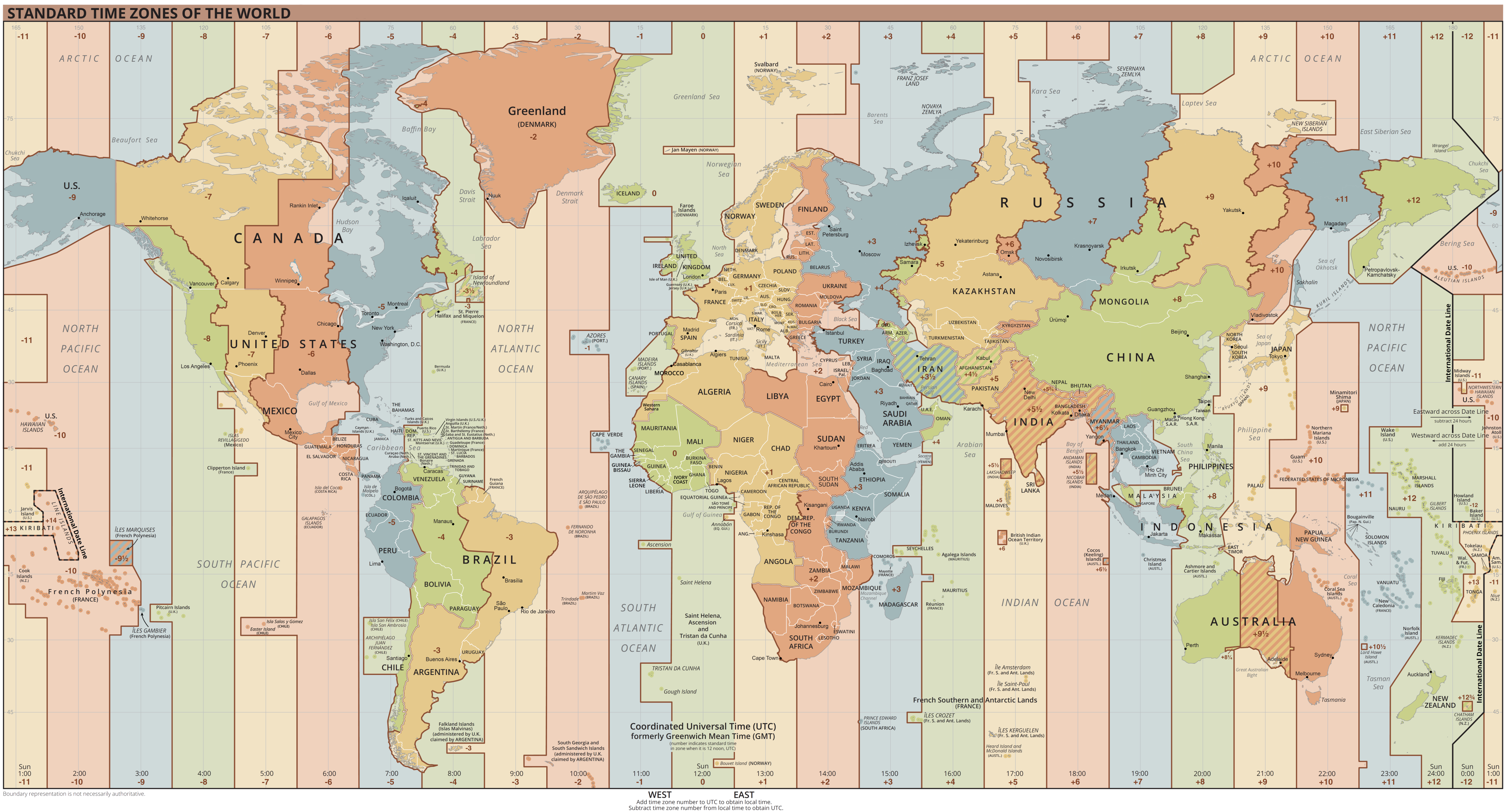
Coordinated Universal Time or UTC is the primary time standard by which the world regulates clocks and time. It is within about one second of mean solar time (such as UT1) at 0° longitude (at the IERS Reference Meridian as the currently used prime meridian) and is not adjusted for daylight saving time. It is effectively a successor to Greenwich Mean Time (GMT). The coordination of time and frequency transmissions around the world began on 1 January 1960. UTC was first officially adopted as CCIR Recommendation 374, ''Standard-Frequency and Time-Signal Emissions'', in 1963, but the official abbreviation of UTC and the official English name of Coordinated Universal Time (along with the French equivalent) were not adopted until 1967. The system has been adjusted several times, including a brief period during which the time-coordination radio signals broadcast both UTC and "Stepped Atomic Time (SAT)" before a new UTC was adopted in 1970 and implemented in 1972. This change also a ... [...More Info...] [...Related Items...] OR: [Wikipedia] [Google] [Baidu] |
Outflow (meteorology)
Outflow, in meteorology, is air that flows outwards from a storm system. It is associated with ridging, or anticyclonic flow. In the low levels of the troposphere, outflow radiates from thunderstorms in the form of a wedge of rain-cooled air, which is visible as a thin rope-like cloud on weather satellite imagery or a fine line on weather radar imagery. For observers on the ground, a thunderstorm outflow boundary often approaches in otherwise clear skies as a low, thick cloud that brings with it a gust front. Low-level outflow boundaries can disrupt the center of small tropical cyclones. However, outflow aloft is essential for the strengthening of a tropical cyclone. If this outflow is restricted or undercut, the tropical cyclone weakens. If two tropical cyclones are in close proximity, the upper-level outflow from the upwind system can limit the development of the other system. Thunderstorms For thunderstorms, outflow tends to indicate the development of a system. Large quan ... [...More Info...] [...Related Items...] OR: [Wikipedia] [Google] [Baidu] |
Wind Shear
Wind shear (or windshear), sometimes referred to as wind gradient, is a difference in wind speed and/or direction over a relatively short distance in the atmosphere. Atmospheric wind shear is normally described as either vertical or horizontal wind shear. Vertical wind shear is a change in wind speed or direction with a change in altitude. Horizontal wind shear is a change in wind speed with a change in lateral position for a given altitude. Wind shear is a microscale meteorological phenomenon occurring over a very small distance, but it can be associated with mesoscale or synoptic scale weather features such as squall lines and cold fronts. It is commonly observed near microbursts and downbursts caused by thunderstorms, fronts, areas of locally higher low-level winds referred to as low-level jets, near mountains, radiation inversions that occur due to clear skies and calm winds, buildings, wind turbines, and sailboats. Wind shear has significant effects on the control of a ... [...More Info...] [...Related Items...] OR: [Wikipedia] [Google] [Baidu] |
Tropical Cyclogenesis
Tropical cyclogenesis is the development and strengthening of a tropical cyclone in the atmosphere. The mechanisms through which tropical cyclogenesis occurs are distinctly different from those through which temperate cyclogenesis occurs. Tropical cyclogenesis involves the development of a warm-core cyclone, due to significant convection in a favorable atmospheric environment. Tropical cyclogenesis requires six main factors: sufficiently warm sea surface temperatures (at least ), atmospheric instability, high humidity in the lower to middle levels of the troposphere, enough Coriolis force to develop a low-pressure center, a pre-existing low-level focus or disturbance, and low vertical wind shear. Tropical cyclones tend to develop during the summer, but have been noted in nearly every month in most basins. Climate cycles such as ENSO and the Madden–Julian oscillation modulate the timing and frequency of tropical cyclone development. There is a limit on tropical cyclone i ... [...More Info...] [...Related Items...] OR: [Wikipedia] [Google] [Baidu] |
Chuuk State
Chuuk State (; also known as Truk) is one of the four states of the Federated States of Micronesia (FSM). The other states are Kosrae State, Pohnpei State, and Yap State. It consists of several island groups: * Namoneas * Faichuuk * Hall Islands * Namonuito Atoll (Magur Islands) (northwest) * Pattiw (Western Islands) * Mortlock Islands Chuuk is the most populous state of the FSM with 50,000 inhabitants on . Chuuk Lagoon is where most people live. Weno Island in the lagoon functions as state capital and is FSM's biggest city. It is scheduled to possibly vote for independence as proposed. History Indigenous settlement Chuuk was first settled by Austronesians, believed to be from the Lapita culture of Island Melanesia. Archaeological evidence indicates that islands of Feefen and Wééné Islands had human settlements in the first and second century BC. Later evidence indicates that widespread human settlements appeared in Chuuk during the 14th century AD, as the Chuukese cul ... [...More Info...] [...Related Items...] OR: [Wikipedia] [Google] [Baidu] |
Convection (meteorology)
Atmospheric convection is the result of a parcel-environment instability, or temperature difference layer in the atmosphere. Different lapse rates within dry and moist air masses lead to instability. Mixing of air during the day which expands the height of the planetary boundary layer leads to increased winds, cumulus cloud development, and decreased surface dew points. Moist convection leads to thunderstorm development, which is often responsible for severe weather throughout the world. Special threats from thunderstorms include hail, downbursts, and tornadoes. Overview There are a few general archetypes of atmospheric instability that are used to explain convection (or lack thereof). A necessary (but not sufficient) condition for convection is that the environmental lapse rate (the rate of decrease of temperature with height) is steeper than the lapse rate experienced by a rising parcel of air. When this condition is met, upward-displaced air parcels can become buoyant an ... [...More Info...] [...Related Items...] OR: [Wikipedia] [Google] [Baidu] |
Typhoon Dolphin (2015)
Typhoon Dolphin was a powerful tropical cyclone that produced the first typhoon-force winds on Guam since Typhoon Pongsona in 2002. The seventh named storm of the 2015 Pacific typhoon season, Dolphin formed on May 6 in the vicinity of the Federated States of Micronesia (FSM). Moving eastward at first, the storm slowly organized before beginning a north and west-northwest trajectory. Dolphin intensified into a typhoon before passing between Guam and Rota on May 15, producing typhoon-force winds on both islands. It later rapidly intensified as it curved to the north. The American-based Joint Typhoon Warning Center (JTWC) designated Dolphin as a super typhoon, while the Japan Meteorological Agency (JMA) estimated 10 minute sustained winds of . Dolphin turned to the northeast and weakened, becoming extratropical on May 20 and exiting the western Pacific basin on May 24. The storm first affected the FSM, notably Pohnpei where it dropped of rainfall over th ... [...More Info...] [...Related Items...] OR: [Wikipedia] [Google] [Baidu] |
Westerly Wind Burst
A westerly wind burst is a phenomenon commonly associated with El Niño events, whereby the typical east-to-west trade winds across the equatorial Pacific shift to west-to-east. A westerly wind burst is defined by Harrison and Vecchi (1997) as sustained winds of over a period of 5–20 days. However, no concrete definition has been determined, with Tziperman and Yu (2007) defining them as having winds of and lasting "at least a few days". On average, three of these events take place each year, but are significantly more common during El Niño years. They have been linked to various mesoscale phenomena, including tropical cyclones, mid-latitude cold surges, and the Madden–Julian oscillation. Their connection with Kelvin waves also indicate a connection with the onset of El Niño events, with every major occurrence since the 1950s featuring a westerly wind burst upon their onset. Recent studies, including Yu et al. (2003), have indicated some correlation between westerly ... [...More Info...] [...Related Items...] OR: [Wikipedia] [Google] [Baidu] |
