|
Tustna (island)
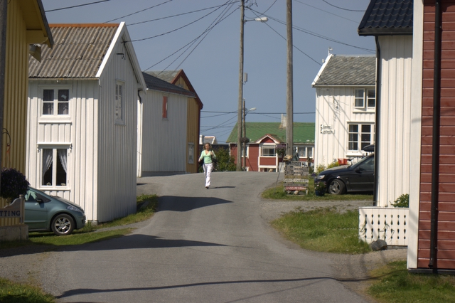
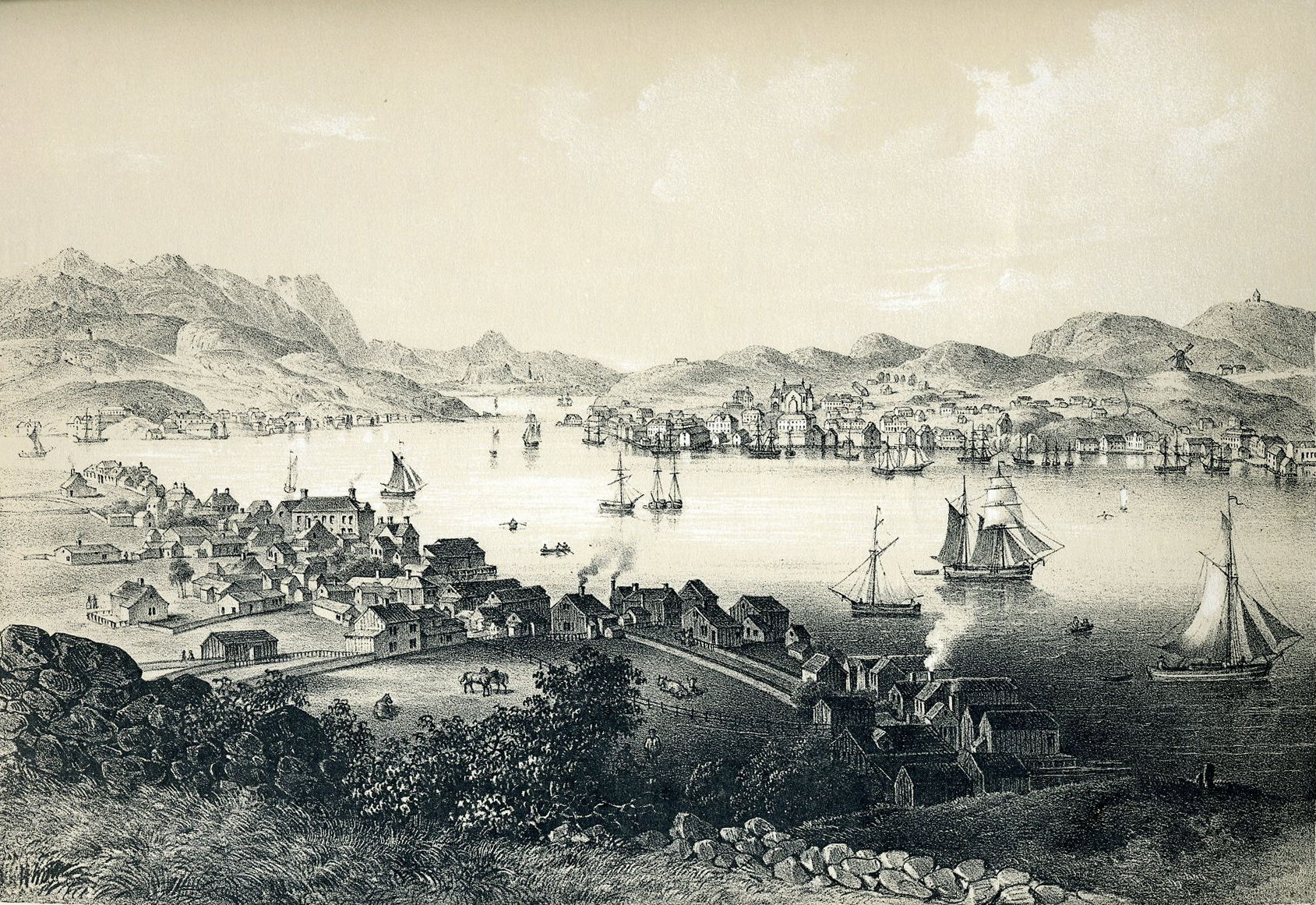
Tustna is an island in Aure Municipality in Møre og Romsdal county, Norway. The island lies in the western part of the municipality. The island of Tustna lies west of the islands of Stabblandet and Solskjelsøya; to the northeast of the islands of Frei and Nordlandet; and south of the island of Smøla. The Edøyfjorden runs along the northern shores of the island, the Vinjefjorden (and Halsafjorden) are to the south, the Freifjorden is to the southwest, the Talgsjøen is to the west, and the open Norwegian Sea is to the northwest. The island of Tustna and surrounding islands was part of the municipality of Tustna from 1 January 1874 until 1 January 2006, when it was merged into Aure Municipality. The main population centers on the island are Tømmervåg on the western coast, Leira on the northern coast, and Gullstein on the eastern coast. The island is connected to the neighboring island of Stabblandet in the east by a bridge at the village of Tustna, and there is a ferr ... [...More Info...] [...Related Items...] OR: [Wikipedia] [Google] [Baidu] |
Møre Og Romsdal
Møre og Romsdal (; en, Møre and Romsdal) is a county in the northernmost part of Western Norway. It borders the counties of Trøndelag, Innlandet, and Vestland. The county administration is located in the town of Molde, while Ålesund is the largest town. The county is governed by the Møre og Romsdal County Municipality which includes an elected county council and a county mayor. The national government is represented by the county governor. Name The name ''Møre og Romsdal'' was created in 1936. The first element refers to the districts of Nordmøre and Sunnmøre, and the last element refers to Romsdal. Until 1919, the county was called "Romsdalens amt", and from 1919 to 1935 "Møre fylke". For hundreds of years (1660-1919), the region was called ''Romsdalen amt'', after the Romsdalen valley in the present-day Rauma Municipality. The Old Norse form of the name was ''Raumsdalr''. The first element is the genitive case of the name ''Raumr'' derived from the name of the ... [...More Info...] [...Related Items...] OR: [Wikipedia] [Google] [Baidu] |
Store Norske Leksikon
The ''Great Norwegian Encyclopedia'' ( no, Store Norske Leksikon, abbreviated ''SNL''), is a Norwegian-language online encyclopedia. The online encyclopedia is among the most-read Norwegian published sites, with more than two million unique visitors per month. Paper editions 1978–2007 The ''SNL'' was created in 1978, when the two publishing houses Aschehoug and Gyldendal merged their encyclopedias and created the company Kunnskapsforlaget. Up until 1978 the two publishing houses of Aschehoug and Gyldendal, Norway's two largest, had published ' and ', respectively. The respective first editions were published in 1907–1913 (Aschehoug) and 1933–1934 (Gyldendal). The slump in sales for paper-based encyclopedias around the turn of the 21st century hit Kunnskapsforlaget hard, but a fourth edition of the paper encyclopedia was secured by a grant of ten million Norwegian kroner from the foundation Fritt Ord in 2003. The fourth edition consisted of 16 volumes, a t ... [...More Info...] [...Related Items...] OR: [Wikipedia] [Google] [Baidu] |
List Of Islands Of Norway
This is a list of islands of Norway sorted by name. For a list sorted by area, see List of islands of Norway by area. A * Alden * Aldra * Algrøy * Alsta * Altra * Anda * Andabeløya * Andørja * Andøya, Vesterålen * Andøya, Agder * Arnøy, Salten * Arnøya * Arøya * Askerøya * Askrova * Askøy * Aspøy * Aspøya * Atløy * Austra * Austvågøya * Averøya * Azero B * Barmen * Barmøya * Barøya * Bear Island (Bjørnøya) * Bergsøya, Gjemnes * Bergsøya, Herøy * Bispøyan * Bjarkøya * Bjorøy * Bjørnøya * Bjørøya * Bleiksøya * Blomøy * Bokn * Bolga * Bolsøya * Borgan * Borøya, Tvedestrand * Bouvetøya * Bragdøya * Brattøra * Bremangerlandet * Brottøya * Bru * Bulandet * Bømlo * Børøya D * Dimnøya * Dolmøya * Dryna * Dvergsøya * Dyrøya, Troms * Dyrøya, Øksnes * Dønna E * Edøya * Eika, Møre og Romsdal * Ellingsøya * Elvalandet * Engeløya * Ertvågsøya F * Fanøya * Fedje * Feøy * Finnøy * Finnøya, Møre og Romsda ... [...More Info...] [...Related Items...] OR: [Wikipedia] [Google] [Baidu] |
Old Norse
Old Norse, Old Nordic, or Old Scandinavian, is a stage of development of North Germanic languages, North Germanic dialects before their final divergence into separate Nordic languages. Old Norse was spoken by inhabitants of Scandinavia and their Viking expansion, overseas settlements and chronologically coincides with the Viking Age, the Christianization of Scandinavia and the consolidation of Scandinavian kingdoms from about the 7th to the 15th centuries. The Proto-Norse language developed into Old Norse by the 8th century, and Old Norse began to develop into the modern North Germanic languages in the mid-to-late 14th century, ending the language phase known as Old Norse. These dates, however, are not absolute, since written Old Norse is found well into the 15th century. Old Norse was divided into three dialects: Old West Norse, ''Old West Norse'' or ''Old West Nordic'' (often referred to as ''Old Norse''), Old East Norse, ''Old East Norse'' or ''Old East Nordic'', and ''Ol ... [...More Info...] [...Related Items...] OR: [Wikipedia] [Google] [Baidu] |
Smøla Municipality
Smøla is a municipality in Møre og Romsdal county, Norway. It is part of the Nordmøre region. The administrative centre of the municipality is the village of Hopen, other villages include Dyrnes, Råket, and Veiholmen. The municipality is the 272nd largest by area out of the 356 municipalities in Norway. Smøla is the 273rd most populous municipality in Norway with a population of 2,120. The municipality's population density is and its population has decreased by 2.8% over the previous 10-year period. General information The municipality of Smøla was established on 1 January 1960 after the merger of the municipalities of Edøy (population: 1,135), Brattvær (population: 1,361), and Hopen (population: 1,550). The initial population of Smøla was 4,046. The boundaries have not changed since that time. Name The municipality is named after the main island of Smøla ( non, Smyl or ). The name is probably related to the modern Norwegian words ''smule'' and ''smuldre'' whic ... [...More Info...] [...Related Items...] OR: [Wikipedia] [Google] [Baidu] |
Edøya
Edøya is an island in Smøla Municipality in Møre og Romsdal county, Norway. The island lies in the Edøyfjorden between the larger islands of Smøla (to the north) and Ertvågsøya and Tustna (to the south). The island played an important political role during the Viking Age. More recently, it was the center of the old municipality of Edøy and the historic Old Edøy Church is located on the island. In 2019, archaeologists from the Norwegian Institute for Cultural Heritage Research, using large-scale high-resolution georadar technology, determined that a 17 meter long Viking ship was buried near Edøy Church. They estimate the ship's age as over 1,000 years: from the Merovingian or Viking period; the group planned to conduct additional searches in the area. A similar burial was found previously by a NIKU team in 2018, in Gjellestad. The island has a road connection to the island of Smøla and there is a ferry connection from Edøya to Tustna to the south. This is the only ... [...More Info...] [...Related Items...] OR: [Wikipedia] [Google] [Baidu] |
Kristiansund (town)
Kristiansund (, ; historically spelled Christianssund and earlier named Fosna) is a town in Kristiansund Municipality in Møre og Romsdal county, Norway. The town is the administrative centre of the municipality. it is located on the islands of Kirkelandet, Innlandet, and Nordlandet in the Nordmøre region of the county. The town has a population (2018) of 18,292 and a population density of . Kristiansund is one of the most densely populated cities of Norway, having what is arguably the country's most urban small city centre, due to the relatively small size of the islands on which it is built and the very constricted central harbour/town area of Kirkelandet. Etymology The town, formerly spelled ''Christianssund'', was named after the Danish-Norwegian King Christian VI in 1742. The last element of the name, ''sund'', means "strait". The old name of the town/village (originally the island Kirkelandet) was ''Fosna'' or ''Fosen'' ( non, fólgsn) which means "hiding place" (her ... [...More Info...] [...Related Items...] OR: [Wikipedia] [Google] [Baidu] |
Seivika–Tømmervåg Ferry
The Seivika–Tømmervåg Ferry is a ferry service on County Road 680 across the Talgsjø channel in the Nordmøre district in the Norwegian county of Møre og Romsdal. It connects the Seivika ferry dock on the island of Nordlandet in the municipality of Kristiansund to the Tømmervåg ferry dock on the island of Tustna in the municipality of Aure. The route is operated by the transport conglomerate Fjord1. The duration of the passage is 25 minutes, and the route is served by MF ''Bjørnsund'' and MF ''Stordal'' with 32 departures per day in each direction every day. The route was served by MF ''Glutra'' from 2002 to 2010, when the vessel was damaged by a fire. In 2014 the annual average daily traffic Annual average daily traffic, abbreviated AADT, is a measure used primarily in transportation planning, transportation engineering and retail location selection. Traditionally, it is the total volume of vehicle traffic of a highway or road for a y ... was 690 vehicles and 596 ... [...More Info...] [...Related Items...] OR: [Wikipedia] [Google] [Baidu] |
Gullstein
Gullstein is a village in Aure Municipality in Møre og Romsdal county, Norway. The village is located on the eastern side of the Tustna (island), island of Tustna. The Soleimsund Bridge connects Gullstein (and the island of Tustna) to the neighboring island of Stabblandet to the east. The village was the administrative centre of the former municipality of Tustna which became part of Aure Municipality in 2006. The village is the site of Gullstein Church. References Villages in Møre og Romsdal Aure, Norway {{MøreRomsdal-geo-stub ... [...More Info...] [...Related Items...] OR: [Wikipedia] [Google] [Baidu] |
Leira, Møre Og Romsdal
Leira is a small village in the municipality of Volda, in Møre og Romsdal county, Norway. It lies between the villages of Bjørke and Viddal, at the end of Hjørundfjorden. The village is located in the Sunnmørsalpene mountains, about from the mountains Skårasalen (to the northwest), Jakta (to the northeast), Kvitegga (to the southeast), and Hornindalsrokken (to the south). There are about 15–20 residents in Leira, with most residents farming their land. Leira is fairly isolated, with only one road leading to it. The road goes from Bjørke, through a long tunnel through the mountain, ''Kamben'', before reaching Leira. The road continues along the fjord to Viddal where the road ends. The closest urban area is the village of Volda, about to the northwest of Leira. Prior to 2020, the village and surrounding area was part of the neighbouring municipality of Ørsta. Name The name is derived from the Norwegian language word ''leire'' which means 'clay Clay is a type of ... [...More Info...] [...Related Items...] OR: [Wikipedia] [Google] [Baidu] |
Tømmervåg
Tømmervåg is a village in the municipality of Aure in Møre og Romsdal county, Norway. The village is located on the western coast of the island of Tustna, about northeast of the town of Kristiansund. The village has a ferry connection (part of County Road 680) across the Talgsjø channel to the island of Nordlandet in the municipality of Kristiansund Kristiansund (, ; historically spelled Christianssund and earlier named Fosna) is a municipality on the western coast of Norway in the Nordmøre district of Møre og Romsdal county. The administrative center of the municipality is the town of .... The village of Tømmervåg is the site of the Sør-Tustna Chapel. References Villages in Møre og Romsdal Aure, Norway {{MøreRomsdal-geo-stub ... [...More Info...] [...Related Items...] OR: [Wikipedia] [Google] [Baidu] |


