|
Tropical Storm Amy (1975)
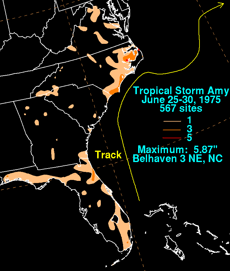
Tropical Storm Amy was the first tropical cyclone to develop during the 1975 Atlantic hurricane season. Forming on June 28 from a trough of low pressure, Amy gradually attained tropical storm status off the coast of North Carolina. A rapidly approaching trough caused Amy to turn sharply eastward before the storm took a general northeastward track. On July 2, the storm reached its peak intensity with winds of 70 mph (110 km/h) and a barometric pressure of 981 mbar (hPa; 28.97 inHg). During most of the storm's existence, Amy featured many subtropical characteristics but was not classified as such due to the proximity to land. By July 4, the system moved southeast of Newfoundland before becoming extratropical. The main effects from Amy were rough seas, reaching up to in height, that were felt from North Carolina to New Jersey, inflicting minor coastal flooding and beach erosion. On June 30, a schooner carrying four people capsized off the Nor ... [...More Info...] [...Related Items...] OR: [Wikipedia] [Google] [Baidu] |
Florida
Florida is a state located in the Southeastern region of the United States. Florida is bordered to the west by the Gulf of Mexico, to the northwest by Alabama, to the north by Georgia, to the east by the Bahamas and Atlantic Ocean, and to the south by the Straits of Florida and Cuba; it is the only state that borders both the Gulf of Mexico and the Atlantic Ocean. Spanning , Florida ranks 22nd in area among the 50 states, and with a population of over 21 million, it is the third-most populous. The state capital is Tallahassee, and the most populous city is Jacksonville. The Miami metropolitan area, with a population of almost 6.2 million, is the most populous urban area in Florida and the ninth-most populous in the United States; other urban conurbations with over one million people are Tampa Bay, Orlando, and Jacksonville. Various Native American groups have inhabited Florida for at least 14,000 years. In 1513, Spanish explorer Juan Ponce de León became the first k ... [...More Info...] [...Related Items...] OR: [Wikipedia] [Google] [Baidu] |
Wind Shear
Wind shear (or windshear), sometimes referred to as wind gradient, is a difference in wind speed and/or direction over a relatively short distance in the atmosphere. Atmospheric wind shear is normally described as either vertical or horizontal wind shear. Vertical wind shear is a change in wind speed or direction with a change in altitude. Horizontal wind shear is a change in wind speed with a change in lateral position for a given altitude. Wind shear is a microscale meteorological phenomenon occurring over a very small distance, but it can be associated with mesoscale or synoptic scale weather features such as squall lines and cold fronts. It is commonly observed near microbursts and downbursts caused by thunderstorms, fronts, areas of locally higher low-level winds referred to as low-level jets, near mountains, radiation inversions that occur due to clear skies and calm winds, buildings, wind turbines, and sailboats. Wind shear has significant effects on the control of a ... [...More Info...] [...Related Items...] OR: [Wikipedia] [Google] [Baidu] |
Atlantic Tropical Storms
The Atlantic Ocean is the second-largest of the world's five oceans, with an area of about . It covers approximately 20% of Earth's surface and about 29% of its water surface area. It is known to separate the " Old World" of Africa, Europe and Asia from the "New World" of the Americas in the European perception of the World. The Atlantic Ocean occupies an elongated, S-shaped basin extending longitudinally between Europe and Africa to the east, and North and South America to the west. As one component of the interconnected World Ocean, it is connected in the north to the Arctic Ocean, to the Pacific Ocean in the southwest, the Indian Ocean in the southeast, and the Southern Ocean in the south (other definitions describe the Atlantic as extending southward to Antarctica). The Atlantic Ocean is divided in two parts, by the Equatorial Counter Current, with the North(ern) Atlantic Ocean and the South(ern) Atlantic Ocean split at about 8°N. Scientific explorations of the Atlantic ... [...More Info...] [...Related Items...] OR: [Wikipedia] [Google] [Baidu] |
Cape Hatteras, North Carolina
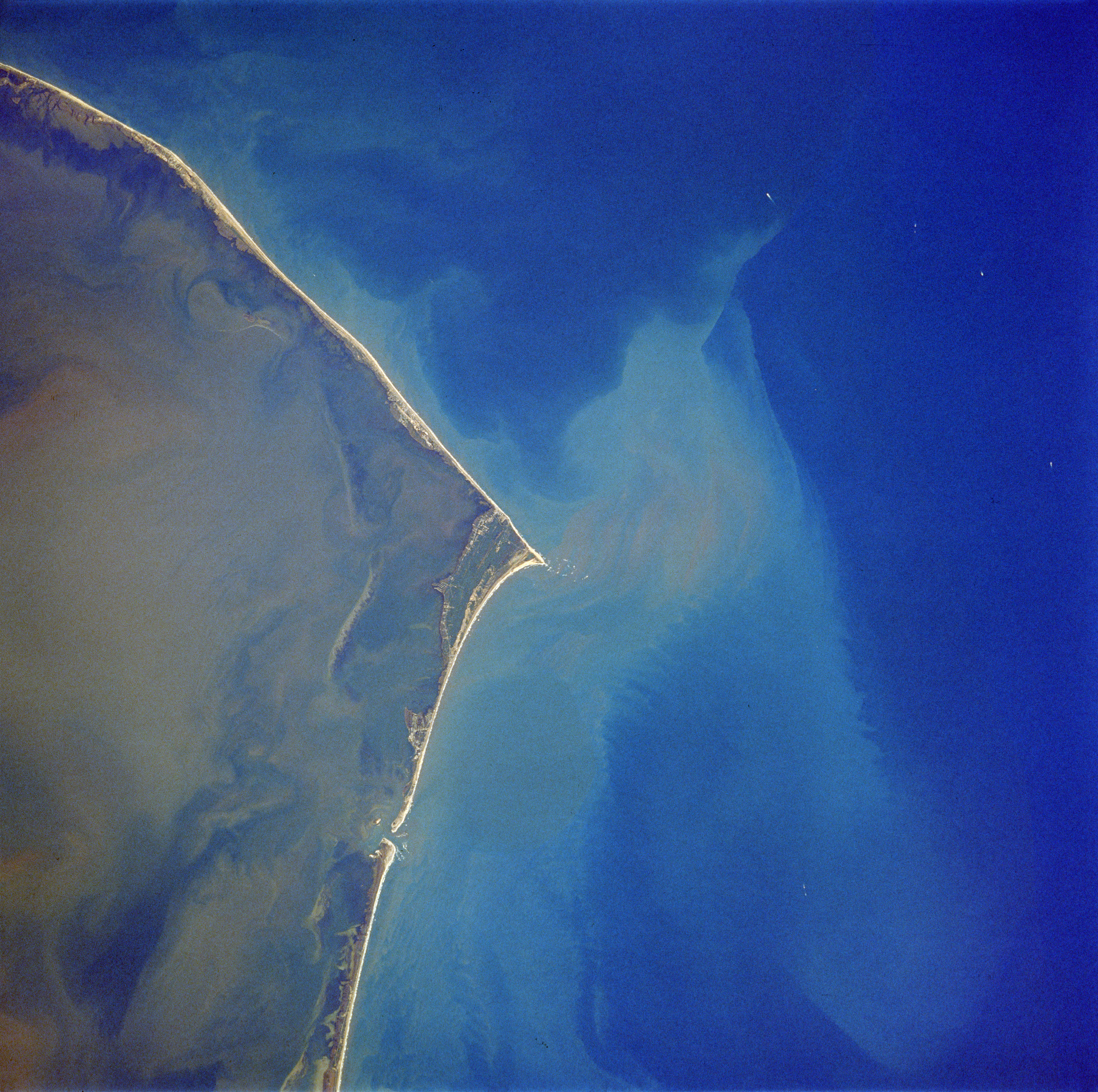
Cape Hatteras is a cape located at a pronounced bend in Hatteras Island, one of the barrier islands of North Carolina. Long stretches of beach, sand dunes, marshes, and maritime forests create a unique environment where wind and waves shape the topography. A large area of the Outer Banks is part of a National Park, called the Cape Hatteras National Seashore. It is also the nearest landmass on the North American mainland to Bermuda, which is about to the east-southeast. The treacherous waters off the coast of the Outer Banks are known as the Graveyard of the Atlantic, Over 600 ships wrecked here as victims of shallow shoals, storms, and war. Diamond Shoals, a bank of shifting sand ridges hidden beneath the turbulent sea off Cape Hatteras, has never promised safe passage for ships. In the past 400 years, the graveyard has claimed many lives, but island villagers saved many. As early as the 1870s, villagers served in the United States Life-Saving Service. Others staffed lightho ... [...More Info...] [...Related Items...] OR: [Wikipedia] [Google] [Baidu] |
Belhaven, North Carolina
Belhaven is a waterfront town in Beaufort County, North Carolina, Beaufort County, North Carolina, United States. The population was 1,688 at the 2010 United States Census, 2010 Census. Belhaven is located in North Carolina's Inner Banks region. History The Belhaven City Hall was listed on the National Register of Historic Places in 1981. Healthcare The community formerly had a hospital, Pungo District Hospital, which opened in 1949. Pantego Creek LLC, the operator, asked for a third party to acquire the hospital as the operator could not pay for the care of the large number of Medicaid and Medicare (United States), Medicare patients using the hospital. In 2011 Vidant Health acquired the hospital; in 2013 Vidant stated that it was unable to keep the hospital in operation due to poor finances and announced that it was going to close the hospital. Pantego Creek Board closed it in 2014, and it was demolished in 2016. Vidant opened a non-emergency clinic in the area. Geography Belhave ... [...More Info...] [...Related Items...] OR: [Wikipedia] [Google] [Baidu] |
Squall Line
A squall line, or more accurately a quasi-linear convective system (QLCS), is a line of thunderstorms, often forming along or ahead of a cold front. In the early 20th century, the term was used as a synonym for cold front (which often are accompanied by abrupt and gusty wind shifts). Linear thunderstorm structures often contain heavy precipitation, hail, frequent lightning, strong straight-line winds, and occasionally tornadoes or waterspouts. Particularly strong straight-line winds can occur where the linear structure forms into the shape of a bow echo. Tornadoes can occur along waves within a line echo wave pattern (LEWP), where mesoscale low-pressure areas are present. Some bow echoes can grow to become derechos as they move swiftly across a large area. On the back edge of the rainband associated with mature squall lines, a wake low can be present, on very rare occasions associated with a heat burst. Theory Polar front theory was developed by Jacob Bjerknes, derived from a dens ... [...More Info...] [...Related Items...] OR: [Wikipedia] [Google] [Baidu] |
Funnel Cloud
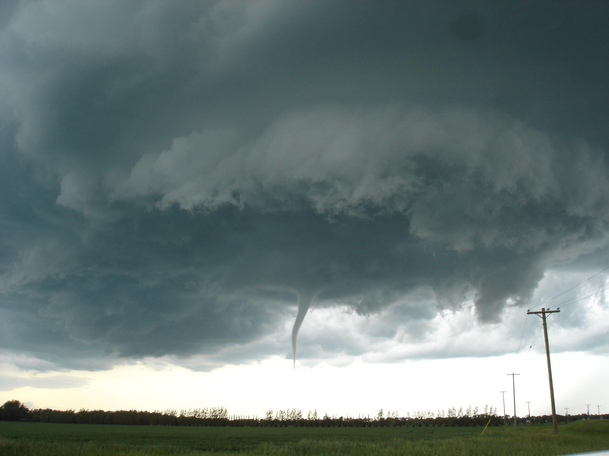
A funnel cloud is a funnel-shaped cloud of condensed water droplets, associated with a rotating column of wind and extending from the base of a cloud (usually a cumulonimbus or towering cumulus cloud) but not reaching the ground or a water surface. A funnel cloud is usually visible as a cone-shaped or needle like protuberance from the main cloud base. Funnel clouds form most frequently in association with supercell thunderstorms, and are often, but not always, a visual precursor to tornadoes. Funnel clouds are visual phenomena, these are not the vortex of wind itself. "Classic" funnel clouds If a funnel cloud touches the surface the feature is considered a tornado, although ground level circulations begin before the visible condensation cloud appears. Most tornadoes begin as funnel clouds, but some funnel clouds do not make surface contact and these cannot be counted as tornadoes from the perspective of a naked eye observer, even as tornadic circulations of some intensity alm ... [...More Info...] [...Related Items...] OR: [Wikipedia] [Google] [Baidu] |
Hampton, Virginia
Hampton () is an independent city (United States), independent city in the Commonwealth (U.S. state), Commonwealth of Virginia in the United States. As of the 2020 United States Census, 2020 census, the population was 137,148. It is the List of cities in Virginia, 7th most populous city in Virginia and List of United States cities by population, 204th most populous city in the nation. Hampton is included in the Hampton Roads United States metropolitan area, Metropolitan Statistical Area (officially known as the Virginia Beach–Norfolk–Newport News, VA–NC MSA) which is the List of United States metropolitan statistical areas by population, 37th largest in the United States, with a total population of 1,799,674 (2020). This area, known as "America's First Region", also includes the independent cities of Chesapeake, Virginia, Chesapeake, Virginia Beach, Virginia, Virginia Beach, Newport News, Virginia, Newport News, Norfolk, Virginia, Norfolk, Portsmouth, Virginia, Portsmou ... [...More Info...] [...Related Items...] OR: [Wikipedia] [Google] [Baidu] |
Newfoundland (island)
Newfoundland (, ; french: link=no, Terre-Neuve, ; ) is a large island off the east coast of the North American mainland and the most populous part of the Canadian province of Newfoundland and Labrador. It has 29 percent of the province's land area. The island is separated from the Labrador Peninsula by the Strait of Belle Isle and from Cape Breton Island by the Cabot Strait. It blocks the mouth of the Saint Lawrence River, creating the Gulf of Saint Lawrence, the world's largest estuary. Newfoundland's nearest neighbour is the French overseas collectivity of Saint Pierre and Miquelon. With an area of , Newfoundland is the world's 16th-largest island, Canada's fourth-largest island, and the largest Canadian island outside the North. The provincial capital, St. John's, is located on the southeastern coast of the island; Cape Spear, just south of the capital, is the easternmost point of North America, excluding Greenland. It is common to consider all directly neighbouring i ... [...More Info...] [...Related Items...] OR: [Wikipedia] [Google] [Baidu] |
Amy 1975 Rainfall
Amy is a female given name, sometimes short for Amanda, Amelia, Amélie, or Amita. In French, the name is spelled ''"Aimée"''. People A–E * Amy Acker (born 1976), American actress * Amy Vera Ackman, also known as Mother Giovanni (1886–1966), Australian hospital administrator * Amy Adams (born 1974), American actress * Amy Alcott (born 1956) – American Hall of Fame golfer * Amy Archer-Gilligan, (1873–1962), American serial killer * Amy Beach (1867–1944), American composer and pianist * Amy Birnbaum (born 1975), American voice actress * Amy Bishop (born 1965), American professor and mass shooter * Amy Braverman, American statistician * Amy Brenneman (born 1964), American actress * Amy Bruckner (born 1991), American actress and singer * Amy Callaghan (born 1992), British politician * Amy Carmichael (1867–1951), British missionary to India * Amy Castle (born 1990), American actress and internet personality * Amy Cimorelli (born 1995), American singer * Amy Carter ... [...More Info...] [...Related Items...] OR: [Wikipedia] [Google] [Baidu] |
Extratropical Cyclone
Extratropical cyclones, sometimes called mid-latitude cyclones or wave cyclones, are low-pressure areas which, along with the anticyclones of high-pressure areas, drive the weather over much of the Earth. Extratropical cyclones are capable of producing anything from cloudiness and mild showers to severe gales, thunderstorms, blizzards, and tornadoes. These types of cyclones are defined as large scale (synoptic) low pressure weather systems that occur in the middle latitudes of the Earth. In contrast with tropical cyclones, extratropical cyclones produce rapid changes in temperature and dew point along broad lines, called weather fronts, about the center of the cyclone. Terminology The term " cyclone" applies to numerous types of low pressure areas, one of which is the extratropical cyclone. The descriptor ''extratropical'' signifies that this type of cyclone generally occurs outside the tropics and in the middle latitudes of Earth between 30° and 60° latitude. They are term ... [...More Info...] [...Related Items...] OR: [Wikipedia] [Google] [Baidu] |
Cape Race, Newfoundland
Cape Race is a point of land located at the southeastern tip of the Avalon Peninsula on the island of Newfoundland, in Newfoundland and Labrador, Canada. Its name is thought to come from the original Portuguese name for this cape, "Raso", meaning flat or low-lying. The Cape appeared on early sixteenth century maps as Cabo Raso and its name may derive from a cape of the same name at the mouth of the Tagus River in Portugal. The cape was the location of the Cape Race LORAN-C transmitter until the system was decommissioned in 2010. It is also home to the Cape Race Lighthouse, notable for having received the distress call from the RMS ''Titanic''. Geography Dense fog, rocky coasts, and its proximity to trans-Atlantic shipping routes have resulted in many shipwrecks near Cape Race over the years. One of the most famous was the . Cape Race is a flat, barren point of land jutting out into the Atlantic Ocean, its cliffs rising almost vertically to above sea level. On average it is ... [...More Info...] [...Related Items...] OR: [Wikipedia] [Google] [Baidu] |


