|
Tromsø Satellite Station
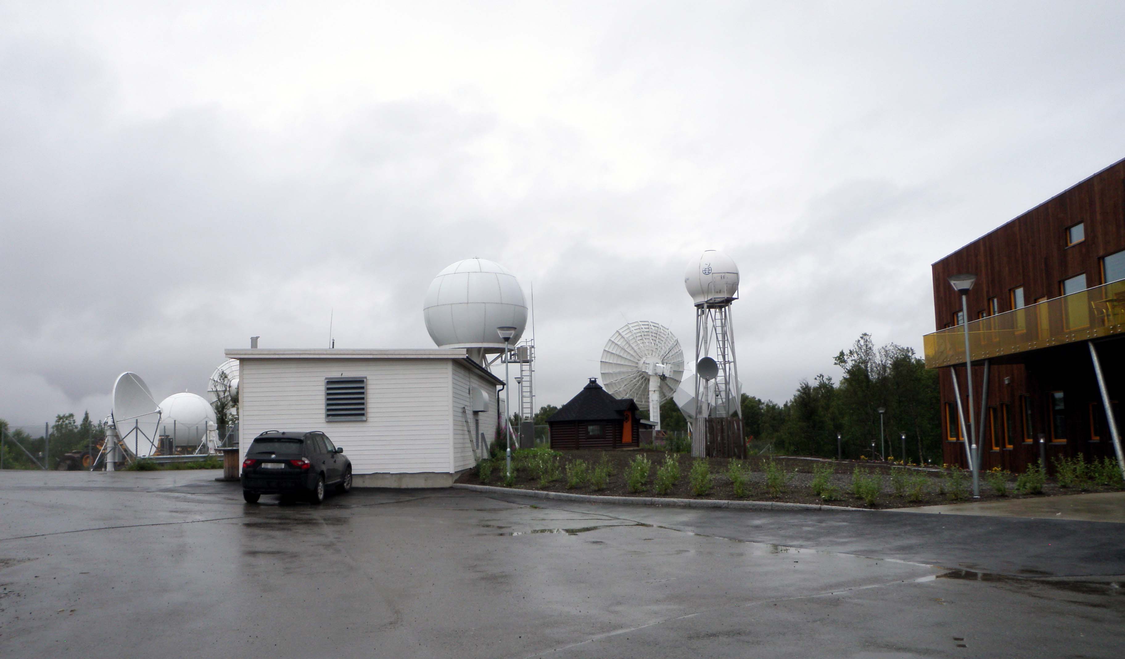
Tromsø Satellite Station ( no, Tromsø Satellittstasjon, TSS), until 1988 known as Tromsø Telemetry Station ( no, Tromsø telemetristasjon), is a satellite earth station located in Tromsø, Norway. The facility is owned by Kongsberg Satellite Services (KSAT), a joint venture between the Kongsberg Group and the Norwegian Space Centre (NSC). In addition to hosting its own antennas serving thirty satellites, TSS acts as the center-point of KSAT's operations and provides backbone services for the high Arctic Svalbard Satellite Station (SvalSat) and the Antarctic Troll Satellite Station (TrollSat). Originally proposed in 1965, the station was established by the Royal Norwegian Council for Scientific and Industrial Research (NTNF) in 1967 in close cooperation with the Norwegian Defence Research Establishment (NDRE) and located adjacent to Tromsø Geophysical Observatory. From its inception until 1974, it served low-Earth-orbit (LEO) satellites operated by the European Space Resea ... [...More Info...] [...Related Items...] OR: [Wikipedia] [Google] [Baidu] |
Tromsø Satellite Station 2013
Tromsø (, , ; se, Romsa ; fkv, Tromssa; sv, Tromsö) is a List of municipalities of Norway, municipality in Troms og Finnmark county, Norway. The administrative centre of the municipality is the Tromsø (city), city of Tromsø. Tromsø lies in Northern Norway. The municipality is the 21st largest by area out of the 356 municipalities in Norway. With a population of 77,544, Tromsø is the 12th most populous municipality in Norway. The municipality's population density is and its population has increased by 12.2% over the previous 10-year period. It is the largest urban area in Northern Norway and the third largest north of the Arctic Circle anywhere in the world (following Murmansk and Norilsk). The city center of Tromsø is located on the island of Tromsøya, but the urban area also encompasses part of the nearby mainland and part of the island Kvaløya. Tromsø is north of the Arctic Circle. Tromsøya is connected to the mainland by the Tromsø Bridge and the Tromsøysun ... [...More Info...] [...Related Items...] OR: [Wikipedia] [Google] [Baidu] |
Landsat Program
The Landsat program is the longest-running enterprise for acquisition of satellite imagery of Earth. It is a joint NASA / United States Geological Survey, USGS program. On 23 July 1972, the Landsat 1, Earth Resources Technology Satellite was launched. This was eventually renamed to Landsat 1 in 1975. The most recent, Landsat 9, was launched on 27 September 2021. The instruments on the Landsat satellites have acquired millions of images. The images, archived in the United States and at Landsat receiving stations around the world, are a unique resource for global change research and applications in agriculture, cartography, geology, forestry, regional planning, surveillance and education, and can be viewed through the U.S. Geological Survey (USGS) "EarthExplorer" website. Landsat 7 data has eight spectral bands with Image resolution#Spatial resolution, spatial resolutions ranging from ; the temporal resolution is 16 days. Landsat images are usually divided into scenes for easy do ... [...More Info...] [...Related Items...] OR: [Wikipedia] [Google] [Baidu] |
Parliament Of Norway
The Storting ( no, Stortinget ) (lit. the Great Thing) is the supreme legislature of Norway, established in 1814 by the Constitution of Norway. It is located in Oslo. The unicameral parliament has 169 members and is elected every four years based on party-list proportional representation in nineteen multi-seat constituencies. A member of Stortinget is known in Norwegian as a ''stortingsrepresentant'', literally "Storting representative". The assembly is led by a president and, since 2009, five vice presidents: the presidium. The members are allocated to twelve standing committees as well as four procedural committees. Three ombudsmen are directly subordinate to parliament: the Parliamentary Intelligence Oversight Committee and the Office of the Auditor General. Parliamentarianism was established in 1884, with the Storting operating a form of "qualified unicameralism", in which it divided its membership into two internal chambers making Norway a de facto bicameral parliament ... [...More Info...] [...Related Items...] OR: [Wikipedia] [Google] [Baidu] |
Ny-Ålesund
Ny-Ålesund ("New Ålesund") is a small town in Oscar II Land on the island of Spitsbergen in Svalbard, Norway. It is situated on the Brøgger peninsula ( Brøggerhalvøya) and on the shore of the bay of Kongsfjorden. The company town is owned and operated by Kings Bay, which provides facilities for permanent research activities by 19 institutions from 11 countries. The town is ultimately owned by the Ministry of Climate and Environment and is not incorporated (i.e. is not recognised as a town by the Norwegian government). Ny-Ålesund has an all-year permanent population of 30 to 35, with the summer population reaching 114. Its facilities include Ny-Ålesund Airport, Hamnerabben, Svalbard Rocket Range, a port and Ny-Ålesund Town and Mine Museum, as well as a number of buildings dedicated to research and environmental monitoring activities. It is the northernmost functional civilian settlement in the world. The town was founded in 1917 by Peter Brandal and his mining company, Ki ... [...More Info...] [...Related Items...] OR: [Wikipedia] [Google] [Baidu] |
Kongsfjord Telemetry Station
Kongsfjord Telemetry Station ( no, Kongsfjord telemetristasjon) was a satellite ground station located nearby Ny-Ålesund in Svalbard, Norway. It was used between 1967 and 1974 as one of the four initial ground stations which were part of the European Space Tracking Network (ESTRACK) serving the European Space Research Organization's (ESRO) first generation of satellites. The station provided radio tracking, telemetry and commanding services as well as data download. Although owned by ESRO, the facilities were constructed and operated by the Royal Norwegian Council for Scientific and Industrial Research (NTNF). Plans for the station's construction started in the early 1960s and negotiations between ESRO and Norwegian authorities started in 1964, despite Norway's lack of membership in ESRO. An initial disagreement of whether to locate the facility by Ny-Ålesund or Longyearbyen was overcome, and an agreement was signed on 14 December 1964. However, it was followed up by numerous ... [...More Info...] [...Related Items...] OR: [Wikipedia] [Google] [Baidu] |
ISIS (satellite)
ISIS 1 and 2 ("International Satellites for Ionospheric Studies") were the third and fourth in a series of Canadian satellites launched to study the ionosphere over one complete solar cycle. After the success of Canada's Alouette 1, Canada and the United States jointly sent up three more satellites in the ISIS program. The first was named Alouette 2 (after originally being named ISIS-X). As was the case for the Alouette satellites, RCA Ltd. of Montreal was the prime contractor for both ISIS 1 and 2. A third satellite, ISIS 3, was scheduled for construction, but when the government's focus shifted towards communications satellites, it was cancelled in 1969. The funds were instead used to produce the Communications Technology Satellite (also known as Hermes), which was launched in 1976. ISIS 1 ISIS 1 (1969-009A) was launched at 6h43 UTC on January 30, 1969 by a Delta rocket at the Western test range at Vandenberg AFB in California. Unlike the Alouette satellites, the ISIS ha ... [...More Info...] [...Related Items...] OR: [Wikipedia] [Google] [Baidu] |
Alouette 2
Alouette 2 was a Canadian research satellite launched at 04:48 UTC on November 29, 1965, by a Thor Agena rocket with Explorer 31 from the Western test range at Vandenberg AFB in California. It was (like its predecessor Alouette 1, and Explorer 31) designed to explore the ionosphere. History The name "Alouette" came from the French for "skylark" and from the title of a popular French-Canadian folk song. Alouette 2 was also known as ISIS-X since it was the first in a series of ISIS satellites: International Satellites for Ionospheric Studies. The next one was called ISIS-I. The Alouette 2 was built up from the identical backup satellite to Alouette 1. It had many more experiments and more sophisticated support systems than the earlier satellite. It lasted for 10 years, being terminated on August 1, 1975. RCA Victor of Montreal, Quebec, was the prime contractor; Havilland Aircraft of Toronto, Ontario, served as associate contractor. Post mission After the ''Alouette 2'' ... [...More Info...] [...Related Items...] OR: [Wikipedia] [Google] [Baidu] |
University Of Tromsø
The University of Tromsø – The Arctic University of Norway (Norwegian: ''Universitetet i Tromsø – Norges arktiske universitet''; Northern Sami: ''Romssa universitehta – Norgga árktalaš universitehta'') is a state university in Norway and the world's northernmost university. Located in the city of Tromsø, Norway, it was established by an act of parliament in 1968, and opened in 1972. It is one of ten universities in Norway. The University of Tromsø is the largest research and educational institution in Northern Norway and the sixth-largest university in Norway. The university's location makes it a natural venue for the development of studies of the region's natural environment, culture, and society. The main focus of the university's activities is on auroral light research, space science, fishery science, biotechnology, linguistics, multicultural societies, Saami culture, telemedicine, epidemiology and a wide spectrum of Arctic research projects. The close vicinity ... [...More Info...] [...Related Items...] OR: [Wikipedia] [Google] [Baidu] |
Sounding Rocket
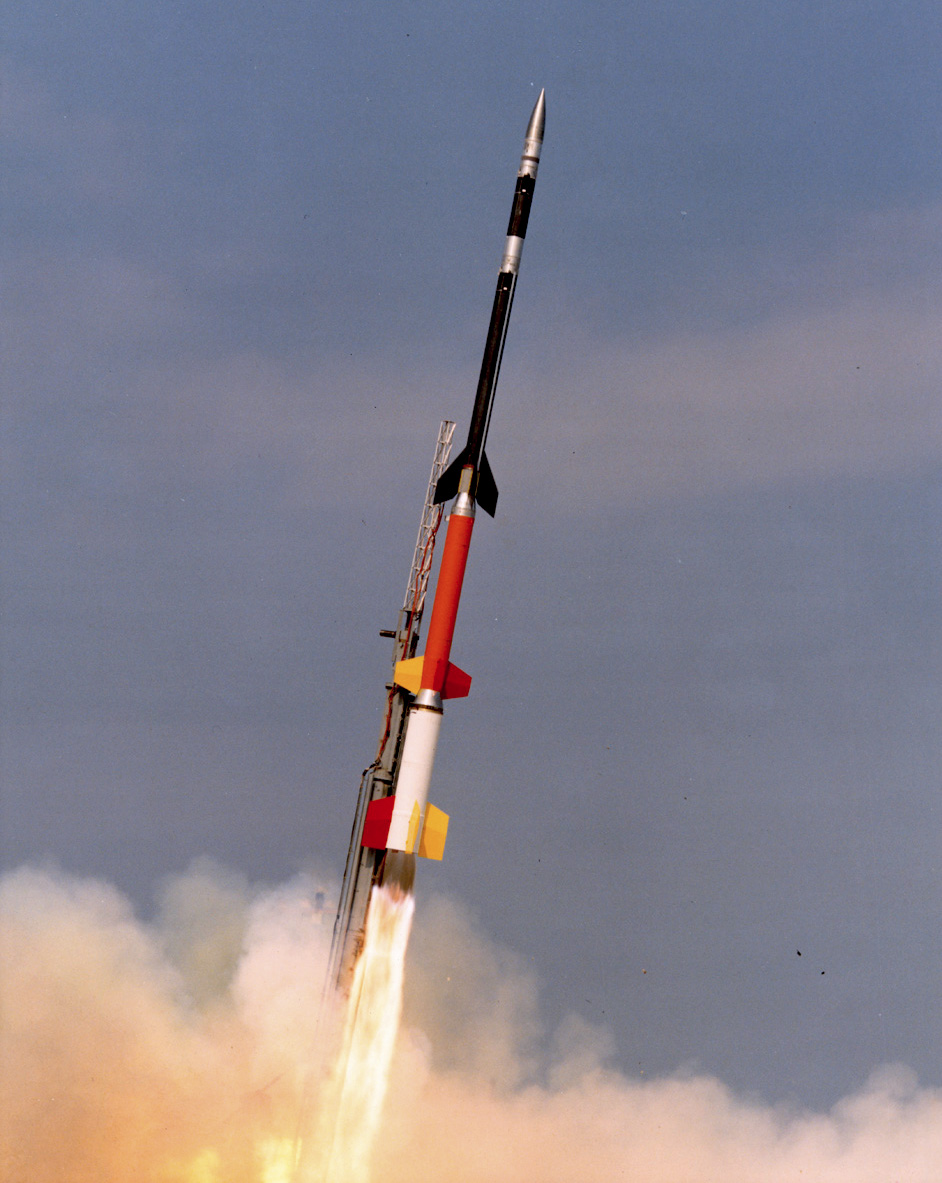
A sounding rocket or rocketsonde, sometimes called a research rocket or a suborbital rocket, is an instrument-carrying rocket designed to take measurements and perform scientific experiments during its sub-orbital flight. The rockets are used to launch instruments from 48 to 145 km (30 to 90 miles) above the surface of the Earth, the altitude generally between weather balloons and satellites; the maximum altitude for balloons is about 40 km (25 miles) and the minimum for satellites is approximately 121 km (75 miles). Certain sounding rockets have an apogee between 1,000 and 1,500 km (620 and 930 miles), such as the Black Brant X and XII, which is the maximum apogee of their class. Sounding rockets often use military surplus rocket motors. NASA routinely flies the Terrier Mk 70 boosted Improved Orion, lifting 270–450-kg (600–1,000-pound) payloads into the exoatmospheric region between 97 and 201 km (60 and 125 miles). Etymology The origin of the term ... [...More Info...] [...Related Items...] OR: [Wikipedia] [Google] [Baidu] |
Ionosphere
The ionosphere () is the ionized part of the upper atmosphere of Earth, from about to above sea level, a region that includes the thermosphere and parts of the mesosphere and exosphere. The ionosphere is ionized by solar radiation. It plays an important role in atmospheric electricity and forms the inner edge of the magnetosphere. It has practical importance because, among other functions, it influences radio propagation to distant places on Earth. History of discovery As early as 1839, the German mathematician and physicist Carl Friedrich Gauss postulated that an electrically conducting region of the atmosphere could account for observed variations of Earth's magnetic field. Sixty years later, Guglielmo Marconi received the first trans-Atlantic radio signal on December 12, 1901, in St. John's, Newfoundland (now in Canada) using a kite-supported antenna for reception. The transmitting station in Poldhu, Cornwall, used a spark-gap transmitter to produce a signal with a freq ... [...More Info...] [...Related Items...] OR: [Wikipedia] [Google] [Baidu] |
Real-time Data
Real-time data (RTD) is information that is delivered immediately after collection. There is no delay in the timeliness of the information provided. Real-time data is often used for navigation or tracking. Such data is usually processed using real-time computing although it can also be stored for later or off-line data analysis. Real-time data is not the same as dynamic data. Real-time data can be dynamic (e.g. a variable indicating current location) or static (e.g. a fresh log entry indicating location at a specific time). In economics Real-time economic data, and other official statistics, are often based on preliminary estimates, and therefore are frequently adjusted as better estimates become available. These later adjusted data are called "revised data". The terms real-time economic data and real-time economic analysis were coined by Francis X. Diebold and Glenn D. Rudebusch. Macroeconomist Glenn D. Rudebusch defined real-time analysis as 'the use of sequential information se ... [...More Info...] [...Related Items...] OR: [Wikipedia] [Google] [Baidu] |


.jpg)
_2.jpg)
