|
Triveni Sangam
In Hindu tradition, Triveni Sangam is the confluence (Sanskrit: ''sangama'') of three rivers that is also a sacred place, with a bath here said to flush away all of one's sins and free one from the cycle of rebirth. Triveni Sangam in Allahabad Triveni Sangam is the confluence of the Ganges (Ganga), the Yamuna, and the mythical Saraswati River. Triveni Sangam is located at Prayag – the area of Allahabad neighbouring the confluence; for this reason, the confluence is also sometimes referred to as Prayag. At Triveni Sangam, the Ganges and the Yamuna can be identified by their different colours – the water of the Ganges is clear while that of the Yamuna is greenish in colour. The third river, the mythical Saraswati, is called invisible. The auspiciousness of the confluence of two rivers is referred to in the ''Rigveda'', which says, "Those who bathe at the place where the two rivers, white and dark, flow together, rise up to heaven." A place of religious importance a ... [...More Info...] [...Related Items...] OR: [Wikipedia] [Google] [Baidu] |
Allahabad
Allahabad (), officially known as Prayagraj, also known as Ilahabad, is a metropolis in the Indian state of Uttar Pradesh.The other five cities were: Agra, Kanpur (Cawnpore), Lucknow, Meerut, and Varanasi (Benares). It is the administrative headquarters of the Allahabad district—the most populous district in the state and 13th most populous district in India—and the Allahabad division. The city is the judicial capital of Uttar Pradesh with the Allahabad High Court being the highest judicial body in the state. Allahabad is the seventh most populous city in the state, thirteenth in Northern India and thirty-sixth in India, with an estimated population of 1.53 million in the city. In 2011, it was ranked the world's 40th fastest-growing city. Allahabad, in 2016, was also ranked the third most liveable urban agglomeration in the state (after Noida and Lucknow) and sixteenth in the country. Hindi is the most widely spoken language in the city. Allahabad lies close t ... [...More Info...] [...Related Items...] OR: [Wikipedia] [Google] [Baidu] |
Kabini
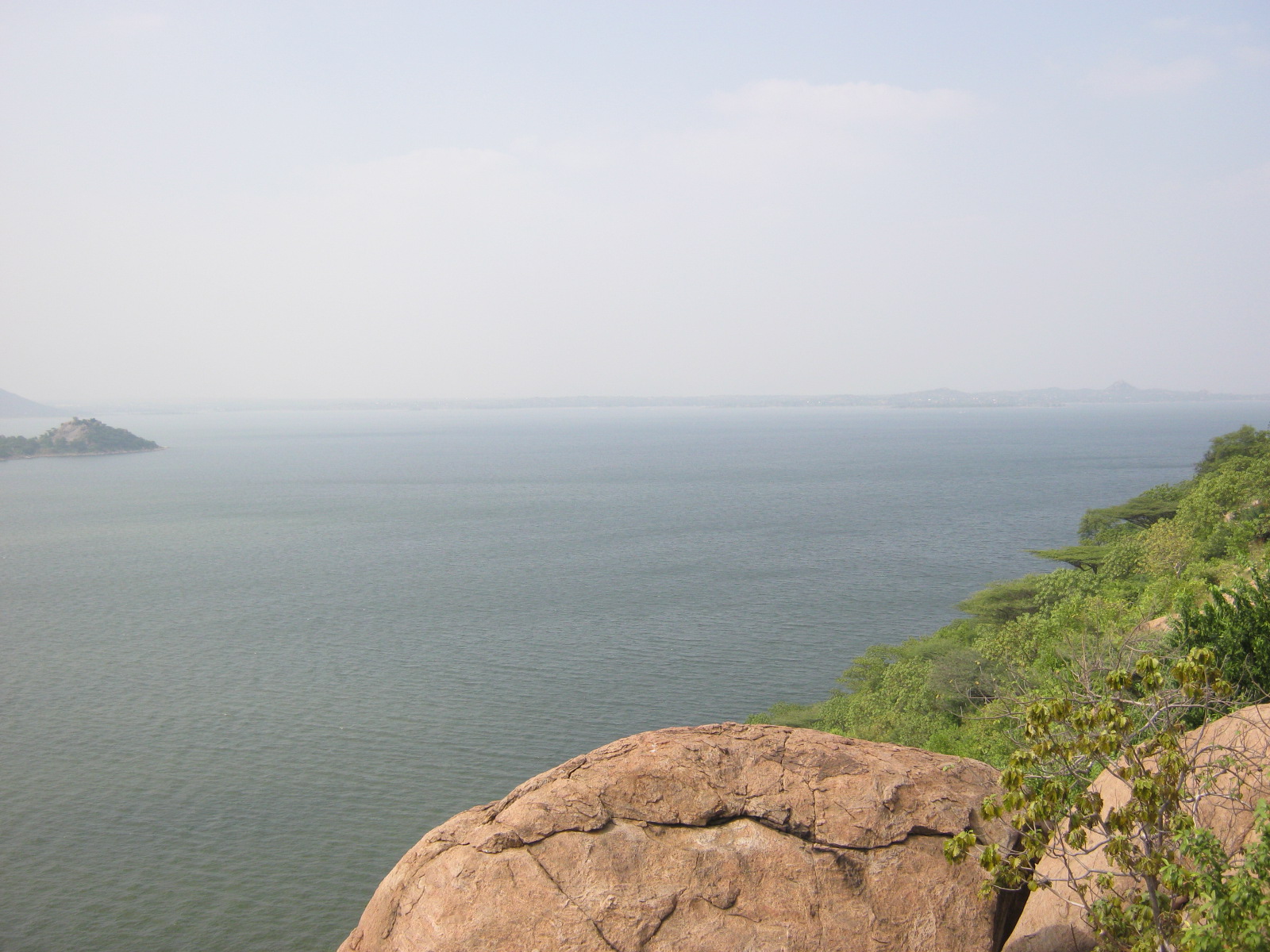
The Kabini River is one of the major tributaries of the river Cauvery in southern India. It originates near Kavilumpara in Kozhikode district of Kerala state by the confluence of the Panamaram River and the Mananthavady River. It flows eastward through Wayanad district, entering Mysore district of Karnataka, to join the Kaveri River in Mysore district of Karnataka Close to the town of Sargur it forms the huge Kabini Reservoir. The backwaters of the Kabini reservoir are very rich in wildlife especially in summer when the water level recedes to form rich grassy meadows. The Kabini dam is in length with an original gross storage of 19.52 tmcft. The Kabini Dam is situated between villages Bichanahalli and Bidarahalli having distance of 6 km away from Sargur town in Heggadadevana kote taluk, Mysore district, Karnataka. Wildlife The Kabini Forest Reserve is one of the most popular wildlife destinations of Karnataka, probably because of its accessibility, lush gree ... [...More Info...] [...Related Items...] OR: [Wikipedia] [Google] [Baidu] |
India
India, officially the Republic of India ( Hindi: ), is a country in South Asia. It is the seventh-largest country by area, the second-most populous country, and the most populous democracy in the world. Bounded by the Indian Ocean on the south, the Arabian Sea on the southwest, and the Bay of Bengal on the southeast, it shares land borders with Pakistan to the west; China, Nepal, and Bhutan to the north; and Bangladesh and Myanmar to the east. In the Indian Ocean, India is in the vicinity of Sri Lanka and the Maldives; its Andaman and Nicobar Islands share a maritime border with Thailand, Myanmar, and Indonesia. Modern humans arrived on the Indian subcontinent from Africa no later than 55,000 years ago., "Y-Chromosome and Mt-DNA data support the colonization of South Asia by modern humans originating in Africa. ... Coalescence dates for most non-European populations average to between 73–55 ka.", "Modern human beings—''Homo sapiens''—originated in Africa. Th ... [...More Info...] [...Related Items...] OR: [Wikipedia] [Google] [Baidu] |
Mysore District
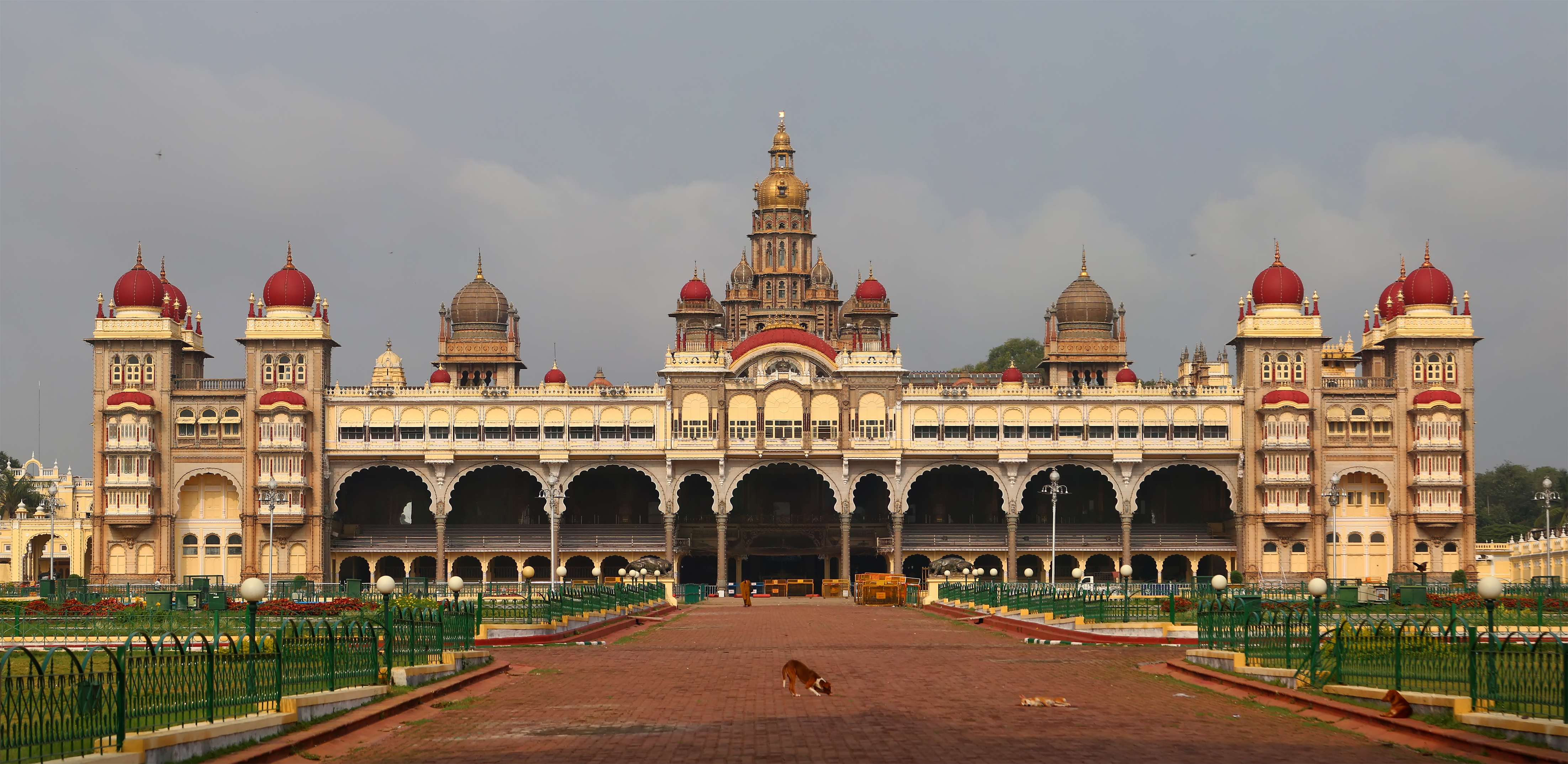
Mysore district, officially Mysuru district is an administrative district located in the southern part of the state of Karnataka, India. It is the administrative headquarters of Mysore division. Chamarajanagar District was carved out of the original larger Mysore District in the year 1998. The district is bounded by Chamrajanagar district to the southeast, Mandya district to the east and northeast, Kerala state to the south, Kodagu district to the west, and Hassan district to the north. This district has a prominent place in the history of Karnataka; Mysore was ruled by the Wodeyars from the year 1399 till the independence of India in the year 1947. It features many tourist destinations, from Mysore Palace to Nagarhole National Park. It is the third-most populous district in Karnataka (out of 31), after Bangalore Urban. Etymology Mysore district gets its name from the city of Mysore which is also the headquarters of the district. The original name of this city was M ... [...More Info...] [...Related Items...] OR: [Wikipedia] [Google] [Baidu] |
Panchayat Town
A nagar panchayat (town panchayat; ) or Notified Area Council (NAC) in India is a settlement in transition from rural to urban and therefore a form of an urban political unit comparable to a municipality. An urban centre with more than 12,000 and less than 40,000 inhabitants is classified as a nagar panchayat. Such councils are formed under the panchayati raj administrative system. In census data, the abbreviation T.P. is used to indicate a "town panchayat". Tamil Nadu was the first state to introduce the panchayat town as an intermediate step between rural villages and urban local bodies (ULB). The structure and the functions of the nagar panchayat are decided by the state government. Management Each nagar panchayat has a committee consisting of a chairman with ward members. Membership consists of a minimum of ten elected ward members and three nominated members. The NAC members of the Nagar are elected from the several wards of the nagar panchayat on the basis of adult fra ... [...More Info...] [...Related Items...] OR: [Wikipedia] [Google] [Baidu] |
Kannada
Kannada (; ಕನ್ನಡ, ), originally romanised Canarese, is a Dravidian language spoken predominantly by the people of Karnataka in southwestern India, with minorities in all neighbouring states. It has around 47 million native speakers, and was additionally a second or third language for around 13 million non-native speakers in Karnataka. Kannada was the court language of some of the most powerful dynasties of south and central India, namely the Kadambas, Chalukyas, Rashtrakutas, Yadava Dynasty or Seunas, Western Ganga dynasty, Wodeyars of Mysore, Nayakas of Keladi Hoysalas and the Vijayanagara empire. The official and administrative language of the state of Karnataka, it also has scheduled status in India and has been included among the country's designated classical languages.Kuiper (2011), p. 74R Zydenbos in Cushman S, Cavanagh C, Ramazani J, Rouzer P, ''The Princeton Encyclopedia of Poetry and Poetics: Fourth Edition'', p. 767, Princeton Un ... [...More Info...] [...Related Items...] OR: [Wikipedia] [Google] [Baidu] |
Karnataka
Karnataka (; ISO: , , also known as Karunāḍu) is a state in the southwestern region of India. It was formed on 1 November 1956, with the passage of the States Reorganisation Act. Originally known as Mysore State , it was renamed ''Karnataka'' in 1973. The state corresponds to the Carnatic region. Its capital and largest city is Bengaluru. Karnataka is bordered by the Lakshadweep Sea to the west, Goa to the northwest, Maharashtra to the north, Telangana to the northeast, Andhra Pradesh to the east, Tamil Nadu to the southeast, and Kerala to the southwest. It is the only southern state to have land borders with all of the other four southern Indian sister states. The state covers an area of , or 5.83 percent of the total geographical area of India. It is the sixth-largest Indian state by area. With 61,130,704 inhabitants at the 2011 census, Karnataka is the eighth-largest state by population, comprising 31 districts. Kannada, one of the classical languages of In ... [...More Info...] [...Related Items...] OR: [Wikipedia] [Google] [Baidu] |
Kodagu
Kodagu (also known by its former name Coorg) is an administrative district in the Karnataka state of India. Before 1956, it was an administratively separate Coorg State, at which point it was merged into an enlarged Mysore State. It occupies an area of in the Western Ghats of southwestern Karnataka. In 2001 its population was 548,561, 13.74% of which resided in the district's urban centre, making it the least populous of the 31 districts in Karnataka. The nearest railway stations are Mysore Junction, located around away, Thalassery, and Kannur, the latter two located in Kerala at a distance of about . The nearest airports are Kannur International Airport in Kerala ( from Madikeri) and Mangalore International Airport ( from Madikeri). Geography Kodagu is located on the eastern slopes of the Western Ghats. It has a geographical area of . The district is bordered by Dakshina Kannada district to the northwest, Hassan district to the north, Mysore district to the eas ... [...More Info...] [...Related Items...] OR: [Wikipedia] [Google] [Baidu] |
Kaveri
The Kaveri (also known as Cauvery, the anglicized name) is one of the major Indian rivers flowing through the states of Karnataka and Tamil Nadu. The Kaveri river rises at Talakaveri in the Brahmagiri range in the Western Ghats, Kodagu district of the state of Karnataka, at an elevation of 1,341 m above mean sea level and flows for about 800 km before its outfall into the Bay of Bengal. It reaches the sea in Poompuhar in Mayiladuthurai district. It is the third largest river after Godavari and Krishna in southern India, and the largest in the State of Tamil Nadu, which, on its course, bisects the state into north and south. In ancient Tamil literature, the river was also called Ponni (the golden maid, in reference to the fine silt it deposits). The Kaveri is a sacred river to the people of South India and is worshipped as the Goddess Kaveriamma (Mother Cauvery). It is considered to be among the seven holy rivers of India. It is extensively used for agricultur ... [...More Info...] [...Related Items...] OR: [Wikipedia] [Google] [Baidu] |
Erode
Erode () is a city in the Indian state of Tamil Nadu. Erode is the seventh largest urban agglomeration in the state, after Chennai, Coimbatore, Madurai, Tiruchirapalli, Tiruppur and Salem. It is also the administrative headquarters of the Erode district. Administered by a city municipal corporation since 2008, Erode is a part of Erode Lok Sabha constituency that elects its member of parliament. Located on the banks of River Kaveri, it is situated centrally on South Indian Peninsula, about southwest of its state capital Chennai, south of Bengaluru, east of Coimbatore and east of Kochi. Erode is an agricultural, textile and a BPO hub and among the largest producers of turmeric, hand-loom and knitwear, and food products. History Etymology of Erode might have its origin in the Tamil phrase ''Eeru Odai'' meaning ''two streams'' based on presence of two water courses of Perumpallam and Pichaikaranpallam Canal. Alternatively, it might have been derived from Tam ... [...More Info...] [...Related Items...] OR: [Wikipedia] [Google] [Baidu] |
Kooduthurai
Kooduthurai, or Mukkoodal is a holy place situated in Bhavani near Erode, Tamil Nadu, India. The place is situated at the confluence of three rivers: Kaveri, Bhavani and the mystic Kisan River. On the banks of Kooduthurai, Thirunana Sangameswarar Temple is located. The name comes from Tamil Tamil may refer to: * Tamils, an ethnic group native to India and some other parts of Asia ** Sri Lankan Tamils, Tamil people native to Sri Lanka also called ilankai tamils **Tamil Malaysians, Tamil people native to Malaysia * Tamil language, nati ... 'koodu' (join or mingle) and 'thurai' (river bed). References Tourist attractions around Erode Villages in Erode district {{Erode-geo-stub ... [...More Info...] [...Related Items...] OR: [Wikipedia] [Google] [Baidu] |


