|
Treshnish
The Treshnish Isles are an archipelago of small islands and skerries, lying west of the Isle of Mull, in Scotland. They are part of the Inner Hebrides. Trips to the Treshnish Isles operate from Ulva Ferry, Tobermory, Ardnamurchan and Tiree. Geography The archipelago extends over a distance of roughly , from the island of in the south (towards ) to the north-east. The largest island in the group, Lunga, is west of Gometra, south-west of (on the Isle of Mull), south-east of Coll, and north-west of Staffa.Ordnance Survey Landranger Map (1:50 000) "Iona & West Mull". Sheet 48 Other relatively large islands in the group are , Fladda and . There are numerous small skerries, particularly north of Lunga. All the islands are of volcanic origin. History There are several possible duns on the islands of Iron Age origin. Little is known of the early history, although these prominent landmarks would have been significant waypoints for the Norse settlers during their conquest in t ... [...More Info...] [...Related Items...] OR: [Wikipedia] [Google] [Baidu] |
Bac Beag
Bac Beag is a Scottish island, one of the Treshnish Isles in the Inner Hebrides. Origin of name The Gaelic name has several possible interpretations. The meaning of ''Beag'' clearly means “small” (as opposed to Bac Mòr, its larger sister), but the word ''Bac'' can mean either a "bank", or an "obstacle" or "hindrance". Geography Bac Beag, along with its sister island, Bac Mor, lies south of Lunga, and is at the south-western end of the Treshnish Isles’ chain. In contrast to Bac Mòr, Bac Beag is low-lying and fairly flat. It is of volcanic origin. Wildlife Like the other Treshnish Isles, Bac Beag is uninhabited and is owned by a charity, the Hebridean Trust. The Treshnish Isles are designated a Site of Special Scientific Interest and a Special Protection Area A Special Protection Area (SPA) is a designation under the European Union Directive on the Conservation of Wild Birds. Under the Directive, Member States of the European Union (EU) have a duty to safeguard the ... [...More Info...] [...Related Items...] OR: [Wikipedia] [Google] [Baidu] |
Cairn Na Burgh Beag
Cairn na Burgh Beag is one of the Treshnish Isles in the Inner Hebrides, Scotland. Cairn na Burgh Beag is the smaller of the two "Carnburgs" (as they are nicknamed) at the northeastern end of the Treshnish Isles in the Inner Hebrides. (The other is Cairn na Burgh Mòr.) Cairnburgh Castle, which guards the entrance to Loch Tuath on the west coast of Mull Mull may refer to: Places *Isle of Mull, a Scottish island in the Inner Hebrides **Sound of Mull, between the Isle of Mull and the rest of Scotland * Mount Mull, Antarctica *Mull Hill, Isle of Man * Mull, Arkansas, a place along Arkansas Highway ..., is located on the larger of the pair. However, an unusual feature of the castle is that its defences straddle both islands: There is a small guard-house and a well on Cairn na Burgh Beag."Cairnburgh Castle" Gazetteer for S ... [...More Info...] [...Related Items...] OR: [Wikipedia] [Google] [Baidu] |
Lunga, Treshnish Isles
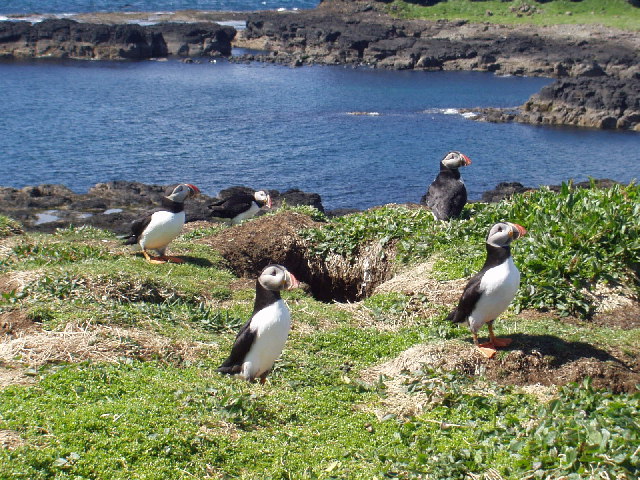
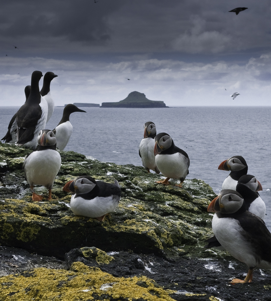
The island of Lunga is the largest of the Treshnish Isles in Argyll and Bute, Scotland. The Isles are part of the Loch Na Keal National Scenic Area. History Lunga, which is of volcanic origin, has been described as 'a green jewel in a peacock sea'. It was inhabited until the 19th century, and still bears the remains of blackhouses. The remains of the ruined village, abandoned in 1857, lie in the northeastern part of the island. Wildlife As one of the Treshnish Isles, Lunga is a designated Site of Special Scientific Interest, Special Protection Area and Special Area of Conservation. These designations reflect the importance of the island for its marine life, including the grey seals that inhabit the waters around it, and for its breeding colonies of seabirds, including storm-petrels, kittiwakes, Manx shearwaters, guillemot, puffin, European shag and razorbills. (The birds also breed on the Harp Rock, a sea stack separated from Lunga by a narrow gut.) In addition, barna ... [...More Info...] [...Related Items...] OR: [Wikipedia] [Google] [Baidu] |
Fladda, Treshnish Isles
Fladda is the northernmost of the Treshnish Isles. Its name comes from the Old Norse ''Flat-ey'' meaning "flat island". Fladda is owned by the Hebridean Trust. Archaeology Fladda's archaeology is recorded by the Royal Commission on the Ancient and Historical Monuments of Scotland. It refers to a building and mounds which may be the site of an early Christian chapel and burial ground. It notes the similarity to finds on Colonsay. In Literature Fladda is mentioned in Frank Fraser Darling Sir Frank Fraser Darling FRSE (23 June 1903 – 22 October 1979) was an English ecologist, ornithologist, farmer, conservationist and author, who is strongly associated with the highlands and islands of Scotland. He gives his name to the Fraser ...'s book Island Years. He lived on the neighbouring island of Lunga with his wife and son while carrying out research. Darling notes that Fladda was the site of the summer home of the Robertsons, who at that time had been fishing lobsters around ... [...More Info...] [...Related Items...] OR: [Wikipedia] [Google] [Baidu] |
Loch Na Keal
Loch na Keal ( gd, Loch na Caol), meaning Loch of the Kyle, or Narrows, also Loch of the Cliffs, is the principal sea loch on the western, or Atlantic coastline of the island of Mull, in the Inner Hebrides, Argyll and Bute, Scotland. Loch na Keal extends over inland, almost bisecting Mull, and extending to within of the eastern shore. The loch gives its name to the Loch na Keal National Scenic Area, one of forty national scenic areas in Scotland. Geography Loch na Keal consists of a wide triangular shaped outer loch, separated from Loch Tuath to the north by the islands of Gometra and Ulva, leading into a narrow inner loch. The island of Staffa is at the mouth of the outer loch, Inch Kenneth is in the outer loch, and Eorsa is in the inner loch. The outer loch's northern coastline on Ulva is made of basaltic ridges and many rocks and islets, with many different types of vegetation. The southern coastline, bounded by the Ardmeanach peninsula, has cliffs, land slips and substant ... [...More Info...] [...Related Items...] OR: [Wikipedia] [Google] [Baidu] |
Bac Mòr
Bac Mòr is a Scottish island, one of the Treshnish Isles, sometimes referred to as The Dutchman's Cap in English because of its shape. Origin of name The Gaelic name has more than one possible interpretation. Although ''Mòr'' clearly means "large" (as opposed to Bac Beag, its smaller sister), the word ''Bac'' can mean either a "bank", or an "obstacle" or "hindrance". The island's profile is one of the more distinctive amongst the Scottish Islands. Geology Bac Mòr is of ancient volcanic origin, and the peak in the middle is a former cone. The low-lying plain surrounding it is a glassy lava field. The remains of summer sheilings have been found on the island, suggesting that it was inhabited at one time, even though it has no safe landing places. Wildlife The Treshnish Isles, which are uninhabited today, are owned by a charity, the Hebridean Trust. They have been collectively designated as a Site of Special Scientific Interest and a Special Protection Area A Special Prote ... [...More Info...] [...Related Items...] OR: [Wikipedia] [Google] [Baidu] |
Inner Hebrides
The Inner Hebrides (; Scottish Gaelic: ''Na h-Eileanan a-staigh'', "the inner isles") is an archipelago off the west coast of mainland Scotland, to the south east of the Outer Hebrides. Together these two island chains form the Hebrides, which experience a mild oceanic climate. The Inner Hebrides comprise 35 inhabited islands as well as 44 uninhabited islands with an area greater than . Skye, Mull, and Islay are the three largest, and also have the highest populations. The main commercial activities are tourism, crofting, fishing and whisky distilling. In modern times the Inner Hebrides have formed part of two separate local government jurisdictions, one to the north and the other to the south. Together, the islands have an area of about , and had a population of 18,948 in 2011. The population density is therefore about . There are various important prehistoric structures, many of which pre-date the first written references to the islands by Roman and Greek authors. In the ... [...More Info...] [...Related Items...] OR: [Wikipedia] [Google] [Baidu] |
Cairn Na Burgh Mòr
Cairn na Burgh Mòr (also Cairnburgh More) is one of the Treshnish Isles in the Inner Hebrides of Scotland. Cairn na Burgh Mòr is the larger of the two "Carnburgs" (as they are nicknamed) at the northeastern end of the Treshnish Isles in the Inner Hebrides - the other being "Cairn na Burgh Beag". The larger of a pair guards the entrance to Loch Tuath on the west coast of Mull Mull may refer to: Places *Isle of Mull, a Scottish island in the Inner Hebrides ** Sound of Mull, between the Isle of Mull and the rest of Scotland * Mount Mull, Antarctica *Mull Hill, Isle of Man * Mull, Arkansas, a place along Arkansas Highway .... These grassy islands are both remnants of ancient lava flows, and have a distinctive profile: flat-topped and trimmed with cliffs. Cairn na Burgh Mòr has fortifications on the grassy slope. Cairnburgh Castle and a chapel are located on the isle. It is no longer inhabited. Footnotes Treshnish Isles Uninhabited islands of Argyll and Bute ... [...More Info...] [...Related Items...] OR: [Wikipedia] [Google] [Baidu] |
Argyll And Bute
Argyll and Bute ( sco, Argyll an Buit; gd, Earra-Ghàidheal agus Bòd, ) is one of 32 unitary authority council areas in Scotland and a lieutenancy area. The current lord-lieutenant for Argyll and Bute is Jane Margaret MacLeod (14 July 2020). The administrative centre for the council area is in Lochgilphead at Kilmory Castle, a 19th-century Gothic Revival building and estate. The current council leader is Robin Currie, a councillor for Kintyre and the Islands. Description Argyll and Bute covers the second-largest administrative area of any Scottish council. The council area adjoins those of Highland, Perth and Kinross, Stirling and West Dunbartonshire. Its border runs through Loch Lomond. The present council area was created in 1996, when it was carved out of the Strathclyde region, which was a two-tier local government region of 19 districts, created in 1975. Argyll and Bute merged the existing Argyll and Bute district and one ward of the Dumbarton district. The Dumbart ... [...More Info...] [...Related Items...] OR: [Wikipedia] [Google] [Baidu] |
Isle Of Mull
The Isle of Mull ( gd, An t-Eilean Muileach ) or just Mull (; gd, Muile, links=no ) is the second-largest island of the Inner Hebrides (after Skye) and lies off the west coast of Scotland in the Council areas of Scotland, council area of Argyll and Bute. Covering , Mull is the fourth-largest island in Scotland and Great Britain. From 2001 to 2020, the population has gradually increased: during 2020 the populace was estimated to be 3,000, in the United Kingdom Census 2011, 2011 census it was approximately 2,800, and in 2001, it was measured at 2,667 people. It has the eighth largest Island population in Scotland. In the summer, these numbers are augmented by an influx of many tourists. Much of the year-round population lives in the colourful main settlement of Tobermory, Mull, Tobermory. There are two distilleries on the island: the Tobermory distillery, formerly named Ledaig, produces single malt Scotch whisky and another, opened in 2019 and located in the vicinity of Tir ... [...More Info...] [...Related Items...] OR: [Wikipedia] [Google] [Baidu] |
Hebridean Trust
The Hebrides (; gd, Innse Gall, ; non, Suðreyjar, "southern isles") are an archipelago off the west coast of the Scottish mainland. The islands fall into two main groups, based on their proximity to the mainland: the Inner and Outer Hebrides. These islands have a long history of occupation (dating back to the Mesolithic period), and the culture of the inhabitants has been successively influenced by the cultures of Celtic-speaking, Norse-speaking, and English-speaking peoples. This diversity is reflected in the various names given to the islands, which are derived from the different languages that have been spoken there at various points in their history. The Hebrides are where much of Scottish Gaelic literature and Gaelic music has historically originated. Today, the economy of the islands is dependent on crofting, fishing, tourism, the oil industry, and renewable energy. The Hebrides have less biodiversity than mainland Scotland, but a significant number of seals and se ... [...More Info...] [...Related Items...] OR: [Wikipedia] [Google] [Baidu] |
Tobermory, Mull
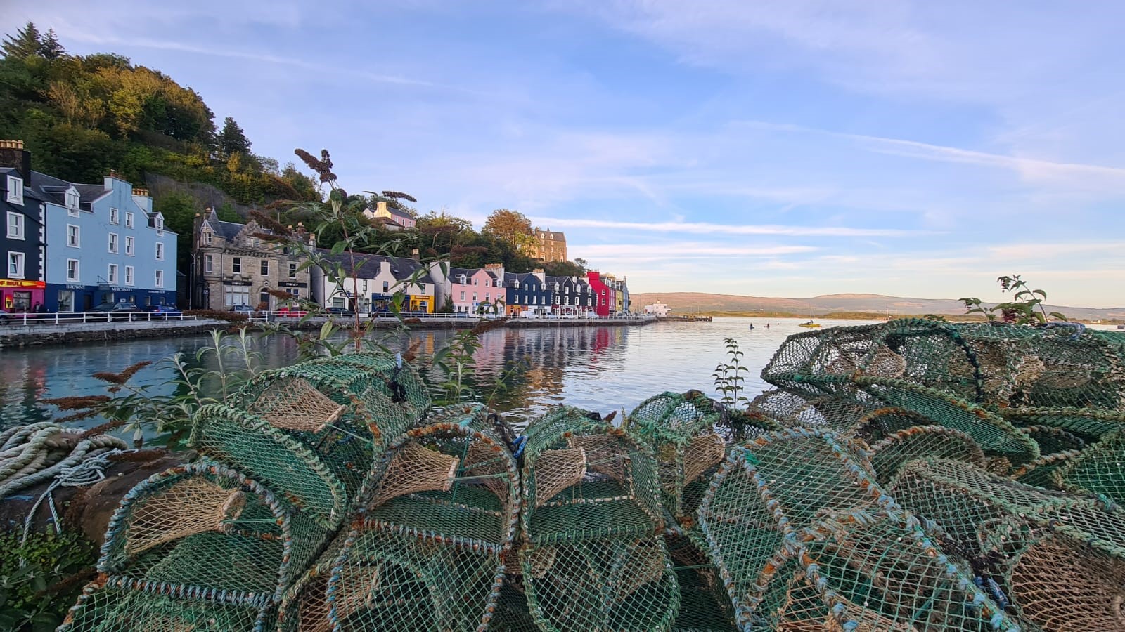
Tobermory (; gd, Tobar Mhoire) is the capital of, and until 1973 the only burgh on, the Isle of Mull in the Scottish Inner Hebrides. It is located on the east coast of Mishnish, the most northerly part of the island, near the northern entrance of the Sound of Mull. The village was founded as a fishing port in 1788; its layout was based on the designs of Dumfriesshire engineer Thomas Telford. It has a current population of about 1,000. Etymology The name ''Tobermory'' is derived from the Gaelic ', meaning "Mary's well". The name refers to a well located nearby which was dedicated in ancient times to the Virgin Mary. Prehistory and archaeology Archaeological Excavations have taken place at Baliscate just outside of the town. The site was first noted by Hylda Marsh and Beverley Langhorn as part of the Scotland's Rural Past. In 2009, it was partially excavated Time Team and a further longer excavation took place in 2012 as part of a community archaeology project through the Mul ... [...More Info...] [...Related Items...] OR: [Wikipedia] [Google] [Baidu] |


