|
Trentbarton
Trentbarton operates both local and regional bus services in Derbyshire, Leicestershire, Nottinghamshire and Staffordshire, England. It is a subsidiary of the Wellglade Group. History In October 1913, Trent Motor Traction Company was founded and commenced operating a bus service between Ashbourne and Derby, with a second service between Derby and Stapleford introduced the following month. By 1925, a network of services were operating from Derby, Loughborough and Nottingham. As services expanded, the business grew, with a total of seven depots.History Trent Barton During the 1930s, some 52 smaller operators were bought out. In August 1949, Trent Motor Traction Company began to operate some services in partnership with |
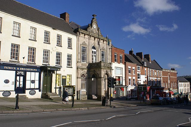
Ashbourne, Derbyshire
Ashbourne is a market town in the Derbyshire Dales district in Derbyshire, England. Its population was measured at 8,377 in the 2011 census and was estimated to have grown to 9,163 by 2019. It has many historical buildings and independent shops. The town offers a historic annual Shrovetide football match. Its position near the southern edge of the Peak District makes it the closest town to Dovedale, to which Ashbourne is sometimes referred to as the gateway. The town is west of Derby, south-east of Buxton, east of Stoke-on-Trent, south-south-east of Manchester, south-west of Sheffield and north of Lichfield. Nearby towns include Matlock, Uttoxeter, Leek, Cheadle and Bakewell. History The town's name derives from the Old English ''æsc-burna'' meaning "stream with ash trees". Ashbourne was granted a market charter in 1257. In medieval times it was a frequent rest stop for pilgrims walking "St Non's Way" to the shrine of Saint Fremund at Dunstable in Bedfordsh ... [...More Info...] [...Related Items...] OR: [Wikipedia] [Google] [Baidu] |
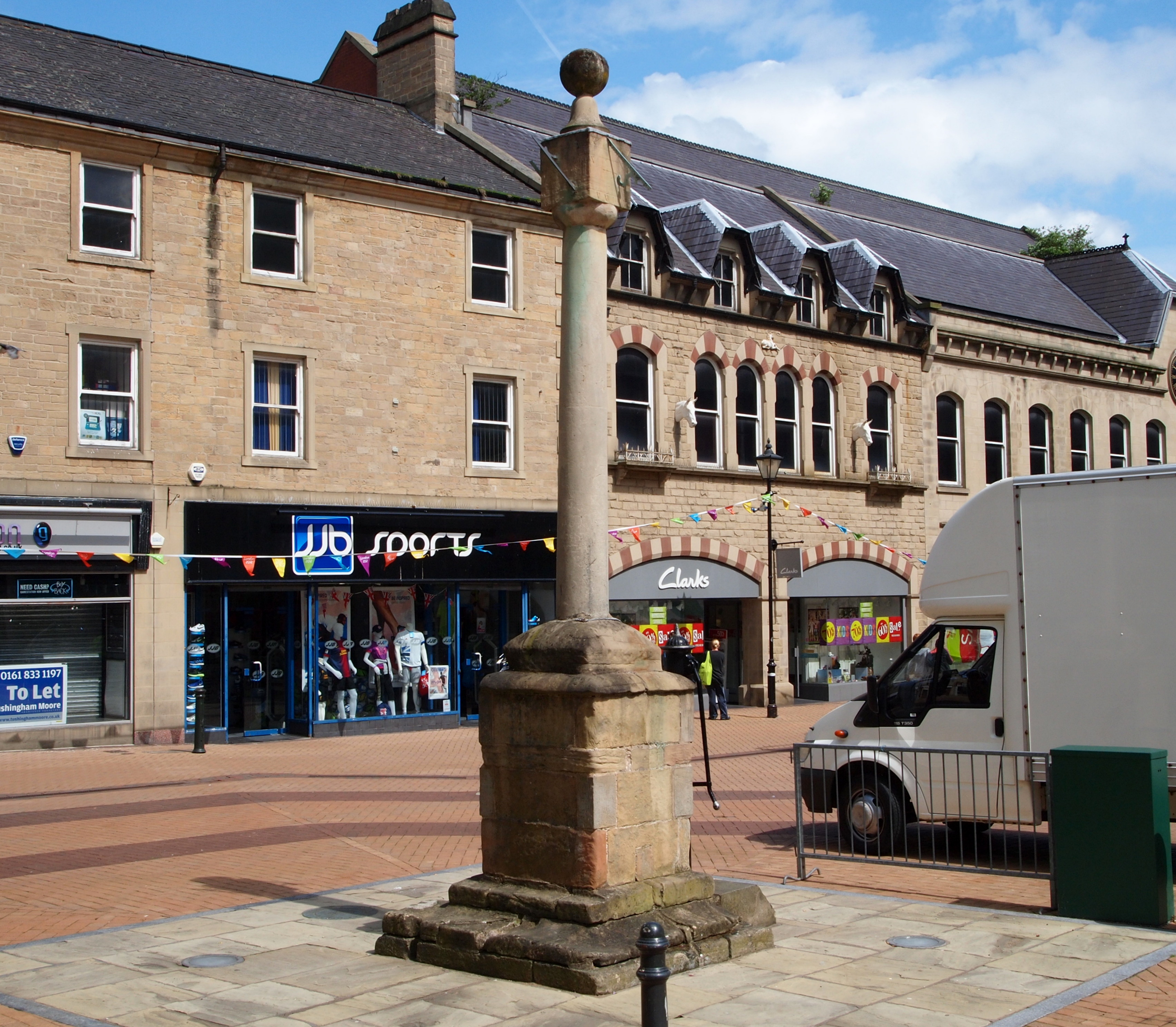
Ilkeston
Ilkeston is a town in the Borough of Erewash, Derbyshire, England, on the River Erewash, from which the borough takes its name, with a population at the 2011 census of 38,640. Its major industries, coal mining, iron working and lace making/textiles, have now all but disappeared. The town is close to both Derby and Nottingham and is near the M1 motorway and the border with Nottinghamshire. The eastern boundary of Ilkeston is only two miles from Nottingham's western edge and it is part of the Nottingham Urban Area. History and culture Ilkeston was probably founded in the 6th century AD, and gets its name from its supposed founder, Elch or Elcha, who was an Anglian chieftain ("Elka's Tun" = Elka's Town). The town appears as Tilchestune in the Domesday Book of 1086, when it was owned principally by Gilbert de Ghent. Gilbert also controlled nearby Shipley, West Hallam and Stanton by Dale.''Domesday Book: A Complete Translation''. London: Penguin, 2003. pp. 753–4 Ilkeston was cr ... [...More Info...] [...Related Items...] OR: [Wikipedia] [Google] [Baidu] |
Wellglade Group
The Wellglade Group (WG), is a transport group operating bus and tram services in the English Midlands. History Wellglade was formed in 1986 when Brian King and Ian Morgan purchased Trent Buses from the National Bus Company in a management buyout. In 1989 the business of Barton Transport was purchased.History TrentbartonWellglade Tramlink Nottingham In 1998 Wellglade purchased the Kinchbus business in . In January 2010 |
Bus Deregulation In The United Kingdom
Bus deregulation in Great Britain was the abolition of Road Service Licensing outside of Greater London for bus services. This began in 1980 with the abolition of Road Service Licensing for long-distance bus services and was extended into local bus services in 1986. The abolition of Road Service Licensing removed the public sector's role in fare-setting, routes and bus frequencies and returned these powers to bus operators under the Transport Act 1985. History The bus industry grew significantly after the First World War in Britain with many demobilised soldiers starting bus companies with new skills in motor engineering and driving acquired through their military service. These bus services began to erode the railways' profits as they abstracted passengers from railways, the impact of this on the railways led to the creation of the big four. The bus industry then began to consolidate and many were acquired by railway companies. Remaining independent operators however were h ... [...More Info...] [...Related Items...] OR: [Wikipedia] [Google] [Baidu] |
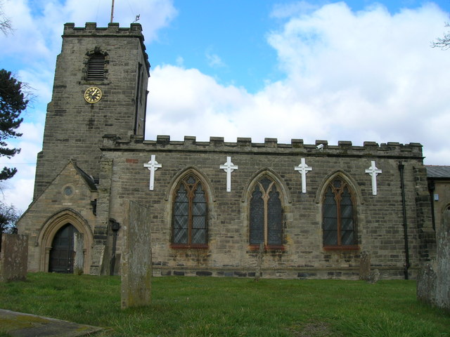
Keyworth
Keyworth is a large Village of Nottinghamshire, England. It is located about 6 miles (11 km) southeast of the centre of Nottingham. It sits on a small, broad hilltop about 200 feet above sea level which is set in the wider undulating boulder clay that characterises the area south of Nottingham. Keyworth is twinned with the French town of Feignies. Demographics A 2001 census which was conducted indicates that the civil parish had a population of 6,920, reducing to 6,733 at the 2011 census. Crime Keyworth was the home of Colette Aram who was murdered by Paul Stewart Hutchinson in 1983. Transport The bus company Trentbarton operates The Keyworth service from Keyworth to Nottingham via Plumtree, Tollerton, Edwalton and West Bridgford, daily, from early in the morning until around midnight (with additional late-night buses on Fridays and Saturdays). Keyworth is approximately 8 miles to the closest railway station, Nottingham railway station, Keyworth once had its own st ... [...More Info...] [...Related Items...] OR: [Wikipedia] [Google] [Baidu] |
Cotgrave
Cotgrave is a town and civil parish in the borough of Rushcliffe in Nottinghamshire, England, some 5 miles (8 km) south-east of central Nottingham. It perches on the South Nottinghamshire Wolds about 131 feet (40 metres) above sea level. Cotgrave's 2001 population of 7,373 people fell to 7,203 at the 2011 Census, though Owthorpe was included. It was estimated at 8,113 in 2019. Position With an ancient heart that has largely escaped development, Cotgrave still has a village atmosphere despite its population. This is accented by its amenities and infrastructure, which have remained comparatively underdeveloped, even though large housing estates were built round the village in the 1960s for people working for the coalmine. It is edged between the A52, A606 and A46. To the west are Tollerton and Nottingham Airport, which has facilities for private planes and flight instruction. History Cotgrave's origins may be in the Iron Age. A 6th-century Anglo-Saxon burial ground ha ... [...More Info...] [...Related Items...] OR: [Wikipedia] [Google] [Baidu] |
Calverton, Nottinghamshire
Calverton () is a village and civil parish in Nottinghamshire, of some , in the Gedling district, about 7 miles north-east of Nottingham, and 10 miles south-east of Mansfield. England, and situated, like nearby Woodborough and Lambley, on one of the small tributaries of the Dover Beck. The 2011 census found 7,076 inhabitants in 2,987 households. About two miles to the north of the village is the site of the supposed deserted settlement of Salterford. The parish is bounded on the south-east by Woodborough, to the south-west by Arnold, Papplewick and Ravenshead, to the north by Blidworth, and to the north-east by Oxton and Epperstone. During most of its existence Calverton was a forest village, in that part of Sherwood known as Thorney Wood Chase, with a rural economy limited by a lack of grazing land, in which handicrafts (like woodworking and the knitting of stockings), must in consequence have assumed a more than usual importance. The parliamentary enclosure of 1780 brough ... [...More Info...] [...Related Items...] OR: [Wikipedia] [Google] [Baidu] |
Skylink (bus Service)
Skylink is the brand name for bus services that serve East Midlands Airport in Leicestershire. Services are presently operated by Kinchbus and trentbarton, both a part of Derbyshire-based Wellglade Group. History Nottingham City Transport previously operated the Skylink Nottingham service until 2012 when the service was replaced by a new Skylink service operated by trentbarton via Long Eaton, which also replaced the indigo service between Long Eaton and Loughborough via East Midlands Airport and Sutton Bonington that ran between 2002 and 2012. Following a local petition, an hourly extension service to Coalville via Shepshed was introduced in September 2015. Kinchbus have operated the Skylink service between Leicester and Derby since April 2009. The route was originally called AirLine Shuttle, and ran between Loughborough and Long Eaton then Derby via the airport. Arriva Midlands previously operated a limited-stop service (coloured light green) between Leicester and the airp ... [...More Info...] [...Related Items...] OR: [Wikipedia] [Google] [Baidu] |
East Midlands Airport
East Midlands Airport is an international airport in the East Midlands of England, close to Castle Donington in northwestern Leicestershire, between Loughborough (), Derby () and Nottingham (); Leicester is () to the south and Lincoln () northeast. It serves the whole East Midlands region of Leicestershire, Nottinghamshire, Lincolnshire, Northamptonshire, Rutland and Derbyshire. The airfield was originally built as a Royal Air Force station known as RAF Castle Donington in 1943, before being redeveloped as a civilian airport in 1965. East Midlands Airport has established itself as a hub for low-fare airlines such as Jet2.com and Ryanair and tour operators like TUI Airways, which serve a range of domestic and European short-haul destinations. Passenger numbers peaked in 2008 at 5.6 million but declined to around 4.5 million in 2015, making it the 11th-busiest airport in the UK by passenger traffic. A central air cargo hub, it was the second-busiest UK airport for freight traffi ... [...More Info...] [...Related Items...] OR: [Wikipedia] [Google] [Baidu] |
Mansfield
Mansfield is a market town and the administrative centre of Mansfield District in Nottinghamshire, England. It is the largest town in the wider Mansfield Urban Area (followed by Sutton-in-Ashfield). It gained the Royal Charter of a market town in 1227. The town lies in the Maun Valley, north of Nottingham and near Sutton-in-Ashfield. Most of the 109,000 population live in the town itself (including Mansfield Woodhouse), with Warsop as a secondary centre. Mansfield is the one local authority in Nottinghamshire with a publicly elected mayor. History Roman to Mediaeval Period Settlement dates to the Roman period. Major Hayman Rooke in 1787 discovered a villa between Mansfield Woodhouse and Pleasley; a cache of denarii was found near King's Mill in 1849. Early English royalty stayed there; Mercian Kings used it as a base to hunt in Sherwood Forest. The Royal Manor of Mansfield was held by the King. In 1042 Edward the Confessor possessed a manor in Mansfield. Will ... [...More Info...] [...Related Items...] OR: [Wikipedia] [Google] [Baidu] |
Chesterfield, Derbyshire
Chesterfield is a market town and unparished area in the Borough of Chesterfield, Derbyshire, England, north of Derby and south of Sheffield at the confluence of the River Rother and River Hipper. In 2011 the built-up-area subdivision had a population of 88,483, making it the second-largest settlement in Derbyshire, after Derby. The wider borough had a population of 103,801 in 2011. In 2011, the town had a population of 76,753. It has been traced to a transitory Roman fort of the 1st century CE. The name of the later Anglo-Saxon village comes from the Old English ''ceaster'' (Roman fort) and ''feld'' (pasture). It has a sizeable street market three days a week. The town sits on an old coalfield, but little visual evidence of mining remains. The main landmark is the crooked spire of the Church of St Mary and All Saints. History Chesterfield was in the Hundred of Scarsdale. The town received its market charter in 1204 from King John, which constituted the town as a f ... [...More Info...] [...Related Items...] OR: [Wikipedia] [Google] [Baidu] |


_-_geograph.org.uk_-_2919099.jpg)


