|
Tree Wētā
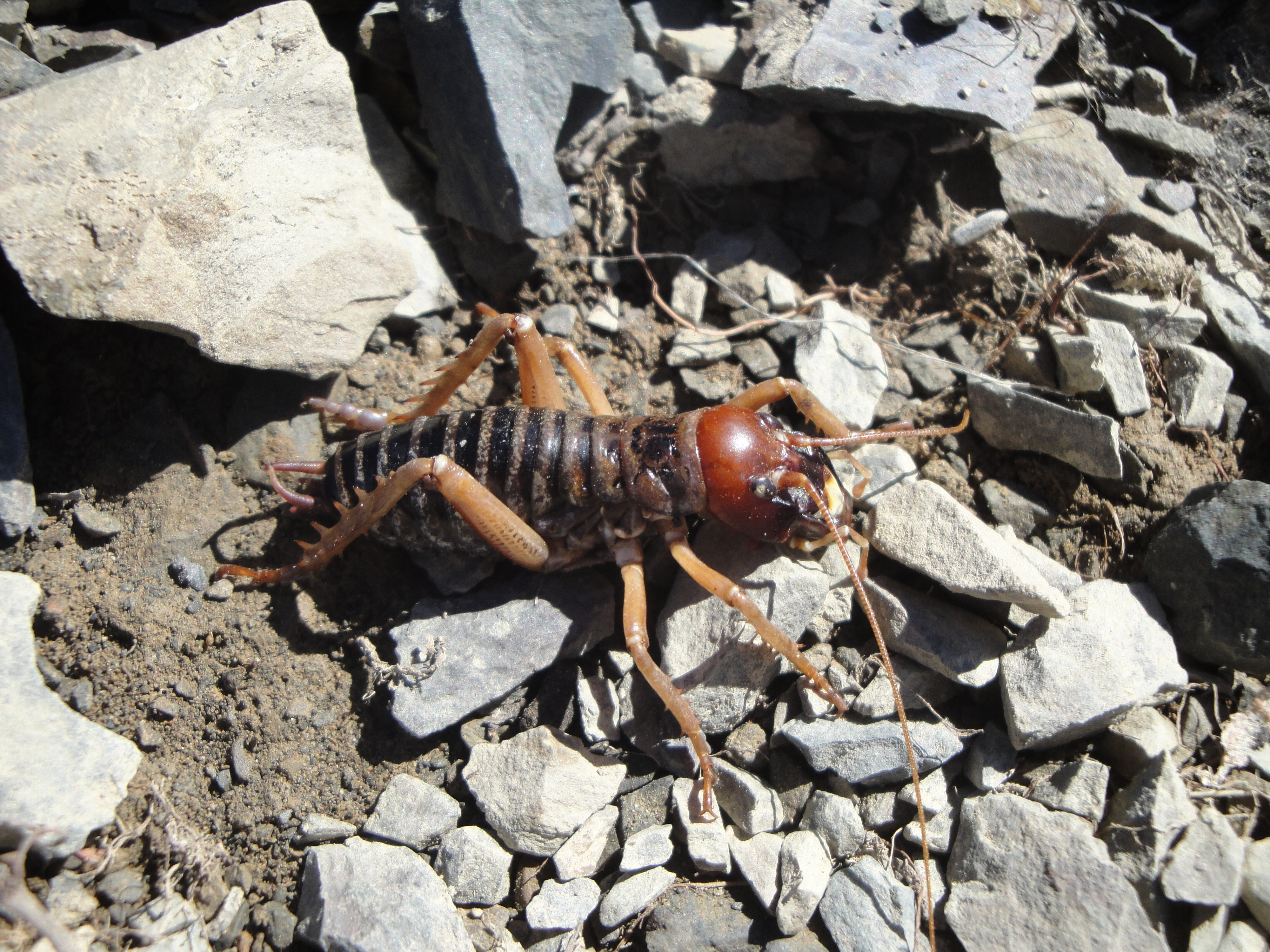
Tree wētā are wētā in the genus ''Hemideina'' of the family Anostostomatidae. The genus is endemic to New Zealand. There are seven species within the genus ''Hemideina'', found throughout the country except lowland Otago and Southland. Because many tree wētā species are common and widespread they have been used extensively in studies of ecology and evolution. Habitat Tree wētā are commonly encountered in forests and suburban gardens throughout most of New Zealand. They are up to 40 mm long and most commonly live in holes in trees formed by beetle and moth larvae or where rot has set in after a twig has broken off. The hole, called a gallery, is maintained by the wētā and any growth of the bark surrounding the opening is chewed away. They readily occupy a preformed gallery in a piece of wood (a "wētā motel") and can be kept in a suburban garden as pets. A gallery might house a harem of up to 10 adult females and one male. Behaviour Tree wētā are nocturnal ... [...More Info...] [...Related Items...] OR: [Wikipedia] [Google] [Baidu] |
Hemideina Crassidens
''Hemideina crassidens'', commonly known as the Wellington tree wētā, is a large, flightless, nocturnal insect in the family Anostostomatidae. This wētā species is endemic to New Zealand and populates regions in the southern half of North Island/Te Ika a Maui and the north-west of the South Island/Te Wai Pounamu. They forage arboreally during the night and are most likely polyphagous. There is obvious sexual dimorphism in adults. Individuals are reliant on tree cavities for refuge, social interactions and mating. The conservation status of ''H. crassidens'' is "not threatened". Distribution and habitat ''Hemideina crassidens'' is endemic to New Zealand. Populations are distributed between the Ruapehu district and Wellington district of the North Island, and in the Westland district of the South Island. A closely related native tree wētā, ''Hemideina thoracica'', is widely distributed in the northern two-thirds of the North Island New Zealand. It has been suggested ... [...More Info...] [...Related Items...] OR: [Wikipedia] [Google] [Baidu] |
Wairarapa
The Wairarapa (; ), a geographical region of New Zealand, lies in the south-eastern corner of the North Island, east of metropolitan Wellington and south-west of the Hawke's Bay Region. It is lightly populated, having several rural service towns, with Masterton being the largest. It is named after its largest lake, Lake Wairarapa. The region is referred to as The Wairarapa, particularly when used after a preposition (e.g., locals will say they live "in the Wairarapa", and travel "to" and "from the Wairarapa"). Boundaries The Wairarapa is shaped like a rectangle, about long (from Palliser Bay north to Woodville) and wide (from the Tararua Range east to the coast). The Ngāti Kahungunu tribe's boundary for the region is similar. Their tribal area begins at Pōrangahau and ends at Turakirae. It is the southernmost of their three rohe (homelands) running down the eastern North Island from Wairoa. For the Rangitāne tribe, the Wairarapa is part of a wider homeland that incl ... [...More Info...] [...Related Items...] OR: [Wikipedia] [Google] [Baidu] |
Karyotype
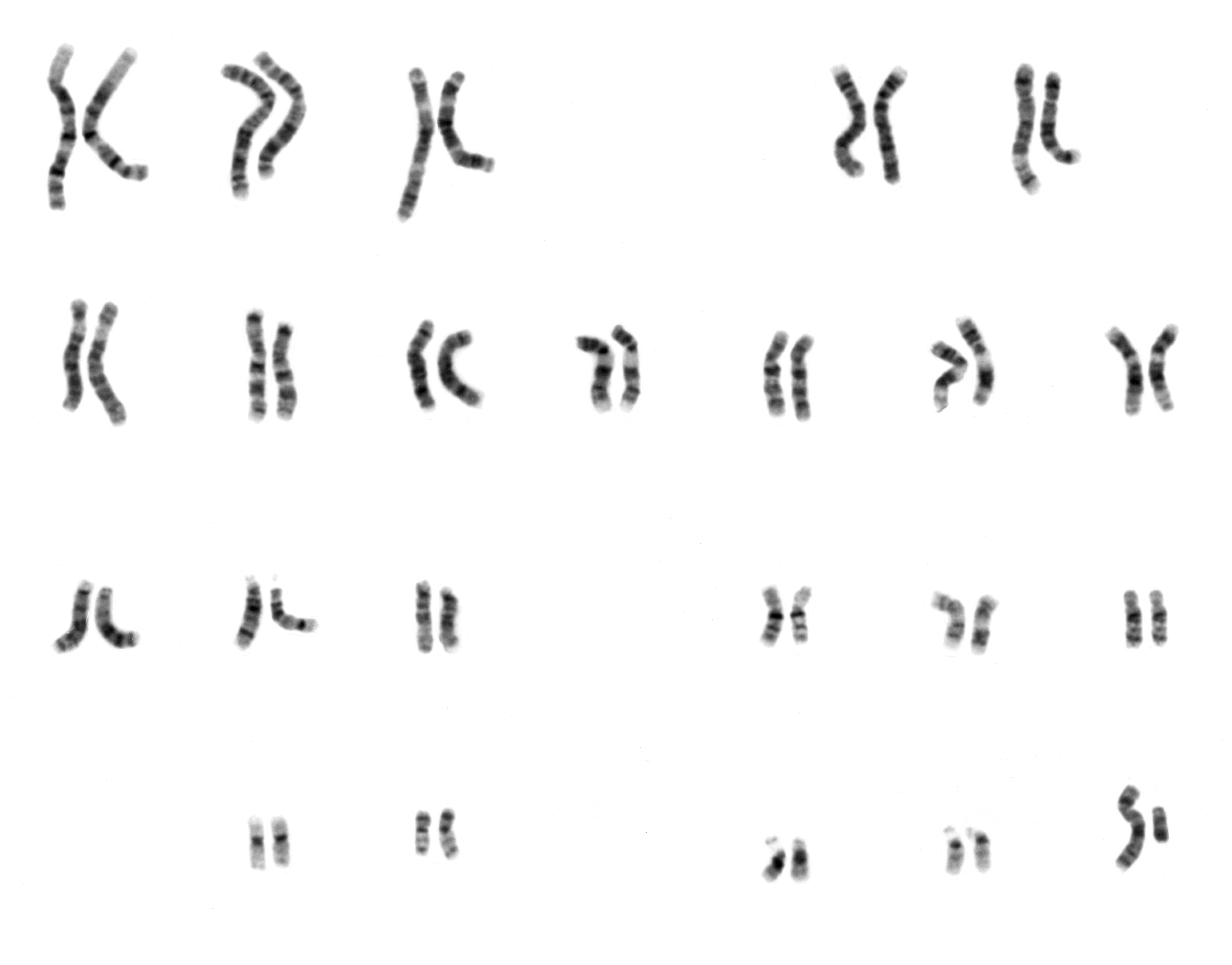
A karyotype is the general appearance of the complete set of metaphase chromosomes in the cells of a species or in an individual organism, mainly including their sizes, numbers, and shapes. Karyotyping is the process by which a karyotype is discerned by determining the chromosome complement of an individual, including the number of chromosomes and any abnormalities. A karyogram or idiogram is a graphical depiction of a karyotype, wherein chromosomes are organized in pairs, ordered by size and position of centromere for chromosomes of the same size. Karyotyping generally combines light microscopy and photography, and results in a photomicrographic (or simply micrographic) karyogram. In contrast, a schematic karyogram is a designed graphic representation of a karyotype. In schematic karyograms, just one of the sister chromatids of each chromosome is generally shown for brevity, and in reality they are generally so close together that they look as one on photomicrographs as well ... [...More Info...] [...Related Items...] OR: [Wikipedia] [Google] [Baidu] |
Banks Peninsula
Banks Peninsula is a peninsula of volcanic origin on the east coast of the South Island of New Zealand. It has an area of approximately and encompasses two large harbours and many smaller bays and coves. The South Island's largest city, Christchurch, is immediately north of the peninsula. Geology Banks Peninsula forms the most prominent volcanic feature of the South Island, similar to — but more than twice as large as — the older Dunedin volcano (Otago Peninsula and Harbour) to the southwest. Geologically, the peninsula comprises the eroded remnants of two large (Lyttelton formed first, then Akaroa), and the smaller Mt Herbert Volcanic Group. These formed due to intraplate volcanism between approximately eleven and eight million years ago (Miocene) on a continental crust. The peninsula formed as offshore islands, with the volcanoes reaching to about 1,500 m above sea level. Two dominant craters formed Lyttelton and Akaroa Harbours. The Canterbury ... [...More Info...] [...Related Items...] OR: [Wikipedia] [Google] [Baidu] |
Hemideina Ricta
''Hemideina ricta'', known as the Banks Peninsula tree wētā, is an insect that is endemic to New Zealand. Taxonomy ''Hemideina ricta'' Hutton, 1896 is a tree wētā that belongs to the insect order Orthoptera. It was originally described by Frederick Hutton in 1896, based on two male and five female specimens from Banks Peninsula and South Canterbury. It is one of seven species in the endemic New Zealand genus '' Hemideina''. Identification Adults of the Banks Peninsula tree wētā are red-brown in colour, can weigh 4–6 g, and can reach 40–55 mm in length. The head of the mature male Banks Peninsula tree wētā is much larger and darker than that of females or juvenile males, with large mandibles used to fight other males. ''Hemideina ricta'' is similar to ''H. femorata,'' which is also found in forest fragments on Banks Peninsula. These two species can be differentiated using the number of stridulatory ridges on their abdomen. ''Hemideina ricta'' has more than 20 ... [...More Info...] [...Related Items...] OR: [Wikipedia] [Google] [Baidu] |
High Country (New Zealand)
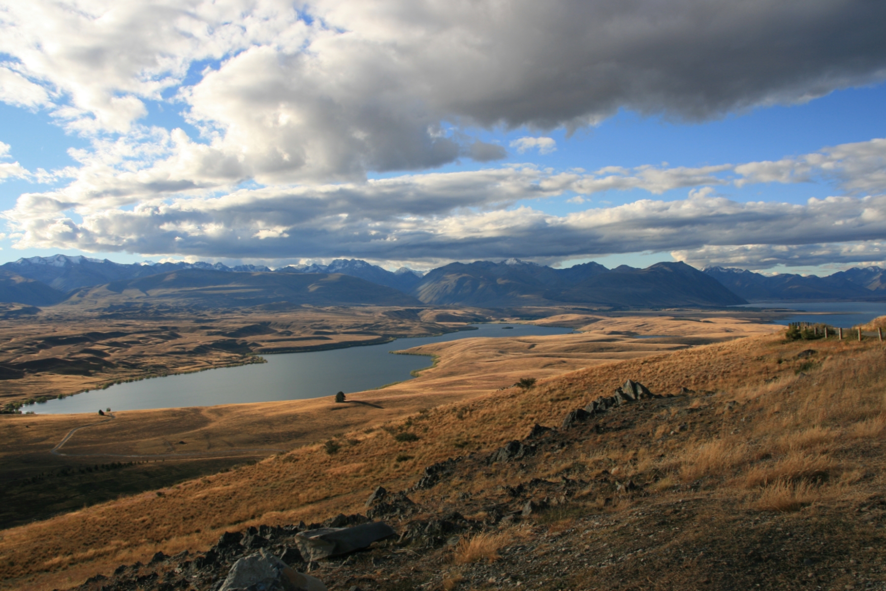
High country is a New Zealand term for the elevated pastoral land of the South Island and – to a lesser extent – North Island. This terrain, which can be compared loosely with the outback of Australia, high veldt of South Africa and pampas of Argentina, lies in the rain shadow of the country's mountain ranges and tends to be extensively farmed land with a continental climate consisting of low rainfall, cold winters and hot summers. Livestock farmed in these regions include sheep and – increasingly – deer and alpaca, and a major ground-covering plant of the area is tussock. Regions of New Zealand closely associated with the high country include Central Otago and the Mackenzie Basin in the South Island, and parts of the North Island Volcanic Plateau. Much of the land is at a high altitude (hence its name), with the majority of the high country being more than 600 metres (2000 feet) above sea level. The land is marked with geological features associated with glaciation ... [...More Info...] [...Related Items...] OR: [Wikipedia] [Google] [Baidu] |
Hemideina Maori
''Hemideina maori'', also known as the mountain stone wētā, is a wētā of the family Anostostomatidae. They are a large, flightless, nocturnal orthopteran endemic to New Zealand. Mountain stone wētā are long lived and are found on many central mountain ranges in New Zealand's South Island. __TOC__ Taxonomy ''Hemideina maori'' was first described in 1891 by Swiss Entomologists Alphonse Pictet and Henri de Saussure. Habitat and distribution Unlike other ''Hemideina'' species ''H. maori'' occupy an alpine habitat. They are found at high elevation (above the tree line) of the South Island of New Zealand. They have been found above 1500 metres above sea level (m.a.s.l) with a lower limit of 1100m.a.s.l, from the Kaikoura Ranges south to the Rock and Pillar range in Otago. They use cavities under rock slabs ('tors') broken from schist outcrops as retreats during the day. Tors are separated by alpine meadows with no rocks and therefore are assumed to have no wētā, causin ... [...More Info...] [...Related Items...] OR: [Wikipedia] [Google] [Baidu] |
Canterbury, New Zealand
Canterbury ( mi, Waitaha) is a region of New Zealand, located in the central-eastern South Island. The region covers an area of , making it the largest region in the country by area. It is home to a population of The region in its current form was established in 1989 during nationwide local government reforms. The Kaikoura District joined the region in 1992 following the abolition of the Nelson-Marlborough Regional Council. Christchurch, the South Island's largest city and the country's second-largest urban area, is the seat of the region and home to percent of the region's population. Other major towns and cities include Timaru, Ashburton, Rangiora and Rolleston. History Natural history The land, water, flora, and fauna of Waitaha/Canterbury has a long history stretching from creation of the greywacke basement rocks that make up the Kā Tiritiri o te Moana/Southern Alps to the arrival of the first humans. This history is linked to the creation of the earth, the s ... [...More Info...] [...Related Items...] OR: [Wikipedia] [Google] [Baidu] |
Hemideina Femorata
''Hemideina femorata'', the Canterbury tree weta or in Māori, ''putangatanga'', is a flightless nocturnal insect from the order Orthoptera and the genus '' Hemideina'', it is endemic to Canterbury, New Zealand, on the South Island. Description The tree weta in New Zealand are large flightless nocturnal insects.O'Brien, B., & Field, L. (2001). Morphology and Anatomy of New Zealand Wetas. Department of Biological Sciences, University of Waikato. Weta have three main sections to their body, the head, thorax and abdomen. Tree weta are often distinguished by their sizable hindlegs, strong jaws, tusks on the males, their glossy and hard exoskeleton and their size. Weta often have antennae twice as long as their bodies,Crowe, A.(2002). Which New Zealand Insect? Penguin Books. which are used to help it feel its way in the dark and safely navigate. Structurally male tree wetas have a larger head than the females, which may make up 40% of their body length. The females have a long spike ... [...More Info...] [...Related Items...] OR: [Wikipedia] [Google] [Baidu] |
West Coast, New Zealand
The West Coast ( mi, Te Tai Poutini, lit=The Coast of Poutini, the Taniwha) is a regions of New Zealand, region of New Zealand on the west coast of the South Island that is administered by the West Coast Regional Council, and is known co-officially as Te Tai Poutini. It comprises the Territorial authorities of New Zealand, territorial authorities of Buller District, Grey District and Westland District. The principal towns are Westport, New Zealand, Westport, Greymouth and Hokitika. The region, one of the more remote areas of the country, is also the most sparsely populated. With a population of just 32,000 people, Te Tai Poutini is the least populous region in New Zealand, and it is the only region where the population is declining. The region has a rich and important history. The land itself is ancient, stretching back to the Carboniferous period; this is evident by the amount of carboniferous materials naturally found there, especially coal. First settled by Ngāi Tahu, Kāi T ... [...More Info...] [...Related Items...] OR: [Wikipedia] [Google] [Baidu] |
South Island
The South Island, also officially named , is the larger of the two major islands of New Zealand in surface area, the other being the smaller but more populous North Island. It is bordered to the north by Cook Strait, to the west by the Tasman Sea, and to the south and east by the Pacific Ocean. The South Island covers , making it the world's 12th-largest island. At low altitude, it has an oceanic climate. The South Island is shaped by the Southern Alps which run along it from north to south. They include New Zealand's highest peak, Aoraki / Mount Cook at . The high Kaikōura Ranges lie to the northeast. The east side of the island is home to the Canterbury Plains while the West Coast is famous for its rough coastlines such as Fiordland, a very high proportion of native bush and national parks, and the Fox and Franz Josef Glaciers. The main centres are Christchurch and Dunedin. The economy relies on agriculture and fishing, tourism, and general manufacturing and services. ... [...More Info...] [...Related Items...] OR: [Wikipedia] [Google] [Baidu] |


