|
Transbay Tower
Salesforce Tower, formerly known as Transbay Tower, is a 61-story skyscraper at 415 Mission Street, between First and Fremont Street, in the South of Market district of downtown San Francisco. Its main tenant is Salesforce, a cloud-based software company. The building is tall, with a top roof height of . Designed by César Pelli and developed by Hines Interests Limited Partnership and Boston Properties, it was the last building designed by Pelli to be completed in his lifetime. As of 2018, Salesforce Tower is the tallest building in San Francisco and the second-tallest building both in California and west of the Mississippi River after the Wilshire Grand Center in Los Angeles. Salesforce Tower is obelisk-shaped, with a grid of metal fins running from the base of the building to the roof. The building sits on a land fill, and multiple load-bearing pillars reach below the foundation and into bedrock. The exterior of the building consists of a glass and steel curtain wall with a ... [...More Info...] [...Related Items...] OR: [Wikipedia] [Google] [Baidu] |
Mission Street
Mission Street is a north-south arterial thoroughfare in Daly City and San Francisco, California that runs from Daly City's southern border to San Francisco's northeast waterfront. The street and San Francisco's Mission District through which it runs were named for the Spanish Mission Dolores, several blocks away from the modern route. Only the southern half is historically part of El Camino Real, which connected the missions. Part of Mission Street in Daly City is signed as part of State Route 82 (SR 82). Alignment From the south, Mission Street begins as a continuation of SR 82/El Camino Real at the Colma-Daly City border, just south of San Pedro Road. Mission Street then runs north to the Top of the Hill district, where SR 82 splits as San Jose Avenue to the northeast, and Mission Street continues north-northeast. It then crosses the San Francisco city limits mid-block between Templeton Avenue in Daly City and Huron Avenue in San Francisco. Mission Street then turns back nor ... [...More Info...] [...Related Items...] OR: [Wikipedia] [Google] [Baidu] |
Obelisk
An obelisk (; from grc, ὀβελίσκος ; diminutive of ''obelos'', " spit, nail, pointed pillar") is a tall, four-sided, narrow tapering monument which ends in a pyramid-like shape or pyramidion at the top. Originally constructed by Ancient Egyptians and called ''tekhenu'', the Greeks used the Greek term to describe them, and this word passed into Latin and ultimately English. Ancient obelisks are monolithic; they consist of a single stone. Most modern obelisks are made of several stones. Ancient obelisks Egyptian Obelisks were prominent in the architecture of the ancient Egyptians, and played a vital role in their religion placing them in pairs at the entrance of the temples. The word "obelisk" as used in English today is of Greek rather than Egyptian origin because Herodotus, the Greek traveler, was one of the first classical writers to describe the objects. A number of ancient Egyptian obelisks are known to have survived, plus the " Unfinished Obelisk" found part ... [...More Info...] [...Related Items...] OR: [Wikipedia] [Google] [Baidu] |
1989 Loma Prieta Earthquake
The 1989 Loma Prieta earthquake occurred on California's Central Coast on October 17 at local time. The shock was centered in The Forest of Nisene Marks State Park in Santa Cruz County, approximately northeast of Santa Cruz on a section of the San Andreas Fault System and was named for the nearby Loma Prieta Peak in the Santa Cruz Mountains. With an magnitude of 6.9 and a maximum Modified Mercalli intensity of IX (''Violent''), the shock was responsible for 63 deaths and 3,757 injuries. The Loma Prieta segment of the San Andreas Fault System had been relatively inactive since the 1906 San Francisco earthquake (to the degree that it was designated a seismic gap) until two moderate foreshocks occurred in June 1988 and again in August 1989. Damage was heavy in Santa Cruz County and less so to the south in Monterey County, but effects extended well to the north into the San Francisco Bay Area, both on the San Francisco Peninsula and across the bay in Oakland. No surface faultin ... [...More Info...] [...Related Items...] OR: [Wikipedia] [Google] [Baidu] |
Land Lot
In real estate, a lot or plot is a tract or parcel of land owned or meant to be owned by some owner(s). A plot is essentially considered a parcel of real property in some countries or immovable property (meaning practically the same thing) in other countries. Possible owner(s) of a plot can be one or more person(s) or another legal entity, such as a company/corporation, organization, government, or trust. A common form of ownership of a plot is called fee simple in some countries. A small area of land that is empty except for a paved surface or similar improvement, typically all used for the same purpose or in the same state is also often called a plot. Examples are a paved car park or a cultivated garden plot. This article covers plots (more commonly called lots in some countries) as defined parcels of land meant to be owned as units by an owner(s). Like most other types of property, lots or plots owned by private parties are subject to a periodic property tax payable by th ... [...More Info...] [...Related Items...] OR: [Wikipedia] [Google] [Baidu] |
Financial District, San Francisco
The Financial District is a neighborhood in San Francisco, California, United States, that serves as its main central business district and had 372,829 jobs according to U.S. census tracts as of 2012-2016. It is home to the city's largest concentration of corporate headquarters, law firms, insurance companies, real estate firms, savings and loan banks, and other financial institutions. Multiple Fortune 500 companies headquartered in San Francisco have their offices in the Financial District, including Wells Fargo, Salesforce, PG&E, Uber, Gap, and Williams-Sonoma. Since the 1980s, restrictions on high-rise construction have shifted new development to the adjacent South of Market area surrounding the Transbay Transit Center. This area is sometimes called the South Financial District by real estate developers, or simply included as part of the Financial District itself. However, the COVID-19 pandemic in the United States has accelerated the exodus of business from the downtown core ... [...More Info...] [...Related Items...] OR: [Wikipedia] [Google] [Baidu] |
Market Street (San Francisco)
Market Street is a major thoroughfare in San Francisco, California. It begins at The Embarcadero in front of the Ferry Building at the northeastern edge of the city and runs southwest through downtown, passing the Civic Center and the Castro District, to the intersection with Portola Drive in the Twin Peaks neighborhood. Beyond this point, the roadway continues into the southwestern quadrant of San Francisco. Portola Drive extends south to the intersection of St. Francis Boulevard and Sloat Boulevard, where it continues as Junipero Serra Boulevard. Market Street is the boundary of two street grids. Streets on its southeast side are parallel or perpendicular to Market Street, while those on the northwest are nine degrees off from the cardinal directions. Market Street is a major transit artery for the city of San Francisco, and has carried in turn horse-drawn streetcars, cable cars, electric streetcars, electric trolleybuses, and diesel buses. Today Muni's buses, trolleybuse ... [...More Info...] [...Related Items...] OR: [Wikipedia] [Google] [Baidu] |
San Francisco Transbay Terminal
The San Francisco Transbay Terminal was a transportation complex in San Francisco, California, United States, roughly in the center of the rectangle bounded north–south by Mission Street and Howard Street, and east–west by Beale Street and 2nd Street in the South of Market area of the city. It opened on January 14, 1939 as a train station and was converted into a bus depot in 1959. The terminal mainly served San Francisco's downtown and Financial District, as transportation from surrounding communities of the Bay Area terminated there such as: Golden Gate Transit buses from Marin County, AC Transit buses from the East Bay, and SamTrans buses from San Mateo County. Long-distance buses from beyond the Bay Area such as Greyhound and Amtrak also served the terminal. Several bus lines of the San Francisco Municipal Railway connected with the terminal. It closed on August 7, 2010, to make way for the construction of the replacement facility, the Transbay Transit Center, and assoc ... [...More Info...] [...Related Items...] OR: [Wikipedia] [Google] [Baidu] |
Architectural Design Competition
An architectural design competition is a type of design competition in which an organization that intends on constructing a new building invites architects to submit design proposals. The winning design is usually chosen by an independent panel of design professionals and stakeholders (such as government and local representatives). This procedure is often used to generate new ideas for building design, to stimulate public debate, generate publicity for the project, and allow emerging designers the opportunity to gain exposure. Architecture competitions are often used to award commissions for public buildings: in some countries rules for tendering public building contracts stipulate some form of mandatory open architectural competition. [...More Info...] [...Related Items...] OR: [Wikipedia] [Google] [Baidu] |
Transbay Transit Center
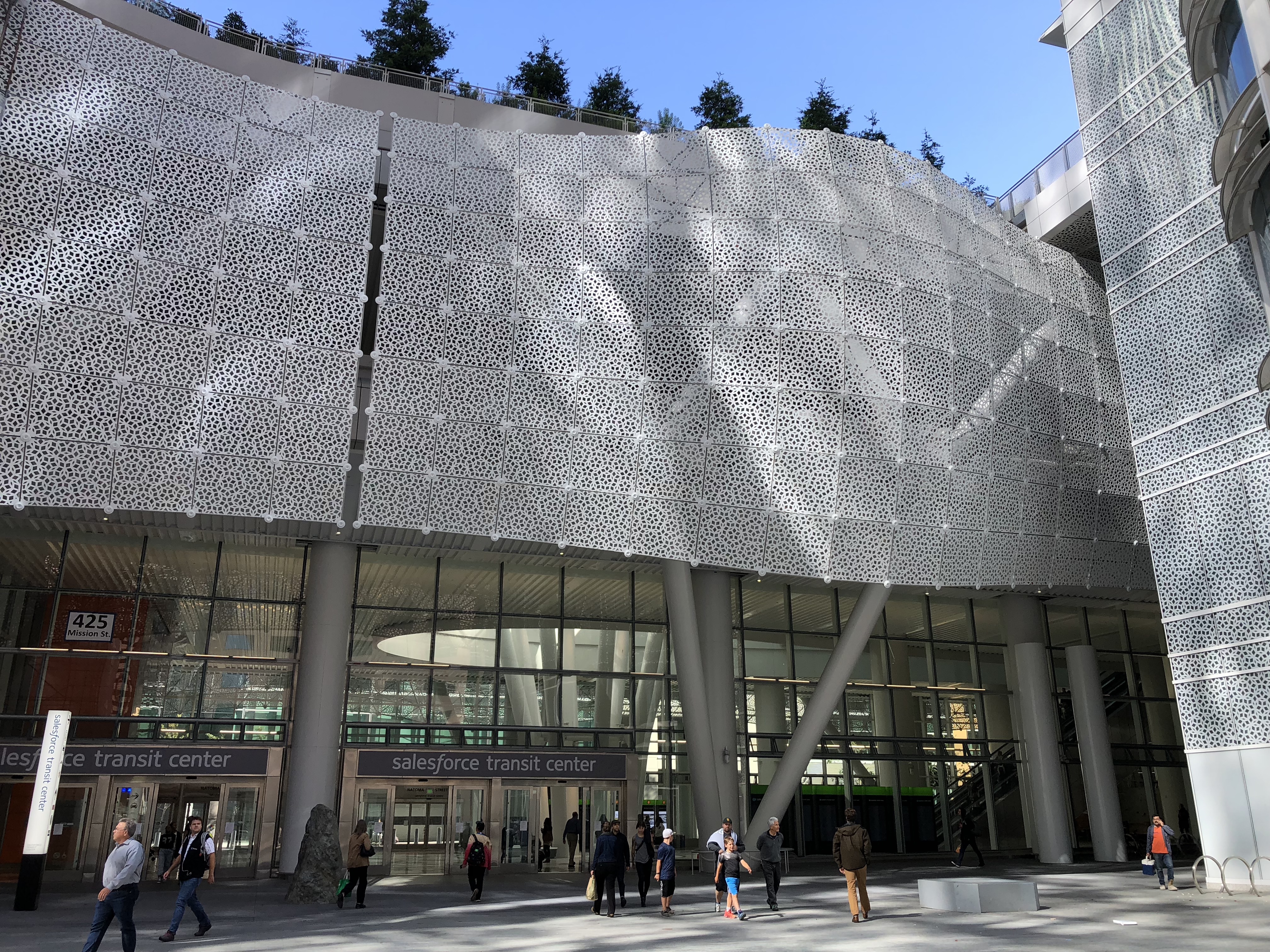
The Transbay Transit Center (officially the Salesforce Transit Center for sponsorship purposes) is a transit station in downtown San Francisco. It serves as the primary bus terminal — and potentially as a future rail terminal — for the San Francisco Bay Area. The centerpiece of the San Francisco Transbay development, the construction is governed by the Transbay Joint Powers Authority (TJPA). The building is located one block south of Market Street, a primary commercial and transportation artery in San Francisco. Construction of the new terminal was necessitated by the 1989 Loma Prieta earthquake, which damaged the 1939-opened Transbay Terminal, and voters approved funds for the new Transbay Transit Center in 1999. Construction on the first phase, the aboveground bus terminal, began in 2010. Limited Muni bus service began in December 2017, and full service from AC Transit and other regional and intercity bus operators began in August 2018. Full funding has not yet been se ... [...More Info...] [...Related Items...] OR: [Wikipedia] [Google] [Baidu] |
San Francisco Transbay Development
The San Francisco Transbay development is a completed redevelopment plan for the neighborhood surrounding the Transbay Transit Center site, South of Market near the Financial District in San Francisco, California. The new transit center replaced the since-demolished San Francisco Transbay Terminal, and new skyscrapers, such as Salesforce Tower, took advantage of the height increases allowed through the San Francisco Transit Center District Plan. The sale of several land parcels formerly owned by the state and given to the managing Transbay Joint Powers Authority helped finance the construction of the transit center. History The original Transbay Terminal opened in 1939 as the San Francisco terminus for the Key System and other commuter trains that travelled across the new San Francisco–Oakland Bay Bridge to the East Bay. Train service to San Francisco was discontinued in 1958 and the Transbay Terminal was reconfigured for buses. Transbay train service would resume in 1974 with ... [...More Info...] [...Related Items...] OR: [Wikipedia] [Google] [Baidu] |
Green Building
Green building (also known as green construction or sustainable building) refers to both a structure and the application of processes that are environmentally responsible and resource-efficient throughout a building's life-cycle: from planning to design, construction, operation, maintenance, renovation, and demolition. This requires close cooperation of the contractor, the architects, the engineers, and the client at all project stages.Yan Ji and Stellios Plainiotis (2006): Design for Sustainability. Beijing: China Architecture and Building Press. The Green Building practice expands and complements the classical building design concerns of economy, utility, durability, and comfort. Green building also refers to saving resources to the maximum extent, including energy saving, land saving, water saving, material saving, etc., during the whole life cycle of the building, protecting the environment and reducing pollution, providing people with healthy, comfortable and efficient u ... [...More Info...] [...Related Items...] OR: [Wikipedia] [Google] [Baidu] |
Brise Soleil
''Brise soleil'', sometimes ''brise-soleil'' (; ), is an architectural feature of a building that reduces heat gain within that building by deflecting sunlight. More recently, vertical Brise soleil have become popular. Both systems allow low-level sun to enter a building in the mornings, evenings and during winter but cut out direct light during summer. Architecture ''Brise-soleil'' can comprise a variety of permanent sun-shading structures, ranging from the simple patterned concrete walls popularized by Le Corbusier in the Palace of Assembly to the elaborate wing-like mechanism devised by Santiago Calatrava for the Milwaukee Art Museum or the mechanical, pattern-creating devices of the Institut du Monde Arabe by Jean Nouvel. In the typical form, a horizontal projection extends from the sunside facade of a building. This is most commonly used to prevent facades with a large amount of glass from overheating during the summer. Often louvers are incorporated into the shade to p ... [...More Info...] [...Related Items...] OR: [Wikipedia] [Google] [Baidu] |
.jpg)


