|
Trade Wind Airport
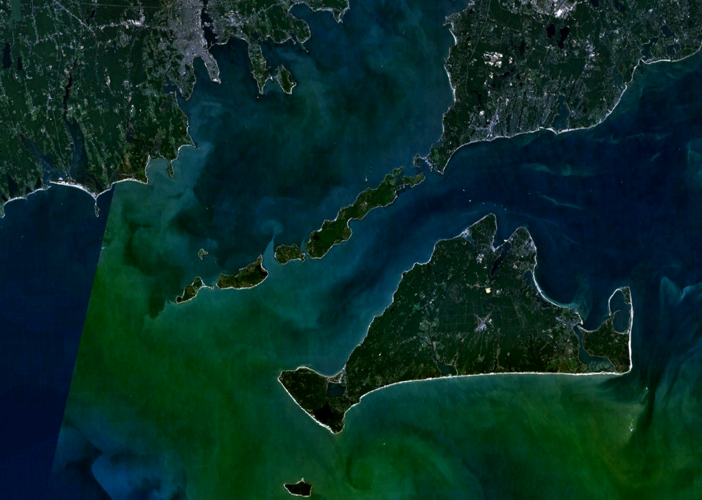
Trade Wind Airport is an airfield in Oak Bluffs, Massachusetts, located in Dukes County on the Island of Martha's Vineyard. The airfield has been in operation since at least 1938. It has two turf runways, numbered 6/24 and 13/31. Only runway 6/24 is currently in use. There is a hangar on the property, but there are currently no fueling or hangar facilities available. No overnight parking of planes is allowed, so planes must leave the same day. Aircraft wishing to park overnight use one of the other two airports on the island, Martha's Vineyard Airport or Katama Airpark Katama Airpark ''FAA Form 5010 for 1B2''. Federal Aviation Administration. 2023. is a public airport in the Katama section of Edgartown, Massachusetts, in Dukes County on the island of Martha's Vineyard. The airport, owned by the Town of Edgart .... The airport is on 71.9 acres of land known as the Trade Wind Fields Preserve and is owned and operated by the Martha's Vineyard Land Bank Commission. The airpor ... [...More Info...] [...Related Items...] OR: [Wikipedia] [Google] [Baidu] |
Oak Bluffs, Massachusetts
Oak Bluffs is a town located on the island of Martha's Vineyard in Dukes County, Massachusetts, United States. The population was 5,341 at the 2020 United States Census. It is one of the island's principal points of arrival for summer tourists, and is noted for its "gingerbread cottages" and other well-preserved mid- to late-nineteenth-century buildings. The town has been a historically important center of African American culture since the eighteenth century. History The first inhabitants of Oak Bluffs were the Wampanoag people, who have lived on Martha's Vineyard (Wampanoag name: Noepe) for approximately 10,000 years. The area that is now Oak Bluffs was called "Ogkeshkuppe," which means "damp/wet thicket or woods." The area was later settled by Europeans in 1642 and was part of Edgartown until 1880, when it was officially incorporated as Cottage City. The town re-incorporated in 1907 as Oak Bluffs, named because the town was the site of an oak grove along the bluffs overlo ... [...More Info...] [...Related Items...] OR: [Wikipedia] [Google] [Baidu] |
Dukes County
Dukes County is a county located in the U.S. state of Massachusetts. As of the 2020 census, the population was 20,600, making it the second-least populous county in Massachusetts. Its county seat is Edgartown. Dukes County comprises the Vineyard Haven, MA Micropolitan Statistical Area. The county consists of the island of Martha's Vineyard (including Chappaquiddick Island), the Elizabeth Islands (including Cuttyhunk), the island of Nomans Land, and other associated islets. History The original inhabitants of the islands were Wampanoag, who had several villages. Political jurisdiction over the lands were granted by the English monarchy in overlapping claims to two different British nobles, from which Massachusetts Bay Company settler Thomas Mayhew purchased them in 1641. Mayhew established a colony in his new domain, carefully purchasing land ownership rights from the native inhabitants, and maintaining native governments to continue unimpeded. In 1665, Mayhew's lands were in ... [...More Info...] [...Related Items...] OR: [Wikipedia] [Google] [Baidu] |
Martha's Vineyard
Martha's Vineyard, often simply called the Vineyard, is an island in the Northeastern United States, located south of Cape Cod in Dukes County, Massachusetts, known for being a popular, affluent summer colony. Martha's Vineyard includes the smaller adjacent Chappaquiddick Island, which is usually connected to the Vineyard. The two islands have sometimes been separated by storms and hurricanes, which last occurred from 2007 to 2015. It is the 58th largest island in the U.S., with a land area of about , and the third-largest on the East Coast, after Long Island and Mount Desert Island. Martha's Vineyard constitutes the bulk of Dukes County, which also includes the Elizabeth Islands and the island of Nomans Land (Massachusetts), Nomans Land. The Vineyard was home to one of the earliest known deaf communities in the United States; consequently, a sign language, the Martha's Vineyard Sign Language, emerged on the island among both deaf and hearing islanders. The 2010 census report ... [...More Info...] [...Related Items...] OR: [Wikipedia] [Google] [Baidu] |
Abandoned & Little-Known Airfields
Abandoned & Little-Known Airfields is an online database An online database is a database accessible from a local network or the Internet, as opposed to one that is stored locally on an individual computer or its attached storage (such as a CD). Online databases are hosted on websites, made available as s ... detailing information and first hand memories about airports in the United States which are no longer in operation, or are rarely used. The website was started by Paul Freeman in 1999 as he had developed an interest on the subject. In 2015, there were over 2,000 airports chronicled on the site and it had been viewed over 1.7 million times. Freeman continues to edit the site along with a small team of " airfield archeologists" who do primary source research using old aeronautical charts, directories and related publications. Frequent contributors on the site include Phil Beutel, K.O. Eckland, Christopher Freeze, Chris Kennedy, Bill Larkins, Ron Plante, Brian Rehwinkel, Dann ... [...More Info...] [...Related Items...] OR: [Wikipedia] [Google] [Baidu] |
Martha's Vineyard Airport
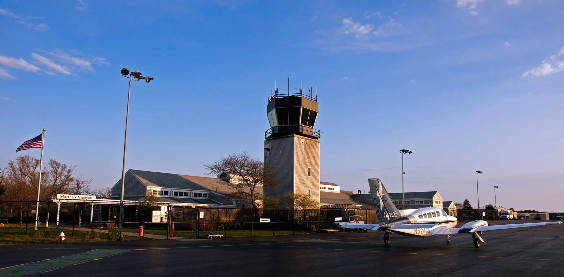
Martha's Vineyard Airport is a public airport located in the middle of the island of Martha's Vineyard, three miles (5 km) south of the central business district of Vineyard Haven, in Dukes County, Massachusetts, United States. This airport is owned by Dukes County and lies on the border between the towns of West Tisbury and Edgartown. It is the largest of three airports and the only one on the island served by airlines. In addition to service from six commercial airlines, it is used by a significant number of general aviation aircraft. The other airports on the Island are Katama Airpark and Trade Wind Airport. The airport identifier MVY has entered into general use as an abbreviation for the island of Martha's Vineyard and is often used for non-aviation purposes. Terminal and facilities Martha's Vineyard Airport covers an area of it has two asphalt runways; * Runway 6/24: 5,504 x 100 ft (1,678 x 30 m), ILS/DME equipped, with approved GPS approaches * Runway 15 ... [...More Info...] [...Related Items...] OR: [Wikipedia] [Google] [Baidu] |
Katama Airpark
Katama Airpark ''FAA Form 5010 for 1B2''. Federal Aviation Administration. 2023. is a public airport in the Katama section of Edgartown, Massachusetts, in Dukes County on the island of Martha's Vineyard. The airport, owned by the Town of Edgartown, has three runways, averages 22 takeoffs and landings per day, and has one aircraft based on its field. Katama is one of three airports on the island. The main airport Martha's Vineyard Airport (MVY) is the only airport with commercial service, and handles the majority of the island's general aviation traffic as well. The third airport is the smaller Trade Wind Airport, a grass airfield in Oak Bluffs. History During World War II, Martha's Vineyard Airport functioned both as an outer defense and a training facility for gunnery and pilots. In addition to the main airport there was a small airfield at Katama near a gunnery practice area at the beach. Following World War II this airport was purchased by Steven Gentle, who ran the Katama ... [...More Info...] [...Related Items...] OR: [Wikipedia] [Google] [Baidu] |
Defunct Airports In Massachusetts
{{Disambiguation ...
Defunct (no longer in use or active) may refer to: * ''Defunct'' (video game), 2014 * Zombie process or defunct process, in Unix-like operating systems See also * * :Former entities * End-of-life product * Obsolescence Obsolescence is the state of being which occurs when an object, service, or practice is no longer maintained or required even though it may still be in good working order. It usually happens when something that is more efficient or less risky r ... [...More Info...] [...Related Items...] OR: [Wikipedia] [Google] [Baidu] |
Buildings And Structures In Oak Bluffs, Massachusetts
A building, or edifice, is an enclosed structure with a roof and walls standing more or less permanently in one place, such as a house or factory (although there's also portable buildings). Buildings come in a variety of sizes, shapes, and functions, and have been adapted throughout history for a wide number of factors, from building materials available, to weather conditions, land prices, ground conditions, specific uses, prestige, and aesthetic reasons. To better understand the term ''building'' compare the list of nonbuilding structures. Buildings serve several societal needs – primarily as shelter from weather, security, living space, privacy, to store belongings, and to comfortably live and work. A building as a shelter represents a physical division of the human habitat (a place of comfort and safety) and the ''outside'' (a place that at times may be harsh and harmful). Ever since the first cave paintings, buildings have also become objects or canvasses of much artistic ... [...More Info...] [...Related Items...] OR: [Wikipedia] [Google] [Baidu] |


