|
Topoxté
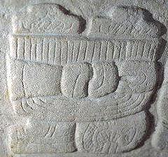
Topoxte () (or Topoxté in Spanish orthography) is a pre-Columbian Maya archaeological site in the Petén Basin in northern Guatemala with a long occupational history dating as far back as the Middle Preclassic.Pinto & Noriega 1995, pp.576–7. As the capital of the Kowoj Maya, it was the largest of the few Postclassic Mesoamerican sites in the area. Topoxte is located on an island on Yaxha Lake across from the important Classic period center of Yaxha.Sharer & Traxler 2006, p.617. Topoxte was named by Teobert Maler in 1904;Chase 1976, p.155. the name means "seed of the Ramón tree." There is no record of the name Topoxte prior to this. The Ramón tree, commonly known as breadnut, was an important component of the ancient Maya diet. Prior to this the site was known as ''Islapag'', as noted in 1831 by Juan Galindo in his report to the Society of Antiquaries of London. Location Topoxte occupies five of a cluster of six islands at the western end of Lake Yaxha in the municipa ... [...More Info...] [...Related Items...] OR: [Wikipedia] [Google] [Baidu] |
Petén Basin
The Petén Basin is a geographical subregion of Mesoamerica, primarily located in northern Guatemala within the Department of El Petén, and into Campeche state in southeastern Mexico. During the Late Preclassic and Classic periods of pre-Columbian Mesoamerican chronology many major centers of the Maya civilization flourished, such as Tikal and Calakmul. A distinctive Petén-style of Maya architecture and inscriptions arose. The archaeological sites La Sufricaya and Holmul are also located in this region. History By the first half of the 1st millennium BCE, the Petén and Mirador Basin of this region were already well-established with a number of monumental sites and cities of the Maya civilization. Significant Maya sites of this Preclassic era of Mesoamerican chronology include Nakbé, El Mirador, Naachtun, San Bartolo and Cival in the Mirador Basin. Classic Period Later, Petén became the heartland of the Maya Classic Period (c. 200 – 900 CE). At its height ... [...More Info...] [...Related Items...] OR: [Wikipedia] [Google] [Baidu] |
Petén Department
Petén is a department of Guatemala. It is geographically the northernmost department of Guatemala, as well as the largest by area at it accounts for about one third of Guatemala's area. The capital is Flores. The population at the mid-2018 official estimate was 595,548. Geography The Petén department is bordered on the east by Belize and by Mexico (with the Mexican states of Chiapas to the west, Tabasco to the northwest and Campeche to the north). To the south it borders the Guatemalan departments of Alta Verapaz and Izabal.ITMB Publishing Ltd. 2005. Much of the western border with Mexico is formed by the Usumacinta River and its tributary the Salinas River. Portions of the southern border of the department are formed by the rivers Gracias a Dios and Santa Isabel. The Petén lowlands are formed by a densely forested low-lying limestone plain featuring karstic topography. The area is crossed by low east-west oriented ridges of Cenozoic limestone and is characterise ... [...More Info...] [...Related Items...] OR: [Wikipedia] [Google] [Baidu] |
Municipalities Of Guatemala
The departments of Guatemala are divided into 340 municipalities A municipality is usually a single administrative division having corporate status and powers of self-government or jurisdiction as granted by national and regional laws to which it is subordinate. The term ''municipality'' may also mean the ..., or ''municipios''. The municipalities are listed below, by department. List References {{DEFAULTSORT:Municipalities Of Guatemala Subdivisions of Guatemala Guatemala, Municipalities Guatemala 2 Municipalities, Guatemala Guatemala geography-related lists ... [...More Info...] [...Related Items...] OR: [Wikipedia] [Google] [Baidu] |
Parque Yaxha Nakum Naranjo Sitio Topoxte 2015-01-21-06
*
*
{{dab, surname ...
Parque is the Galician, Portuguese and Spanish word for " park", and may refer to: * Parque (TransMilenio), a metro station in Bogotá, Colombia * Parque (Lisbon Metro), in Portugal * Parque (Santurce), a subbarrio in San Juan, Puerto Rico * Jim Parque, a baseball player See also * Parquetry, a type of flooring * Park (other) A park is an area of land with a recreational or other specific purpose. Park or Parks may also refer to: Places United Kingdom * Park (Reading ward), an electoral ward of the Borough of Reading, Berkshire, England * Park (Sefton ward), an ... [...More Info...] [...Related Items...] OR: [Wikipedia] [Google] [Baidu] |
Uaxactun
Uaxactun (pronounced ) is an ancient sacred place of the Maya civilization, located in the Petén Basin region of the Maya lowlands, in the present-day department of Petén, Guatemala. The site lies some north of the major center of Tikal. The name is sometimes spelled as Waxaktun. History of discovery With recent achievements in the decipherment of the ancient Maya hieroglyphic writing system, it has been determined that the ancient name for this site translates roughly as ''Siaan K'aan'' or "Born in Heaven". The name ''Uaxactun'' was given to the site by its rediscoverer, archaeologist Sylvanus Morley, in May 1916. He coined the name from Maya words ''Waxac'' and ''Tun'', to mean "Eight Stones". The name has two meanings; Morley's stated reason for the name was to commemorate it as the first site where an inscription dating from the 8th Baktún of the Maya calendar was discovered (making it then the earliest known Maya date). The other meaning is a pun, since "Uaxactun ... [...More Info...] [...Related Items...] OR: [Wikipedia] [Google] [Baidu] |
Tikal
Tikal () (''Tik’al'' in modern Mayan orthography) is the ruin of an ancient city, which was likely to have been called Yax Mutal, found in a rainforest in Guatemala. It is one of the largest archeological sites and urban centers of the pre-Columbian Maya civilization. It is located in the archeological region of the Petén Basin in what is now northern Guatemala. Situated in the Departments of Guatemala, department of El Petén, the site is part of Guatemala's Tikal National Park and in 1979 it was declared a UNESCO World Heritage Site. Tikal was the capital of a conquest state that became one of the most powerful kingdoms of the ancient Maya. Though monumental architecture at the site dates back as far as the 4th century BC, Tikal reached its apogee during the Mesoamerican chronology, Classic Period, c. 200 to 900. During this time, the Maya city, city dominated much of the Maya region politically, economically, and militarily, while interacting with areas throughout Mesoamer ... [...More Info...] [...Related Items...] OR: [Wikipedia] [Google] [Baidu] |
Ixtepeque
Volcán Ixtepeque is a stratovolcano in southern Guatemala. It consists of several rhyolitic lava domes and basaltic cinder cones. Its name is derived from the nahuatl word for obsidian. Ixtepeque was one of the most important obsidian sources in pre-Columbian Mesoamerica. See also * List of volcanoes in Guatemala This is a list of active, dormant, and extinct volcanoes in Guatemala. Volcanoes See also * Central America Volcanic Arc * List of volcanoes in El Salvador * List of volcanoes in Honduras * List of volcanoes in Mexico Footnotes ... References * Mountains of Guatemala Volcano Stratovolcanoes of Guatemala Obsidian {{NorthAm-protected-area-stub ... [...More Info...] [...Related Items...] OR: [Wikipedia] [Google] [Baidu] |
Obsidian Use In Mesoamerica
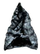
Obsidian is a naturally formed volcanic glass that was an important part of the material culture of Pre-Columbian Mesoamerica. Obsidian was a highly integrated part of daily and ritual life, and its widespread and varied use may be a significant contributor to Mesoamerica's lack of metallurgy. Lithic and contextual analysis of obsidian, including source studies, are important components of archaeological studies of past Mesoamerican cultures and inform scholars on economy, technological organization, long-distance trade, ritual organization, and socio-cultural structure. Production techniques Due to its glassy internal structure, obsidian is relatively easy to work, as it breaks in very predictable and controlled ways via conchoidal fracturing. This contributed to its prolific use throughout Mesoamerica. It is obtained by either quarrying source sites or in nodule form from riverbeds or fractured outcrops. Following the removal of cortex (when applicable), bifacial, uni ... [...More Info...] [...Related Items...] OR: [Wikipedia] [Google] [Baidu] |
Zacpeten
Zacpeten is a pre-Columbian Maya archaeological site in the northern Petén Department of Guatemala. It is notable as one of the few Maya communities that maintained their independence through the early phases of Spanish control over Mesoamerica. History The site of Zacpeten occupies a peninsula on Lake Salpeten in the Petén Department of northern Guatemala. The site was sporadically inhabited by the Maya since its initial settlement during the Middle Preclassic (1000 – 300 BC). After abandonment during Late Preclassic and Early Classic, the site was resettled from the Late to Terminal Classic (AD 600 – 950). Abandoned again, it was reoccupied in the Late Postclassic by the Maya peoples who survived the Classic Maya collapse and migrated from Mayapan in Yucatán (now in Mexico) after the collapse of the city in the fifteenth century. These people, the Kowoj Maya, brought their distinctive pottery and constructed typical Mayapan temple assemblages with a raised shrine ly ... [...More Info...] [...Related Items...] OR: [Wikipedia] [Google] [Baidu] |
Mexico
Mexico ( Spanish: México), officially the United Mexican States, is a country in the southern portion of North America. It is bordered to the north by the United States; to the south and west by the Pacific Ocean; to the southeast by Guatemala, Belize, and the Caribbean Sea; and to the east by the Gulf of Mexico. Mexico covers ,Mexico '' The World Factbook''. . making it the world's 13th-largest country by area; with approximately 12 ... [...More Info...] [...Related Items...] OR: [Wikipedia] [Google] [Baidu] |
Belize
Belize (; bzj, Bileez) is a Caribbean and Central American country on the northeastern coast of Central America. It is bordered by Mexico to the north, the Caribbean Sea to the east, and Guatemala to the west and south. It also shares a water boundary with Honduras to the southeast. It has an area of and a population of 441,471 (2022). Its mainland is about long and wide. It is the least populated and least densely populated country in Central America. Its population growth rate of 1.87% per year (2018 estimate) is the second-highest in the region and one of the highest in the Western Hemisphere. Its capital is Belmopan, and its largest city is the namesake city of Belize City. Belize is often thought of as a Caribbean country in Central America because it has a history similar to that of English-speaking Caribbean nations. Indeed, Belize’s institutions and official language reflect its history as a British colony. The Maya civilization spread into the area of B ... [...More Info...] [...Related Items...] OR: [Wikipedia] [Google] [Baidu] |


