|
Tom Sharp (trader)
William Thomas Sharp (May 30, 1838 – November 26, 1929) was a former Confederate soldier and later an explorer who operated a trading post on the Taos Trail and founded the now extinct town of Malachite, Colorado. It was located on the Huerfano River in Huerfano County, Colorado. He became a nationally known horse and cattle breeder. Early life and the Civil War William Thomas Sharp was born in Hannibal in Marion County, Missouri on May 30, 1838. Sharp was a Confederate soldier during the American Civil War, serving under Major General Sterling Price. Early in the war, he received numerous wounds and was paroled from the army. He was then put in a wagon for the far west. Career Western travel Beginning with a trip Pikes Peak in 1859, and sandwiched around his service during the Civil War, Sharp traveled across the American West and British Columbia until 1868. He was a prospector and railroad worker. He also supplied meat to mining camps in California and Oregon with an Angl ... [...More Info...] [...Related Items...] OR: [Wikipedia] [Google] [Baidu] |
Hannibal, Missouri
Hannibal is a city along the Mississippi River in Marion and Ralls counties in the U.S. state of Missouri. According to the 2020 U.S. Census, the population was 17,312, making it the largest city in Marion County. The bulk of the city is in Marion County, with a tiny sliver in the south extending into Ralls County. Developed for river traffic, today the city is tied to vehicle traffic, intersected by Interstate 72 and U.S. Routes 24, 36, and 61. It is across the river from East Hannibal, Illinois. Hannibal is approximately northwest of St. Louis (also bordering the Mississippi), east-northeast of Kansas City and miles east of Saint Joseph (both cities on the Missouri River), and approximately west of Springfield, Illinois. Hannibal is not the county seat, but it has one of two county courthouses. There is also one in Palmyra, the county seat, which is located more centrally in the county. Hannibal is the principal city of the Hannibal, Missouri micropolitan area, w ... [...More Info...] [...Related Items...] OR: [Wikipedia] [Google] [Baidu] |
Apache
The Apache () are a group of culturally related Native American tribes in the Southwestern United States, which include the Chiricahua, Jicarilla, Lipan, Mescalero, Mimbreño, Ndendahe (Bedonkohe or Mogollon and Nednhi or Carrizaleño and Janero), Salinero, Plains (Kataka or Semat or "Kiowa-Apache") and Western Apache ( Aravaipa, Pinaleño, Coyotero, Tonto). Distant cousins of the Apache are the Navajo, with whom they share the Southern Athabaskan languages. There are Apache communities in Oklahoma and Texas, and reservations in Arizona and New Mexico. Apache people have moved throughout the United States and elsewhere, including urban centers. The Apache Nations are politically autonomous, speak several different languages, and have distinct cultures. Historically, the Apache homelands have consisted of high mountains, sheltered and watered valleys, deep canyons, deserts, and the southern Great Plains, including areas in what is now Eastern Arizona, Northern M ... [...More Info...] [...Related Items...] OR: [Wikipedia] [Google] [Baidu] |
Ute Mountain Ute Indian Reservation
The Ute Mountain Ute Tribe (Ute dialect: Wʉgama Núuchi) is one of three federally recognized tribes of the Ute Nation, and are mostly descendants of the historic Weeminuche Band who moved to the Southern Ute reservation in 1897. Their reservation is headquartered at Towaoc, Colorado on the Ute Mountain Ute Indian Reservation in southwestern Colorado, northwestern New Mexico and small sections of Utah. History The Ute Mountain Ute Tribe are descendants of the Weeminuche bandPritzker, 245 (''Weminuche'', ''Weemeenooch'', ''Wiminuc'', ''Guiguinuches'') lived west of the Great Divide along the Dolores River of western Colorado, in the Abajo Mountains, in the Valley of the San Juan River its northern tributaries and in the San Juan Mountains including eastern Utah. They moved to the Southern Ute reservation in 1897. Two thousand years ago, the Utes lived and ranged in the mountains and desert over much of the Colorado Plateau present day eastern Utah, western Colorado, northern ... [...More Info...] [...Related Items...] OR: [Wikipedia] [Google] [Baidu] |
Southern Ute Indian Reservation
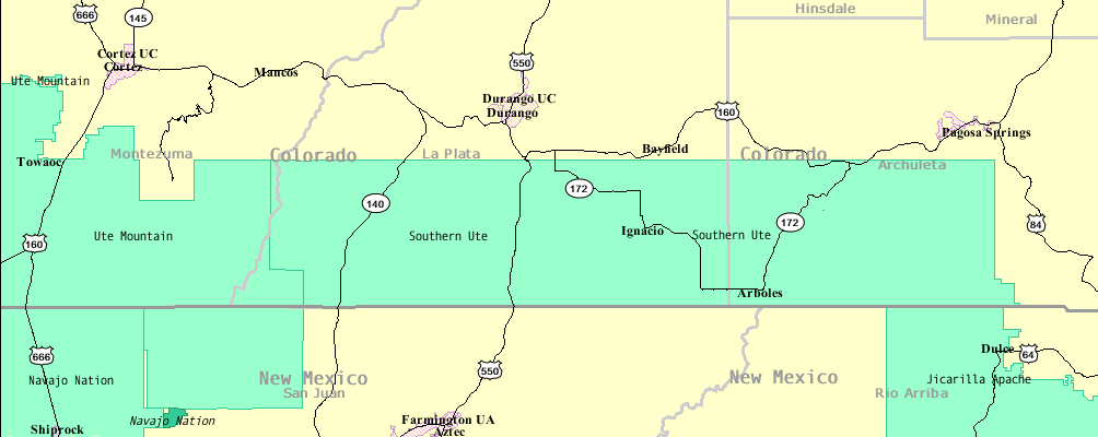
The Southern Ute Indian Reservation (Ute dialect: Kapuuta-wa Moghwachi Núuchi-u) is a Native American reservation in southwestern Colorado near the northern New Mexico state line. Its territory consists of land from three counties; in descending order of surface area they are La Plata, Archuleta, and Montezuma Counties. The reservation has a land area of 1,058.785 sq mi (2,742.24 km²). Its largest communities are Ignacio and Arboles. The only other community that is recognized as a separate place by the Census Bureau is the CDP of Southern Ute, which lies just southeast of Ignacio. History Historic bands The Southern Ute tribes include the Muache, Capote, and the Weeminuche, the latter of which are at Ute Mountain. These tribes were considered the Southern Utes. Capote The Capote (''Kapuuta Núuchi'', ''Kapota'', ''Kahpota'') band lived east of the Great Divide south of the Conejos River and east of the Rio Grande towards the west site of the Sangre de Cristo M ... [...More Info...] [...Related Items...] OR: [Wikipedia] [Google] [Baidu] |
Gardner, Colorado
Gardner is a census-designated place (CDP) and post office in and governed by Huerfano County, Colorado, United States. The Gardner post office has the ZIP Code 81040. At the United States Census 2020, the population of the Gardner CDP was 106. History The Gardner Post Office has been in operation since 1871. The community has the name of Herbert Gardner, a local pioneer. Herbert was the son of Henry Gardner. Geography The Gardner CDP has an area of , all land. Demographics The United States Census Bureau defined the for the See also * List of census-designated places in Colorado The U.S. has 210 census-designated places. The United States Census Bureau defines certain unincorporated communities as census-designated places (CDPs) for enumeration in each decennial census. The Census Bureau defined 187 CDPs in Colorado ... References External links Gardner @ Sangres.comGardner, Colorado Mining Claims And MinesHuerfano County website {{authority control C ... [...More Info...] [...Related Items...] OR: [Wikipedia] [Google] [Baidu] |
Alamosa, Colorado
Alamosa is a home rule municipality and the county seat of Alamosa County, Colorado, United States. The city population was 9,806 at the 2020 United States Census. The city is the commercial center of the San Luis Valley in south-central Colorado, and is the home of Adams State University. History Alamosa was established in May 1878 by the Denver and Rio Grande Railroad and quickly became an important rail center. Alamosa was the terminus of the D&RG until 1881, when the line was extended to Monte Vista. The railroad had an extensive construction, repair and shipping facility in Alamosa for many years and headquartered its remaining narrow gauge service here with trackage reaching many points throughout southwest Colorado and northern New Mexico. Alamosa is now a notable tourist town with many nearby attractions, including the Great Sand Dunes National Park and Preserve, Colorado Gators Reptile Park and the Rio Grande Scenic Railroad. The town hosts "Summer Fest on the Rio" whic ... [...More Info...] [...Related Items...] OR: [Wikipedia] [Google] [Baidu] |
Walsenburg, Colorado
The City of Walsenburg is the Statutory City that is the county seat and the most populous municipality of Huerfano County, Colorado, United States. The city population was 3,049 at the 2020 census, down from 3,068 in 2010. History Walsenburg was originally settled under the name of La Plaza de los Leones in 1859. The settlement was named after settler Don Miguel Antonio de Leon, who came along with others from New Mexico. A post office called Walsenburg has been in operation since 1870. The community was named after Fred Walsen, an early settler. Robert Ford, the assassin of outlaw Jesse James, operated a combination saloon and gambling house in Walsenburg; his home at 320 West 7th Street still stands. The town is also remembered in sports history due to a famous newspaper gaffe ("Will Overhead") after the 1933 Indianapolis 500. Colorado Coalfield War Walsenburg played a central role in the 1913-1914 Strike of the United Mine Workers of America against the Rockefeller-own ... [...More Info...] [...Related Items...] OR: [Wikipedia] [Google] [Baidu] |
Taos, New Mexico
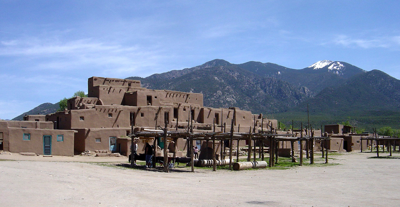
Taos is a town in Taos County in the north-central region of New Mexico in the Sangre de Cristo Mountains. Initially founded in 1615, it was intermittently occupied until its formal establishment in 1795 by Nuevo México Governor Fernando Chacón to act as fortified plaza and trading outpost for the neighboring Native American Taos Pueblo (the town's namesake) and Hispano communities, including Ranchos de Taos, Cañon, Taos Canyon, Ranchitos, El Prado, and Arroyo Seco. The town was incorporated in 1934. As of the 2010 census, its population was 5,716. Taos is the county seat of Taos County. The English name ''Taos'' derives from the native Taos language meaning "(place of) red willows". Taos is the principal town of the Taos, NM, Micropolitan Statistical Area, which includes all of Taos County. History Taos Pueblo The Taos Pueblo, which borders the north boundary of the town of Taos, has been occupied for nearly a millennium. It is estimated that the pueblo was b ... [...More Info...] [...Related Items...] OR: [Wikipedia] [Google] [Baidu] |
San Luis Valley
The San Luis Valley is a region in south-central Colorado with a small portion overlapping into New Mexico. The valley is approximately long and wide, extending from the Continental Divide on the northwest rim into New Mexico on the south. It contains 6 counties and portions of 3 others. It is an extensive high-elevation depositional basin of approximately with an average elevation of above sea level. The valley is a section of the Rio Grande Rift and is drained to the south by the Rio Grande, which rises in the San Juan Mountains to the west of the valley and flows south into New Mexico. The San Luis Valley has a cold desert climate but has substantial water resources from the Rio Grande and groundwater. The San Luis Valley was ceded to the United States by Mexico following the Mexican–American War. Hispanic settlers began moving north and settling in the valley after the United States made a treaty with the Utes and established a fort in the early 1850s. Prior ... [...More Info...] [...Related Items...] OR: [Wikipedia] [Google] [Baidu] |
Sangre De Cristo Pass
Sangre de Cristo Pass, elevation , is a mountain pass in the Sangre de Cristo Mountains of the U.S. State of Colorado. The pass is located immediately north of U.S. Highway 160 one half mile (800 m) northwest of North La Veta Pass. The pass separates Costilla County from Huerfano County, the Rio Grande drainage basin from the Arkansas River basin, and the headwaters of Sangre de Cristo Creek from those of Oak Creek. Sangre de Cristo Pass was a popular early route between the Rio Grande and the Arkansas River for native peoples, trappers, and traders. The pass was the site of the Spanish Fort of 1819, the only permanent structure built by the Spanish government in the Mountain West north of the present State of New Mexico. See also *Mountain passes of Colorado This is a list of some important mountain passes in the Rocky Mountains of the U.S. State of Colorado. __TOC__ Mountain passes and highway summits traversed by improved roads Mountain summit highways Mo ... [...More Info...] [...Related Items...] OR: [Wikipedia] [Google] [Baidu] |
Trapper's Trail
The Trapper's Trail or Trappers' Trail is a north-south path along the eastern base of the Rocky Mountains that links the Great Platte River Road at Fort Laramie and the Santa Fe Trail at Bent's Old Fort. Along this path there were a number of trading posts, also called trading forts. History In 1802, after the Spanish territory of Louisiana was given back to France through treaty in 1800, trappers began entering the Louisiana Territory and trapped beavers in the mountains. In 1803, the United States purchased the land which encompassed the present state of Colorado with the Louisiana Purchase and explorers came to the area to survey the land. The trail was an important trade route for fur trappers and traders in the North American fur trade from about 1820 and into the Pikes Peak Gold Rush beginning 1859. Trapper's Trail was first known to be used in 1820 for Stephen H. Long’s expedition. Colonel Henry Dodge used it in 1835 for the Dodge-Leavenworth Expedition or First ... [...More Info...] [...Related Items...] OR: [Wikipedia] [Google] [Baidu] |
Chipeta
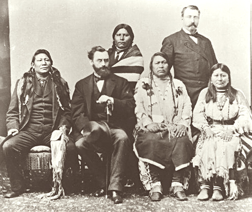
Chipeta or White Singing Bird (1843 or 1844 – August 1924) was a Native American woman, and the second wife of Chief Ouray of the Uncompahgre Ute tribe. Born a Kiowa Apache, she was raised by the Utes in what is now Conejos, Colorado. An advisor and confidant of her husband, Chipeta continued as a leader of her people after his death in 1880. She was an Indian rights advocate and diplomat. She used diplomacy to try to achieve peace with the white settlers in Colorado and in 1985, Chipeta was inducted into Colorado Women's Hall of Fame. Background ''Chipeta'', "White Singing Bird" in the Ute ( Shoshonean) language, was born into the Kiowa Apache tribe in about 1843 or 1844. She was adopted and raised by the Uncompahgre Utes of present-day Colorado. She learned their traditional ways and became a skilled artisan in beadwork and tanning. In 1859, she married Chief Ouray of the Uncompahgres, becoming his second wife. She came to act as his advisor and confidant, often sitting ... [...More Info...] [...Related Items...] OR: [Wikipedia] [Google] [Baidu] |


