|
Timeline Of The 2009 Pacific Typhoon Season
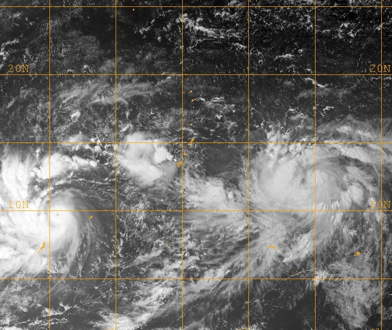
This timeline documents all of the events of the 2009 Pacific typhoon season which was the period that tropical cyclones formed in the Western Pacific Ocean during 2009, with most of the tropical cyclones forming between May and November. The scope of this article is limited to the Pacific Ocean, north of the equator between 100°E and the International Date Line. Tropical storms that form in the entire Western Pacific basin are assigned a name by the Japan Meteorological Agency. Tropical depressions that form in this basin are given a number with a "W" suffix by the United States' Joint Typhoon Warning Center. In addition, the Philippine Atmospheric, Geophysical and Astronomical Services Administration (PAGASA) assigns names to tropical cyclones (including tropical depressions) that enter or form in the Philippine area of responsibility. These names, however, are not in common use outside of the Philippines. During the season, a total of 41 systems were designated as Tropical De ... [...More Info...] [...Related Items...] OR: [Wikipedia] [Google] [Baidu] |
Typhoon Nida (2009)
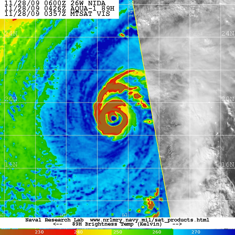
Typhoon Nida, known in the Philippines as Typhoon Vinta, was the most intense tropical cyclone worldwide in 2009. It was also the most intense tropical cyclone in the Northwest Pacific Ocean during the 2000s, tied with Jangmi in 2008. Meteorological history Early on November 21 the Joint Typhoon Warning Center (JTWC) reported that an area of convection had persisted within a monsoon trough about 880 km, (545 mi) to the southeast of Guam island. At this time the system was moving around the subtropical ridge of pressure, with an anticyclone over the cyclone helping the convection to consolidate over a broad and elongated low level circulation center which was located in an area of minimal vertical wind shear. Later that morning a Tropical Cyclone Formation Alert was released as deep convection increased in organization with multiple bands of convection starting to wrap into the developing low level circulation center. The system was then declared as a tropical depress ... [...More Info...] [...Related Items...] OR: [Wikipedia] [Google] [Baidu] |
Tropical Depression 18W (2009)
Tropical Depression 18W was a weak, short-lived tropical cyclone that brought heavy rains to parts of the Mariana Islands ahead of the more intense Typhoon Melor. Forming from an area of low pressure on September 26, 18W was first monitored by the Japan Meteorological Agency (JMA) as a tropical depression. Tracking generally towards the west, deep convection gradually developed around the system and the Joint Typhoon Warning Center (JTWC) issued their first advisory on the depression early on September 28. Although the depression initially struggled to maintain deep convection, it eventually became better organized and was upgraded to a tropical storm on September 29 by the JTWC. Several hours after reaching this intensity, the system began to rapidly dissipate as its inflow and outflow were severely disrupted by two nearby storms, Parma to the west and Melor to the east. The cyclone fully dissipated near Guam early on September 30 before being absorbed by Typho ... [...More Info...] [...Related Items...] OR: [Wikipedia] [Google] [Baidu] |
Hong Kong Observatory
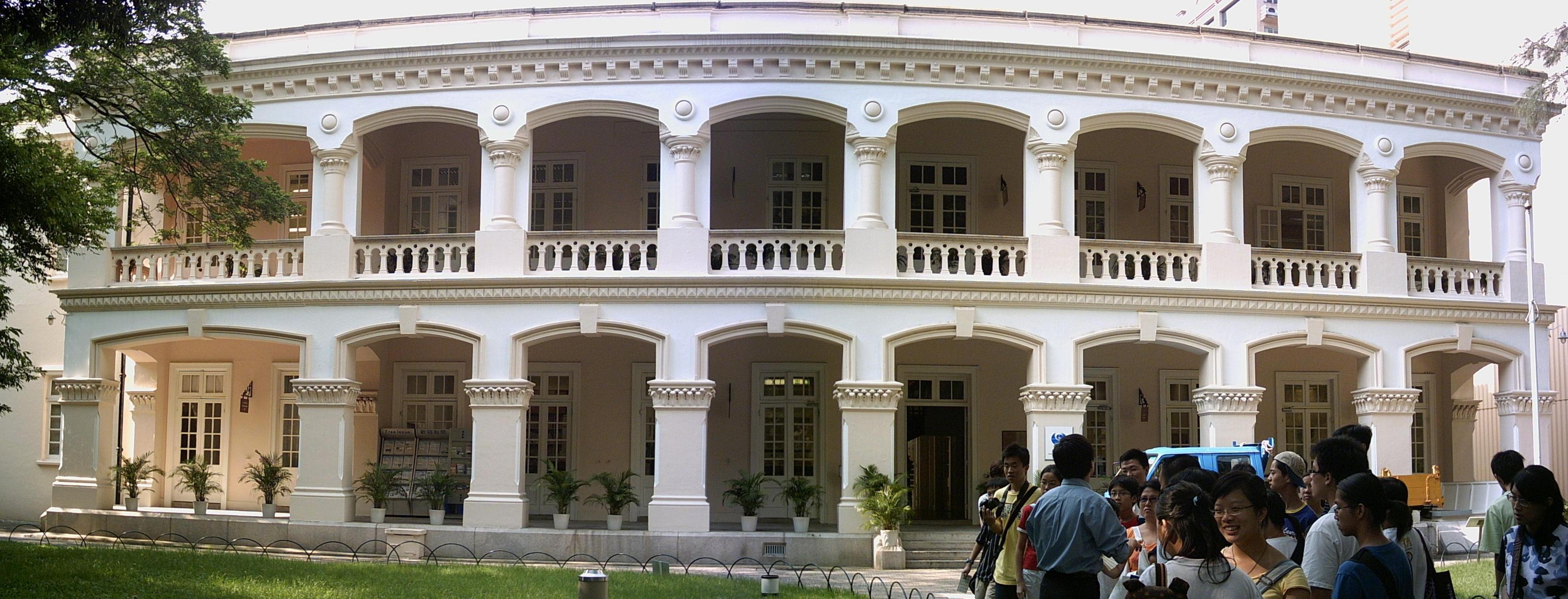
The Hong Kong Observatory is a weather forecast agency of the government of Hong Kong. The Observatory forecasts the weather and issues warnings on weather-related hazards. It also monitors and makes assessments on radiation levels in Hong Kong and provides other meteorological and geophysical services to meet the needs of the public and the shipping, aviation, industrial and engineering sectors. Overview The Observatory was established on 2 March 1883 as the Hong Kong Observatory by Sir George Bowen, the 9th Governor of Hong Kong, with (1852–1941) as its first director. Early operations included meteorological and magnetic observations, a time service based on astronomical observations and a tropical cyclone warning service. The Observatory was renamed the Royal Observatory Hong Kong () after obtaining a Royal Charter in 1912. The Observatory adopted the current name and emblem in 1997 after the Handover of Hong Kong, transfer of Hong Kong's sovereignty from the UK ... [...More Info...] [...Related Items...] OR: [Wikipedia] [Google] [Baidu] |
China Meteorological Administration
The China Meteorological Administration (CMA) is the national weather service of the People's Republic of China. The institution is located in Beijing. History The agency was originally established in December 1949 as the Central Military Commission Meteorological Bureau. It replaced the Central Weather Bureau formed in 1941. In 1994, the CMA was transformed from a subordinate governmental body into one of the public service agencies under the State Council.CMA.gov history Meteorological bureaus are established in 31 , |
World Meteorological Organization
The World Meteorological Organization (WMO) is a specialized agency of the United Nations responsible for promoting international cooperation on atmospheric science, climatology, hydrology and geophysics. The WMO originated from the International Meteorological Organization, a nongovernmental organization founded in 1873 as a forum for exchanging weather data and research. Proposals to reform the status and structure of the IMO culminated in the World Meteorological Convention of 1947, which formally established the World Meteorological Organization. The Convention entered into force on 23 March 1950, and the following year the WMO began operations as an intergovernmental organization within the UN system. The WMO is made up of 193 countries and territories, and facilitates the "free and unrestricted" exchange of data, information, and research between the respective meteorological and hydrological institutions of its members. It also collaborates with nongovernmental partners ... [...More Info...] [...Related Items...] OR: [Wikipedia] [Google] [Baidu] |
Philippine Atmospheric, Geophysical And Astronomical Services Administration
Pagasa may refer to: * ''Pagasa'' (genus), an insect genus in the family Nabidae *PAGASA, an acronym for the Philippine Atmospheric, Geophysical and Astronomical Services Administration *"May Pagasa", a pen-name of José Rizal *Pagasa, alternate spelling of Pagasae Pagasae or Pagases ( el, Παγασαί, Pagasaí), also Pagasa, was a town and polis (city-state) of Magnesia in ancient Thessaly, currently a suburb of Volos. It is situated at the northern extremity of the bay named after it (Παγασητι� ..., a city of ancient Thessaly See also * Pag-asa (other) {{dab ... [...More Info...] [...Related Items...] OR: [Wikipedia] [Google] [Baidu] |
Joint Typhoon Warning Center
The Joint typhoon Warning Center (JTWC) is a joint United States Navy – United States Air Force command in Pearl Harbor, Hawaii. The JTWC is responsible for the issuing of tropical cyclone warnings in the North-West Pacific Ocean, South Pacific Ocean, and Indian Ocean for all branches of the U.S. Department of Defense and other U.S. government agencies. Their warnings are intended for the protection of primarily military ships and aircraft as well as military installations jointly operated with other countries around the world. Its U.S. Navy components are aligned with the Naval Meteorology and Oceanography Command. History The origins of the Joint Typhoon Warning Center (JTWC) can be traced back to June 1945, when the Fleet Weather Center/Typhoon Tracking Center was established on the island of Guam, after multiple typhoons, including Typhoon Cobra of December 1944 and Typhoon Connie in June 1945, had caused a significant loss of men and ships. At this time the center ... [...More Info...] [...Related Items...] OR: [Wikipedia] [Google] [Baidu] |
Japan Meteorological Agency
The , abbreviated JMA, is an agency of the Ministry of Land, Infrastructure, Transport and Tourism. It is charged with gathering and providing results for the public in Japan that are obtained from data based on daily scientific observation and research into natural phenomena in the fields of meteorology, hydrology, seismology and volcanology, among other related scientific fields. Its headquarters is located in Minato, Tokyo. JMA is responsible for gathering and reporting weather data and forecasts for the general public, as well as providing aviation and marine weather. JMA other responsibilities include issuing warnings for volcanic eruptions, and the nationwide issuance of earthquake warnings of the Earthquake Early Warning (EEW) system. JMA is also designated one of the Regional Specialized Meteorological Centers of the World Meteorological Organization (WMO). It is responsible for forecasting, naming, and distributing warnings for tropical cyclones in the Northwestern ... [...More Info...] [...Related Items...] OR: [Wikipedia] [Google] [Baidu] |
International Date Line
The International Date Line (IDL) is an internationally accepted demarcation on the surface of Earth, running between the South and North Poles and serving as the boundary between one calendar day and the next. It passes through the Pacific Ocean, roughly following the 180° line of longitude and deviating to pass around some territories and island groups. Crossing the date line eastbound decreases the date by one day, while crossing the date line westbound increases the date. Geography Circumnavigating the globe People traveling westward around the world must set their clocks: *Back by one hour for every 15° of longitude crossed, and *Forward by 24 hours upon crossing the International Date Line. People traveling eastward must set their clocks: *Forward by one hour for every 15° of longitude crossed, and *Back by 24 hours upon crossing the International Date Line. Failing to do this would make their time inaccurate to the local time. The Arab geographer Abulfed ... [...More Info...] [...Related Items...] OR: [Wikipedia] [Google] [Baidu] |
100th Meridian East
The meridian 100° east of Greenwich is a line of longitude that extends from the North Pole across the Arctic Ocean, Asia, the Indian Ocean, the Southern Ocean, and Antarctica to the South Pole. The 100th meridian east forms a great circle with the 80th meridian west. From Pole to Pole Starting at the North Pole and heading south to the South Pole The South Pole, also known as the Geographic South Pole, Terrestrial South Pole or 90th Parallel South, is one of the two points where Earth's axis of rotation intersects its surface. It is the southernmost point on Earth and lies antipod ..., the 100th meridian east passes through: : {{geographical coordinates, state=collapsed e100 meridian east ... [...More Info...] [...Related Items...] OR: [Wikipedia] [Google] [Baidu] |
Tropical Cyclones
A tropical cyclone is a rapidly rotating storm system characterized by a low-pressure center, a closed low-level atmospheric circulation, strong winds, and a spiral arrangement of thunderstorms that produce heavy rain and squalls. Depending on its location and strength, a tropical cyclone is referred to by different names, including hurricane (), typhoon (), tropical storm, cyclonic storm, tropical depression, or simply cyclone. A hurricane is a strong tropical cyclone that occurs in the Atlantic Ocean or northeastern Pacific Ocean, and a typhoon occurs in the northwestern Pacific Ocean. In the Indian Ocean, South Pacific, or (rarely) South Atlantic, comparable storms are referred to simply as "tropical cyclones", and such storms in the Indian Ocean can also be called "severe cyclonic storms". "Tropical" refers to the geographical origin of these systems, which form almost exclusively over tropical seas. "Cyclone" refers to their winds moving in a circle, whirling round ... [...More Info...] [...Related Items...] OR: [Wikipedia] [Google] [Baidu] |
2009 Pacific Typhoon Season
The 2009 Pacific typhoon season was a below average season that spawned only 22 named storms, 13 typhoons, and five super typhoons. It was also recognized as the deadliest season in the Philippines for decades. The first half of the season was very quiet whereas the second half of the season was extremely active. The season's first named storm, Kujira, developed on May 3 while the season's last named storm, Nida, dissipated on December 3. During August, Typhoon Morakot, devastated Taiwan killing nearly 800 people and was known for being the deadliest typhoon to impact the country. Typhoons Ketsana and Parma both affected the Philippines bringing extreme flooding which killed more than 600 people with damages over US$300 million from both storms. Typhoon Nida during late November reached 1-minute winds of , which is the most intense in the basin since Typhoon Paka in 1997. The scope of this article is limited to the Pacific Ocean to the north of the equator between 100°E and 18 ... [...More Info...] [...Related Items...] OR: [Wikipedia] [Google] [Baidu] |


