|
Timeline Of The 1977 Pacific Hurricane Season
The 1977 Pacific hurricane season stands alongside 2010 as the least active Pacific hurricane season since reliable records began in 1971. Only eight tropical storms formed throughout the year; four further intensified into hurricanes, yet none strengthened into major hurricanes—a Category 3 or stronger on the Saffir–Simpson scale—an occurrence not seen again until 2003. Most tropical cyclones remained over the open eastern Pacific; however, the remnants of hurricanes Doreen and Heather led to heavy rainfall which damaged or destroyed structures and flooded roadways throughout the Southwest United States. Notably, Hurricane Anita which originally formed in the Gulf of Mexico made the rare trek across Mexico into the eastern Pacific, briefly existing as a tropical depression. Eight deaths were recorded while damage reached $39.6 million (1977 USD). __TOC__ Seasonal summary The 1977 Pacific hurricane season was an inactive season, with the first cyclone formin ... [...More Info...] [...Related Items...] OR: [Wikipedia] [Google] [Baidu] |
2010 Pacific Hurricane Season
The 2010 Pacific hurricane season was the least active Pacific hurricane season since modern records, tied with 1977. The season saw only eight named storms, alongside a record-breaking low of three hurricanes. However, of those three, two of them became major hurricanes, and one hurricane, Celia, reached Category 5 intensity on the Saffir-Simpson scale. Also had the second-fewest ACE units on record, as many of the storms were weak and short-lived. The season officially began on May 15 in the East Pacific Ocean, and on June 1 in the Central Pacific; they ended on November 30. These dates conventionally delimit the period of each year when most tropical cyclones form in the Pacific basin. However, the formation of tropical cyclones is possible at any time of the year. Unlike the previous season, the first storm of the season, Agatha, formed during the month of May. Agatha developed on May 29 near the coast of Guatemala. In the second week of June, a sudden spre ... [...More Info...] [...Related Items...] OR: [Wikipedia] [Google] [Baidu] |
Arroyo (creek)
An arroyo (; from Spanish arroyo , "brook"), also called a wash, is a dry stream, creek, stream bed or gulch that temporarily or seasonally fills and flows after sufficient rain. Flash floods are common in arroyos following thunderstorms. ''Wadi'' (Arabic) is used in North Africa and Western Asia for similar landforms. The desert dry wash biome is restricted to the arroyos of the southwestern United States. Arroyos provide a water source to desert animals. Types and processes Arroyos can be natural fluvial landforms or constructed flood control channels. The term usually applies to a Grade (slope), sloped or mountainous terrain in xeric and desert climates. In addition: in many rural communities arroyos are also the principal transportation routes; and in many urban communities arroyos are also parks and recreational locations, often with linear multi-use bicycle, pedestrian, and equestrian trails. Flash flooding can cause the deep arroyos or deposition of sediment on flo ... [...More Info...] [...Related Items...] OR: [Wikipedia] [Google] [Baidu] |
Imperial County, California
Imperial County is a County (United States), county on the southeast border of the U.S. state of California. As of the 2020 United States Census, 2020 census, the population was 179,702, making it the least populous county in Southern California. The county seat is El Centro, California, El Centro. Imperial is the most recent California county to be established, as it was created in 1907 out of portions of San Diego County. Imperial County is located in the far southeast of California, in the Imperial Valley. It borders San Diego County to the west, Riverside County, California, Riverside County to the north, the U.S. state of Arizona to the east and the Mexico, Mexican state of Baja California to the south. It includes the El Centro Metropolitan Statistical Area and is part of the Southern California San Diego–Imperial (California), border region, the smallest but most economically diverse region in the state. Although this region is a desert, with high temperatures and low ... [...More Info...] [...Related Items...] OR: [Wikipedia] [Google] [Baidu] |
San Diego, California
San Diego ( , ; ) is a city on the Pacific Ocean coast of Southern California located immediately adjacent to the Mexico–United States border. With a 2020 population of 1,386,932, it is the eighth most populous city in the United States and the seat of San Diego County, the fifth most populous county in the United States, with 3,338,330 estimated residents as of 2019. The city is known for its mild year-round climate, natural deep-water harbor, extensive beaches and parks, long association with the United States Navy, and recent emergence as a healthcare and biotechnology development center. San Diego is the second largest city in the state of California, after Los Angeles. Historically home to the Kumeyaay people, San Diego is frequently referred to as the "Birthplace of California", as it was the first site visited and settled by Europeans on what is now the U.S. west coast. Upon landing in San Diego Bay in 1542, Juan Rodríguez Cabrillo claimed the area for Spain, ... [...More Info...] [...Related Items...] OR: [Wikipedia] [Google] [Baidu] |
San Jacinto Mountains
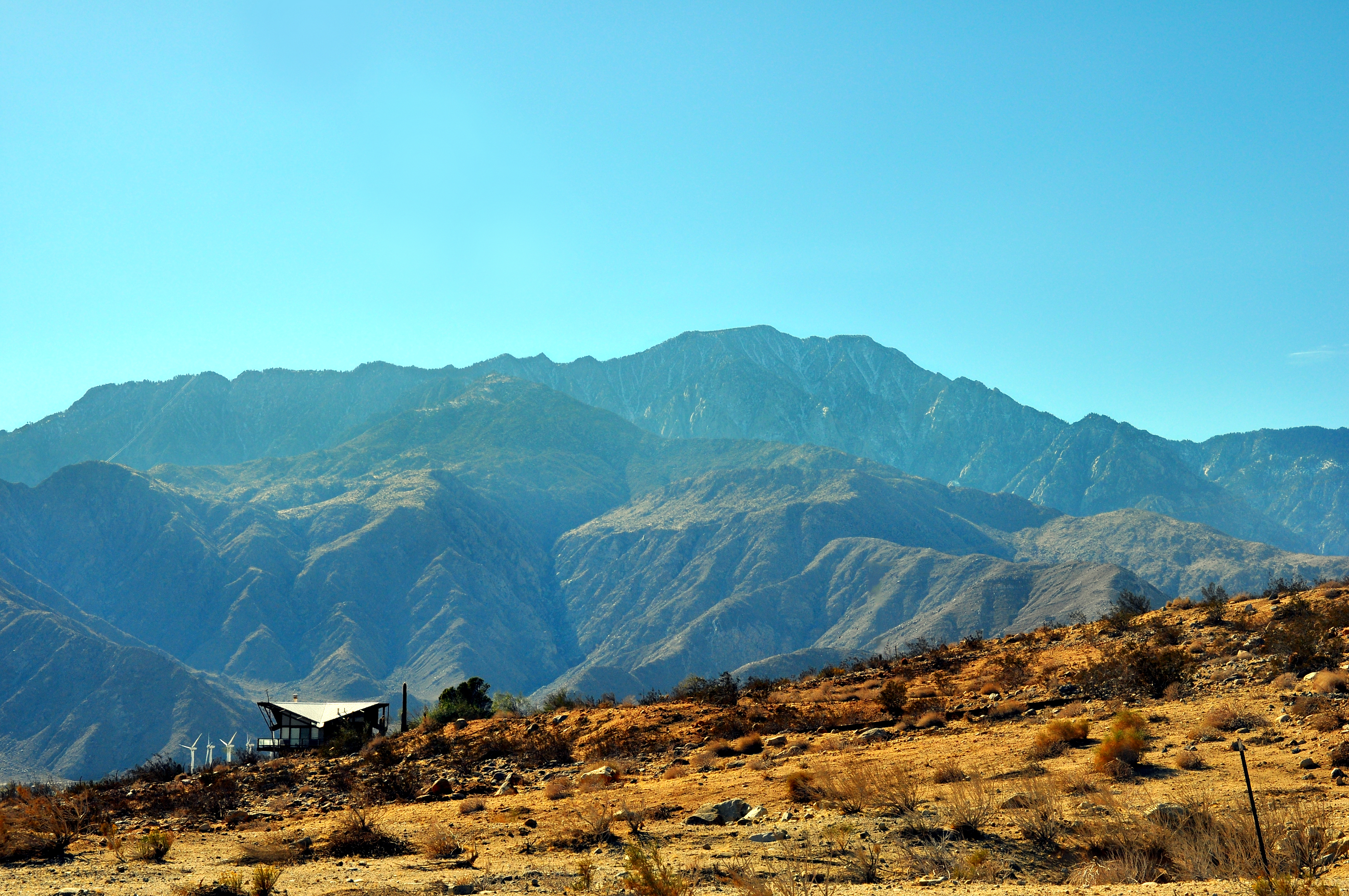
The San Jacinto Mountains (''Avii Hanupach''Munro, P., et al. ''A Mojave Dictionary''. Los Angeles: UCLA. 1992. in Mojave) are a mountain range in Riverside County, located east of Los Angeles in southern California in the United States. The mountains are named for one of the first Black Friars, Saint Hyacinth (San Jacinto in Spanish), who is a popular patron in Latin America. Geography The range extends for approximately from the San Bernardino Mountains southeast to the Santa Rosa Mountains. The San Jacinto Mountains are the northernmost of the Peninsular Ranges, which run from Southern California to the southern tip of the Baja California Peninsula. The highest peak in the range is San Jacinto Peak (3,302 m; 10,834 ft), and the range is also a Great Basin Divide landform for the Salton Watershed to the east. The Coachella Valley stretches along the eastern side of the range, including the cities of Palm Springs and Rancho Mirage. San Gorgonio Pass separates th ... [...More Info...] [...Related Items...] OR: [Wikipedia] [Google] [Baidu] |
Mexicali, Baja California
Mexicali (; ) is the capital city of the Mexican state of Baja California. The city, seat of the Mexicali Municipality, has a population of 689,775, according to the 2010 census, while the Calexico–Mexicali metropolitan area is home to 1,000,000 inhabitants on both sides of the United States-Mexico border. Mexicali is a regional economic and cultural hub for the border region of The Californias. Mexicali was founded at the turn of the 20th century, when the region's agricultural economy experienced a period of boom. The city rapidly expanded throughout the 20th century, owing to the proliferation of maquiladoras in the city, making the Mexicali economy more interconnected with businesses from across the border. Today, Mexicali is a major manufacturing center and an emerging tourist destination. History The Spaniards arrived in the area after crossing the Sonoran Desert's "Camino del Diablo" or Devil's Road. This led to the evangelization of the area by Catholic missionaries ... [...More Info...] [...Related Items...] OR: [Wikipedia] [Google] [Baidu] |
Los Cabos Municipality
Los Cabos () is a municipality located at the southern tip of Mexico's Baja California Peninsula, in the state of Baja California Sur. It encompasses the two towns of Cabo San Lucas and San José del Cabo (the municipal seat) linked by a thirty-two-km Resort Corridor of beach-front properties and championship golf courses. The area was remote and rural until the latter 20th century, when the Mexican government began to develop Cabo San Lucas for tourism, which then spread east to the municipal seat. The main draw is the climate and geography, where desert meets the sea, along with sport fishing, resorts and golf. This tourism is by far the main economic activity with over two million visitors per year. Over 1 million visit from the United States. Although San José del Cabo is the seat of government for the municipality of Los Cabos, it is smaller than the other city of Cabo San Lucas. However, because of federal and private investments in tourism, its growth is now rivaling t ... [...More Info...] [...Related Items...] OR: [Wikipedia] [Google] [Baidu] |
Punta Eugenia
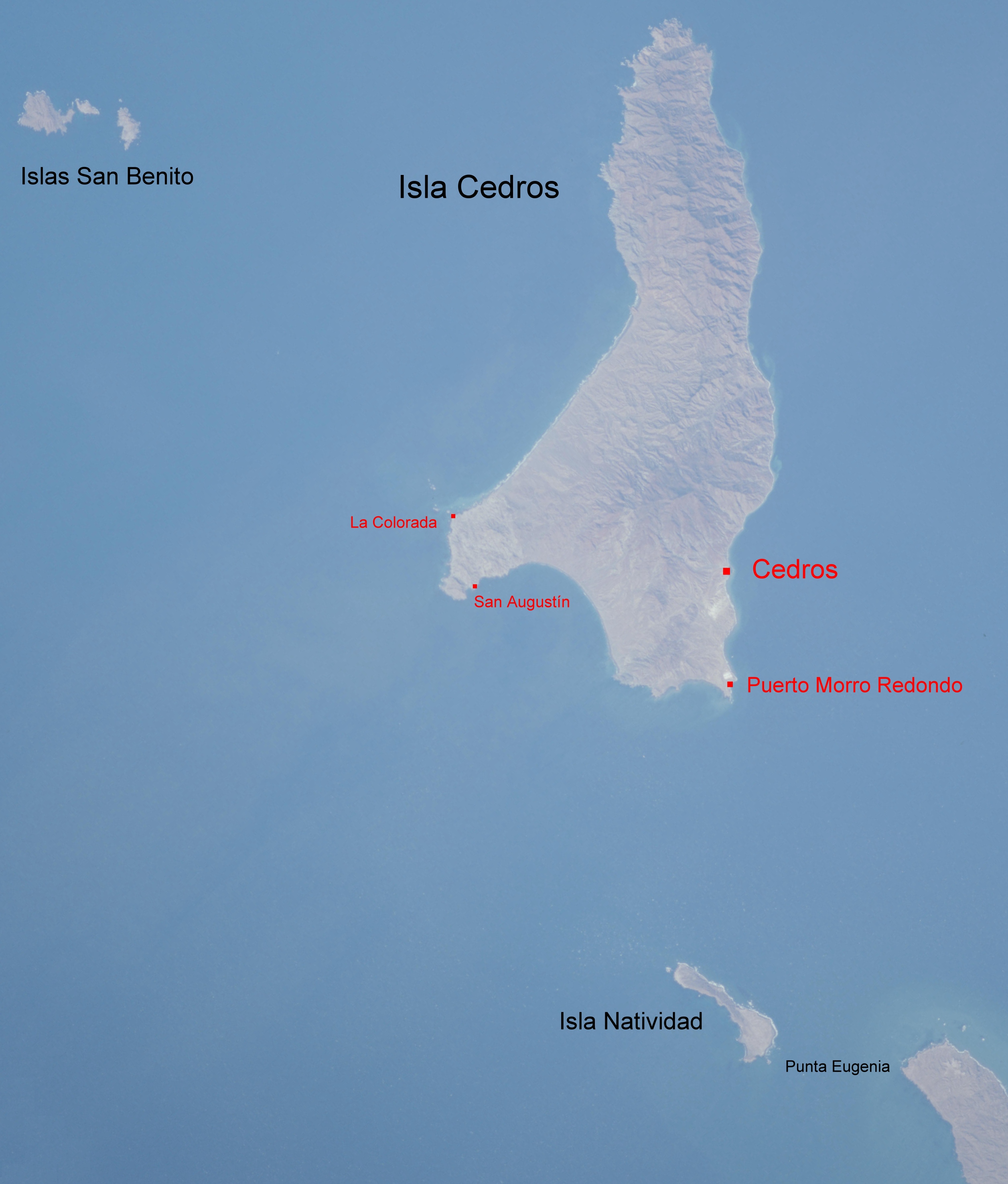
Punta Eugenia is a headland in the Mulegé Municipality. It marks the Western tip of the Vizcaíno Peninsula, thus being the westernmost point on the mainland of the state of Baja California Sur. It belongs to the larger area of El Vizcaíno Biosphere Reserve; it is separated from the mainland of the Baja Peninsula by the Vizcaíno Desert. Infrastructural developments, like the completion of the Vizcaíno-Bahía Tortugas Highway recently allowed for better integration of the traditionally secluded area (Punta Eugenia can be accessed from Bahía Tortugas by a dirt road). Touristically, the area of Punta Eugenia is still largely unexploited. The settlement Punta Eugenia, with 19 inhabitants in 2017, is traditionally populated by native and seasonally recruited fishermen and their families. Fishing industry in the Vizcaíno region annually produces thousands of tons of various species, that are mostly exported to Asia and the North American market. To the Northwest of Punta Eugenia ... [...More Info...] [...Related Items...] OR: [Wikipedia] [Google] [Baidu] |
Landfall (meteorology)
Landfall is the event of a storm moving over land after being over water. More broadly, and in relation to human travel, it refers to 'the first land that is reached or seen at the end of a journey across the sea or through the air, or the fact of arriving there. Tropical cyclone A tropical cyclone is classified as making landfall when the center of the storm moves across the coast; in a relatively strong tropical cyclone, this is when the eye moves over land. This is where most of the damage occurs within a mature tropical cyclone, such as a typhoon or hurricane, as most of the damaging aspects of these systems are concentrated near the eyewall. Such effects include the peaking of the storm surge, the core of strong winds coming ashore, and heavy flooding rains. These coupled with high surf can cause major beach erosion. When a tropical cyclone makes landfall, the eye usually closes in upon itself due to negative environmental factors over land, such as friction with th ... [...More Info...] [...Related Items...] OR: [Wikipedia] [Google] [Baidu] |
Atmospheric Convection
Atmospheric convection is the result of a parcel-environment instability, or temperature difference layer in the atmosphere. Different lapse rates within dry and moist air masses lead to instability. Mixing of air during the day which expands the height of the planetary boundary layer leads to increased winds, cumulus cloud development, and decreased surface dew points. Moist convection leads to thunderstorm development, which is often responsible for severe weather throughout the world. Special threats from thunderstorms include hail, downbursts, and tornadoes. Overview There are a few general archetypes of atmospheric instability that are used to explain convection (or lack thereof). A necessary (but not sufficient) condition for convection is that the environmental lapse rate (the rate of decrease of temperature with height) is steeper than the lapse rate experienced by a rising parcel of air. When this condition is met, upward-displaced air parcels can become buoyant and th ... [...More Info...] [...Related Items...] OR: [Wikipedia] [Google] [Baidu] |

.jpg)
.jpg)

.jpg)
.jpg)

