|
Tiltill Valley
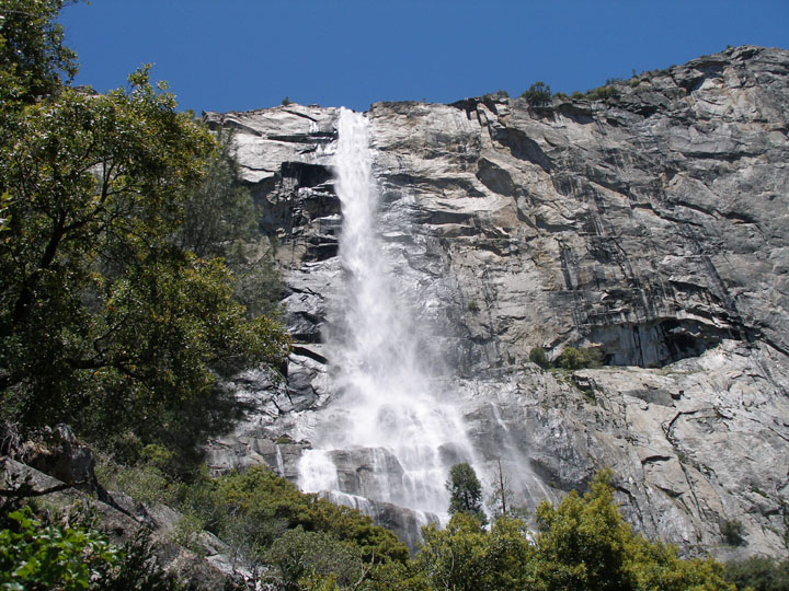
Tiltill Valley is a remote valley in northern Yosemite National Park. It is accessible only to hikers and equestrians. The valley is most easily reached via trail heads in the vicinity of the Hetch Hetchy Valley and Lake Eleanor. The valley provides access to many remote alpine lakes throughout the largely untamed wilderness that defines the northern portion of Yosemite National Park and the adjacent Emigrant Wilderness The Emigrant Wilderness of Stanislaus National Forest is a wilderness area in the Sierra Nevada. It is bordered by Yosemite National Park on the south, the Toiyabe National Forest and the Hoover Wilderness on the east, and State Route 108 .... References Landforms of Yosemite National Park Valleys of Tuolumne County, California Valleys of California {{US-NationalParkService-stub ... [...More Info...] [...Related Items...] OR: [Wikipedia] [Google] [Baidu] |
Yosemite National Park
Yosemite National Park ( ) is an American national park in California, surrounded on the southeast by Sierra National Forest and on the northwest by Stanislaus National Forest. The park is managed by the National Park Service and covers an area of and sits in four County, countiescentered in Tuolumne County, California, Tuolumne and Mariposa County, California, Mariposa, extending north and east to Mono County, California, Mono and south to Madera County, California, Madera County. Designated a World Heritage Site in 1984, Yosemite is internationally recognized for its granite cliffs, waterfalls, clear streams, Sequoiadendron giganteum, giant sequoia groves, lakes, mountains, meadows, glaciers, and Biodiversity, biological diversity. Almost 95 percent of the park is designated National Wilderness Preservation System, wilderness. Yosemite is one of the largest and least fragmented habitat blocks in the Sierra Nevada, and the park supports a diversity of plants and animals. The ... [...More Info...] [...Related Items...] OR: [Wikipedia] [Google] [Baidu] |
Hetch Hetchy Valley
Hetch Hetchy is a valley, a reservoir, and a water system in California in the United States. The glacial Hetch Hetchy Valley lies in the northwestern part of Yosemite National Park and is drained by the Tuolumne River. For thousands of years before the arrival of settlers from the United States in the 1850s, the valley was inhabited by Native Americans who practiced subsistence hunting-gathering. During the late 19th century, the valley was renowned for its natural beauty – often compared to that of Yosemite Valley – but also targeted for the development of water supply for irrigation and municipal interests. The controversy over damming Hetch Hetchy became mired in the political issues of the day. The law authorizing the dam passed Congress on December 7, 1913. In 1923, the O'Shaughnessy Dam was completed on the Tuolumne River, flooding the entire valley under the Hetch Hetchy Reservoir. The dam and reservoir are the centerpiece of the Hetch Hetchy Project, which in 1934 be ... [...More Info...] [...Related Items...] OR: [Wikipedia] [Google] [Baidu] |
Emigrant Wilderness
The Emigrant Wilderness of Stanislaus National Forest is a wilderness area in the Sierra Nevada. It is bordered by Yosemite National Park on the south, the Toiyabe National Forest and the Hoover Wilderness on the east, and State Route 108 over Sonora Pass on the north. It is an elongated area that extends northeast about in length and up to in width. Watersheds drain to the Stanislaus and Tuolumne Rivers. This area is entirely within Tuolumne County, California and is approximately east of San Francisco, California and south of Lake Tahoe. The Emigrant Wilderness is a glaciated landscape of scenic beauty. The northeastern third of the Wilderness is dominated by volcanic ridges and peaks; the remaining areas consist of many sparsely vegetated, granitic ridges interspersed with numerous lakes and meadows. Elevations range from below near Cherry Reservoir to at Leavitt Peak, but the elevation range of most of the popular areas is . Precipitation averages annually, 8 ... [...More Info...] [...Related Items...] OR: [Wikipedia] [Google] [Baidu] |
Landforms Of Yosemite National Park
A landform is a natural or anthropogenic land feature on the solid surface of the Earth or other planetary body. Landforms together make up a given terrain, and their arrangement in the landscape is known as topography. Landforms include hills, mountains, canyons, and valleys, as well as shoreline features such as bays, peninsulas, and seas, including submerged features such as mid-ocean ridges, volcanoes, and the great ocean basins. Physical characteristics Landforms are categorized by characteristic physical attributes such as elevation, slope, orientation, stratification, rock exposure and soil type. Gross physical features or landforms include intuitive elements such as berms, mounds, hills, ridges, cliffs, valleys, rivers, peninsulas, volcanoes, and numerous other structural and size-scaled (e.g. ponds vs. lakes, hills vs. mountains) elements including various kinds of inland and oceanic waterbodies and sub-surface features. Mountains, hills, plateaux, and plains are the fo ... [...More Info...] [...Related Items...] OR: [Wikipedia] [Google] [Baidu] |
Valleys Of Tuolumne County, California
A valley is an elongated low area often running between hills or mountains, which will typically contain a river or stream running from one end to the other. Most valleys are formed by erosion of the land surface by rivers or streams over a very long period. Some valleys are formed through erosion by glacial ice. These glaciers may remain present in valleys in high mountains or polar areas. At lower latitudes and altitudes, these glacially formed valleys may have been created or enlarged during ice ages but now are ice-free and occupied by streams or rivers. In desert areas, valleys may be entirely dry or carry a watercourse only rarely. In areas of limestone bedrock, dry valleys may also result from drainage now taking place underground rather than at the surface. Rift valleys arise principally from earth movements, rather than erosion. Many different types of valleys are described by geographers, using terms that may be global in use or else applied only locally. ... [...More Info...] [...Related Items...] OR: [Wikipedia] [Google] [Baidu] |


.jpg)