|
Tierra Rejada Park
Tierra Rejada Park is a 150-acre park located in the northern Simi Hills foothills, in southwestern Simi Valley city near Moorpark, in Ventura County, California. There are several trails leaving from the park to: Moorpark; Mount McCoy, Oak Canyon, Coyote Hills Park, Long Canyon, Wood Ranch Open Space, and other open-space nature areas in southwestern Simi Valley. Trails up into the Simi Hills, offer panoramic views of the Simi Valley, the Santa Rosa Valley, eastern Moorpark, and the western Santa Susana Mountains. The main Tierra Rejada Trailhead is adjacent to the Arroyo Simi The Arroyo Simi (Spanish language, Spanish for "Small Stream of Simi", sometimes also referred to as Simi Creek)Appleton, Bill (2009). ''Santa Susana''. Arcadia Publishing. Page 27. . is a westwards-running Arroyo (creek), creek, located in Calif ... wash, and the city is planning trailheads from the park along the new Arroyo Simi Greenway along the creek.http://www.simivalley.org/Modules/ShowDocu ... [...More Info...] [...Related Items...] OR: [Wikipedia] [Google] [Baidu] |
Simi Valley, CA
Simi Valley (; Chumashan languages, Chumash: ''Shimiyi'') is a city in Simi Valley (valley), the valley of the same name in the southeast region of Ventura County, California, United States. Simi Valley is from Downtown Los Angeles, making it part of the Greater Los Angeles Area. The city sits next to Thousand Oaks, California, Thousand Oaks, Moorpark, California, Moorpark, and Chatsworth, Los Angeles, Chatsworth. As of the 2020 United States census, 2020 U.S. Census the population was 126,356, up from 124,243 in 2010. The city of Simi Valley is surrounded by the Santa Susana Mountains and the Simi Hills, west of the San Fernando Valley, and northeast of the Conejo Valley. It grew as a commuter town, commuter bedroom community for the cities in the Los Angeles area, and the San Fernando Valley when a freeway was built over the Santa Susana Pass. The Ronald Reagan Presidential Library, where the Ronald Reagan, former president was buried in 2004, is in Simi Valley. The Reagan Li ... [...More Info...] [...Related Items...] OR: [Wikipedia] [Google] [Baidu] |
Simi Hills
The Simi Hills are a low rocky mountain range of the Transverse Ranges in eastern Ventura County and western Los Angeles County, of southern California, United States. Geography The Simi Hills are aligned east-west and run for , and average around north-south. The Simi Hills are part of the central Transverse Ranges System. They lie almost entirely within southeastern Ventura County, with some southern and eastern foothills within western Los Angeles County. The Simi Hills are on the western edge of the San Fernando Valley. The Simi Valley lies to the north, and the Conejo Valley lies to the southwest. The San Fernando Valley communities of Chatsworth, West Hills, and Woodland Hills are in the eastern hills and adjacent valley floor in Los Angeles city and county. The cities of Agoura Hills and Westlake Village are also located in Los Angeles County, generally southwest of the Simi Hills. The cities of Thousand Oaks (to the west) and Simi Valley city (to the north) are in ... [...More Info...] [...Related Items...] OR: [Wikipedia] [Google] [Baidu] |
Simi Valley, California
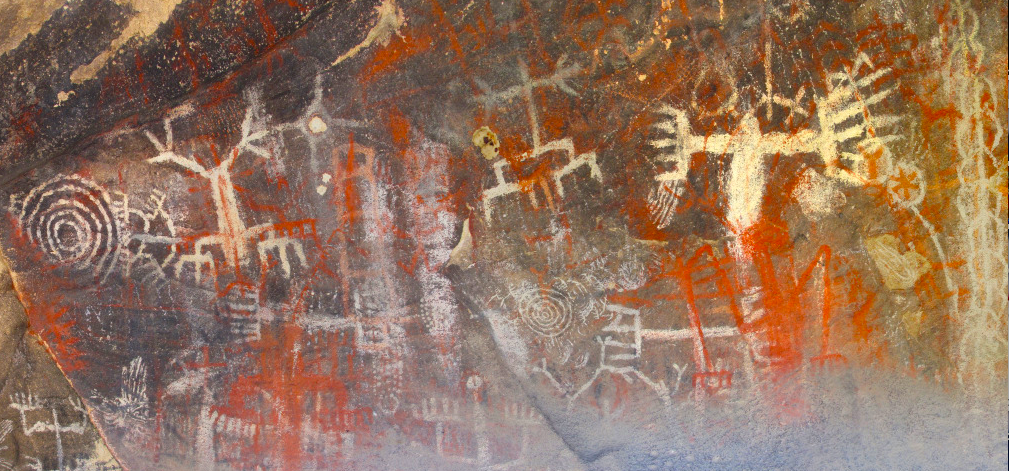
Simi Valley (; Chumash: ''Shimiyi'') is a city in the valley of the same name in the southeast region of Ventura County, California, United States. Simi Valley is from Downtown Los Angeles, making it part of the Greater Los Angeles Area. The city sits next to Thousand Oaks, Moorpark, and Chatsworth. As of the 2020 U.S. Census the population was 126,356, up from 124,243 in 2010. The city of Simi Valley is surrounded by the Santa Susana Mountains and the Simi Hills, west of the San Fernando Valley, and northeast of the Conejo Valley. It grew as a commuter bedroom community for the cities in the Los Angeles area, and the San Fernando Valley when a freeway was built over the Santa Susana Pass. The Ronald Reagan Presidential Library, where the former president was buried in 2004, is in Simi Valley. The Reagan Library has hosted Republican primary debates in 2012 and 2016. History Chumash/pre-colonial period Simi Valley was once inhabited by the Chumash people, who also s ... [...More Info...] [...Related Items...] OR: [Wikipedia] [Google] [Baidu] |
Moorpark
Moorpark is a city in Ventura County in Southern California. Moorpark was founded in 1900. The town grew from just over 4,000 citizens in 1980 to over 25,000 by 1990. As of 2006, Moorpark was one of the fastest-growing cities in Ventura County.. The population was 34,421 at the 2010 census, up from 31,415 at the 2000 census. Etymology The town most likely was named after the Moorpark apricot, which used to grow in the area (hence the apricot flower on the town's seal and flag). The apricot, in turn, was named for Admiral Lord Anson's estate Moor Park in Hertfordshire, England, the apricot was introduced in 1688. Some of Moorpark's previous unofficial and official names include Epworth, Fremontville, Penrose, Fairview, and Little Simi. History Chumash people were the first to inhabit what is now known as Moorpark. A Chumash village, known as Quimisac (Kimishax), was located in today's Happy Camp Canyon Regional Park. They were hunters and gatherers who often traveled between ... [...More Info...] [...Related Items...] OR: [Wikipedia] [Google] [Baidu] |
Ventura County, California
Ventura County () is a county in the southern part of the U.S. state of California. As of the 2020 census, the population was 843,843. The largest city is Oxnard, and the county seat is the city of Ventura. Ventura County comprises the Oxnard–Thousand Oaks–Ventura, CA Metropolitan Statistical Area, which is part of the Greater Los Angeles area (Los Angeles-Long Beach, CA Combined Statistical Area). It is also considered the southernmost county along the California Central Coast. Two of the Channel Islands are part of the county: Anacapa Island, which is the most visited island in Channel Islands National Park, and San Nicolas Island. History Pre-colonial period Ventura County was historically inhabited by the Chumash people, who also settled much of Santa Barbara and San Luis Obispo Counties, with their presence dating back 10,000–12,000 years. The Chumash were hunter-gatherers, fishermen, and also traders with the Mojave, Yokuts, and Tongva Indians. The Chum ... [...More Info...] [...Related Items...] OR: [Wikipedia] [Google] [Baidu] |
Mount McCoy (Simi Valley)
Mount McCoy (previously known as Verde Hill)McKinney, John (2013). ''HIKE Ventura County: Best Day Hikes around Ventura, Ojai and the Simi Hills''. The Trailmaster, Inc. Page 98. is a 1,325-foot-high peak in Simi Valley, California known for its characteristic 12 foot white cross on the top. There are numerous trails leading to Mount McCoy, which sits in a nature area operated by the Rancho Simi Recreation and Park District (RSRPD), while the cross and its immediate surroundings are owned by the Simi Valley Historical Society. By 1813, the cross on Mt. McCoy was a landmark for the Friars and others in the Simi Valley. An 1858 map of the Simi Valley does show a cross on Mt. McCoy, but a newer cross was erected by Robert E. Harrington in 1921, and a concrete one later in 1941. Mount McCoy has been a landmark for the area since before the town was founded. In 1986, Mount McCoy was designated Ventura County Landmark No. 106. The main trailhead is located at 2 Washburn Street at the ... [...More Info...] [...Related Items...] OR: [Wikipedia] [Google] [Baidu] |
Wood Ranch Open Space
Wood is a porous and fibrous structural tissue found in the stems and roots of trees and other woody plants. It is an organic materiala natural composite of cellulose fibers that are strong in tension and embedded in a matrix of lignin that resists compression. Wood is sometimes defined as only the secondary xylem in the stems of trees, or it is defined more broadly to include the same type of tissue elsewhere such as in the roots of trees or shrubs. In a living tree it performs a support function, enabling woody plants to grow large or to stand up by themselves. It also conveys water and nutrients between the leaves, other growing tissues, and the roots. Wood may also refer to other plant materials with comparable properties, and to material engineered from wood, or woodchips or fiber. Wood has been used for thousands of years for fuel, as a construction material, for making tools and weapons, furniture and paper. More recently it emerged as a feedstock for the product ... [...More Info...] [...Related Items...] OR: [Wikipedia] [Google] [Baidu] |
Simi Valley
Simi Valley (; Chumash: ''Shimiyi'') is a city in the valley of the same name in the southeast region of Ventura County, California, United States. Simi Valley is from Downtown Los Angeles, making it part of the Greater Los Angeles Area. The city sits next to Thousand Oaks, Moorpark, and Chatsworth. As of the 2020 U.S. Census the population was 126,356, up from 124,243 in 2010. The city of Simi Valley is surrounded by the Santa Susana Mountains and the Simi Hills, west of the San Fernando Valley, and northeast of the Conejo Valley. It grew as a commuter bedroom community for the cities in the Los Angeles area, and the San Fernando Valley when a freeway was built over the Santa Susana Pass. The Ronald Reagan Presidential Library, where the former president was buried in 2004, is in Simi Valley. The Reagan Library has hosted Republican primary debates in 2012 and 2016. History Chumash/pre-colonial period Simi Valley was once inhabited by the Chumash people, who also s ... [...More Info...] [...Related Items...] OR: [Wikipedia] [Google] [Baidu] |
Santa Rosa Valley, California
Santa Rosa Valley is a rural unincorporated community, named after the eponymous valley in which it lies, located in Ventura County, California, United States. For statistical purposes, the United States Census Bureau has defined Santa Rosa Valley as a census-designated place (CDP). The census definition of the area may not precisely correspond to local understanding of the area with the same name. The 2010 United States census reported Santa Rosa Valley's population was 3,334. Santa Rosa Valley sits at an elevation of . It lies within the County of Ventura north of Newbury Park, between Thousand Oaks and Camarillo. Norwegian Grade, which was constructed by the Norwegian Colony, connects Santa Rosa Valley to Thousand Oaks, while it may be reached from Santa Rosa Road in Camarillo. The Santa Rosa Valley lies right north of the Conejo Valley and along the Arroyo Santa Rosa and Arroyo Conejo. Most of the area consists of agricultural lands and it is home to a variety of wildlife s ... [...More Info...] [...Related Items...] OR: [Wikipedia] [Google] [Baidu] |
Santa Susana Mountains
The Santa Susana Mountains are a transverse range of mountains in Southern California, north of the city of Los Angeles, in the United States. The range runs east-west, separating the San Fernando and Simi valleys on its south from the Santa Clara River Valley to the north and the Santa Clarita Valley to the northeast. The Oxnard Plain is to the west of the Santa Susana Mountains. Description Geography The Newhall Pass separates the Santa Susana Mountains from the San Gabriel Mountains to the east. Newhall Pass is the major north-south connection between the San Fernando and Santa Clarita valleys, and Interstate 5 and a railroad line share Newhall Pass. The Santa Susana Pass (containing SR 118) connects the Simi and San Fernando valleys, and separates the Santa Susana Mountains from the Simi Hills to the south. Santa Susana Pass State Historic Park is located in the Simi Hills, just south of the Santa Susana Pass, at the northwestern edge of the San Fernando Valley. The Santa S ... [...More Info...] [...Related Items...] OR: [Wikipedia] [Google] [Baidu] |
Arroyo Simi
The Arroyo Simi (Spanish language, Spanish for "Small Stream of Simi", sometimes also referred to as Simi Creek)Appleton, Bill (2009). ''Santa Susana''. Arcadia Publishing. Page 27. . is a westwards-running Arroyo (creek), creek, located in California, United States, running from the city of Simi Valley, California, Simi Valley and crosses the Simi Valley, valley from east to west, before entering the city of Moorpark, California, Moorpark. It originates at Corriganville Movie Ranch, Corriganville Park by the Santa Susana Pass, and streams westwards into Moorpark where it merges with Arroyo Las Posas by Hitch Road. It extends for through the Simi Valley, and leaves the city limits by Oak Park, Simi Valley, Oak Park at the western end Simi Valley, and continues for seven miles in Moorpark. It is a tributary to the Calleguas Creek, which enters the Pacific Ocean by its estuary at Mugu Lagoon by Naval Air Station Point Mugu. Besides an Arroyo (creek), arroyo, it has been described as ... [...More Info...] [...Related Items...] OR: [Wikipedia] [Google] [Baidu] |
California State Route 118
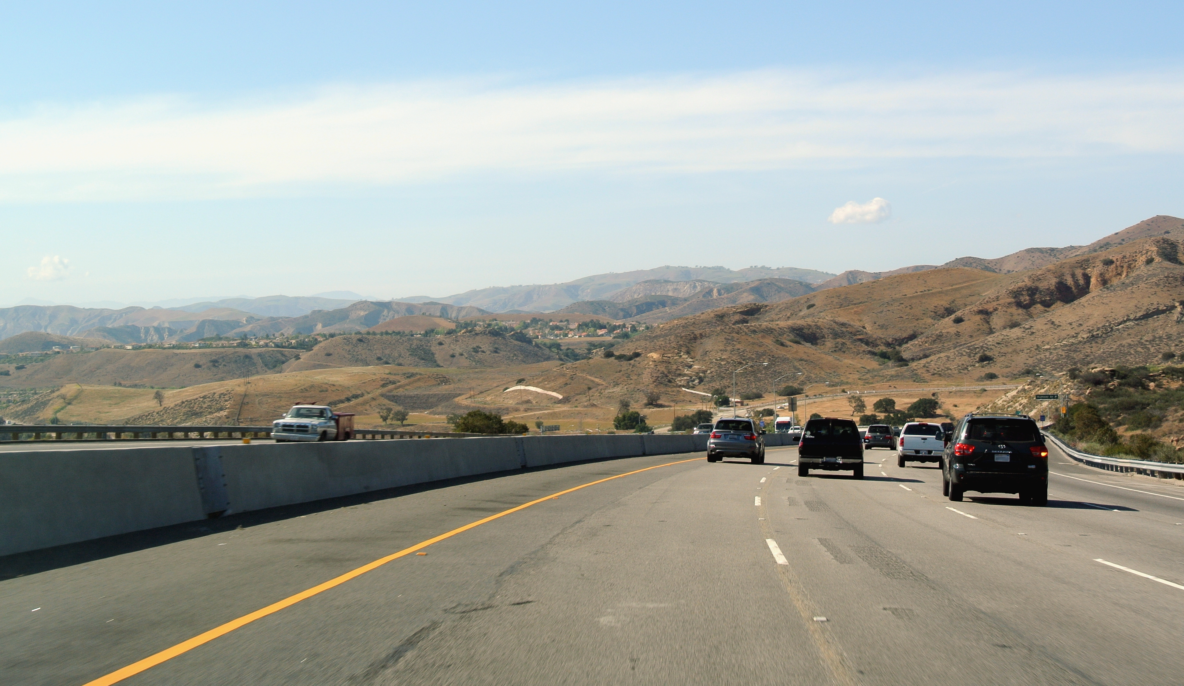
State Route 118 (SR 118) is a state highway in the U.S. state of California that runs west to east through Ventura and Los Angeles counties. It travels from State Route 126 at the eastern edge of Ventura immediately northwest of Saticoy, then through Saticoy, in Ventura County east to Interstate 210 near Lake View Terrace in Los Angeles. SR 118 crosses the Santa Susana Pass and the northern rim of the San Fernando Valley along its route. Route description SR 118 has two distinguishable sections, which connect at the intersection with State Route 23. The western section of SR 118 goes through the more rural areas of Ventura County. SR 118 begins at an intersection with SR 126 in Ventura as Wells Road and heads southeast, crossing the Santa Clara River as Los Angeles Avenue and intersecting SR 232 in unincorporated Ventura County. The highway continues southeast before intersecting Santa Clara Avenue, where Los Angeles Avenue turns east and passes north of Camarillo. In ... [...More Info...] [...Related Items...] OR: [Wikipedia] [Google] [Baidu] |


.jpg)


