|
Thrissur District
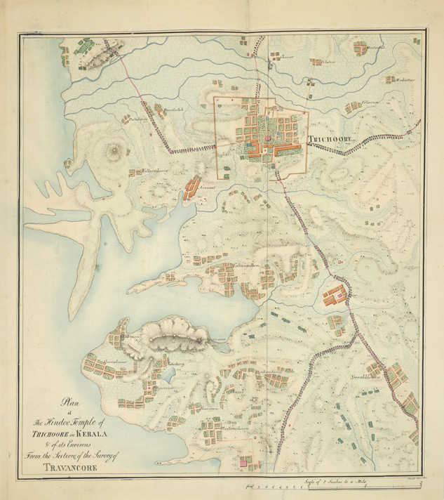
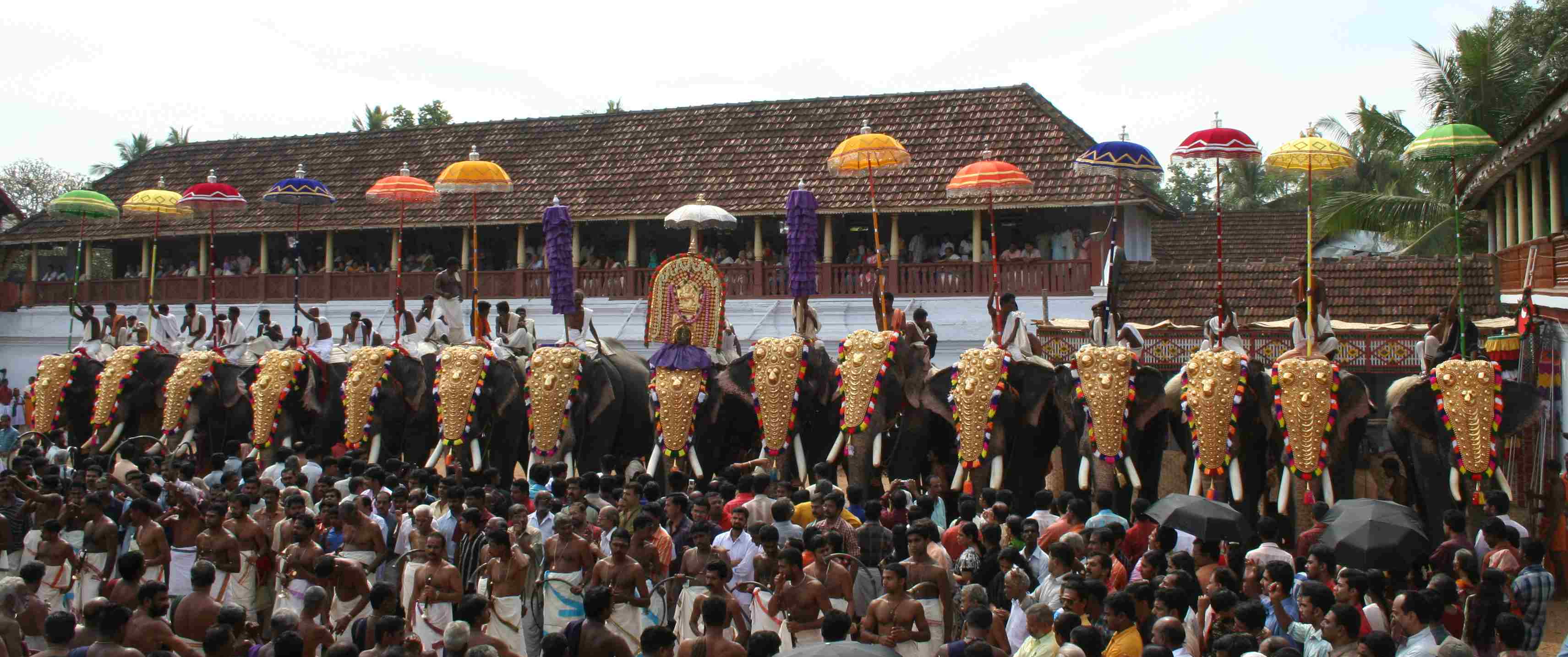
Thrissur (), anglicised as Trichur, is one of the 14 districts in the Indian state of Kerala. It is situated in the central region of the state. Spanning an area of about , the district is home to over 9% of Kerala's population. Thrissur district is bordered by the districts of Palakkad and Malappuram to the north, the districts of Ernakulam and Idukki to the south and Coimbatore to the east. The Arabian Sea lies to the west and Western Ghats stretches towards the east. It is part of the historical Malabar Coast, which has been trading internationally since ancient times. The main language spoken is Malayalam. Thrissur district was formed on 1 July 1949, with the headquarters at Thrissur City. Thrissur is known as the cultural capital of Kerala, and the land of Poorams. The district is known for its ancient temples, churches, and mosques. Thrissur Pooram is the most colourful temple festival in Kerala. Etymology The term 'Thrissur' is the shortened form of the word ' ... [...More Info...] [...Related Items...] OR: [Wikipedia] [Google] [Baidu] |
List Of Districts Of Kerala
The Indian state of Kerala borders Arabian sea coastline on the west, Tamil Nadu on the south and east, Karnataka on the north and north east. Western Ghats form an almost continuous mountain wall, except near Palakkad where there is a natural mountain pass known as the Palakkad Gap. When the independent India amalgamated smaller states together Travancore and Cochin states were integrated to form Travancore-Cochin state on 1 July 1949. However, North Malabar and South Malabar remained under the Madras state. The States Reorganisation Act of 1 November 1956 elevated Kerala to statehood, through the unification of Malayalam-speaking territories in the southwestern Malabar Coast of India. The state of Kerala is divided into 14 revenue districts. On the basis of geographical, historical and cultural similarities the state's districts are generally grouped into three parts – The Northern Kerala districts of Kasaragod, Kannur, Wayanad, Kozhikode, Malappuram; the Central Kerala ... [...More Info...] [...Related Items...] OR: [Wikipedia] [Google] [Baidu] |
Malayalam Language
Malayalam (; , ) is a Dravidian language spoken in the Indian state of Kerala and the union territories of Lakshadweep and Puducherry (Mahé district) by the Malayali people. It is one of 22 scheduled languages of India. Malayalam was designated a "Classical Language of India" in 2013. Malayalam has official language status in Kerala, and Puducherry ( Mahé), and is also the primary spoken language of Lakshadweep, and is spoken by 34 million people in India. Malayalam is also spoken by linguistic minorities in the neighbouring states; with significant number of speakers in the Kodagu and Dakshina Kannada districts of Karnataka, and Kanyakumari, district of Tamil Nadu. It is also spoken by the Malayali Diaspora worldwide, especially in the Persian Gulf countries, due to large populations of Malayali expatriates there. There are significant population in each cities in India including Mumbai, Bengaluru, Delhi, Kolkata, Pune etc. The origin of Malayalam remains a matter of ... [...More Info...] [...Related Items...] OR: [Wikipedia] [Google] [Baidu] |
Temple
A temple (from the Latin ) is a building reserved for spiritual rituals and activities such as prayer and sacrifice. Religions which erect temples include Christianity (whose temples are typically called churches), Hinduism (whose temples are called Mandir), Buddhism, Sikhism (whose temples are called gurudwara), Jainism (whose temples are sometimes called derasar), Islam (whose temples are called mosques), Judaism (whose temples are called synagogues), Zoroastrianism (whose temples are sometimes called Agiary), the Baha'i Faith (which are often simply referred to as Baha'i House of Worship), Taoism (which are sometimes called Daoguan), Shinto (which are sometimes called Jinja), Confucianism (which are sometimes called the Temple of Confucius), and ancient religions such as the Ancient Egyptian religion and the Ancient Greek religion. The form and function of temples are thus very variable, though they are often considered by believers to be, in some sense, the "house" of ... [...More Info...] [...Related Items...] OR: [Wikipedia] [Google] [Baidu] |
Pooram
Pooram pronounced is an annual festival, which is celebrated in temples dedicated to goddesses Durga or Kali held especially in Valluvanadu area and other adjoining parts of north-central Kerala (Present Palakkad, Thrissur, Kannur, Kasaragod and Malappuram districts) after the summer harvest. Harimattom pooram is the one of the famous pooram in Ernakulam. An example of a famous pooram is Thirumandhamkunnu Pooram which has an active participation of 11 Lakh people across the country. Most pooram festivals have at least one ornately decorated elephant being paraded in the procession taken out of the temple precincts. However, there are some well known poorams, such as Anthimahakalankavu Vela, Chelakkara, Aryankavu Pooram at shoranur Palakkad and Machad mamangam near Wadakkanchery that do not use the caparisoned elephant, instead go for stilted mannequins of horses or bullocks. Vela is also a festival like pooram. Thrissur Pooram is the most famous of all poorams, known for f ... [...More Info...] [...Related Items...] OR: [Wikipedia] [Google] [Baidu] |
Malabar Coast
The Malabar Coast is the southwestern coast of the Indian subcontinent. Geographically, it comprises the wettest regions of southern India, as the Western Ghats intercept the moisture-laden monsoon rains, especially on their westward-facing mountain slopes. The term is used to refer to the entire Indian coast from the western coast of Konkan to the tip of India at Kanyakumari. The peak of Anamudi, which is also the point of highest altitude in India outside the Himalayas, and Kuttanad, which is the point of least elevation in India, lie on the Malabar Coast. Kuttanad, also known as ''The Rice Bowl of Kerala'', has the lowest altitude in India, and is also one of the few places in the world where cultivation takes place below sea level. The region parallel to the Malabar Coast gently slopes from the eastern highland of Western Ghats ranges to the western coastal lowland. The moisture-laden winds of the Southwest monsoon, on reaching the southernmost point of the Indian Pe ... [...More Info...] [...Related Items...] OR: [Wikipedia] [Google] [Baidu] |
Arabian Sea
The Arabian Sea ( ar, اَلْبَحرْ ٱلْعَرَبِيُّ, Al-Bahr al-ˁArabī) is a region of the northern Indian Ocean bounded on the north by Pakistan, Iran and the Gulf of Oman, on the west by the Gulf of Aden, Guardafui Channel and the Arabian Peninsula, on the southeast by the Laccadive Sea and the Maldives, on the southwest by Somalia, and on the east by India. Its total area is 3,862,000 km2 (1,491,000 sq mi) and its maximum depth is 4,652 meters (15,262 ft). The Gulf of Aden in the west connects the Arabian Sea to the Red Sea through the strait of Bab-el-Mandeb, and the Gulf of Oman is in the northwest, connecting it to the Persian Gulf. Name The sea is named after Arabia, the historic name of the region to the west of the sea. The Arabian Sea's name in Arabic is ; in Persian it is دریای عرب; in Urdu it is بحیرہ عرب; in Hindi it is अरब सागर; in Gujarati it is અરબી સમુદ્ર; in Marathi it is ... [...More Info...] [...Related Items...] OR: [Wikipedia] [Google] [Baidu] |
Coimbatore District
Coimbatore district is one of the 38 districts in the state of Tamil Nadu in India. Coimbatore is the administrative headquarters of the district. It is one of the most industrialized districts and a major textile, industrial, commercial, educational, information technology, healthcare and manufacturing hub of Tamil Nadu. The region is bounded by Tiruppur district in the east, Nilgiris district in the north, Erode district in the north-east, Palakkad district, Idukki district and small parts of Thrissur district and Ernakulam district of neighboring state of Kerala in the west and south respectively. As of 2011, Coimbatore district had a population of 3,458,045 with a sex-ratio of 1,000 and literacy rate of 84%. Coimbatore district was part of the historical Kongu Nadu and was ruled by the Cheras as it served as the eastern entrance to the Palakkad Gap, the principal trade route between the west coast and Tamil Nadu. Coimbatore was in the middle of the Roman trade route ... [...More Info...] [...Related Items...] OR: [Wikipedia] [Google] [Baidu] |
Ernakulam District
Ernakulam, ; ISO: ''Eṟaṇākuḷaṁ'', in Malayalam: എറണാകുളം), is one of the 14 districts in the Indian state of Kerala, that takes its name from the eponymous city division in Kochi. It is situated in the central part of the state, spans an area of about , and is home to over 9% of Kerala's population. Its headquarters are located at Kakkanad. The district includes Kochi, also known as the commercial capital of Kerala, which is famous for its ancient Churches, Hindu temples, synagogues and mosques. The district includes the largest metropolitan region of the state: Greater Cochin. Ernakulam is the district that yields the most revenue and the largest number of industries in the state. Ernakulam is the third most populous district in Kerala, after Malappuram and Thiruvananthapuram (out of 14 districts). The district also hosts the highest number of international and domestic tourists in Kerala state. The most commonly spoken language in Ernakulam is Mal ... [...More Info...] [...Related Items...] OR: [Wikipedia] [Google] [Baidu] |
Malappuram District
Malappuram (), is one of the List of districts of Kerala, 14 districts in the States and union territories of India, Indian state of Kerala, with a coastline of . It is the most populous district of Kerala, which is home to around 13% of the total population of the state. The district was formed on 16 June 1969, spanning an area of about . It is the third-largest district of Kerala by area, as well as the largest district in the state, bounded by Western Ghats and Arabian Sea to either side. The district is divided into seven Tehsil, Taluks: Eranad Taluk, Eranad, Kondotty Taluk, Kondotty, Nilambur#Nilambur Taluk, Nilambur, Perinthalmanna taluk, Perinthalmanna, Ponnani taluk, Ponnani, Tirur Taluk, Tirur, and Tirurangadi Taluk Office, Tirurangadi. Malayalam is the most spoken language. The district has witnessed significant emigration, especially to the Arab states of the Persian Gulf during the Kerala Gulf diaspora#The Gulf Boom, Gulf Boom of the 1970s and early 1980s, and its ec ... [...More Info...] [...Related Items...] OR: [Wikipedia] [Google] [Baidu] |
Palakkad District
Palakkad District () is one of the 14 districts in the Indian state of Kerala. It was carved out from the southeastern region of the former Malabar District on 1 January 1957. It is located at the centre of Kerala. It is the largest district in the state since 2006. The city of Palakkad is the district headquarters. Palakkad is bordered on the northwest by the Malappuram district, on the southwest by the Thrissur district, on the northeast by Nilgiris district, and on the east by Coimbatore district of Tamil Nadu. The district is nicknamed "The granary of Kerala". Palakkad is the gateway to Kerala due to the presence of the Palakkad Gap, in the Western Ghats. The 2,383 m high Anginda peak, which is situated in the border of Palakkad district, Nilgiris district, and Malappuram district, in Silent Valley National Park, is the highest point of elevation in Palakkad district. Palakkad city is located just 50 km away from Coimbatore, a major city in Tamil Nadu state. The t ... [...More Info...] [...Related Items...] OR: [Wikipedia] [Google] [Baidu] |

.jpg)


.jpg)