|
The Tudor Trail
The Tudor Trail is a 6-mile multi-user linear route between 2 historic buildings in the Wealden countryside. It is also part of 'Regional Route 12' of the National Cycle Network. Route The trail starts at Tonbridge Castle, then leads through Haysden Country Park (around Barden Lake), then through the village of Lower Haysden, it then passes under the Tonbridge by-pass (part of the A21) via a quiet lane, then it uses a bridleway to link back to a portion of Haysden Country Park. It meets the 'Eden Valley Walk' (along distance path between Penshurst and Edenbridge). They then head along 'The Straight Mile' which is the remains of a canal built in the 1829 to join Penshurst to the navigable part of the River Medway. The canal was never completed or ever used. Then mile ends near Ensfield Road which passes over the River Medway. The route then heads along a bridleway to Killick's Bank farm. The route then heads to a section of the route with the only slight climb of the route, he ... [...More Info...] [...Related Items...] OR: [Wikipedia] [Google] [Baidu] |
Kent
Kent is a county in South East England and one of the home counties. It borders Greater London to the north-west, Surrey to the west and East Sussex to the south-west, and Essex to the north across the estuary of the River Thames; it faces the French department of Pas-de-Calais across the Strait of Dover. The county town is Maidstone. It is the fifth most populous county in England, the most populous non-Metropolitan county and the most populous of the home counties. Kent was one of the first British territories to be settled by Germanic tribes, most notably the Jutes, following the withdrawal of the Romans. Canterbury Cathedral in Kent, the oldest cathedral in England, has been the seat of the Archbishops of Canterbury since the conversion of England to Christianity that began in the 6th century with Saint Augustine. Rochester Cathedral in Medway is England's second-oldest cathedral. Located between London and the Strait of Dover, which separates England from mainla ... [...More Info...] [...Related Items...] OR: [Wikipedia] [Google] [Baidu] |
River Medway
The River Medway is a river in South East England. It rises in the High Weald AONB, High Weald, East Sussex and flows through Tonbridge, Maidstone and the Medway conurbation in Kent, before emptying into the Thames Estuary near Sheerness, a total distance of . About of the river lies in East Sussex, with the remainder being in Kent. It has a Drainage basin, catchment area of , the second largest in southern England after the River Thames, Thames. The map opposite shows only the major tributaries: a more detailed map shows the extensive network of smaller streams feeding into the main river. Those tributaries rise from points along the North Downs, the Weald and Ashdown Forest. Tributaries The major tributaries are: * River Eden, Kent, River Eden * River Bourne, Kent, River Bourne, known in the past as the Shode or Busty * River Teise, major sub-tributary River Bewl * River Beult * Loose Stream * River Len Minor tributaries include: * Wateringbury Stream * East Malling St ... [...More Info...] [...Related Items...] OR: [Wikipedia] [Google] [Baidu] |
Cycleways In England
This is a list of recreational cycle routes in England. *The Alban Way, Hertfordshire *The Bristol & Bath Railway Path *The Camel Trail, North Cornwall *ThCheshire Cycleway Cheshire *Clay Trails, Cornwall *Fallowfield Loop, Manchester * Fledborough Trail (Lincoln - Fledborough), Lincs./Notts. *Great Flat Lode trail, Cornwall *Greensand Cycle Way, Bedfordshire * The Greenway, Warwickshire * The Greenway, east London * The Ebury Way Cycle Path *High Peak Trail, Derbyshire *Manifold Way, Staffordshire * Marriott Way, Norfolk *The Milton Keynes redway system *Middlewood Way, Cheshire/Stockport *Mineral Tramway Trails, Cornwall *Monsal Trail, Derbyshire * Nickey Line, Hertfordshire *The Parkland Walk, North London *Reepham Bridle and Cycle Route, Norfolk *Sea to Sea Cycle Route, northern England *Sett Valley Trail, Derbyshire *The Sunshine Trail, Isle of Wight *Tarka Trail, Devon *Tissington Trail, Derbyshire * The Somerset Levels host a number of designated cycleways. * Water Rail W ... [...More Info...] [...Related Items...] OR: [Wikipedia] [Google] [Baidu] |
Penshurst Place, Tonbridge, Kent - Geograph
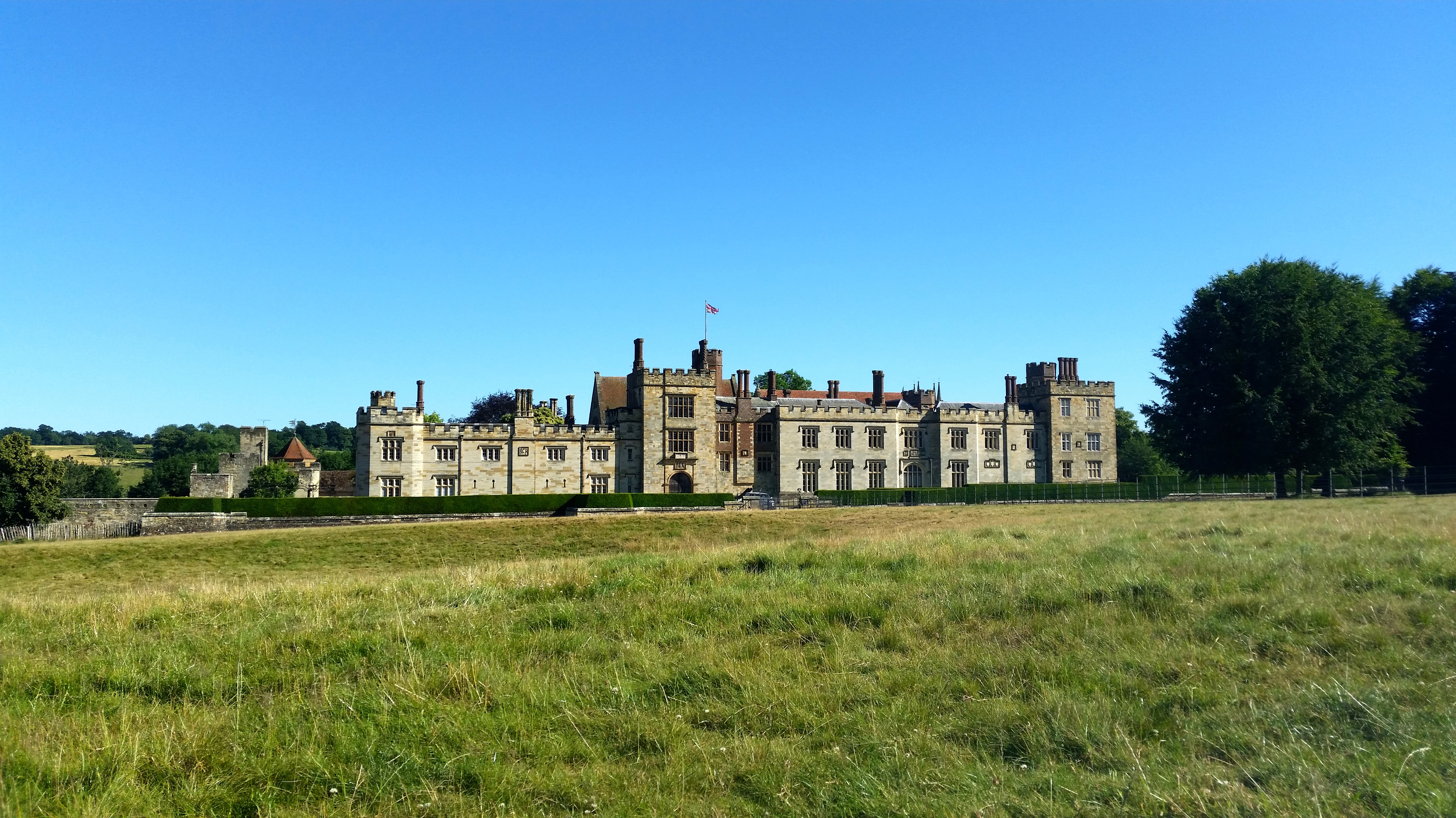
Penshurst is a historic village and civil parish located in a valley upon the northern slopes of the Kentish Weald, at the confluence of the River Medway and the River Eden, within the Sevenoaks district of Kent, England. The village is situated between the market town of Tonbridge and the spa town of Royal Tunbridge Wells, some south of Sevenoaks. Penshurst and its neighbouring village, Fordcombe, recorded a combined population of some 1,628 at the 2011 Census. The majority of the parish falls within the High Weald Area of Outstanding Natural Beauty, and the village is itself a conservation zone, with controls on the landscape ensuring the protection of its woodland and fields. There are several listed buildings in the village. The village is the home of two historic estates. Penshurst Place, formerly owned by King Henry VIII, sits at the centre of the village in the valley, while Swaylands is situated at the top of Rogues Hill on the outskirts of the village. History T ... [...More Info...] [...Related Items...] OR: [Wikipedia] [Google] [Baidu] |
Chiddingstone
Chiddingstone is a village and civil parish in the Sevenoaks District of Kent, England. The parish is located on the River Eden between Tonbridge and Edenbridge. The village of Chiddingstone Causeway and the hamlet Chiddingstone Hoath are also included in the parish. Chiddingstone is unique in that, apart from the church and Chiddingstone Castle, the entire village is owned by the National Trust, which describes it as "the best example of a Tudor village left in the country". It is an example of a Tudor one-street village. History Chiddingstone is mentioned in the Domesday Book. It was given to Bishop Odo in 1072 after the Norman invasion as part of his Earldom of Kent. The first house was owned by Roger Attwood, constructed in the typical Kent style. Several villagers including Atwood took part in Jack Cade's rebellion of 1450, and were later pardoned. The Castle Inn is a 15th-century building, which became a hostelry in 1730. It was visited by artists John Millais and C ... [...More Info...] [...Related Items...] OR: [Wikipedia] [Google] [Baidu] |
Hever Castle
Hever Castle ( ) is located in the village of Hever, Kent, near Edenbridge, south-east of London, England. It began as a country house, built in the 13th century. From 1462 to 1539, it was the seat of the Boleyn (originally 'Bullen') family. Anne Boleyn, the second queen consort of King Henry VIII of England, spent her early youth there after her father, Thomas Boleyn, inherited it in 1505. The castle passed to him upon the death of his father, Sir William Boleyn. It later came into the possession of King Henry VIII's fourth wife, Anne of Cleves. The Grade I listed castle, now owned by the Guthrie family's Broadland Properties. History There have been three main periods in the construction of this historic castle. The oldest part of the castle dates to 1270 and consisted of the gatehouse and a walled bailey. It was then owned by James Fiennes, 1st Baron Saye and Sele. The second period was when the castle, then in need of repair, was converted into a manor in 1462 by Geo ... [...More Info...] [...Related Items...] OR: [Wikipedia] [Google] [Baidu] |
Bradley Wiggins
Sir Bradley Marc Wiggins, CBE (born 28 April 1980) is a British former professional road and track racing cyclist, who competed professionally between 2001 and 2016. He began his cycling career on the track, but later made the transition to road cycling. He won world titles in four disciplines (Madison, individual pursuit, team pursuit and road time trial), and Olympic gold in three (individual pursuit, team pursuit and road time trial). He is the only rider to have won both World and Olympic championships on both the track and the road as well as winning the Tour de France. He has worn the leader's jersey in each of the three Grand Tours of cycling and held the world record in team pursuit on multiple occasions. He won a gold medal at four successive Olympic Games from 2004 to 2016, and held the record as Great Britain's most decorated Olympian with 8 medals until Jason Kenny won his 9th in 2021. He is the only rider to win both the Tour de France and Olympic Gold in the same ... [...More Info...] [...Related Items...] OR: [Wikipedia] [Google] [Baidu] |
A21 Road (England)
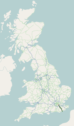
''For other roads with the same name see List of A21 roads.'' The A21 is a trunk road in Southern England, one of several which connect London and various commuter towns to the south coast. It provides a link to Hastings, East Sussex and parts of Kent. Half of the distance covered is over gently undulating terrain, with some hills and bends. Often traffic is slow-moving, particularly on weekdays on the short single carriageway stretches; and in summer with holiday traffic. Because of this, people have described the A21 as "a joke" and businesspeople have been reported to "hate coming down the A21". There have been many proposals to upgrade parts of the A21 in response to this. Parts of the A21 follow the historic turnpike roads: for example the section from Sevenoaks to Tunbridge Wells, opened in 1710; other sections of the road were similarly dealt with later in the century. It is also the location of the first wildlife overbridge in the United Kingdom, near Lamberhurst. The ... [...More Info...] [...Related Items...] OR: [Wikipedia] [Google] [Baidu] |
Tonbridge Castle
Tonbridge Castle is a 13th century castle situated in Tonbridge, Kent, England. Early history Following the Norman Conquest, Richard Fitz Gilbert was granted land in Kent to guard the crossing of the River Medway. He erected a simple Motte-and-bailey, Motte-and-bailey castle on the site. To dig the moat and erect the motte 50,000 tonnes of earth were moved. In 1088, the de Clare family (descendants of Fitz Gilbert) rebelled against William II of England, King William II. His army besieged the castle. After holding for two days the castle fell and as punishment the king had both the castle and the town of Tonbridge burnt to the ground. Before 1100, the de Clares replaced the wooden castle with a stone shell keep. This was reinforced during the thirteenth century, and in 1295 a stone wall was built around the town. The twin-towered gatehouse was built by Richard de Clare, third Earl of Hertford or his son Gilbert. Construction of the gatehouse took 30 years, being completed in 12 ... [...More Info...] [...Related Items...] OR: [Wikipedia] [Google] [Baidu] |
Haysden Country Park
Haysden Country Park is a country park and Local Nature Reserve on the outskirts of Tonbridge in Kent. It is owned by Tonbridge and Malling Borough Council, the Highways Agency, Network Rail and the Environment Agency, and managed by the council. Geography The park comprises of countryside to the west of Tonbridge. The park has two lakes, Barden Lake and Haysden Water, and has a stretch of the River Medway running through it, with various branches and streams. Consequently there are a large number of bridges, many of which are named. The park is home to a variety of wildlife including waterfowl, wild flowers, and insect life. It is designated as a Site of Nature Conservation Interest, and as of it has been designated a Local Nature Reserve. The A21 passes on a viaduct near Haysden Water. Immediately to the east of this viaduct, and roughly parallel to it, is the Medway flood barrier. The railway line from Tonbridge towards Redhill, Surrey also passes through the par ... [...More Info...] [...Related Items...] OR: [Wikipedia] [Google] [Baidu] |
Tonbridge Castle Gatehouse - N Side, Tonbridge, Kent - Geograph
Tonbridge ( ) is a market town in Kent, England, on the River Medway, north of Royal Tunbridge Wells, south west of Maidstone and south east of London. In the administrative borough of Tonbridge and Malling, it had an estimated population of 41,293 in 2018. History The town was recorded in the Domesday Book 1087 as ''Tonebrige'', which may indicate a bridge belonging to the estate or manor (from the Old English tun), or alternatively a bridge belonging to Tunna, a common Anglo-Saxon man's name. Another theory suggests that the name is a contraction of "town of bridges", due to the large number of streams the High Street originally crossed. Until 1870, the town's name was spelt ''Tunbridge'', as shown on old maps including the 1871 Ordnance Survey map and contemporary issues of the Bradshaw railway guide. In 1870, this was changed to ''Tonbridge'' by the GPO due to confusion with nearby Tunbridge Wells, despite Tonbridge being a much older settlement. Tunbridge Wells h ... [...More Info...] [...Related Items...] OR: [Wikipedia] [Google] [Baidu] |


.jpg)
