|
Thames Embankment
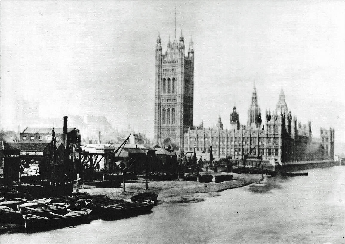
The Thames Embankment is a work of 19th-century civil engineering that reclaimed marshy land next to the River Thames in central London. It consists of the Victoria Embankment and Chelsea Embankment. History There had been a long history of failed proposals to embank the Thames in central London. Embankments along the Thames were first proposed by Christopher Wren in the 1660s, then in 1824 former soldier and aide to George IV, Sir Frederick Trench suggested an embankment known as 'Trench's Terrace' from Blackfriars to Charing Cross. Trench brought a bill to Parliament which was blocked by river interests. In the 1830s, the painter John Martin promoted a version, as realised later, to contain an intercepting sewer. In January 1842 the City Corporation backed a plan designed by James Walker but which was dropped due to government infighting. The government itself built the Chelsea Embankment in 1854 from Chelsea Hospital to Millbank. Started in 1862, the Victoria Embankmen ... [...More Info...] [...Related Items...] OR: [Wikipedia] [Google] [Baidu] |
Thames Embankment, London, England-LCCN2002696941
The River Thames ( ), known alternatively in parts as the River Isis, is a river that flows through southern England including London. At , it is the longest river entirely in England and the second-longest in the United Kingdom, after the River Severn. The river rises at Thames Head in Gloucestershire, and flows into the North Sea near Tilbury, Essex and Gravesend, Kent, via the Thames Estuary. From the west it flows through Oxford (where it is sometimes called the Isis), Reading, Henley-on-Thames and Windsor. The Thames also drains the whole of Greater London. In August 2022, the source of the river moved five miles to beyond Somerford Keynes due to the heatwave in July 2022. The lower reaches of the river are called the Tideway, derived from its long tidal reach up to Teddington Lock. Its tidal section includes most of its London stretch and has a rise and fall of . From Oxford to the Estuary the Thames drops by 55 metres. Running through some of the drier parts of ... [...More Info...] [...Related Items...] OR: [Wikipedia] [Google] [Baidu] |
London Sewerage System
The London sewer system is part of the water infrastructure serving London, England. The modern system was developed during the late 19th century, and as London has grown the system has been expanded. It is currently owned and operated by Thames Water and serves almost all of Greater London. History During the early 19th century the River Thames was an open sewer, with disastrous consequences for public health in London, including cholera epidemics. These were caused by enterotoxin-producing strains of the bacterium ''Vibrio cholerae''. Although the contamination of the water supply was correctly diagnosed by Dr John Snow in 1849 as the method of communication, up to the outbreak of 1866 it was believed that miasma, or bad air, was responsible. Proposals to modernise the sewerage system had been made in the early 1700s but the costs of such a project deterred progress. Further proposals followed in 1856, but were again neglected due to the costs. However, after the Great Stink ... [...More Info...] [...Related Items...] OR: [Wikipedia] [Google] [Baidu] |
Blackfriars Bridge
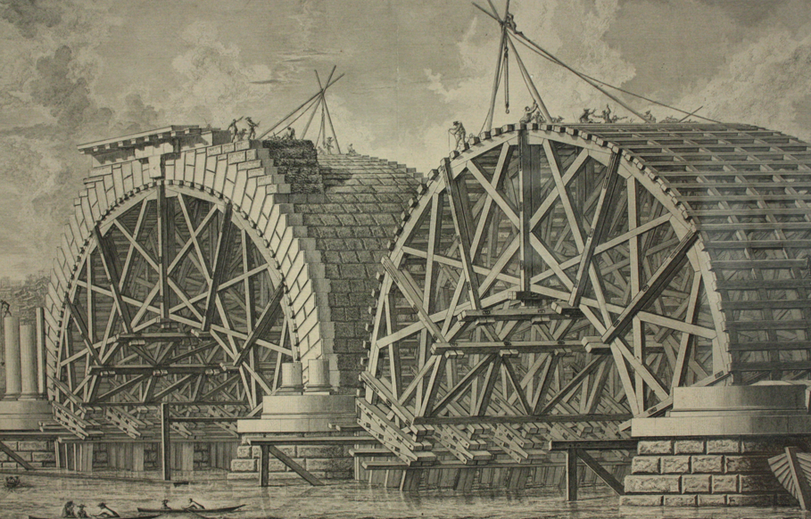
Blackfriars Bridge is a road and foot traffic bridge over the River Thames in London, between Waterloo Bridge and Blackfriars Railway Bridge, carrying the A201 road. The north end is in the City of London near the Inns of Court and Temple Church, along with Blackfriars station. The south end is in the London Borough of Southwark, near the Tate Modern art gallery and the Oxo Tower. History The first fixed crossing at Blackfriars was a long toll bridge designed in an Italianate style by Robert Mylne and constructed with nine semi-elliptical arches of Portland stone. Beating designs by John Gwynn and George Dance, it took nine years to build, opening to the public in 1769. It was the third bridge across the Thames in the then built-up area of London, supplementing the ancient London Bridge, which dated from several centuries earlier, and Westminster Bridge. It was originally named "William Pitt Bridge" (after the Prime Minister William Pitt the Elder) as a dedication, but ... [...More Info...] [...Related Items...] OR: [Wikipedia] [Google] [Baidu] |
Palace Of Westminster
The Palace of Westminster serves as the meeting place for both the House of Commons of the United Kingdom, House of Commons and the House of Lords, the two houses of the Parliament of the United Kingdom. Informally known as the Houses of Parliament, the Palace lies on the north bank of the River Thames in the City of Westminster, in central London, England. Its name, which derives from the neighbouring Westminster Abbey, may refer to several historic structures but most often: the ''Old Palace'', a England in the Middle Ages, medieval building-complex largely Burning of Parliament, destroyed by fire in 1834, or its replacement, the ''New Palace'' that stands today. The palace is owned by the Crown. Committees appointed by both houses manage the building and report to the Speaker of the House of Commons (United Kingdom), Speaker of the House of Commons and to the Lord Speaker. The first royal palace constructed on the site dated from the 11th century, and Westminster beca ... [...More Info...] [...Related Items...] OR: [Wikipedia] [Google] [Baidu] |
Victoria Tower Gardens
Victoria Tower Gardens is a public park along the north bank of the River Thames in London, adjacent to the Victoria Tower, at the south-western corner of the Palace of Westminster. The park, extends southwards from the Palace to Lambeth Bridge, between Millbank and the river. It forms part of the Thames Embankment. Victoria Tower Gardens is a Grade II* listed park created in two stages in 1879–81 and 1913–14. It is in a conservation area, is partly within the UNESCO World Heritage Site of Westminster, and is designated a zone of Monument Saturation. History The northern part of the gardens was acquired by the Government under the Houses of Parliament Act 1867 in order to reduce the fire risk to the Palace of Westminster from the wharves there. There was disagreement about whether at least some of the land should be built on, but eventually the newspaper retailer William Henry Smith donated £1000 towards laying it out as an open space and Parliament paid the remaining £14 ... [...More Info...] [...Related Items...] OR: [Wikipedia] [Google] [Baidu] |
Millbank
Millbank is an area of central London in the City of Westminster. Millbank is located by the River Thames, east of Pimlico and south of Westminster. Millbank is known as the location of major government offices, Burberry headquarters, the Millbank Tower and prominent art institutions such as Tate Britain and the Chelsea College of Art and Design. History The area derives its name from a watermill owned by Westminster Abbey that once stood at a site close to present day College Green. Norden's survey, taken during the reign of Elizabeth I in 1573, records the existence of such a mill although much of the area that comprises Millbank today, was referred to by Samuel Pepys and others as Tothill Fields. Described as a place of plague pits and a "low, marshy locality" suitable for shooting snipe in the nearby "bogs and quagmires". After Cromwell's victory at the Battle of Worcester in September 1651, some 4,000 defeated Royalists were imprisoned at Tothill Fields prior to being so ... [...More Info...] [...Related Items...] OR: [Wikipedia] [Google] [Baidu] |
Cheyne Walk
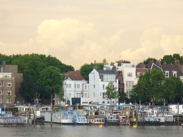
Cheyne Walk is an historic road in Chelsea, London, England, in the Royal Borough of Kensington and Chelsea. It runs parallel with the River Thames. Before the construction of Chelsea Embankment reduced the width of the Thames here, it fronted the river along its whole length. Location At its western end, Cheyne Walk meets Cremorne Road end-on at the junction with Lots Road. The Walk runs alongside the River Thames until Battersea Bridge where, for a short distance, it is replaced by Chelsea Embankment with part of its former alignment being occupied by Ropers Gardens. East of Old Church Street and Chelsea Old Church, the Walk runs along the north side of Albert Bridge Gardens and Chelsea Embankment Gardens parallel with Chelsea Embankment. At the north end of Albert Bridge, the Walk merges with Chelsea Embankment. The Walk ends at Royal Hospital Road. At the western end between Lots Road and Battersea Bridge is a collection of residential houseboats that have been ''in sit ... [...More Info...] [...Related Items...] OR: [Wikipedia] [Google] [Baidu] |
Battersea Bridge
Battersea Bridge is a five-span arch bridge with cast iron, cast-iron girders and granite pier (architecture), piers crossing the River Thames in London, England. It is situated on a sharp bend in the river, and links Battersea south of the river with Chelsea, London, Chelsea to the north. The bridge replaced a ferry service that had operated near the site since at least the middle of the 16th century. The first Battersea Bridge was a toll bridge commissioned by John Spencer, 1st Earl Spencer, John, Earl Spencer, who had recently acquired the rights to operate the ferry. Although a stone bridge was planned, difficulties in raising investment meant that a cheaper wooden bridge was built instead. Designed by Henry Holland (architect), Henry Holland, it was initially opened to pedestrians in November 1771, and to vehicle traffic in 1772. The bridge was inadequately designed and dangerous both to its users and to passing shipping, and boats often collided with it. To reduce the dang ... [...More Info...] [...Related Items...] OR: [Wikipedia] [Google] [Baidu] |
Lamorna
Lamorna ( kw, Nansmornow) is a village, valley and cove in west Cornwall, England, UK. It is on the Penwith peninsula approximately south of Penzance. Lamorna became popular with the artists of the Newlyn School, including Alfred Munnings, Laura Knight and Harold Knight, and is also known for former residents Derek and Jean Tangye who farmed land and wrote "The Minack Chronicles". Toponymy First recorded as ''Nansmorno'' (in 1305), than ''Nansmurnou'' (1309), ''Nansmorne'' (1319), ''Nansmornou'' (1339), ''Nansmorna'' (1387) and ''Namorna'' (1388). In Cornish ''Nans'' means valley, and the 2nd element is possibly ''mor'', which means sea. Geography Lamorna Cove is at the SE end of a north-west to south-east valley. The cove is delineated by Carn-du (Black Rock) on the eastern side and Lamorna Point on the western side. The valley is privately owned from The Wink (public house) down to the cove, which is reached by a narrow lane to the car park and quay. The small village, half ... [...More Info...] [...Related Items...] OR: [Wikipedia] [Google] [Baidu] |
Granite
Granite () is a coarse-grained (phaneritic) intrusive igneous rock composed mostly of quartz, alkali feldspar, and plagioclase. It forms from magma with a high content of silica and alkali metal oxides that slowly cools and solidifies underground. It is common in the continental crust of Earth, where it is found in igneous intrusions. These range in size from dikes only a few centimeters across to batholiths exposed over hundreds of square kilometers. Granite is typical of a larger family of ''granitic rocks'', or ''granitoids'', that are composed mostly of coarse-grained quartz and feldspars in varying proportions. These rocks are classified by the relative percentages of quartz, alkali feldspar, and plagioclase (the QAPF classification), with true granite representing granitic rocks rich in quartz and alkali feldspar. Most granitic rocks also contain mica or amphibole minerals, though a few (known as leucogranites) contain almost no dark minerals. Granite is nearly alway ... [...More Info...] [...Related Items...] OR: [Wikipedia] [Google] [Baidu] |
Embankment Construction Of The Thames Embankment ILN 1865
Embankment may refer to: Geology and geography * A levee, an artificial bank raised above the immediately surrounding land to redirect or prevent flooding by a river, lake or sea * Embankment (earthworks), a raised bank to carry a road, railway, or canal across a low-lying or wet area * Embankment dam, a dam made of mounded earth and rock * Land reclamation along river banks, usually marked by roads and walkways running along it, parallel to the river, as in: ** The Thames Embankment along the north side of the Thames River in London, England *** The Victoria Embankment contained within the Thames Embankments *** The Chelsea Embankment contained within the Thames Embankment ** The Albert Embankment along the south side of the Thames River in London, England ** The Neva embankments along the Neva River in Saint Petersburg, Russia * Embankment tube station, a station on the London Underground Arts * "Embankment", a work by artist Rachel Whiteread Dame Rachel Whiteread (b ... [...More Info...] [...Related Items...] OR: [Wikipedia] [Google] [Baidu] |
Watergate (architecture)
A watergate (or water gate) is a fortified gate, leading directly from a castle or town wall directly on to a quay, river side or harbour. In medieval times it enabled people and supplies to reach the castle or fortification directly from the water, and equally allowed those within the castle direct access to water transport. Examples * Bristol Castle * Newport Castle * Southampton Castle * The Traitors' Gate at the Tower of London The Tower of London, officially His Majesty's Royal Palace and Fortress of the Tower of London, is a historic castle on the north bank of the River Thames in central London. It lies within the London Borough of Tower Hamlets, which is separa ... See also * Irrigation gate References Types of gates Castle architecture City walls {{castle-stub ... [...More Info...] [...Related Items...] OR: [Wikipedia] [Google] [Baidu] |


.jpg)


