|
Texas Park Road 100
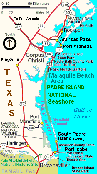
Park Road 100 (PR 100) is a park road in the Rio Grande Valley in Cameron County, in the U.S. state of Texas. It runs along South Padre Island through the town of the same name. Route description PR 100 begins at the Queen Isabella Causeway in Port Isabel, and continues west as State Highway 100. A 2.37-mile bridge crosses Laguna Madre, the only road connecting South Padre Island to the mainland. It then enters the town of South Padre Island and intersects itself near the Schlitterbahn water park and resort. The section of the road south of this intersection acts as a spur for the southernmost part of the island. It continues north through the island/city, passing many resorts, bars and restaurants. Just north of Edwin King Atwood Park, it runs for about half a mile between the Laguna Madre and the Gulf of Mexico before running only a few feet east of the former. It ends shortly after entering the Padre Island National Seashore Padre Island National Seashore (PINS) is a n ... [...More Info...] [...Related Items...] OR: [Wikipedia] [Google] [Baidu] |
Texas Department Of Transportation
The Texas Department of Transportation (TxDOT ) is a government agency in the American state of Texas. Though the public face of the agency is generally associated with the construction and maintenance of the state's immense state highway system, the agency is also responsible for overseeing aviation, rail, and public transportation systems in the state. At one time, TxDOT also administered vehicle registration; but this function transferred to the Texas Department of Motor Vehicles, a state agency which began operations in November 2009. The agency has been headquartered in the Dewitt C. Greer Building at 125 East 11th Street in Downtown Austin, Texas, since 1933. History The Texas Legislature created the Texas Highway Department in 1916 to administer federal highway construction and maintenance. In 1975, its responsibilities increased when the agency merged with the Texas Mass Transportation Commission, resulting in the formation of the State Department of Highways and Pub ... [...More Info...] [...Related Items...] OR: [Wikipedia] [Google] [Baidu] |
Queen Isabella Causeway
Queen Isabella Memorial Bridge was developed as a concrete pier-and-beam bridge with a steel cantilever main beam span. The memorial bridge has a travel distance of and sustains the continuation of Texas Park Road 100. The watercourse thoroughfare is located in southern Cameron County, Texas and is the only road connecting South Padre Island to the geography of Texas. ''The Causeway'' opened in 1974 and replaced the previous bridge, which had also been named Queen Isabella Causeway. A central section of the original causeway was removed and renamed the Queen Isabella State Fishing Pier. The Causeway is the second-longest bridge in Texas, stretching across the Laguna Madre. It is named after Queen Isabella of Castile. Incidents 1996 plane crash On August 13, 1996, at 6:22 p.m., a Cessna TR182 collided with the causeway, killing both the pilot-in-command and the pilot-rated passenger, while maneuvering near Port Isabel, Texas. Witnesses and local authorities reported that the ai ... [...More Info...] [...Related Items...] OR: [Wikipedia] [Google] [Baidu] |
Port Isabel, Texas
Port Isabel is a city in Cameron County, Texas, United States. It is part of the Brownsville–Harlingen–Raymondville and the Matamoros–Brownsville metropolitan areas. The population was 5,006 at the 2010 census. The city's name is given to the Port Isabel Detention Center, to the northwest next to the Port Isabel-Cameron County Airport. History Established as a town after the Mexican War of Independence, Port Isabel became an important cotton-exporting port before the American Civil War. The harbor, town and lighthouse all were fought over and exchanged hands during the Civil War. In September 1967, Hurricane Beulah caused extensive damage to much of the city. On July 23, 2008, Hurricane Dolly, a category 2 storm, also caused extensive damage to the city. Geography Port Isabel is located in eastern Cameron County at 26°4'25" North, 97°12'48" West (26.073675, –97.213234), on the western side of the south end of Laguna Madre, an estuary of the Gulf of Mexic ... [...More Info...] [...Related Items...] OR: [Wikipedia] [Google] [Baidu] |
Padre Island National Seashore
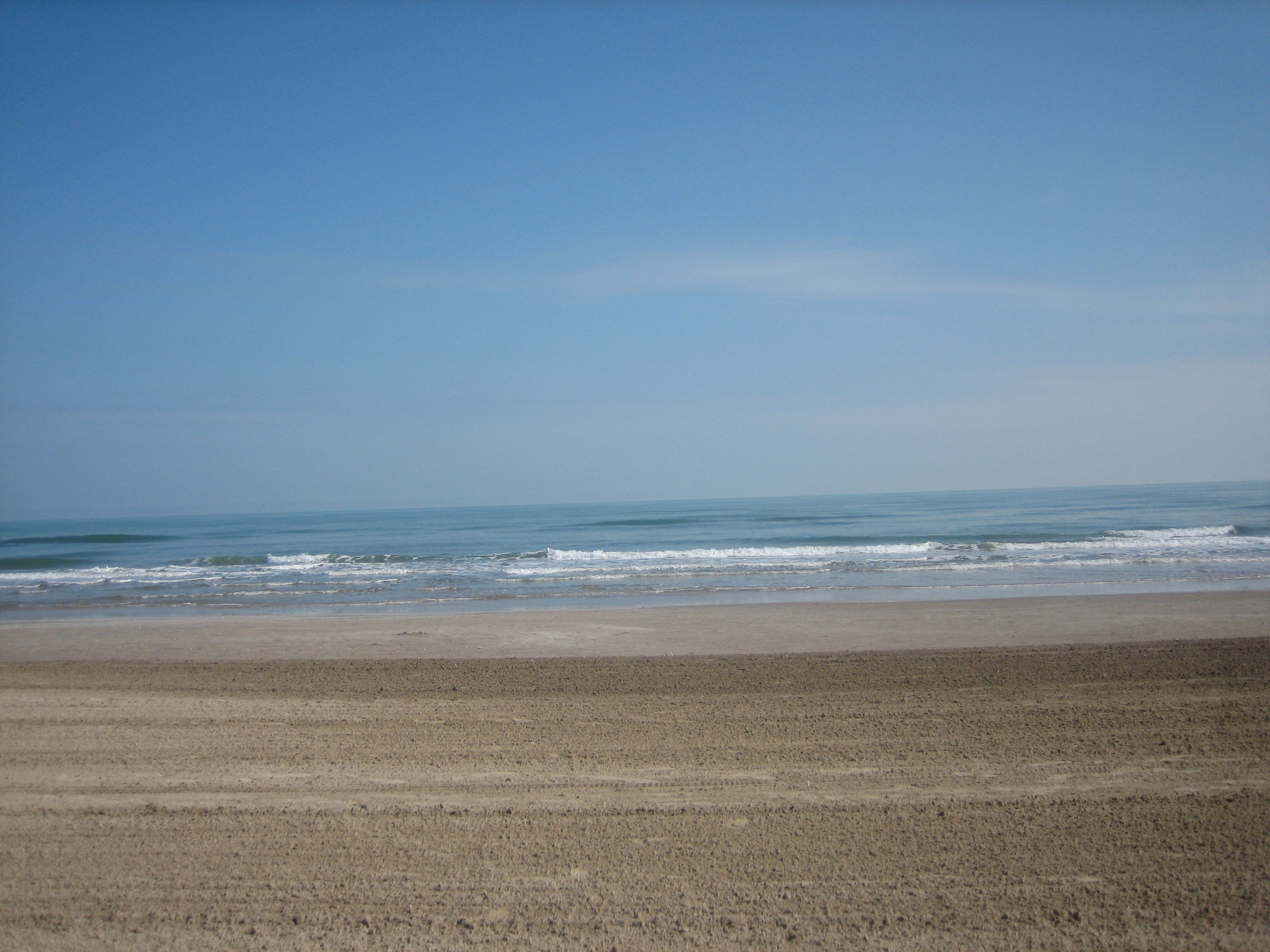
Padre Island National Seashore (PINS) is a national seashore located on Padre Island off the coast of South Texas. In contrast to South Padre Island, known for its beaches and vacationing college students, PINS is located on North Padre Island and consists of a long beach where nature is preserved. Most of the park is primitive, but camping is available, and most of the beach is only accessible to four-wheel-drive vehicles. All but four miles is open to vehicle traffic. PAIS is the fourth designated national seashore in the United States.David Sikes of ''Corpus Christi Caller-Times'', "Padre Island seashore marks 50th", ''Laredo Morning Times'', December 3, 2012, p. 3A North Padre Island is the longest undeveloped barrier island in the world. The national seashore is long with of Gulf beach. PAIS hosts a variety of pristine beach, dune, and tidal flat environments, including the Laguna Madre on its west coast, a famous spot for windsurfing. It is located in parts of Kleberg, ... [...More Info...] [...Related Items...] OR: [Wikipedia] [Google] [Baidu] |
Cameron County, Texas
Cameron County, officially the County of Cameron, is the southernmost county in the U.S. state of Texas. As of the 2020 census, its population was 421,017. Its county seat is Brownsville. The county was founded in 1848 and is named for Captain Ewen Cameron, a soldier during the Texas Revolution and in the ill-fated Mier Expedition. During the later 19th century and through World War II, Fort Brown was a US Army outpost here, stimulating the development of the city of Brownsville. Cameron County comprises the Brownsville– Harlingen, TX metropolitan statistical area, as well as the Brownsville–Harlingen– Raymondville combined statistical area, which itself is part of the larger Rio Grande Valley region. Geography According to the U.S. Census Bureau, the county has a total area of , of which are land and (30%) are covered by water. To the east, the county borders the Gulf of Mexico. Major highways * Interstate 2 * Interstate 69E/ U.S. Highway 77 * Interstate ... [...More Info...] [...Related Items...] OR: [Wikipedia] [Google] [Baidu] |
Texas State Highways
Texas state highways are a network of highways owned and maintained by the U.S. state of Texas. The Texas Department of Transportation (TxDOT) is the state agency responsible for the day-to-day operations and maintenance of the system. Texas has the largest state highway system, followed closely by North Carolina's state highway system. In addition to the nationally numbered Interstate Highways and U.S. Highways, the highway system consists of a main network of state highways, loops, spurs, and beltways that provide local access to the other highways. The system also includes a large network of farm to market roads that connect rural areas of the state with urban areas and the rest of the state highway system. The state also owns and maintains some park and recreational roads located near and within state and national parks, as well as recreational areas. All state highways, regardless of classification, are paved roads. The Old San Antonio Road, also known as the El Camino ... [...More Info...] [...Related Items...] OR: [Wikipedia] [Google] [Baidu] |
Lower Rio Grande Valley
The Lower Rio Grande Valley ( es, Valle del Río Grande), commonly known as the Rio Grande Valley or locally as the Valley or RGV, is a region spanning the border of Texas and Mexico located in a floodplain of the Rio Grande near its mouth. The region includes the southernmost tip of South Texas and a portion of northern Tamaulipas, Mexico. It consists of the Brownsville, Harlingen, Weslaco, Pharr, McAllen, Edinburg, Mission, San Juan, and Rio Grande City metropolitan areas in the United States and the Matamoros, Río Bravo, and Reynosa metropolitan areas in Mexico. The area is generally bilingual in English and Spanish, with a fair amount of Spanglish due to the region's diverse history and transborder agglomerations It is home to some of the poorest cities in the nation, as well as many unincorporated, persistent poverty communities called ''colonias''. A large seasonal influx occurs of "winter Texans" — people who come down from the north for the winter and then ret ... [...More Info...] [...Related Items...] OR: [Wikipedia] [Google] [Baidu] |
Texas
Texas (, ; Spanish language, Spanish: ''Texas'', ''Tejas'') is a state in the South Central United States, South Central region of the United States. At 268,596 square miles (695,662 km2), and with more than 29.1 million residents in 2020, it is the second-largest U.S. state by both List of U.S. states and territories by area, area (after Alaska) and List of U.S. states and territories by population, population (after California). Texas shares borders with the states of Louisiana to the east, Arkansas to the northeast, Oklahoma to the north, New Mexico to the west, and the Mexico, Mexican States of Mexico, states of Chihuahua (state), Chihuahua, Coahuila, Nuevo León, and Tamaulipas to the south and southwest; and has a coastline with the Gulf of Mexico to the southeast. Houston is the List of cities in Texas by population, most populous city in Texas and the List of United States cities by population, fourth-largest in the U.S., while San Antonio is the second most pop ... [...More Info...] [...Related Items...] OR: [Wikipedia] [Google] [Baidu] |
South Padre Island
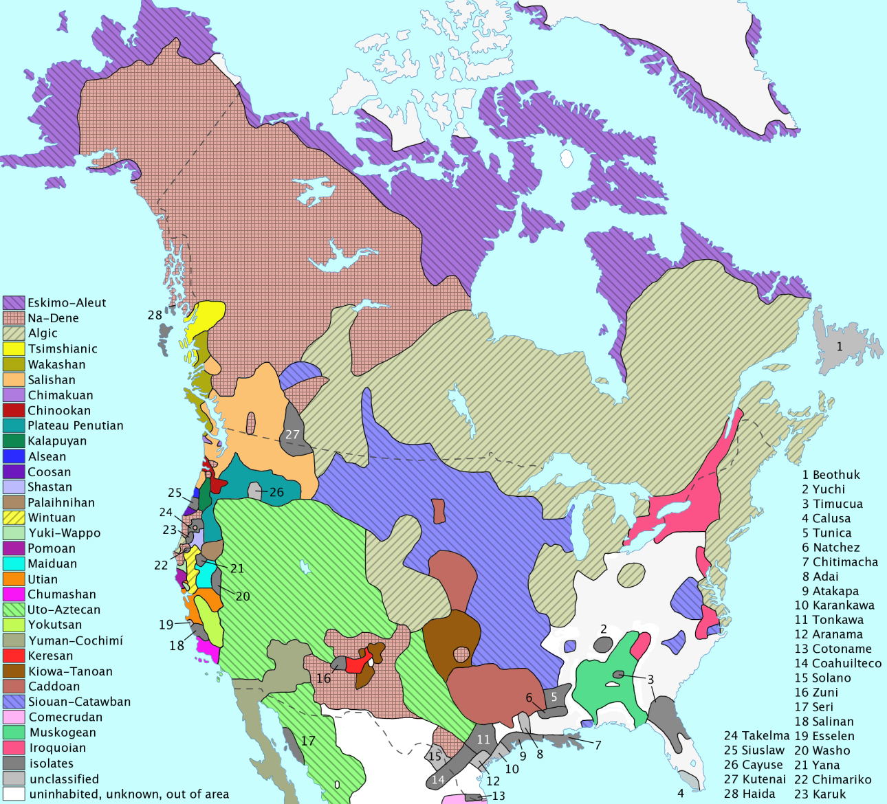
South Padre Island is a barrier island in the U.S. state of Texas. The remote landform is located in Cameron County, Willacy County, and accessible by the Queen Isabella Causeway. South Padre Island was formed when the creation of the Port Mansfield Channel split Padre Island in two. The resort city of South Padre Island, a popular vacation destination, is located on the island. Before the arrival of European settlers in North America, the island was inhabited by native tribes. Western settlement is considered to have been started by Padre Jose Nicolas Balli, who set up a cattle ranch early in the 19th century. He and his family were driven out by the Mexican–American War and were unable to return because of the American Civil War. Most of the island was closed by the National Park Service until 1962, after which settlement was allowed, and incomers began to establish an economy on the island and neighboring Port Isabel. By 1978, the island had a population of around 314; a ... [...More Info...] [...Related Items...] OR: [Wikipedia] [Google] [Baidu] |
South Padre Island, Texas
South Padre Island is a resort town in Cameron County, Texas, United States. It is part of the Brownsville– Harlingen Metropolitan Statistical Area. The population was 2,066 at the 2020 census. The town is located on South Padre Island, a barrier island along the Texas Gulf Coast accessible via the Queen Isabella Causeway from the town of Port Isabel. South Padre Island is named after José Nicolás Ballí (Padre Ballí), a Catholic priest and settler. Storm damage and structure issues Storms * In September 1967, Hurricane Beulah caused extensive damage to much of the town of South Padre Island. * On July 23, 2008, Hurricane Dolly made landfall on the island as a category 1 storm, also causing extensive damage to the town. The Bahia Mar Condominium had extensive damage and had to be gutted due to the damage. * In September 2008 Hurricane Ike caused moderate damage to the island. * In July 2010, the island received heavy rains from Hurricane Alex, but the storm left the ... [...More Info...] [...Related Items...] OR: [Wikipedia] [Google] [Baidu] |
Texas State Highway 100
State Highway 100 (SH 100) is a Texas state highway that runs between "Russeltown" and Port Isabel. It was designated in 1926 along its current route. Its western terminus is at Interstate 69E/U.S. Highway 77/83 and ends at the western end of the Queen Isabella Memorial Causeway at Port Isabel. The route continues as Texas Park Road 100 east and north to a dead end on South Padre Island. History SH 100 was designated on September 15, 1924 on most of its current routing in Deep South Texas, but it ended at Gomez Street in Port Isabel. Since its initial construction, the only two changes in the routing was on January 23, 1975, when SH 100 was extended east 0.5 miles replacing the section of PR 100 from Gomez Street to the western end of the Queen Isabella Causeway, and that SH 100 was rerouted the city of Port Isabel, where the route was transferred to separate one way surface streets to better handle flow onto the Queen Isabella Causeway Route description SH 100 begins at an ... [...More Info...] [...Related Items...] OR: [Wikipedia] [Google] [Baidu] |
Laguna Madre
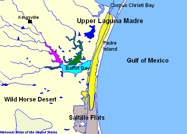
The Laguna Madre is a long, shallow, hypersaline lagoon along the western coast of the Gulf of Mexico in Nueces, Kenedy, Kleberg, Willacy and Cameron Counties in Texas, United States. It is one of seven major estuaries along the Gulf Coast of Texas. The roughly long Saltillo Flats land bridge divides it into Upper and Lower lagoons joined by the Intracoastal Waterway, which has been dredged through the lagoon. Cumulatively, Laguna Madre is approximately long, the length of Padre Island in the US. The main extensions include Baffin Bay in Upper Laguna Madre, Red Fish Bay just below the Saltillo Flats, and South Bay near the Mexican border. As a natural ecological unit, the Laguna Madre of the United States is the northern half of the ecosystem as a whole, which extends into Tamaulipas, Mexico approximately south of the US border, to the vicinity of the Rio Soto La Marina and the town of La Pesca, extending approximately through USA and Mexico in total.Tunnell, Jr. John ... [...More Info...] [...Related Items...] OR: [Wikipedia] [Google] [Baidu] |


