|
Texas 361
State Highway 361 (SH 361) is a state highway in San Patricio and Nueces counties that runs from Gregory in southern Texas, near Corpus Christi, east and south to Padre Island on the Gulf of Mexico coast. History The highway was first designated on April 4, 1956 as the portion of the route from Aransas Pass to Port Aransas, and a 0.7 mile extension in Port Aransas to PR 53 was added to the designation on November 28, 1967. On January 31, 1969 FM 632 from Gregory to Aransas Pass was added to the SH 361 designation. The present route was completed on November 29, 1988 with the designation of PR 53 from Port Aransas to PR 22 on Padre Island as part of SH 361. Route description The highway's northern terminus is the intersection with SH 35 and Spur 202 at Gregory in San Patricio County. The route runs southeast through Ingleside, where it intersects Farm to Market Road 1069, then turns northeast to Aransas Pass. Here the route leaves the Texas mainland and crosses several b ... [...More Info...] [...Related Items...] OR: [Wikipedia] [Google] [Baidu] |
Padre Island
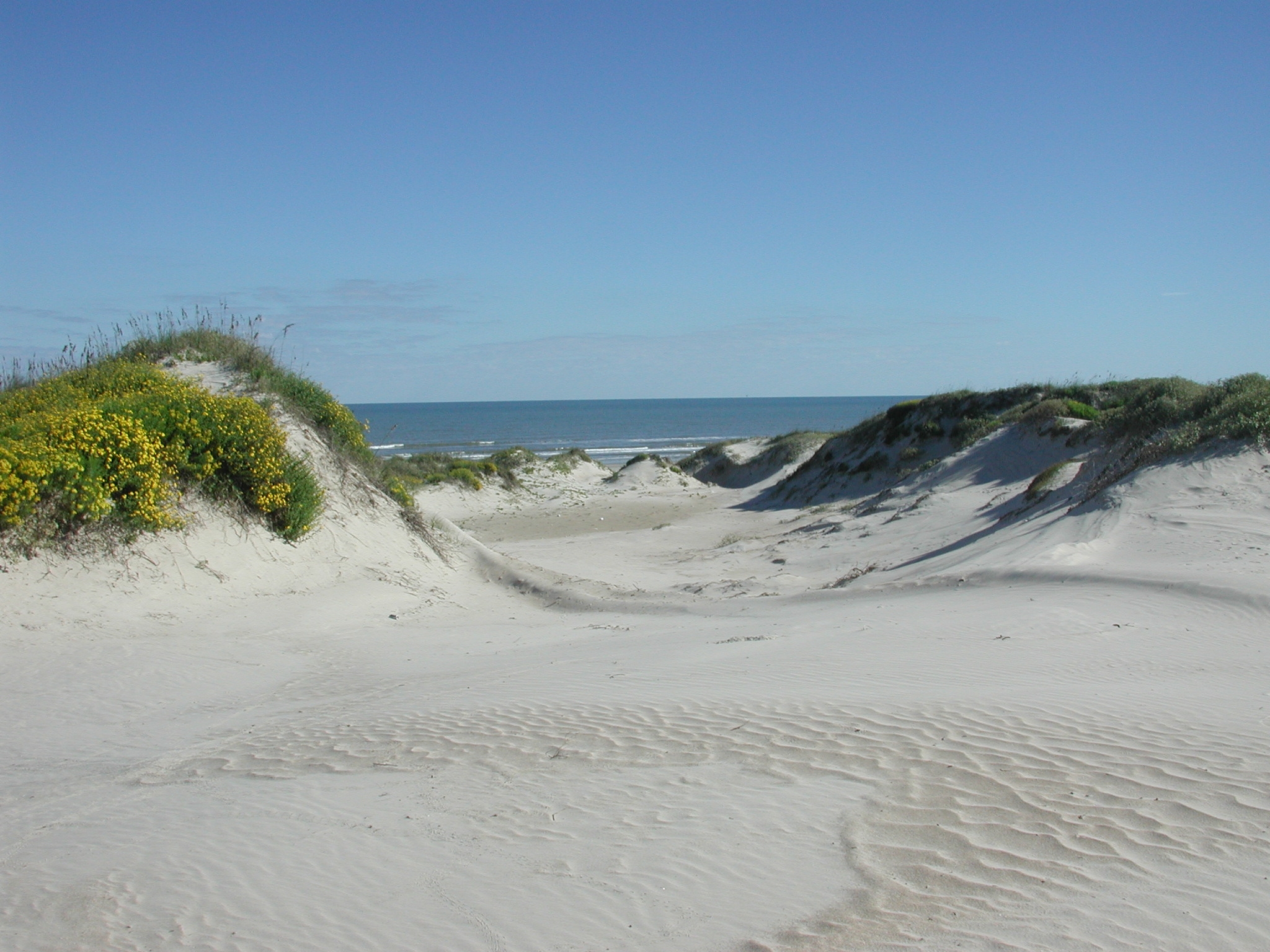
Padre Island is the largest of the Texas barrier islands and the world's longest barrier island. The island is located along Texas's southern coast of the Gulf of Mexico and is noted for its white sandy beaches. Meaning ''father'' in Spanish, it was named after Father José Nicolás Ballí (c.1770-1829), who owned the island and served as a missionary priest and collector of finances for all the churches in the Rio Grande Valley. He also founded the first mission in present-day Cameron County. Padre Island is the second-largest island by area in the contiguous United States, after Long Island in New York on the Atlantic Coast. It is about long and wide, stretching from the city of Corpus Christi, in the north, to the resort community of South Padre Island in the south. The island is oriented north-south, bordered by the Gulf of Mexico on the east and Laguna Madre on the west. The island's northern end connects to Mustang Island by roadway. The southern end of the island is s ... [...More Info...] [...Related Items...] OR: [Wikipedia] [Google] [Baidu] |
Aransas Pass, Texas
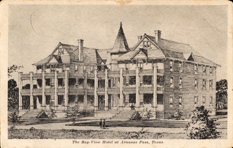
Aransas Pass ( ) is a city in Aransas, Nueces, and San Patricio Counties in the U.S. state of Texas. The population was 7,941 at the 2020 Census. Geography Aransas Pass is located at (27.9019, –97.1395),F on the shore of Redfish Bay, a tidal water body between Corpus Christi Bay to the south and Aransas Bay to the north. The city limits of Aransas Pass encompass most of Redfish Bay and its islands, most of which are in Nueces County, as well a portion of Aransas Bay in Aransas County. The land portion of the city is primarily in San Patricio County, extending north into Aransas County. The city is on the mainland of Texas and is connected to Mustang Island (which contains the city of Port Aransas) by a -long causeway, and a free ferry that carries vehicles to the island. By Texas State Highway 35 and U.S. Route 181, Aransas Pass is northeast of Corpus Christi. According to the United States Census Bureau, the city of Aransas Pass has a total area of , of which are land ... [...More Info...] [...Related Items...] OR: [Wikipedia] [Google] [Baidu] |
Google Maps
Google Maps is a web mapping platform and consumer application offered by Google. It offers satellite imagery, aerial photography, street maps, 360° interactive panoramic views of streets ( Street View), real-time traffic conditions, and route planning for traveling by foot, car, bike, air (in beta) and public transportation. , Google Maps was being used by over 1 billion people every month around the world. Google Maps began as a C++ desktop program developed by brothers Lars and Jens Rasmussen at Where 2 Technologies. In October 2004, the company was acquired by Google, which converted it into a web application. After additional acquisitions of a geospatial data visualization company and a real-time traffic analyzer, Google Maps was launched in February 2005. The service's front end utilizes JavaScript, XML, and Ajax. Google Maps offers an API that allows maps to be embedded on third-party websites, and offers a locator for businesses and other organizations in numero ... [...More Info...] [...Related Items...] OR: [Wikipedia] [Google] [Baidu] |
Adobe Acrobat
Adobe Acrobat is a family of application software and Web services developed by Adobe Inc. to view, create, manipulate, print and manage Portable Document Format (PDF) files. The family comprises Acrobat Reader (formerly Reader), Acrobat (formerly Exchange) and Acrobat.com. The basic Acrobat Reader, available for several desktop and mobile platforms, is freeware; it supports viewing, printing and annotating of PDF files. Additional, "Premium", services are available on paid subscription. The commercial proprietary Acrobat, available for Microsoft Windows and macOS only, can also create, edit, convert, digitally sign, encrypt, export and publish PDF files. Acrobat.com complements the family with a variety of enterprise content management and file hosting services. Purpose The main function of Adobe Acrobat is creating, viewing, and editing PDF documents. It can import popular document and image formats and save them as PDF. It is also possible to import a scanner's output, ... [...More Info...] [...Related Items...] OR: [Wikipedia] [Google] [Baidu] |
Texas Department Of Transportation
The Texas Department of Transportation (TxDOT ) is a government agency in the American state of Texas. Though the public face of the agency is generally associated with the construction and maintenance of the state's immense state highway system, the agency is also responsible for overseeing aviation, rail, and public transportation systems in the state. At one time, TxDOT also administered vehicle registration; but this function transferred to the Texas Department of Motor Vehicles, a state agency which began operations in November 2009. The agency has been headquartered in the Dewitt C. Greer Building at 125 East 11th Street in Downtown Austin, Texas, since 1933. History The Texas Legislature created the Texas Highway Department in 1916 to administer federal highway construction and maintenance. In 1975, its responsibilities increased when the agency merged with the Texas Mass Transportation Commission, resulting in the formation of the State Department of Highways and Pub ... [...More Info...] [...Related Items...] OR: [Wikipedia] [Google] [Baidu] |
Barrier Island
Barrier islands are coastal landforms and a type of Dune, dune system that are exceptionally flat or lumpy areas of sand that form by wave and tidal action parallel to the mainland coast. They usually occur in chains, consisting of anything from a few islands to more than a dozen. They are subject to change during storms and other action, but absorb energy and protect the coastlines and create areas of protected waters where wetlands may flourish. A barrier chain may extend uninterrupted for over a hundred kilometers, excepting the tidal inlets that separate the islands, the longest and widest being Padre Island of Texas, United States. Sometimes an important inlet may close permanently, transforming an island into a peninsula, thus creating a barrier peninsula, often including a beach, barrier beach. The length and width of barriers and overall morphology of barrier coasts are related to parameters including tidal range, wave energy, Sediment transport, sediment supply, Sea leve ... [...More Info...] [...Related Items...] OR: [Wikipedia] [Google] [Baidu] |
Recreation
Recreation is an activity of leisure, leisure being discretionary time. The "need to do something for recreation" is an essential element of human biology and psychology. Recreational activities are often done for enjoyment, amusement, or pleasure and are considered to be "fun". Etymology The term ''recreation'' appears to have been used in English first in the late 14th century, first in the sense of "refreshment or curing of a sick person", and derived turn from Latin (''re'': "again", ''creare'': "to create, bring forth, beget"). Prerequisites to leisure People spend their time on activities of daily living, work, sleep, social duties and leisure, the latter time being free from prior commitments to physiologic or social needs, a prerequisite of recreation. Leisure has increased with increased longevity and, for many, with decreased hours spent for physical and economic survival, yet others argue that time pressure has increased for modern people, as they are committed to too ... [...More Info...] [...Related Items...] OR: [Wikipedia] [Google] [Baidu] |
Tourism
Tourism is travel for pleasure or business; also the theory and practice of touring (other), touring, the business of attracting, accommodating, and entertaining tourists, and the business of operating tour (other), tours. The World Tourism Organization defines tourism more generally, in terms which go "beyond the common perception of tourism as being limited to holiday activity only", as people "travelling to and staying in places outside their usual environment for not more than one consecutive year for leisure and not less than 24 hours, business and other purposes". Tourism can be Domestic tourism, domestic (within the traveller's own country) or International tourism, international, and international tourism has both incoming and outgoing implications on a country's balance of payments. Tourism numbers declined as a result of a strong economic slowdown (the late-2000s recession) between the second half of 2008 and the end of 2009, and in consequence of t ... [...More Info...] [...Related Items...] OR: [Wikipedia] [Google] [Baidu] |
Mustang Island
Mustang Island is a barrier island on the Gulf Coast of Texas in the United States. The island is 18 miles (29 km) long, stretching from Corpus Christi to Port Aransas. The island is oriented generally northeast–southwest, with the Gulf of Mexico on the east and south, and Corpus Christi Bay on the north and west. The island's southern end connects by roadway to Padre Island. At the northern end of the island is Port Aransas, beyond which is San José Island. The Aransas Channel, also known as the "Aransas Pass," which separates Mustang Island from San José Island, is protected by jetties extending into the Gulf from each island. The town of Port Aransas is located at the northern end of the island. Mustang Island State Park encompasses the entire southern third of the island, including 3,955 acres (1,600 ha) and 5 miles (8 km) of beach. The city of Corpus Christi includes the northernmost portion of Padre Island and part of Mustang Island between Port Arans ... [...More Info...] [...Related Items...] OR: [Wikipedia] [Google] [Baidu] |
Port Aransas, Texas
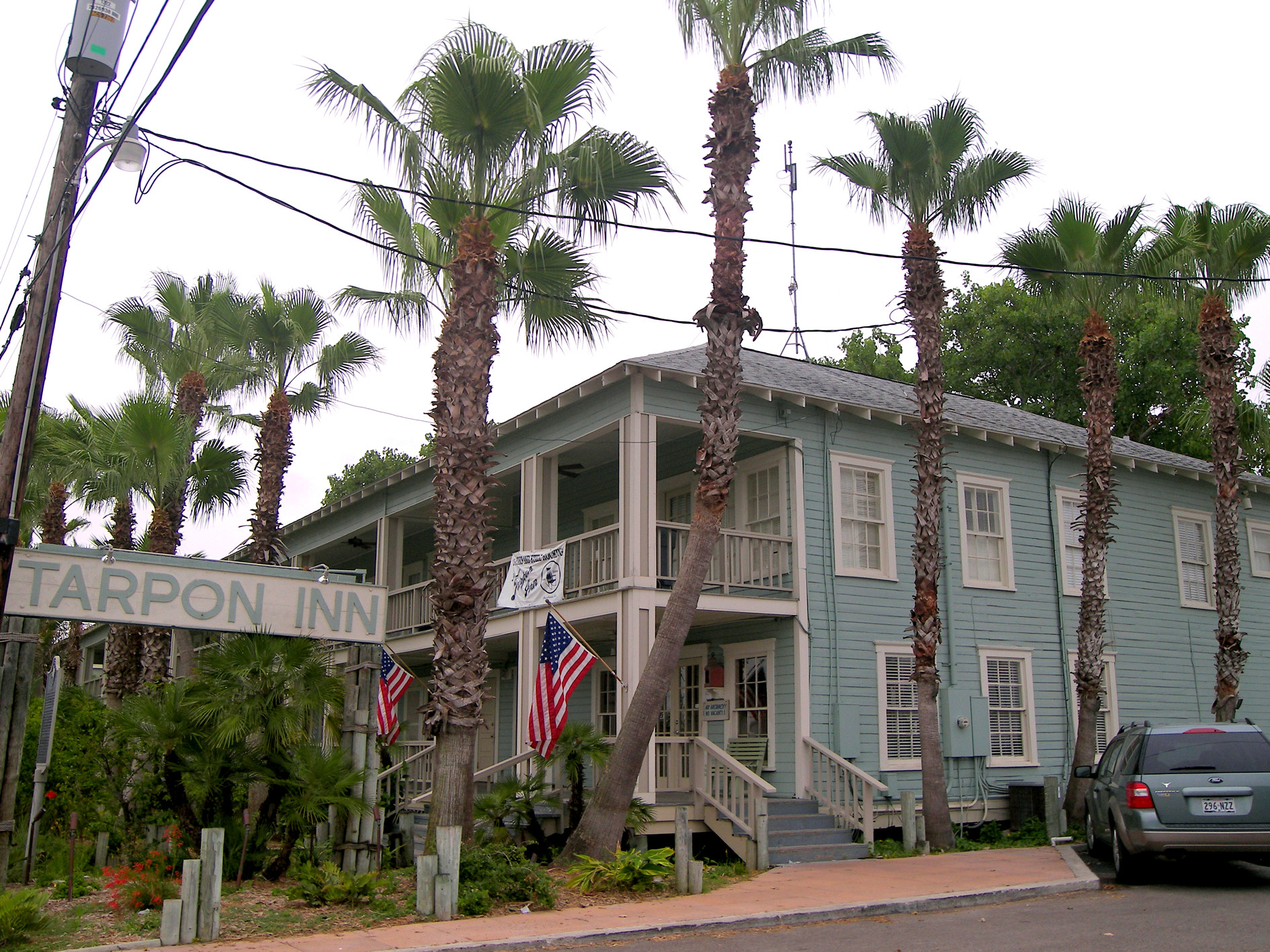
Port Aransas ( ) is a city in Nueces County, Texas, United States. This city is 180 miles southeast of San Antonio. The population was 2,904 at the 2020 census. Port Aransas is the only established town on Mustang Island. It is located north of Padre Island and is one of the longest barrier islands along the Texas coast. Corpus Christi Bay, the Gulf of Mexico, the Lydia Ann Ship Channel and the Corpus Christi Ship Channel make up the surrounding waters. History Early history The Karankawa Indians were living a nomadic existence in the region when Spaniards, led by Alonso Álvarez de Pineda, probed the coast in 1519. Governor Francisco de Garay of Jamaica had commissioned him to explore the Gulf Coast from Florida to Vera Cruz. In the summer of 1519, Piñeda, took a fleet of four ships east to west around the Gulf Coast exploring and mapping five passes along the Texas Coast line, including what is known today as Aransas Pass. In 1720 the French explorer Pierre-Jean de Bérang ... [...More Info...] [...Related Items...] OR: [Wikipedia] [Google] [Baidu] |
Farm To Market Road
In the United States, a farm-to-market road or ranch-to-market road (sometimes farm road or ranch road for short) is a state highway or county road that connects rural or agricultural areas to market towns. These are better quality roads, usually a highway, that farmers and ranchers use to transport products to market towns or distribution centers. Historically used throughout the country, today the term is primarily associated with a large state-maintained highway system in Texas. History By 1930, counties and townships across the U.S. had built a large number of farm-to-market roads, many of which were in need of repairs and safety improvements. The Chief of the Bureau of Public Roads, Thomas Harris MacDonald, considered this need to be driven not by insufficient funding but by inefficient planning and inadequate equipment on the part of thousands of counties. He advocated for an expansion of state-maintained highway systems through the federal-aid highway program, so that count ... [...More Info...] [...Related Items...] OR: [Wikipedia] [Google] [Baidu] |
Gregory, Texas
Gregory is a city in San Patricio County, Texas, United States. The population was 1,907 at the 2010 census. Geography Gregory is located at (27.920604, –97.292480). According to the United States Census Bureau, the city has a total area of , all land. Demographics 2020 census As of the 2020 United States census, there were 1,740 people, 644 households, and 497 families residing in the city. 2000 census As of the census of 2000, there were 2,318 people, 658 households, and 561 families residing in the city. The population density was 1,636.8 people per square mile (630.3/km2). There were 743 housing units at an average density of 524.6/sq mi (202.0/km2). The racial makeup of the city was 70.10% White, 0.60% African American, 0.65% Native American, 0.09% Asian, 0.04% Pacific Islander, 25.37% from other races, and 3.15% from two or more races. Hispanic or Latino of any race were 94.65% of the population. There were 658 households, out of which 43.6% had children un ... [...More Info...] [...Related Items...] OR: [Wikipedia] [Google] [Baidu] |


