|
Tennessee State Route 273
State Route 273 (SR 273) is a long east-west state highway traversing the hills of southern Middle Tennessee. Route description SR 273 begins in Giles County at an intersection with SR 166. It winds its way east through some hills and begins paralleling the Elk River, which it does for the rest of the highway's length, to pass through the community of Prospect. The highway then turns northeast and passes through more Hill and then farmland, where it crosses a bridge over Richland Creek, before entering Elkton and coming to an intersection with US 31/ SR 7. It turns north along a short concurrency with US 31/SR 7 to pass by several homes and businesses before splitting off and going northeast again to have an interchange with I-65 (Exit 6).https://www.tn.gov/content/dam/tn/tdot/maps/county-maps-(us-shields)/a-g/Giles%20County.pdf SR 273 then crosses into Lincoln County and continues winding its way northeast through a mix of farmland and wooded hills to pass through the com ... [...More Info...] [...Related Items...] OR: [Wikipedia] [Google] [Baidu] |
Prospect, Giles County, Tennessee
Prospect is an unincorporated community in Giles County, Tennessee. The zip code is 38477. The southern agricultural pioneer and publisher Cully Cobb was born in Prospect in 1884. Jimmy G. Shoalmire and Roy Vernon Scott Roy is a masculine given name and a family surname with varied origin. In Anglo-Norman England, the name derived from the Norman ''roy'', meaning "king", while its Old French cognate, ''rey'' or ''roy'' (modern ''roi''), likewise gave rise to ..., ''The Public Career of Cully Cobb: A Study in Agricultural Leadership'', (Jackson, Mississippi: University and College Press of Mississippi, 1973), p. 1 References Unincorporated communities in Giles County, Tennessee Unincorporated communities in Tennessee {{GilesCountyTN-geo-stub ... [...More Info...] [...Related Items...] OR: [Wikipedia] [Google] [Baidu] |
Tennessee State Route 274
State Route 274 (SR 274), also known as Old Railroad Bed Road, is a north–south state highway in western Lincoln County, Tennessee. Route description SR 274 begins as a continuation of County Road 11 (CR 11) at the Alabama (We dare defend our rights) , anthem = "Alabama (state song), Alabama" , image_map = Alabama in United States.svg , seat = Montgomery, Alabama, Montgomery , LargestCity = Huntsville, Alabama, Huntsville , LargestCounty = Baldwin County, Al ... state line. It heads north through farmland to pass through the community of Taft, where it has an intersection with SR 110. The highway then winds its northward through several rural hills and valleys for several miles, where it crosses a bridge over the Elk River, before coming to an end at an intersection with SR 273 between Dellrose and Fayetteville. The entire route of SR 274 is a rural two-lane highway. Major intersections References {{reflist 274 Transportation in Lincoln County, Ten ... [...More Info...] [...Related Items...] OR: [Wikipedia] [Google] [Baidu] |
State Highways In Tennessee
State may refer to: Arts, entertainment, and media Literature * ''State Magazine'', a monthly magazine published by the U.S. Department of State * ''The State'' (newspaper), a daily newspaper in Columbia, South Carolina, United States * ''Our State'', a monthly magazine published in North Carolina and formerly called ''The State'' * The State (Larry Niven), a fictional future government in three novels by Larry Niven Music Groups and labels * States Records, an American record label * The State (band), Australian band previously known as the Cutters Albums * ''State'' (album), a 2013 album by Todd Rundgren * ''States'' (album), a 2013 album by the Paper Kites * ''States'', a 1991 album by Klinik * ''The State'' (album), a 1999 album by Nickelback Television * ''The State'' (American TV series), 1993 * ''The State'' (British TV series), 2017 Other * The State (comedy troupe), an American comedy troupe Law and politics * State (polity), a centralized political organizatio ... [...More Info...] [...Related Items...] OR: [Wikipedia] [Google] [Baidu] |
Huntsville, Alabama
Huntsville is a city in Madison County, Limestone County, and Morgan County, Alabama, United States. It is the county seat of Madison County. Located in the Appalachian region of northern Alabama, Huntsville is the most populous city in the state. Huntsville was founded within the Mississippi Territory in 1805 and became an incorporated town in 1811. When Alabama was admitted as a state in 1819, Huntsville was designated for a year as the first capital, before that was moved to more central settlements. The city developed across nearby hills north of the Tennessee River, adding textile mills in the late nineteenth century. Its major growth has taken place since World War II. During the war, the Army established Redstone Arsenal near here with a chemical weapons plant, and nearby related facilities. After the war, additional research was conducted at Redstone Arsenal on rockets, followed by adaptations for space exploration. NASA's Marshall Space Flight Center, the Unit ... [...More Info...] [...Related Items...] OR: [Wikipedia] [Google] [Baidu] |
Elkmont, Alabama
Elkmont is a town in Limestone County, Alabama, Limestone County, Alabama, United States, and is included in the Huntsville-Decatur Combined Statistical Area. As of the 2010 census, the population of the town was 434, down from its record high of 470 in 2000. History Elkmont began as a stop known as "Fort Hampton" along the newly-constructed Tennessee and Alabama Central Railroad in 1859. The name was changed to "Elkmont," after the elk that once flourished in the area, in 1866.Loretta Merrell Ellis,Limestone County History" Limestone County official site. Accessed: 21 September 2017. The Tennessee and Alabama Central eventually became part of the L&N Railroad system, which built the current depot (now used as a community center) in 1887.Kelly Kazek,Scenes from Elkmont: Surprising Location of Alabama's 'Goat Cheese Capital'" AL.com, 27 October 2014. The railroad tracks have since been removed, and are now part of the Richard Martin Trail. Elkmont incorporated in 1873. During t ... [...More Info...] [...Related Items...] OR: [Wikipedia] [Google] [Baidu] |
Tennessee State Route 10
State Route 10 (SR 10) is a south–north route from the Alabama state line in Lincoln County, Tennessee to the Kentucky state line in Macon County. For most of the highway's length, it is an unsigned designation for US 231. Route description Alabama to Murfreesboro SR 10 begins at the Alabama state line in Lincoln County, just north of Hazel Green, Alabama, where it is the unsigned companion route of US 231/ US 431. The highway then goes north through farmland and countryside and has an intersection with SR 275 before going through Park City and crossing a ridge into Fayetteville. Once in Fayetteville, it has a Y-intersection with SR 110 before going through a major business and coming to an intersection with US 64 Bypass (US 64 Byp.). Here, US 431 continues straight into downtown while US 231/SR 10 turns east to follow US 64 Byp. to the south. It then curves to the north before coming to an intersection with ... [...More Info...] [...Related Items...] OR: [Wikipedia] [Google] [Baidu] |
Tennessee State Route 50
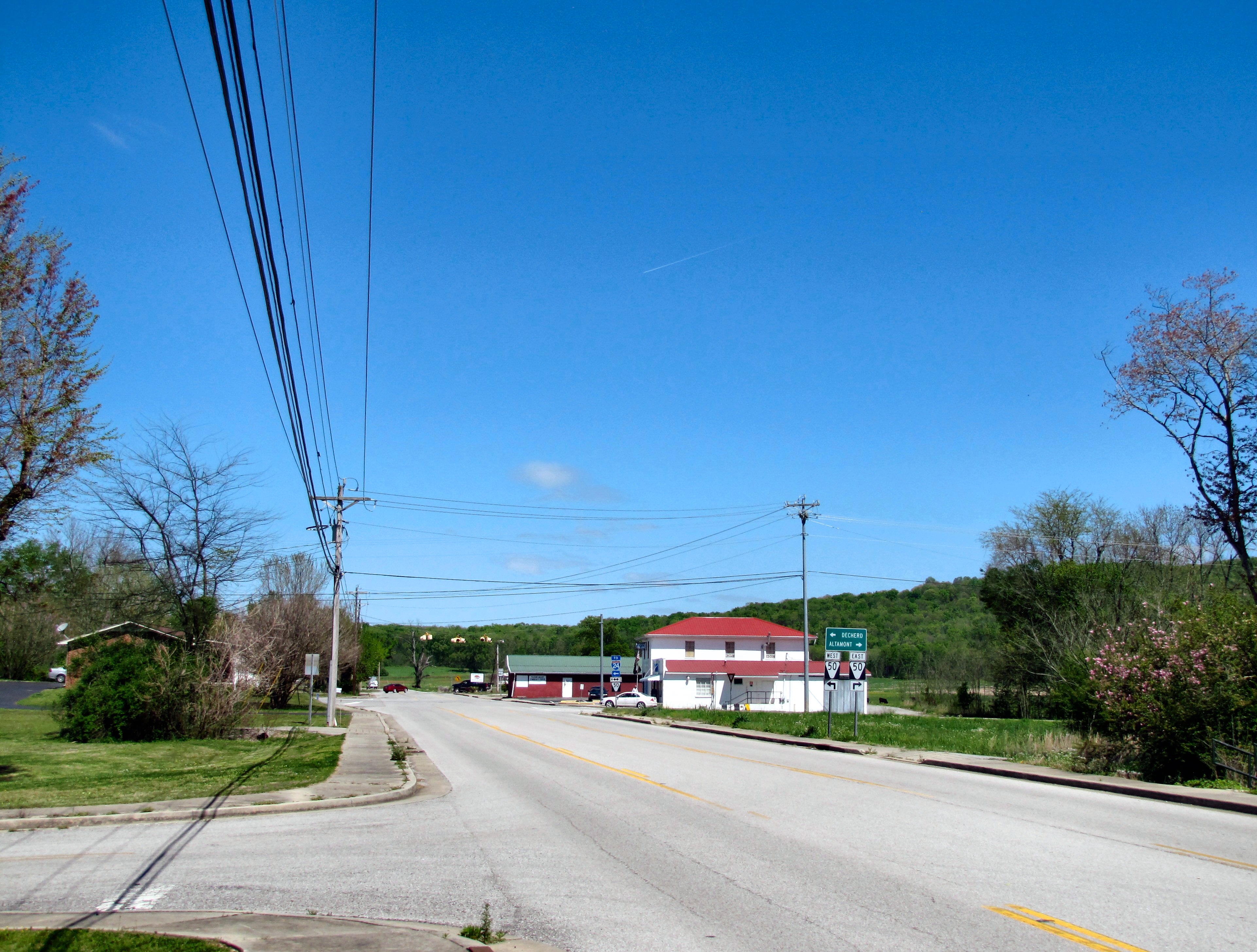
State Route 50 (SR 50) is a west–to–east highway in Middle Tennessee. The road begins near Only and ends in Altamont. The current length is . Route description Hickman County SR 50 begins as a 2-lane secondary highway in Hickman County at exit 148 on I-40 near Only as a continuation of Duck River Road. SR 50 travels southeast and crosses a bridge over the Duck River to enter Only and have an intersection with Dyer Road, which follows SR 50's former alignment through the community. SR 50 then passes through wooded areas as it bypasses Only to the south before having an intersection with SR 229, which provides access to the Turney Center Industrial Complex. SR 50 continues east to cross the Duck River again before paralleling it and having an intersection with SR 438. The highway then has two more crossings of the Duck river before passing near Grinder's Switch and entering Centerville. SR 50 then passes south of downtown as it then comes to an in ... [...More Info...] [...Related Items...] OR: [Wikipedia] [Google] [Baidu] |
Tennessee State Route 15
State Route 15 (SR 15) is a west–east route from Memphis to Monteagle. For much of its route it has an unsigned concurrency with U.S. Route 64. SR 15 does travel through the southern part of all 3 Grand Divisions of the state: West Tennessee, Middle Tennessee, and East Tennessee. Route description Shelby County SR 15 begins as a secondary highway in Shelby County in Northern Memphis at an interchange with SR 14 (Austin Peay Highway). It proceeds east to Bartlett and intersects US 70/US 79/US 64/ SR 1, where it becomes the unsigned companion route of US 64 and becomes a primary highway. US 64/SR 15 then intersect SR 177 just before they have an interchange with I-40 (Exit 18) in Lakeland. They then go east and pass just north of Lenow before having an interchange with I-269 (Winfield Dunn Parkway/Memphis Outer Beltway) (Exit 15), in Eads. Not even a half mile away, they intersect with SR 205 before crossing into Fayette County. Fayette County US 64/SR 15 then ... [...More Info...] [...Related Items...] OR: [Wikipedia] [Google] [Baidu] |
Interstate 65 In Tennessee
Interstate 65 (I-65) runs from Ardmore north in Tennessee to just south of Franklin, Kentucky, forming part of the national highway that goes from Mobile, Alabama, to Gary, Indiana. In Tennessee the highway's official name is the Albert Arnold Gore Sr. Memorial Highway, named for Albert Gore Sr., the former US Senator. Of the four states which I-65 runs through, the segment in Tennessee is the shortest, at long. I-65 serves the state capital and largest city of Nashville and parallels U.S. Route 31 (US 31) its entire length in Tennessee. Route description Southern section and Nashville suburbs I-65 enters Tennessee from Alabama concurrent with US 31 in rural Giles County near the town of Ardmore. About later, near the town of Elkton, is an interchange with State Route 7 (SR 7), where US 31 splits off into a concurrency with that route, heading north toward Pulaski. Continuing through mostly rural territory characterized by sligh ... [...More Info...] [...Related Items...] OR: [Wikipedia] [Google] [Baidu] |
Elkton, Tennessee
Elkton is a city in Giles County, Tennessee, United States. The population was 578 at the 2010 census. Geography Elkton is located in southeastern Giles County at . Most of the city is on the north bank of the Elk River, a southwest-flowing tributary of the Tennessee River. U.S. Route 31 passes through the west side of the city, leading northwest to Pulaski, the Giles County seat, and south to Ardmore at the Alabama border. Interstate 65 passes just east of Elkton, with access from Exit 1 (US 31) south of town and from Exit 6 ( State Route 273) at the north end of the city limits. I-65 leads north to Nashville and south to Birmingham, Alabama. According to the United States Census Bureau, Elkton has a total area of , all land. Demographics As of the census of 2000, there were 510 people, 203 households, and 142 families residing in the city. The population density was 340.6 people per square mile (131.3/km2). There were 226 housing units at an average density of 150. ... [...More Info...] [...Related Items...] OR: [Wikipedia] [Google] [Baidu] |


.jpg)
