|
Tengizbay
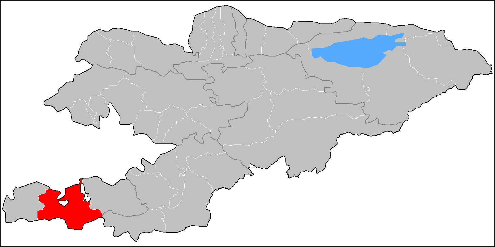
Tengizbay is a mountain pass at the border of Batken Region and Osh Region of Kyrgyzstan. Its elevation is .Soviet military maJ-43-01(1:200,000) It connects the village Daroot-Korgon in the Alay Valley with the city Kyzyl-Kiya in the Fergana Valley The Fergana Valley (; ; ) in Central Asia lies mainly in eastern Uzbekistan, but also extends into southern Kyrgyzstan and northern Tajikistan. Divided into three republics of the former Soviet Union, the valley is ethnically diverse and in the .... References External links Satellite map at Maplandia.com Batken Region Osh Region Mountain passes of Kyrgyzstan {{Osh-geo-stub ... [...More Info...] [...Related Items...] OR: [Wikipedia] [Google] [Baidu] |
Daroot-Korgon
Daroot-Korgon (also ''Daraut-Kurghan'' or ''Darautkorgon'' or ''Daroot-Qurghan'') is a village in the western Alay Valley of Osh Region, Kyrgyzstan. It is the capital of Chong-Alay District. Its population was 6,421 in 2021. It is about 90 km west of Sary-Tash on the river Kyzyl-Suu. To the north is a route to Osh via the Tengizbay pass, used by Russian explorers before the construction of the road though Sary-Tash. To the south, the Altyn River flows north through a deep valley in the Trans-Alay Range. At the head of the valley is a Tajik border post and then Altyn Mazar on the river Muksu which flows west to join the Kyzyl-Suu. South of this is the foot of the Fedchenko Glacier. The village of Kara-Shybak is to the south, and Kyzyl-Eshme is to the east. Aurel Stein suggested that this was the location of the " Stone Tower" that Ptolemy in his famous treatise ''Geography'' wrote as the place where caravans from the Chinese and Roman Empires met and exchanged goo ... [...More Info...] [...Related Items...] OR: [Wikipedia] [Google] [Baidu] |
Kyrgyzstan
Kyrgyzstan,, pronounced or the Kyrgyz Republic, is a landlocked country in Central Asia. Kyrgyzstan is bordered by Kazakhstan to the north, Uzbekistan to the west, Tajikistan to the south, and the People's Republic of China to the east. Its capital and largest city is Bishkek. Ethnic Kyrgyz make up the majority of the country's seven million people, followed by significant minorities of Uzbeks and Russians. The Kyrgyz language is closely related to other Turkic languages. Kyrgyzstan's history spans a variety of cultures and empires. Although geographically isolated by its highly mountainous terrain, Kyrgyzstan has been at the crossroads of several great civilizations as part of the Silk Road along with other commercial routes. Inhabited by a succession of tribes and clans, Kyrgyzstan has periodically fallen under larger domination. Turkic nomads, who trace their ancestry to many Turkic states. It was first established as the Yenisei Kyrgyz Khaganate later in the ... [...More Info...] [...Related Items...] OR: [Wikipedia] [Google] [Baidu] |
Alay Mountains
The Alay or Alai Range ( ky, Алай тоо кыркасы; russian: Алайский хребет) is a mountain range that extends from the Tien Shan mountain range in Kyrgyzstan west into Tajikistan. It is part of the Pamir-Alay mountain system. The range runs approximately east to west. Its highest summit is Pik Tandykul (russian: пик Тандыкуль), reaching 5544 m. It forms the southern border of the Fergana Valley, and in the south it falls steeply to the Alay Valley. The southern slopes of the range drain into the Kyzylsuu or |
Mountain Pass
A mountain pass is a navigable route through a mountain range or over a ridge. Since many of the world's mountain ranges have presented formidable barriers to travel, passes have played a key role in trade, war, and both Human migration, human and animal migration throughout history. At lower elevations it may be called a hill pass. A mountain pass is typically formed between two volcanic peaks or created by erosion from water or wind. Overview Mountain passes make use of a gap (landform), gap, saddle (landform), saddle, col or notch (landform), notch. A topographic saddle is analogous to the mathematical concept of a saddle surface, with a saddle point marking the highest point between two valleys and the lowest point along a ridge. On a topographic map, passes are characterized by contour lines with an hourglass shape, which indicates a low spot between two higher points. In the high mountains, a difference of between the summit and the mountain is defined as a mountain pas ... [...More Info...] [...Related Items...] OR: [Wikipedia] [Google] [Baidu] |
Batken Region
Batken Region ( ky, Баткен облусу, Batken oblusu; russian: Баткенская область, Batkenskaya oblast) is a region ('' oblus'') of Kyrgyzstan. Its capital is Batken. It is bounded on the east by Osh Region, on the south, west and north by Tajikistan, and on the northeast by Uzbekistan. The northern part of the region is part of the flat, agricultural Ferghana Valley. The land rises southward to the mountains on the southern border: the Alay Mountains in the east, and the Turkestan Range in the west. Its total area is . The resident population of the region was 548,247 as of January 2021. The region has sizeable Uzbek (14.7% in 2009) and Tajik (6.9% in 2009) minorities. History Batken Region was created on 15 October 1999 from the westernmost section of Osh Region. This was partly in response to the activities of the Islamic Movement for Uzbekistan (IMU), with bases in Tajikistan. In 1999 they kidnapped a group of Japanese geologists and in 2000 some Amer ... [...More Info...] [...Related Items...] OR: [Wikipedia] [Google] [Baidu] |
Osh Region
Osh Region ( ky, Ош облусу, translit=Osh oblusu; russian: Ошская область, Oshskaya oblast) is a region (''oblast'') of Kyrgyzstan. Its capital is Osh, which is not part of the region. It is bounded by (clockwise) Jalal-Abad Region, Naryn Region, China (Xinjiang), Tajikistan (Districts under Central Government Jurisdiction and Gorno-Badakhshan Autonomous Region), Batken Region, and Uzbekistan (Andijan Region, Andijan and Fergana Regions). Its total area is . The resident population of the region was 1,391,649 as of January 2021. The region has a sizeable Uzbeks, Uzbek (28.0% in 2009) minority. Geography Most of the population lives in the flat northern part of the Oblast, on the edge of the Ferghana Valley. The land gradually rises southward to the crest of the Alay Mountains, drops into the Alay Valley and rises to the Trans-Alai Range which forms the border with Tajikistan. In the east, the land rises to the Ferghana Range, roughly parallel to the Naryn bord ... [...More Info...] [...Related Items...] OR: [Wikipedia] [Google] [Baidu] |
Alay Valley
The Alay Valley ( ky, Алай өрөөнү, ) is a broad, dry valley running east–west across most of southern Osh Region, Kyrgyzstan. It spreads over a length of east–west. The valley extends in north–south direction with varying width of in the west, in the central part, and in the east. The altitude of the valley ranges from near Karamyk to at Toomurun Pass with an average altitude of about . The area of the valley is . The north side is the Alay Mountains which slope down to the Ferghana Valley. The south side is the Trans-Alay Range along the Tajikistan border, with Lenin Peak, (). The western or so is more hills than valley. On the east there is the low Tongmurun pass and then more valley leading to the Irkestam border crossing to China. The eastern Kyzyl-Suu ('Red River') flows from the Tongmurun rise past Irkestam toward Kashgar. The western Kyzyl-Suu flows west from the Tongmurun rise and drains most of the valley, flowing on the north side. It exits thro ... [...More Info...] [...Related Items...] OR: [Wikipedia] [Google] [Baidu] |
Kyzyl-Kiya
Kyzyl-Kyya ( ky, Кызыл-Кыя, russian: Кызыл-Кия ''Kyzyl-Kiya'') is a city in Batken Region, in southwestern Kyrgyzstan. It is a city of regional significance, not part of a district, and consists of the town proper and the villages Karavan, Ak-Bulak and Jin-Jigen. Its area is , and its resident population was 56,819 in 2021 (both including the villages Karavan, Ak-Bulak and Jin-Jigen). It is situated on the southern edge of the Fergana Valley, 32 km southeast of Fergana, and 65 km southwest of Osh. The town is one of the oldest centers of the coal mining industry in Kyrgyzstan. Population Geography Climate Kyzyl-Kyya has a cold semi-arid climate (Köppen climate classification The Köppen climate classification is one of the most widely used climate classification systems. It was first published by German-Russian climatologist Wladimir Köppen (1846–1940) in 1884, with several later modifications by Köppen, notabl ... ''BSk''). The average annua ... [...More Info...] [...Related Items...] OR: [Wikipedia] [Google] [Baidu] |
Fergana Valley
The Fergana Valley (; ; ) in Central Asia lies mainly in eastern Uzbekistan, but also extends into southern Kyrgyzstan and northern Tajikistan. Divided into three republics of the former Soviet Union, the valley is ethnically diverse and in the early 21st century was the scene of conflict. A large triangular valley in what is an often dry part of Central Asia, the Fergana owes its fertility to two rivers, the Naryn River, Naryn and the Kara Darya, which run from the east, joining near Namangan, forming the Syr Darya river. The valley's history stretches back over 2,300 years, when Alexander the Great founded Alexandria Eschate at its southwestern end. Chinese chroniclers date its towns to more than 2,100 years ago, as a path between Greek, Chinese, Bactrian and Parthian civilisations. It was home to Babur, founder of the Mughal Dynasty, tying the region to modern Afghanistan and South Asia. The Russian Empire conquered the valley at the end of the 19th century, and it became part ... [...More Info...] [...Related Items...] OR: [Wikipedia] [Google] [Baidu] |


